Category Archives: rides

17.7 MPH

Or…how I lost 2.5 mph by moving to the Catskills.

I’ve been looking at my ride data. Since I moved to the Catskills, I’ve lost 2.5 mph off my average long-distance solo speed. Sure, it is much hillier out here than in the immediate vicinity of NYC, but you’d think that the high-speed descents would cancel out the grueling 8 mph climbs, right? I’m not in worse shape than I was in NYC; in fact, thanks to 100 feet/mile of climbing on an average ride and many more miles than I’d do in an equivalent period in NYC, I’m in better condition than ever before. At 145 lbs, I fly up those hills.

Although it was initially disconcerting to learn that I lost so much speed, after some thought I figured out the problem: I’ve become a much more cautious descender, particularly when it’s wet (which has been almost all the time we’ve been out here) or on descents with a lot of curves.

I haven’t lost my skills; I can still carve a high-speed turn on gravel just as well as before when I try. But here’s the issue, and it’s been in the back of my mind since we moved out here: if I crash, there’s nobody around to hear me scream. I went for a 30-mile ride a few days ago, and one car passed me. One. Add that to the fact that there are large areas without cell coverage and the potential for a Misery­-type situation is high. If I’m lucky. Contrast that to 9W, where on the interstate hill I’d pedal until I spun out and then get in a full aero tuck over my front wheel. 50 mph+ every time.

I might get over it, I might not. But it was a relief to understand why I’m slower than before. In any case, the only reason why I care about speed is so I can extend my range.

I’m off for an 80-mile ride tomorrow; I haven’t decided if I’m doing the double crossing of the Shawangunk Ridge or a ride out to Neversink Reservoir. Both have an equivalent amount of climbing (in fact, almost identical), but the latter ride is more up-and-down, whereas the climbing in the former is compressed into two Cat 2 climbs.

As promised, I’ll post the Platte Clove ride on Sunday. Definitely worth the trip.

John

medicalwriter.net

Seven Days of Winter

I got out for a few hours every day this week…6 rides, totaling around 160 miles, and one good hike. But before we begin…how do you like the new font?

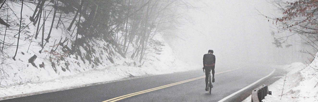
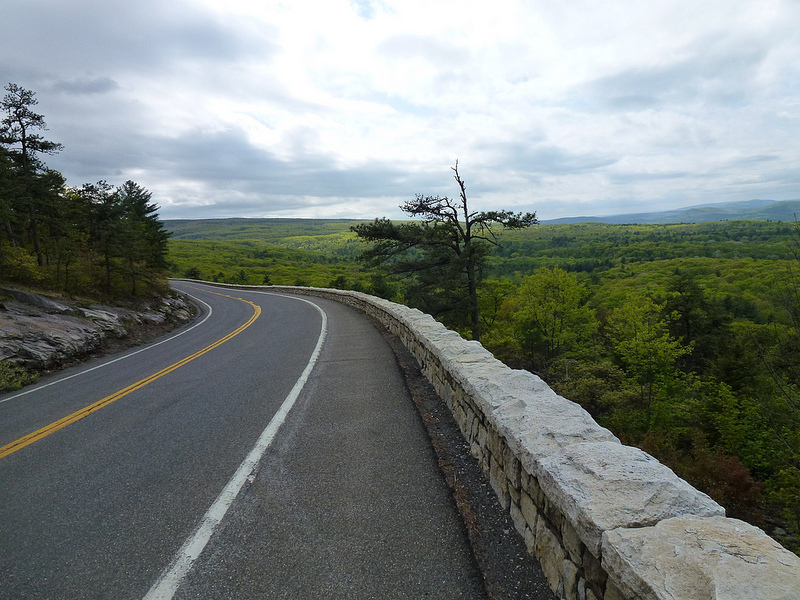
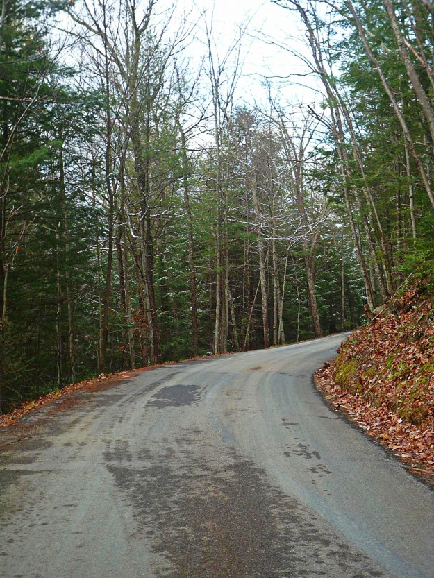
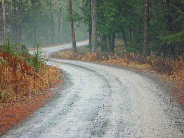
Day 1: 32 miles in relatively mild conditions. An altogether unremarkable ride, although the fog rising off the lakes and streams lent it a mysterious air.

Day 1 2e

Day 1 6

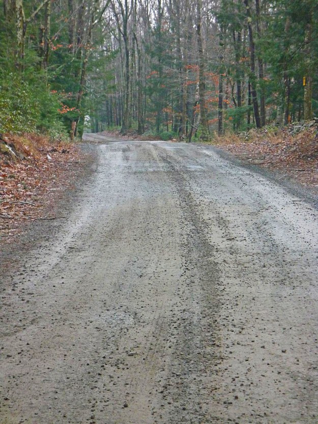
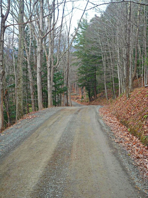
On day 2, there was an all-day downpour. I chose the gravel back roads, and made a mess of myself. I rode 15 miles to the local diner in Naponach, and they wouldn’t let me sit inside, so I enjoyed my weekly grease infusion outside on the smoker’s bench. Luckily, it was sheltered from the rain.

Day 2 1

Day 2 2

Day 2 3

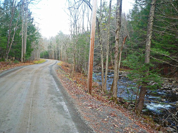
Took the long route home for a total of 35 miles. On the way back, I ran into these guys. Loved the goats, felt sorry for the horses. How anyone can find these things cute is beyond me…they just look stunted and uncomfortable to me. I just learned that they can be trained as service animals, and Illinois just signed a bill allowing them to go anywhere a service animal is allowed. Presumably they’ll have to wear horsey diapers, because–at least to my knowledge and direct experience on the West Side Bike Path in NYC–when horses need to go, they go.

Day 2 9

Day 2 10

As you can see, my neighbors here are very welcoming. I was raised in the country, then moved to NYC and lived there for 16 years. And now I’m back in the country. So does this sign mean I can come in, or do I have to stay out with the rest of the cityits?

Day 2 6

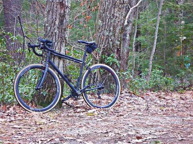
My beautiful baby…repurposed review coming soon.

Day 2 11

Day 3 marked the debut of my new bike, the Lynskey Procross, a titanium ‘cross bike with a silly twisted down tube. There are a number of things I need to do to it; first off I need to drop the bars significantly, cut the sternum puncher to the right length, and I need a substantially longer stem. First time ever on disc brakes. So far, it’s okay, but no English.

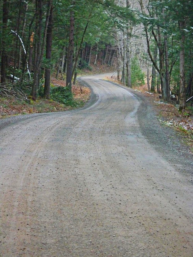
I only had time for 15 miles on Day 3, and I got off the bike every mile or so to make minor adjustments. I got a decent workout though, because most of those miles were riding up and down a local hill. That 32 sprocket is both amazing and disconcerting at the same time. I pride myself on grinding up the steepest hills in 36/25…but I have to admit the 32 on this cassette made an 18-degree ascent quite pleasant.

Lynskey

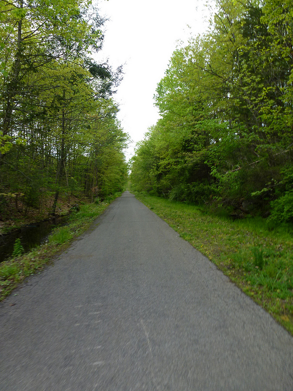
Days 4 and 5 saw me ride about 25-30 miles each day. Again, unremarkable for out here, but goddamn look at how beautiful it is. Only a few months ago I was dodging homeless people and clueless tourists jumping out of the bushes lining the West Side Bike Path just to fight my way to the George Washington Bridge and 50 or 60 miserable miles on 9W.

L1040193_pe

L1040195_pe

Yes, a highway. Just wait until you see our local Speedway and Turnpike.

L1040198_pe

L1040206_pe

If you’re in the area, Tetta’s Tire offers one of the few places to stop and refill. It’s at the intersection of County Road 2 (Krumville Road) and Samsonville-Kerhonksen Road.

L1040199_pe_pe

While you’re there, get a haircut. Maybe get some advice. What are you doing with your life, anyway? Fred can help.

L1040201_pe

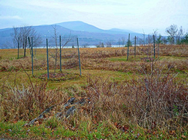
On the way home, I saw this and almost cried. A tragedy.

L1040210_pe

The most beautiful car ever made, outside of a meth shack. Most people love the convertible version of the Jaguar E-Type. For some reason, I’ve always been attracted to the coupe, particularly in the 2+2 configuration, which is considered the least desirable model.

I don’t have a driver’s license (although I am the proud owner of an Audi A7), and I don’t enjoy driving, but I do love cars. I’m fine with taking my bike everywhere; in fact, we’ve lived out here for 3.5 months and I’ve asked my girlfriend to drive me somewhere once. In retrospect, however, I should have asked for a ride to the dentist last month. Riding over potholed gravel is not advisable after having your mouth numbed. It’s one of those things that should be just common sense, like never cooking bacon in the nude. Anyway, now I know, and you do too.

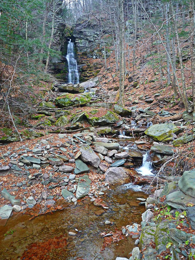
On the sixth day, I didn’t ride. Instead, I went for a 2.5-hour hike with my girlfriend, Margot, and Macs and Panda. The hike begins at about the midpoint of Upper Cherrytown Road. If you check out my Ride With GPS page, I’ve posted instructions on how to get there.

I’d rate the hike about moderate difficulty, meaning that even though I’m in good shape, there were a few parts that left me breathless. Includes some scrambles up relatively loose surfaces with large rocks.

L1040214_pe

Sometimes I wish I had four legs. Or at least that it was acceptable to walk around on all fours. Max and Panda had a much easier time on this hike than we did.

L1040217_pe

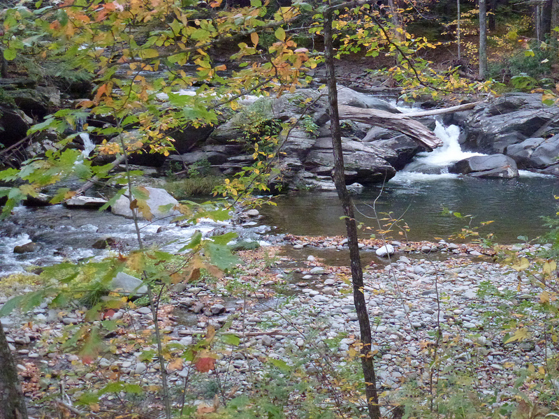
The hike ends at a lovely waterfall. If you continue on, I believe it links through to Yeagerville Road. This trail would be a blast on a mountain bike, but certainly is not doable on any other type of bike. Trust me.

L1040219_pe

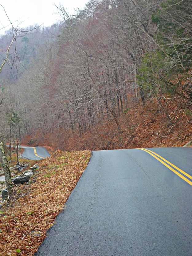
On the seventh day, there was snow and ice. 26.5 miles of it.

L1040229_pe_pe

I thought it might be a good idea to take gravel backroads, with the idea that the gravel would provide some additional traction. Well, that didn’t work out too well. I got about a mile down the closest gravel road, Lower Sahler Mill Road, and then had to turn around and very carefully duck-walk my bike back down the hill.

L1040226_pe

I continued back on Upper Sahler Mill Road, which wasn’t much better, but the asphalt retained enough heat from the day before to produce slush, rather than ice.

L1040227_pe

Not something you want to see when there’s a quarter-inch of black ice on the road and you’re on two wheels.

L1040230_pe

And finally, the latest iteration of the Lynskey. I’m growing to really like this bike. Those are the new Extra Leger 32 mm tires from Grand Bois. Don’t ask me how they performed yet, today was far from a good test.

L1040232_pe_pe

And that was my week. Of course, I left out the 70 hours I spent on work involving a new tyrosine kinase inhibitor for chronic myelogenous leukemia and Philadelphia chromosome positive acute lymphoblastic leukemia (FDA approved as of Friday!). But you don’t want to hear about that, do you?

Later this week I’ll post a ride that everyone should do once: Platte Clove. It will be complete with a brief dissertation on the origins of the Hutterite branch of the Anabaptists and the founding of the Bruderhof. You think I’m kidding, don’t you?

John

http://www.medicalwriter.net

Lundy Road: Highway to Hell?

On the right, Rogue Harbor road. Lundy Road continues on the left. Follow for 3-4 miles  to Pottersville. The road becomes extremely rough, passable only by Jeeps, bikes, and hikers.

Image

The area is quite isolated today; I can’t even imagine what it was like 100 years or more ago. A milling town called Potterville was founded here in the 19th century and named after the owner of a lumber mill, Francis Potter. Potter’s mill was the main source of income for the townspeople until it burned down. Because it was the sole employer in the town, people began leaving. In 1927, there was a flood that accelerated the exodus.

According to Ulster County records, several murders occurred there; a man killed his family and then killed himself; in another incident a murderer was caught and hung in the town square. I’m not superstitious, but some who have visited the remnants of Potterville report a feeling of being watched.

The land Potterville once stood on is now owned by Open Space Institute and the buildings have been demolished, although you can still see some foundations.

The road and the country up there are beautiful, but I have never seen anyone on Lundy Road past this point…scared maybe? Perhaps one year I’ll  organize a Halloween ride up Lundy, to arrive at midnight.

Getting there from NYC: Take the Metro North to Poughkeepsie, and then take this route, which I described in a previous post, to get to Kerhonksen. Then take this route  to the end of Lundy. Fat tires are a good idea, but I regularly ride this route on my precious…my precious…ahem, excuse me…on 25 mm FMBs.

Good luck, and if you make it out alive let me know.

Image


Getting There: Part I–The Hard Way

Over the next few weeks, I’m going to post a number of different routes to the starting points of my rides. We’ll start with one that I’d consider intermediate difficulty. The route starts in Poughkeepsie, New York, which is easily accessible by Metro North Rail from Grand Central Station.

It includes one long, but not particularly challenging, climb over the Gunks on route 55.

Image

You’ll pass over the Walkway on the Hudson–the world’s longest pedestrian bridge–and continue for 5 miles on a bike path.

Image

If you’re using my GPS route, your device will go crazy here. Don’t worry…for some reason Ride With GPS will no longer allow routes to follow bike paths, so I had to draw lines. Just silence your device and follow the bike path until you come out at a ball field nestled in the hills.

Image

Ultimately, you’ll emerge on Route 299. This road is busy, but there’s a wide shoulder and it is ever so slightly downhill into New Paltz. You can easily complete this short segment in a few minutes at 25-30 mph, provided the wind cooperates. Continue through New Paltz, down the hill, and cross the bridge over the river.

Here, you’ll have a decision to make…either way you’re in for a climb. If you take a right, you’ll climb on Mountain Rest Road. If you go straight, you’ll climb on 55 through the middle of Minnewaska State Park. Today, we’ll pretend we went straight, continuing on County Road 6 past this lovely field.

I’d actually recommend this route for the trip out to the good stuff, and then taking Mountain Rest Road on the return trip. You can find a description of that climb on the Rapha site. Trust me, it’s not as bad as it sounds; in fact, my friend who rides a 30-lb bike has accompanied me on several occasions up this climb, no problem. More about that in a separate post.

Image

Between mile 16 and 17, you’ll hook around to the right and start climbing on 55. At the base of this climb, though, there’s a German restaurant, the Mountain Brauhaus, with excellent food, albeit decidedly 70s decor. There is also a convenience store across the street as well as a tiny Eastern Mountain Sports shop. Have some spatzle and fill your water bottles. At some point, I’ll post a route with the Brauhaus closer to the end. It’s not a good place for a meal at the beginning of a ride, but it sure would be welcome after a hundred miles!

Image

When you’re done admiring the waitresses in their lederhosen, continue up 55. The climbing begins at mile 17, and continues through about mile 21. It’s a Cat 2 climb; average grade 3.5%, maximum grade 9.2%.

You’ve reached the top at mile 21. Not much to see there, but if you pause during your 7-mile 50 mph descent, you’ll get a great overview of what lies ahead.Image

At the base of the descent, you’ll reach a T intersection. There’s a gas station where you can refill or get some packaged food; if it’s hot out you’ll definitely have gone through two bottles on that climb.

Where you go from there is up to you, but try to minimize time on 209, which is the only really busy road in the area. If it’s hot out and you need a break, take a left on 209, a right on Lundy, and continue to the secret swimmin’ hole. Just don’t tell the locals who told you how to find it!

Image

You can find the train schedule here. You should have a bike pass, although in 5 years I was only asked for one once. They can be had for $5 at any window in Grand Central. Also bring a bungie cord to attach your bike wherever you can find a spot in the car. The best spots for bikes on Metro North are, unfortunately, usually adjacent to the bathrooms.

The GPS route can be found here.

No more posts until next week; I’m off to California to lend my wisdom to an advisory board.

Enjoy!

John

www.medicalwriter.net

Worth the Trip: Peekamoose 52

(Retrospective note: I have also mapped this complete route out of Poughkeepsie. You can find it here.)

This past Sunday, I was fortunate enough to have excellent weather for what I thought would be a quick 52-mile ride up and over Peekamoose Road, a narrow, poorly maintained road passing through the Catskills. This was the route I developed on Ride With GPS; I planned from the beginning to follow it only loosely because I wanted to explore some of the side roads that extend off of Peekamoose into the deep mountains.

route-1841918-map-full

I had planned on getting an early start. However, my wonderful girlfriend decided to cook me breakfast, so it wasn’t until 10 am that I set out with a belly full of pancakes and fruit salad.

The route starts with Grassy Ridge Road, a rolling but easy warmup for what’s to come. I definitely needed the warmup after that breakfast.

1. Grassy Ridge Road

We continue on High Point Mountain Road, which leads past the Ashokan Reservoir. This is the low point of the ride. Not emotionally…in elevation.

4. Ashokan Reservoir from High Point Mountain Road

Watson Hollow Road leads into the mountains. I took my first detour here onto Moon Haw Road, which leads high into the mountains and ends in what looks like a few trails into the park.

6. Watson Hollow Road

8. Headed into the Mountains

7. Headed into the Mountains

The climbing begins with a slow and painful crawl up Peekamoose. The climb is steady from mile 8.0 to mile 13; maximum grade, 16.5%. I was swearing at myself by the time I got to the top, and I took a few moments to contemplate the sheer stupidity of what I do for fun. As a note, you’ll want to carry ample water and perhaps some food if you are taking this route during the off season, as there are no convenience stores for a refresh. During the season, you’ll see a shed at about the half way point, run by a local who sells the basics.

11. Peekamoose

9. Peekamoose

Once you make it the top, though, you are rewarded with a high-speed 7-mile descent into the next big climb, and some very nice scenery.

If you’re using my GPS route (link below), note that your GPS will occassionally indicate that you are off course. You’re not, and your GPS will find the route again in a few seconds. It’s not like there are any other roads to take, anyway.

12. Peekamoose

13. Peekamoose Waterfall

Peekamoose tops out at 2100 feet after a second climb (not as brutal as the first). I know it’s not much compared with the Rockies, but it’s what we have to work with. From what I understand, though, the roads around here are a lot less forgiving–that is to say, the people who planned and built them didn’t give a damn about extended 15% to 22% grades (more about that later, when I write about Platte Clove).

Here’s the view from the top of the ride.

14. At the top of Peekamoose

From Peekamoose, I turned onto Mill Road, which after a terrifying descent on broken pavement quickly turns into gravel. At exactly the wrong time, meaning just when you’ve hit 50 mph from the descent.

16. Mill Road

From there, it’s a quick trip on Route 55 to Naponach and a diner with edible food. You’re looking at the Gunks in this photo; if you continue on 55 you can climb up and over, ending up in New Paltz and, ultimately, Poughkeepsie. There are easier ways to get there, though.

19. 55 Going into Naponach

The route as shown is 53 miles. With exploratory detours, I rode 72 miles with about 7300 feet of climbing. Not counting the 5-mile section on route 209, I probably saw 10-15 cars the entire day.

A good day.

This route is definitely worth your while. Add in a trip to and from Poughkeepsie (preferably over the Gunks) and you can have a great 100-mile day. I’ll post later this month on good routes from Poughkeepsie to the starting points of my rides.

The complete GPS route can be found here.

John
medicalwriter.net

Ride Report: First sub-32 degree ride of the season

Every year, I turn into a chicken in late November when the weather starts getting really cold. I start thinking up excuses not to ride, and I’ll even skip one or two. I always get over it after a week or two of cold weather, after I realize that—provided I’m dressed properly—I’m not going to die after all. In fact, riding in the cold is a blast.

Today was my first sub-freezing ride of the season. It was only 26 miles, and it might have been 33 or 34 degrees in the sun, but it was pretty damn cold with the wind. I started at my place in Olivebridge, and hit about 10 miles of gravel, starting with Woodland Road, which leads past So-Hi campground.

Unfortunately, the two great parts of the route are linked by Route 209, which has relatively heavy traffic but wide shoulders. I continued on route 209 for 6 miles, and then took a right on Mettacahonts to head back home. The fun begins at Bakerstown Road.

Dug Road. There’s a good climb to get up here. I’m usually accompanied by Dug the dog. I don’t know who owns him (actually her) but she’s always running around in this area. One time she followed me at about 15-20 mph for over 3 miles. She looked tired and was panting really hard, so I let her lap Gatoraid out of the top of my water bottle.

Dug Road peaks with a nice view of the Catskills

Dug leads into Sundale Road. Getting closer to home. I still can’t believe I live here!

And finally Lower Sahler Mill Road. Good trout fishing in the stream to the right.

Here’s the chariot. I’m going to remove the ugly damn Zipp stickers.

In any case, I’m now over my annual case of cold-induced anxiety. At the end of my ride it was 26 degrees and I was fine. In fact, better than last year since I finally gave in and bought some neoprene booties.

Here’s the route. I changed the starting point to Stone Ridge for those of you who are interested in riding these roads.

GPS coordinates can be found here.

…and I promise to fill you in on much longer rides—ones that are worth the trip out here—in the near future.

John

www.medicalwriter.net

Introduction

On September 17, 2012, I finally left New York City behind and moved to Olivebridge, New York. I had been riding up here for years, always taking the train from Grand Central and then leaving from Poughkeepsie. I always had this notion that someday I’d live here. Well, here I am in the foothills of the Catskill Mountains, and this is the view from my window.

And why not? Our neighborhood—South Street Seaport—was going the way of the East Village circa 2003, mostly due to the fact that the fish market had moved out. We both work from home and have no particular reason to be in the city any more.

We were particularly lucky because, just a few weeks after we moved, our neighborhood was flooded and our building was rendered more-or-less permanently uninhabitable.

I’ll be honest: I mostly moved up here because of the riding. This blog will focus on riding in the Catskills, particularly the rough and dirty rides on back roads, on gravel, and occasionally cross country (although the latter is almost always accidental).

I’ve had a chance to ride most everywhere in the Tristate area and beyond, and—take it from me—this is the best riding to be found in three states, and perhaps anywhere in the US. All of it accessible by train from New York. I’ll try to provide guidance on the best rides, where to start, where to refill your water bottles and eat, and what to avoid, and I’ll include maps and GPS files. I’ll also talk about my bikes, post an occasional product review, and lots of pictures of animals.

Enjoy!

John

www.medicalwriter.net