Category Archives: English

English eTapped

It is done.

My friends at Bicycle Depot in New Paltz installed eTap for me. Good decision, they spent a ton of time getting the front to shift right on my very unconventional gearing.

Admission: I have a mountain bike crank and 46/28 ten speed rings from circa 2011–that is to say they are lacking many of the modern conveniences like good shift ramps etc. In any case, they do not get along super well with eTap. Just a note for people who are planning on retrofitting a gravel bike, with gravel gearing, with eTap.

My plan is, ultimately, to get Rotor’s 46/30 “Spiderings” and a Rotor crank to improve shifting. Kind of a bummer to have to get rid of my lovely THM 400-gram crank though. If you want it, you know where to find me.

However, even though the guys at Bicycle Depot were not entirely satisfied with the front shifting, my first words after a ride around the parking lot were “clearly, you guys have higher standards than I do!” It’s still better than mechanical.

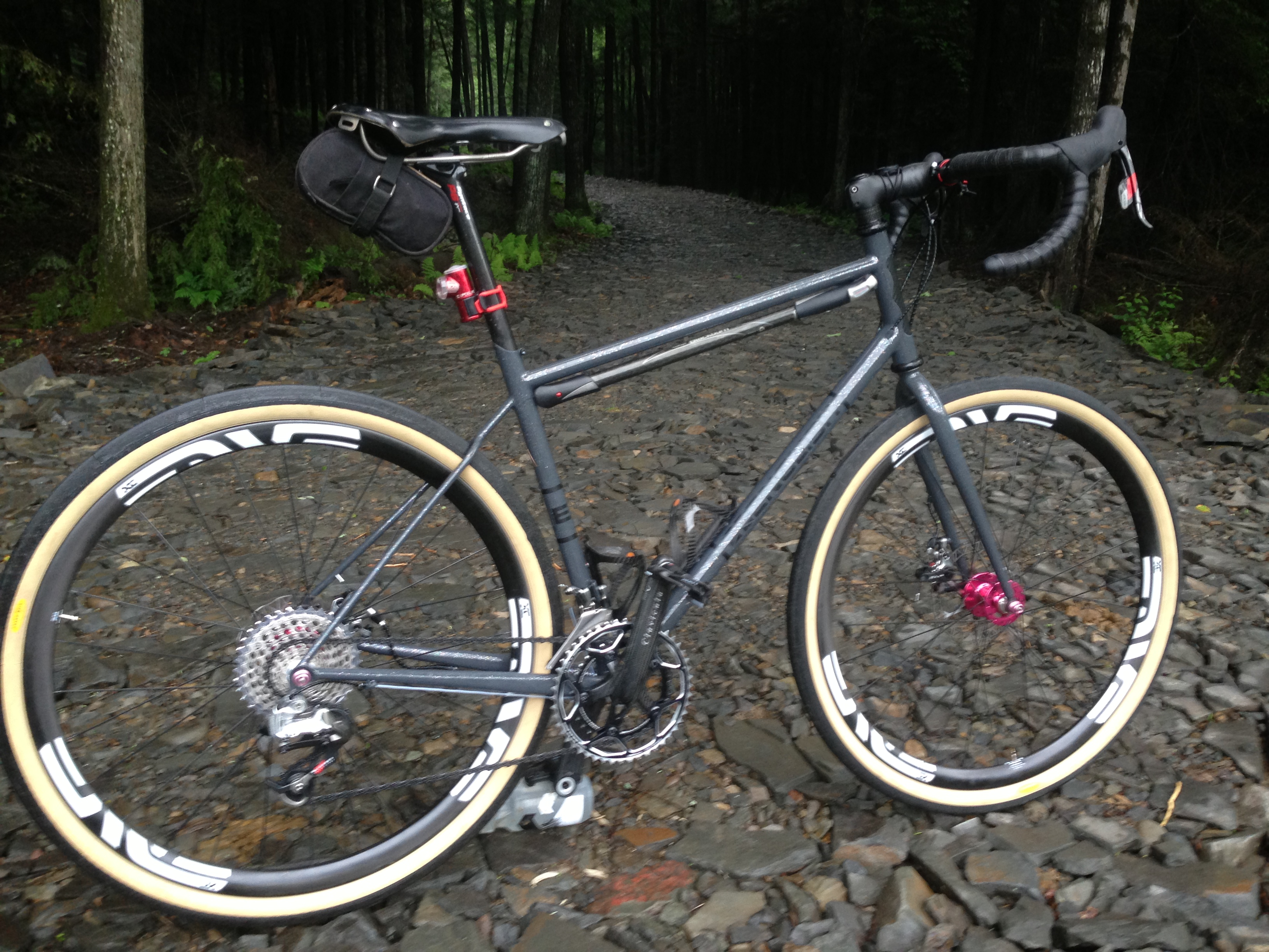
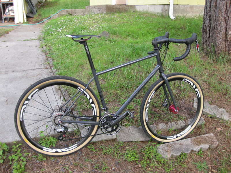
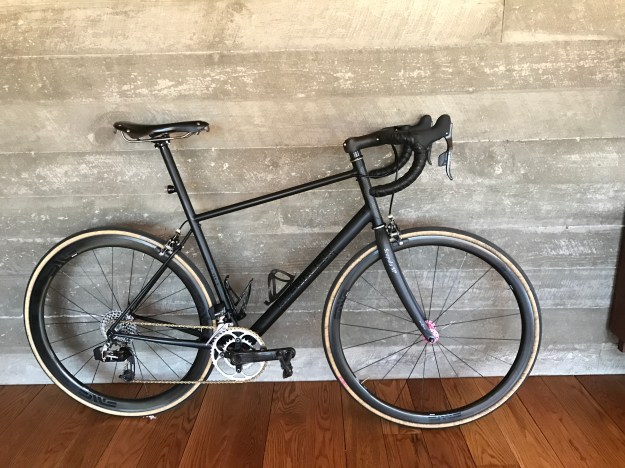
Some pictures, I’m going to ride it for real tomorrow, provided my clients give me a minute to get out of the house.

So refreshing to have new bar tape. The old stuff was getting ratty.

img_0050

Pretty busy up front with levers, Garmin mount, light mount and blips. But only 2 cables! Looks weird.

img_0052

Blips. Mike at Bicycle Depot originally wrapped them under the tape (at my request) and then let me know it looked a little like my handlebars had grown tumors.

img_0053

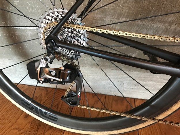
Front derailleur with the aforementioned 10-speed mountain bike rings. Derailleur and old rings do not get along well. I don’t really need 46/28 any more, since…

img_0054

…I have an 11-32 cassette.

img_0055

PS: If you’re more interested in routes, a complete library can be found here.

John

medicalwriter.net

My Dumbass Adventure

I’ve hypothesized for a while that I could get from my area, just south of the Catskills, over to Yeagerville Rd—and from there, to Peekamoose Rd, by taking a little road called Trails End (no apostrophe, thanks).

Trails Endl

On maps, Trails End Rd terminates unceremoniously a few miles from the terminus of Yeagerville Rd. Yet I knew that there was a gravel path that headed over the mountains that was unmarked on maps. I just didn’t know where it ended.

Today, I decided to find out. I won’t bore you with the 10-mile trip to and from, so let’s start at the base of Trails End Rd. I knew that I had a good-sized climb ahead of me, about 1000 feet in just a few miles. Mostly on gravel.

L1020670_pe

As expected, the road ends and gravel begins…

L1020671_pe

There’s nothing like 12% to 15% climbs on loose gravel. I had to get off my bike for a moment and walk about 100 feet, pursued by clouds of hungry mosquitos.

L1020672_pe

About a mile in, you have two choices: There’s a path that is apparently for hikers…

L1020676_pe

Which really doesn’t work well on a bike, even one with fat 650B tires. Too many large rocks. I suppose someone with really good cyclocross skills could navigate it, but that’s definitely not me.

L1020674_pe

However, if you turn around, as I eventually did, there’s a snowmobile trail leading up, up, up.

L1020677_pe

Which leads to some nice, but very loose, gravel roads.

L1020678_pe

L1020679_pe

L1020680_pe L1020681_pe L1020682_pe L1020683_pe

L1020684_pe

It was pretty clear as I reached the apex of the ride that I was actually going over a mountain. As I entered a brief clearing, I couldn’t see any peaks around me–an unusual occurrence. Thus, I made it to the very top of something, but I know not what.

Unfortunately, I did not make it to the end of the path today. A storm was closing in, and there was thunder and lightning off in the distance. I figured it wouldn’t be a good idea to be caught on top of a mountain in the middle of thunderstorm. So I very cautiously picked my way back down the road and returned home. Indeed, within about a mile of my place, the skies opened up!

In retrospect, this was fun, albeit extremely strenuous, but kind of dumb. I went out on a road that is not marked on any map, in an area that has no cell phone service, and climbed over a mountain on loose gravel with inclement weather threatening. I also decided to do it on the fly, so I didn’t inform anyone where I was going to be.

Some day, hopefully this year, I’ll find out what lies on the other end of this path. Preferably with a companion next time!

John

medicalwriter.net