Monthly Archives: November 2013

Graph theory, Eulerian circuits, and the Catskills

How’s that for a nerdy post title? Globecanvas here.

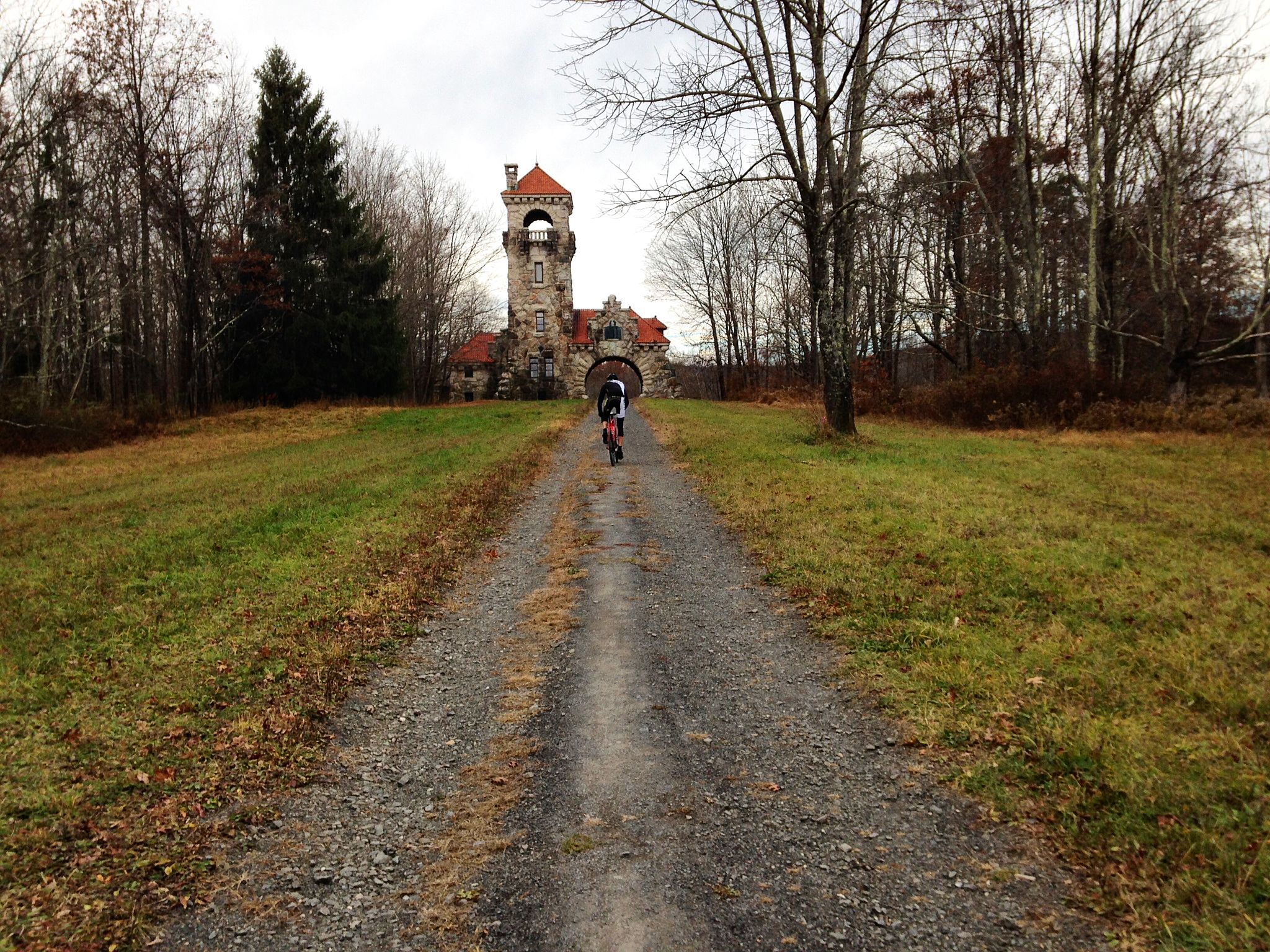
In my previous post, I wrote that you might like to follow the Mohonk Preserve route I posted, or you might just want to bike into the Preserve and see where the spirit takes you.

That advice works in the Preserve, because the carriage roads are dense, and intersections are frequent, relatively speaking. It does not work in the Catskills. As with any mountain range, the topography of the Catskills defines a system with sparse edges (that is, mountain passes) and infrequent vertices (that is, intersections). Unless you have lights, lots of food, and no evening plans, you should at least casually plan your route before cycling into the Catskills.

Add the additional factor that cyclists almost universally hate to retrace their route — we love our loops — and the result is that route planning becomes an exercise in creating Eulerian circuits.  (Score a math nerd point if the you are now waiting for a Konigsberg reference.)

For example, imagine you are starting in Woodstock and you want to climb both Platte Clove and Kaaterskill Falls. Even though both climbs are within 7 miles of Woodstock, you have to ride 85 miles if you don’t want to retrace your route. These two climbs happen to be the only passes through the entire eastern escarpment of the Northern Catskills, so if you want to get from the top of one to the base of the other, you have to ride a long way around.

platteclove-kaaterskill

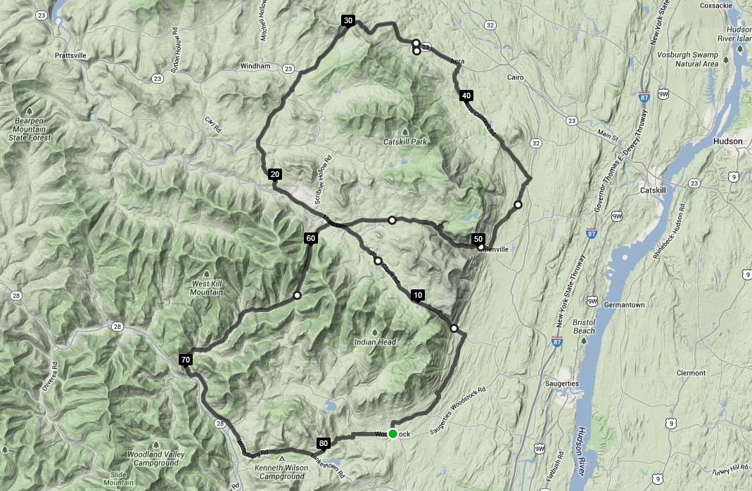
Climbing Peekamoose in the Southern Catskills has the same problem. Starting from Rosendale, the climb is less than 20 miles away, but the shortest loop that includes Peekamose is 70 miles long.

peekamoose

Of course, these are only “problems” in the mathematical sense of the word. After all, long, scenic roads with no intersections are the whole point of riding through the Catskills! The only actual problem is finding enough hours in the day to ride where you want to go.

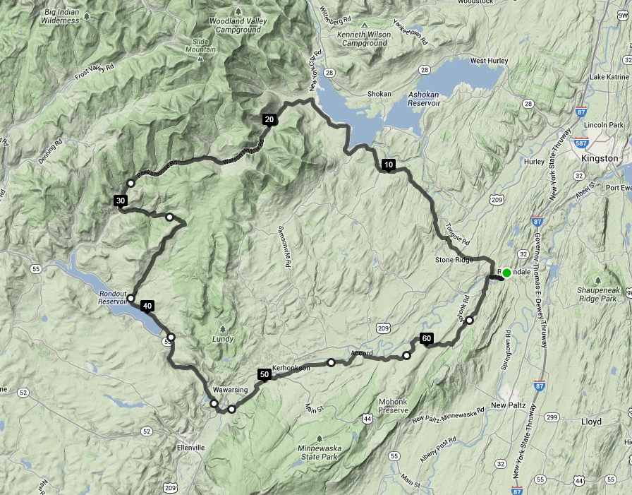
Which brings me to today’s route. I wanted to do an actual Catskills ride, but I only had about 4 hours. My go-to route for this sort of medium range ride follows the entire edge of the Southern Catskills, from one end to the other. (This happens to be a big loop around John F’s soon-to-be-former house, and he’s written about parts of this route before, which much nicer photography, so I’ll keep this ride report on the brief side.)

I started from Rosendale, because I live there, but I also mapped the route from New Paltz if you prefer to start there. Either way, this route has over 100 feet per mile of climbing, so be prepared for a nice low average speed.

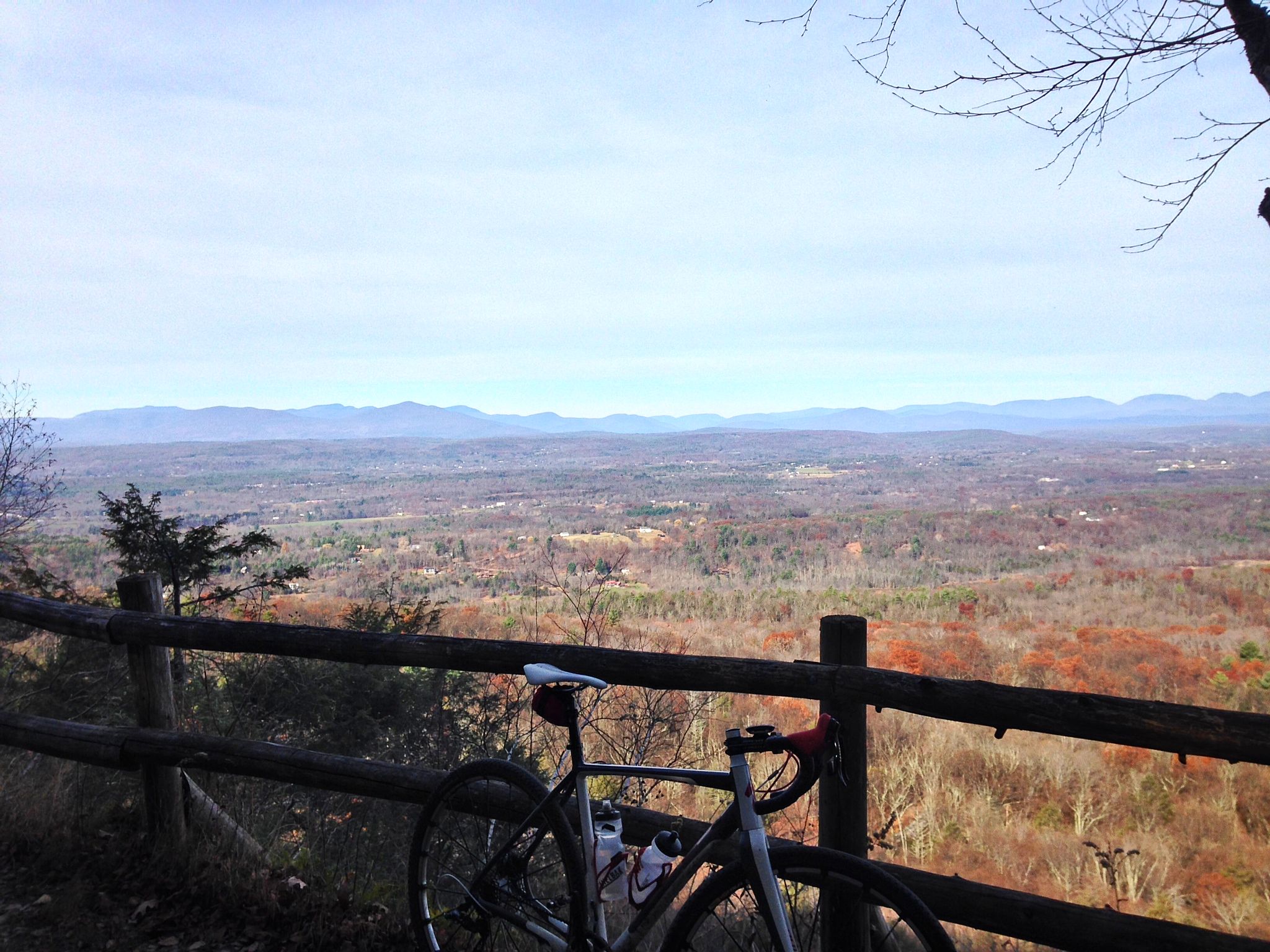
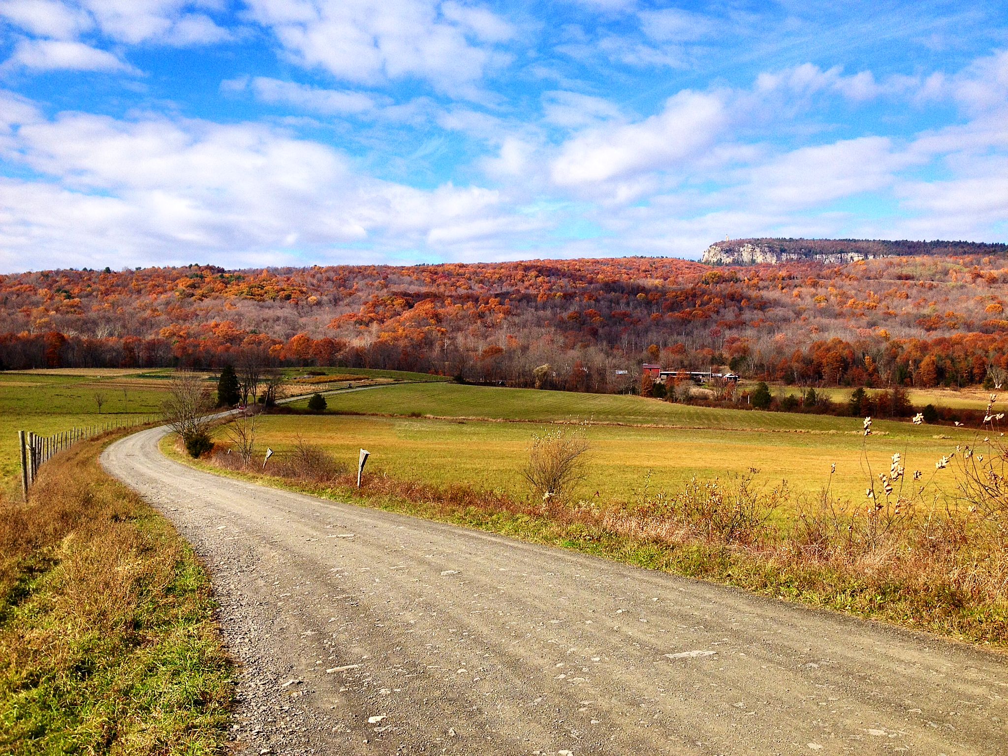
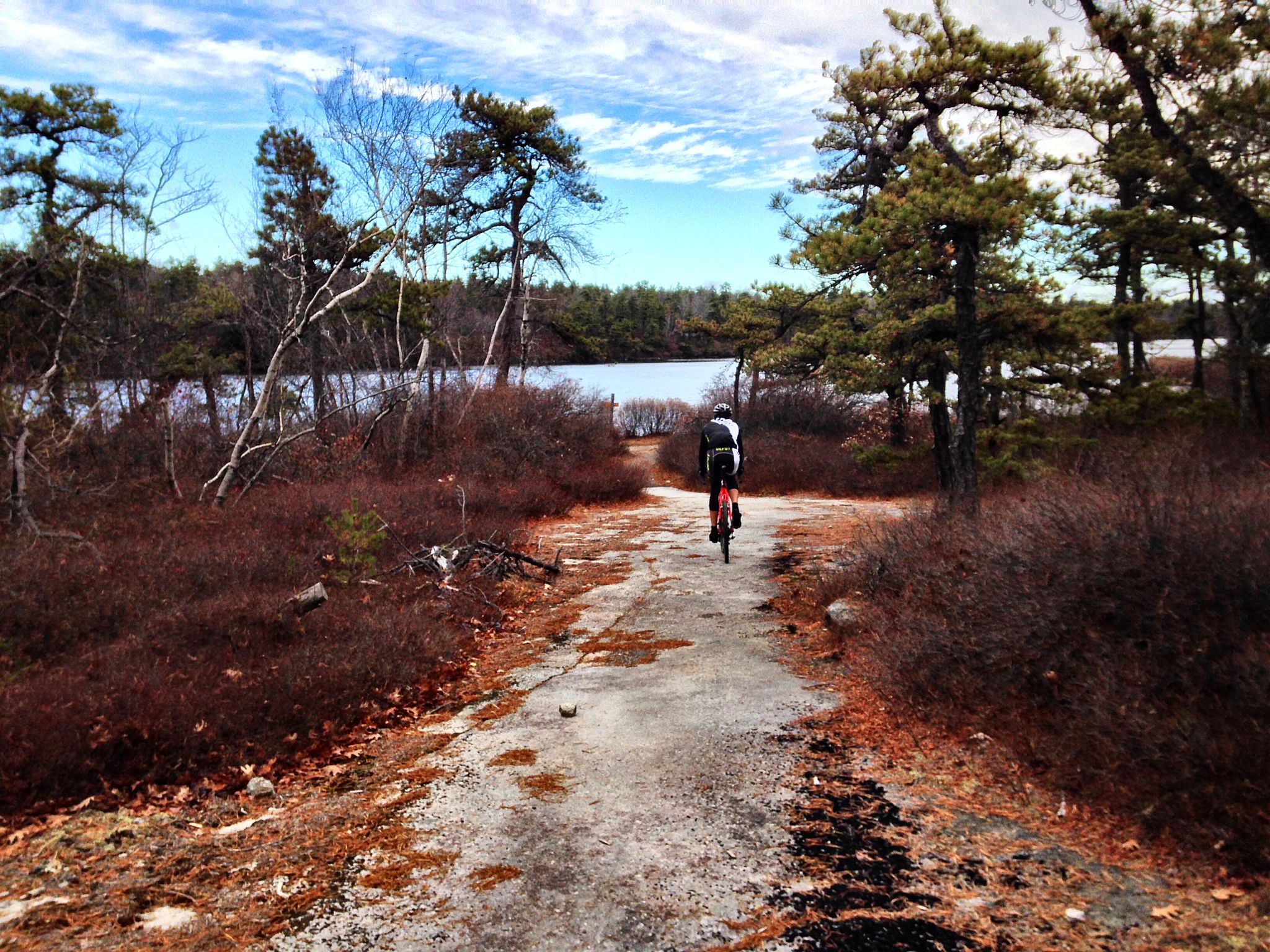
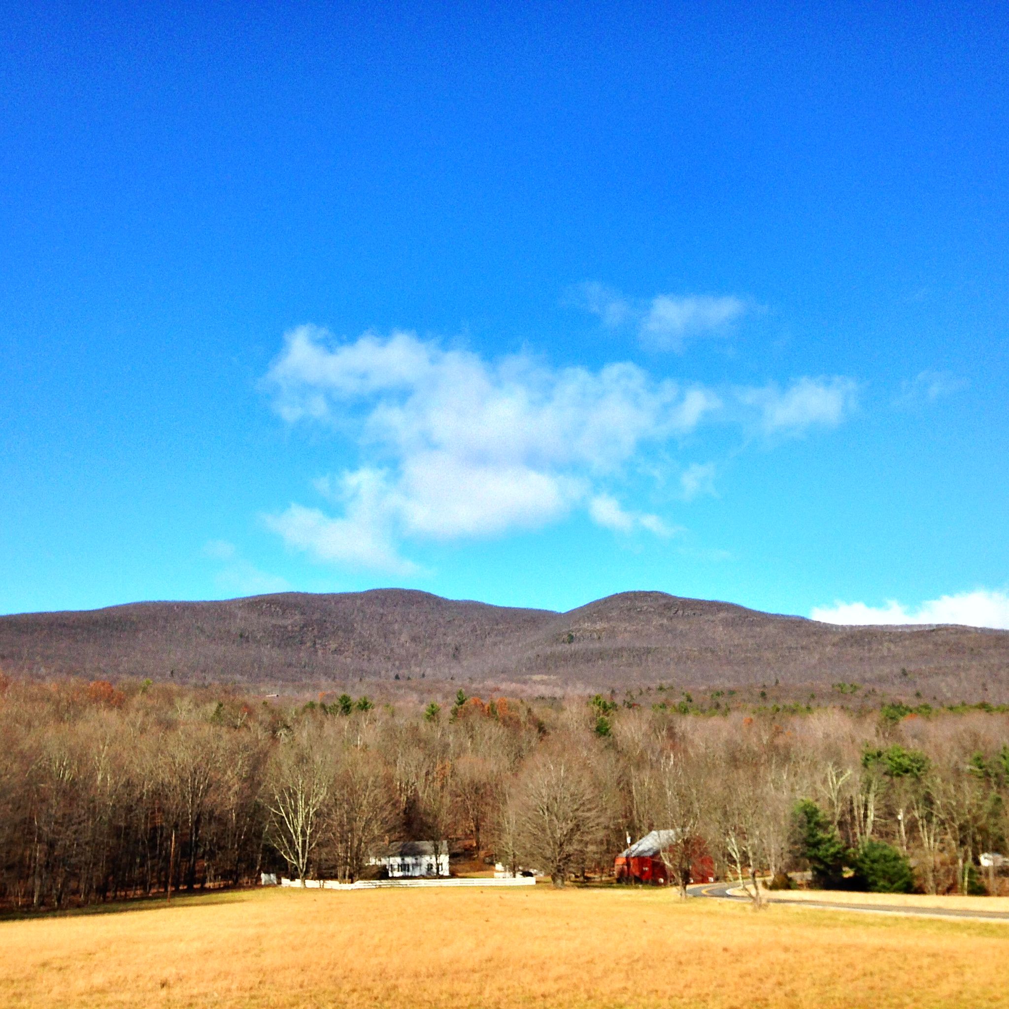
The first part of the ride is on some very quiet, pretty roads along the back side of the Shawangunk ridge. Towpath Road and Stony Kill Road are personal favorites, winding roads with varied terrain and occasional vistas looking toward the Southern Catskills. The peak to the far right is Ashokan High Point. We’ll be there in about 2 1/2 hours.

lawrence hill

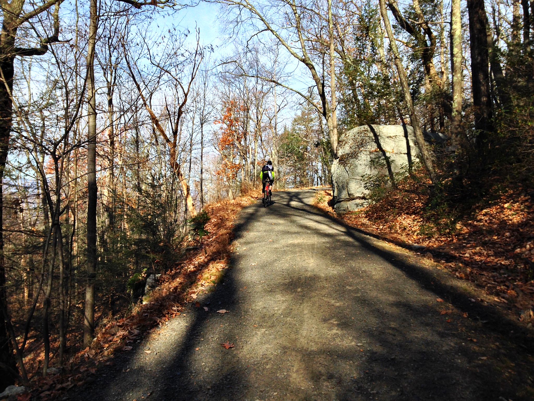
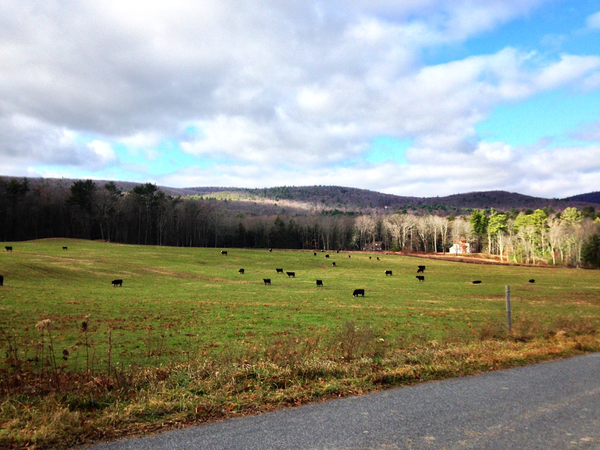
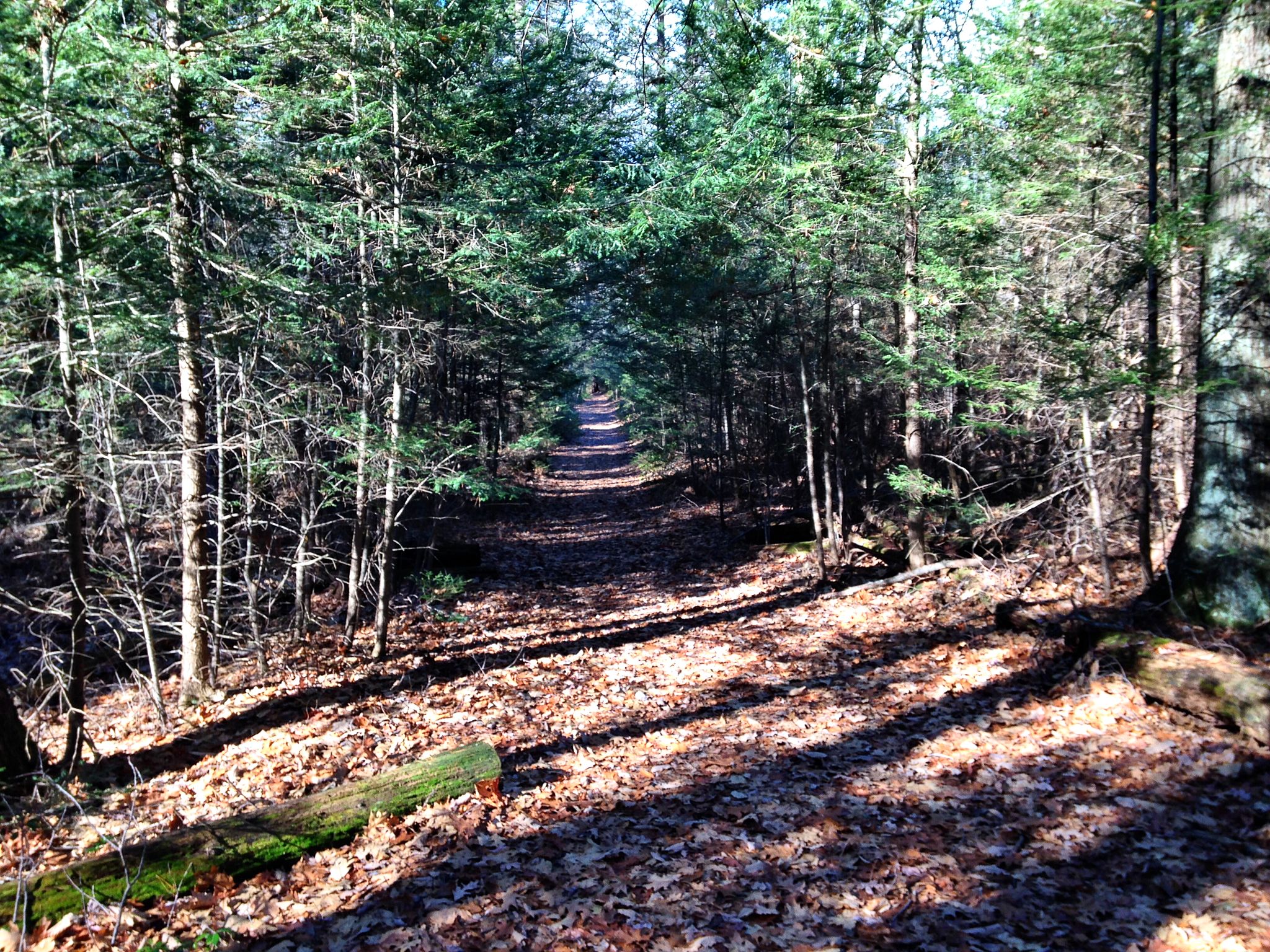
After a high speed descent down the ridge into the sad-looking hamlet of Kerhonkson (sorry, Kerhonksonians), the road turns upward again as the route enters the Catskills highlands. The highlight of this part of the ride is Upper Cherrytown Road, a lovely 10-mile stretch of road with no intersections, along the edge of the mountains. I was impressed by the even distribution of these cows. I also had a bit of deja vu. This may be the second time these cows have appeared on this blog.

cows

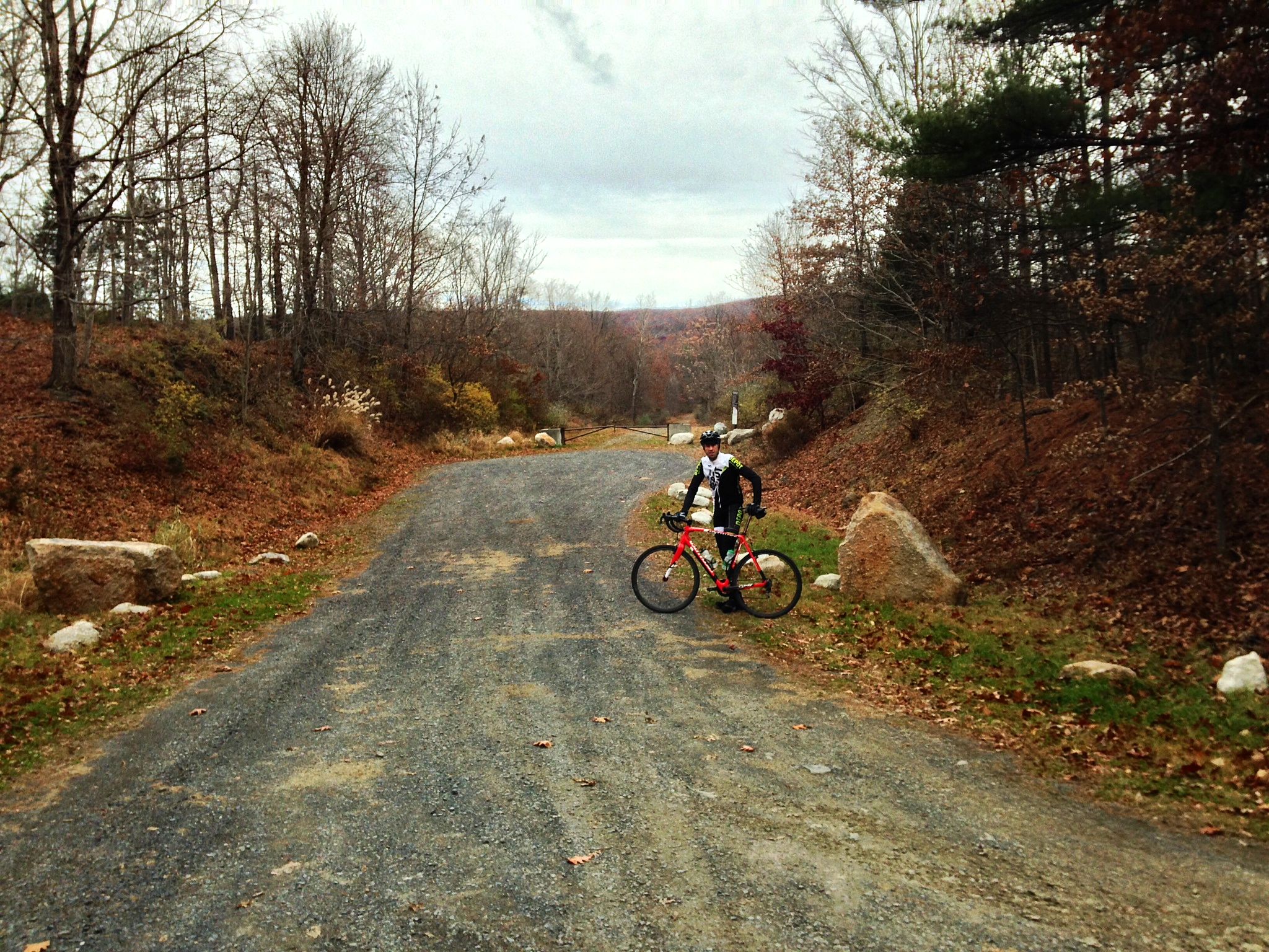
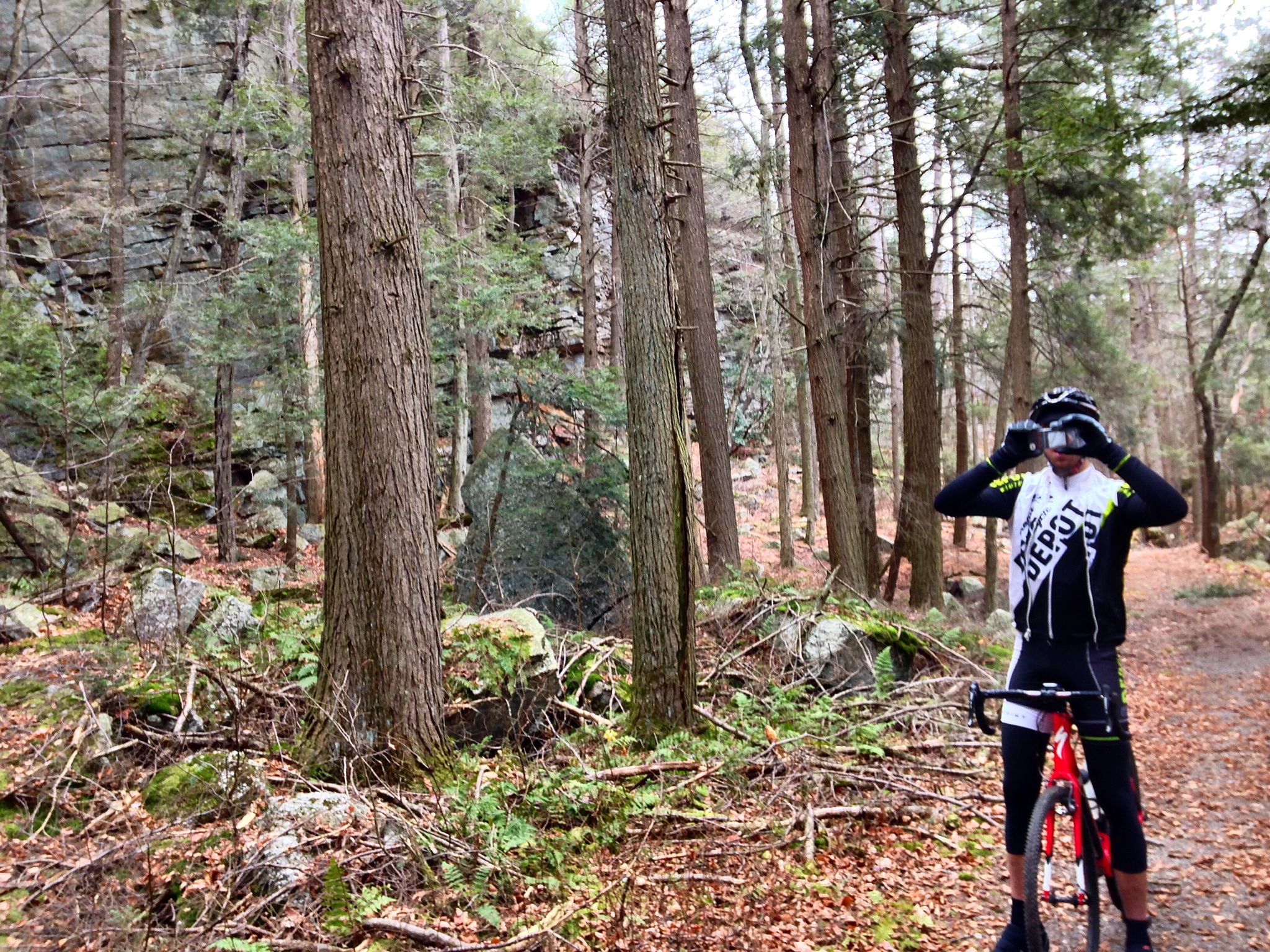
This part of the ride is a long, gradual climb to the Vernooykill Falls trail, which John F has written about before. This path is the only way through the Southern Catskills over to the next pass to the west, but it’s borderline on a road bike, so although it’s a lovely path, I passed on by.

vernooykill

The houses and farms along the west side of the road all have mountains in their back yards. This is Mombaccus Mountain, a minor Catskills peak with a couple of nice steep dead-end climbs.

high point

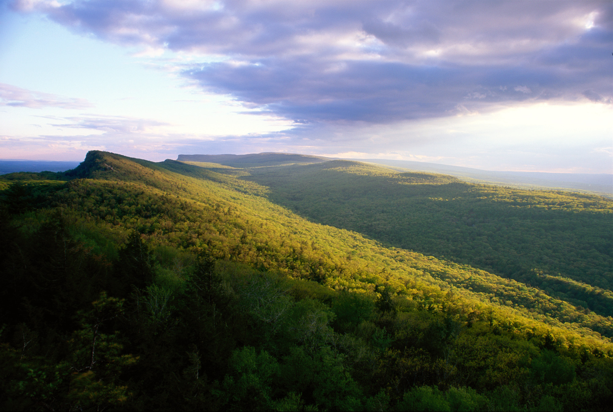
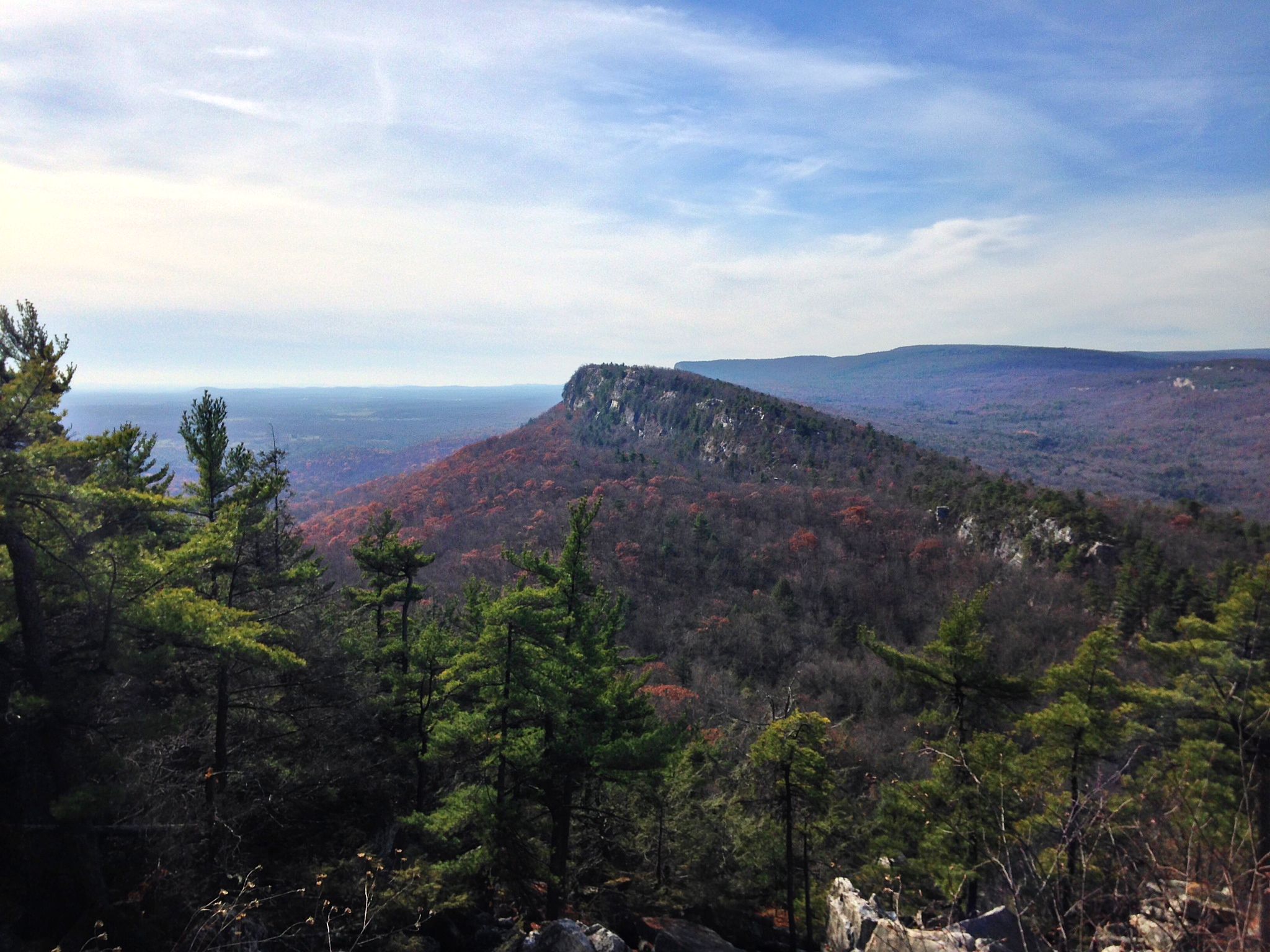
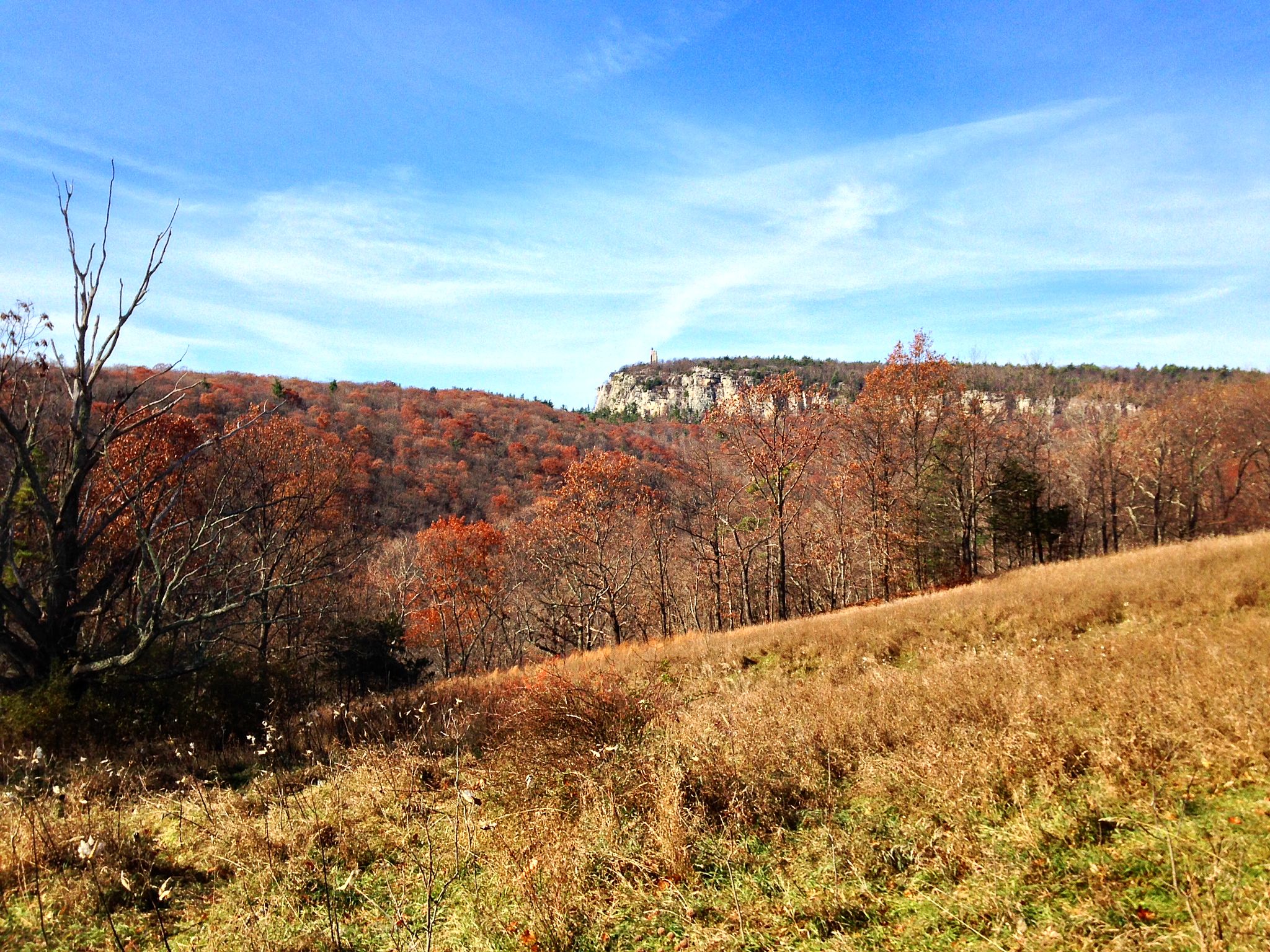
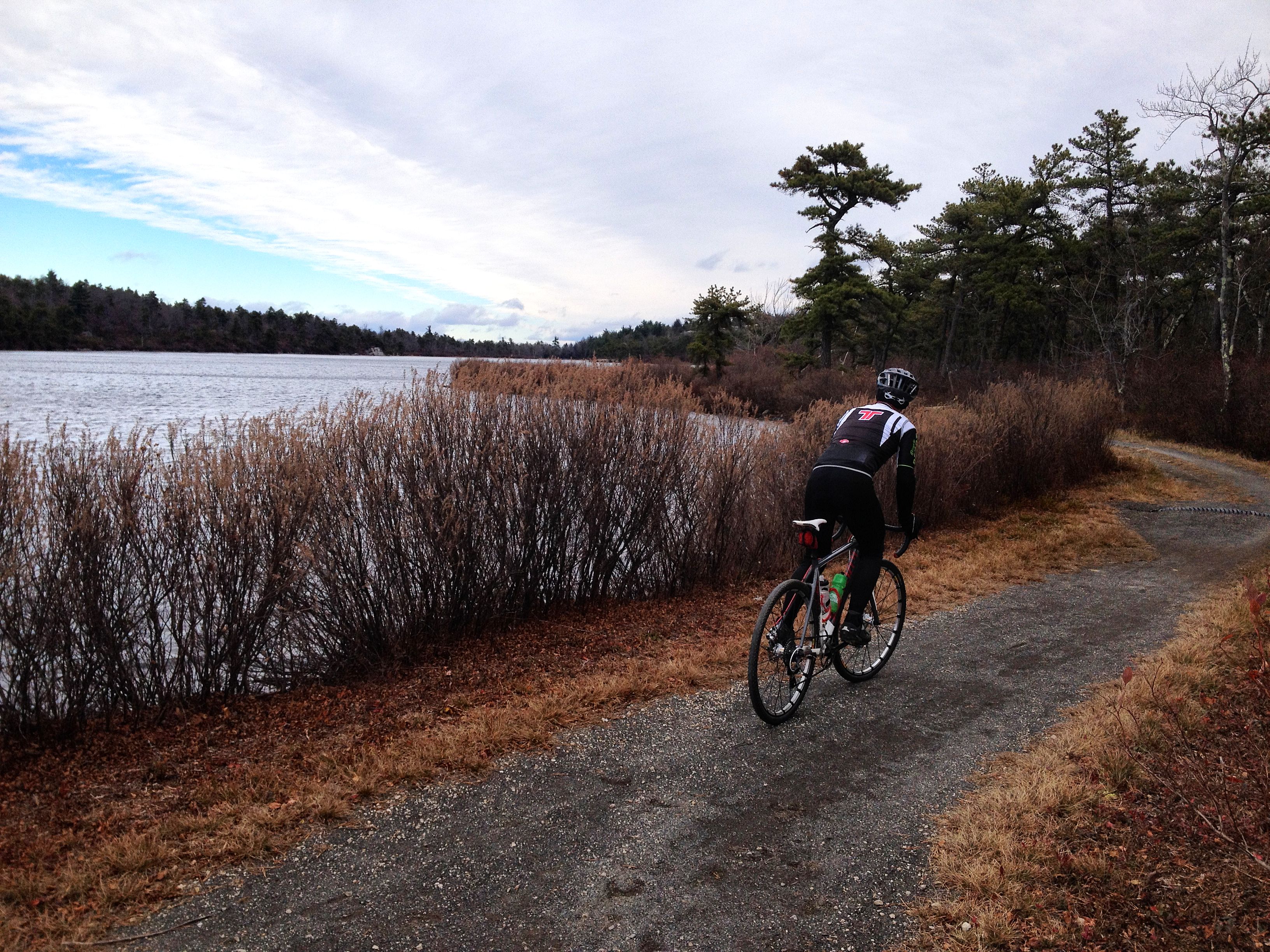
The route then circles Ashokan High Point.  It’s not the highest mountain even in this part of the Catskills, but its high prominence catches the eye from as far away as Dutchess County. High Point Mountain Road is a five star road that follows the skirts of the mountain, with occasional peeks at the Ashokan Reservoir below.

The road is mostly up, but with short and quite steep descents. One of the descents has a farm at the bottom with all sorts of roaming chickens, guinea hens, and assorted avian road hazards. Be careful! Newman once ran over a chicken here and was then chased by an irate farmer. The road also ends in a steep downhill to a stop sign, so be careful there as well.

At the end of High Point Mountain Road, a right turn leads to Route 28A, which circles the west end of the Ashokan Reservoir and crosses the Esopus Creek. 28A ends at Route 28, which is the major route through the center of the Catskills, and a road best avoided on a bicycle. It’s somewhat scenic, but the combination of high-speed traffic and the valley wind tunnel effect is unappealing. Luckily, two excellent roads lead off the other side of Route 28.  Piney Point Road is a great option if you are heading towards Woodstock.

I was about ready to start heading back, so I chose Upper Boiceville Road, which looks at first like an access lane for the high school parking lot, but in fact leads to a surprisingly tough climb up Bostock Mountain Road. This is 2 miles at almost 7% grade, the final 3/4 mile at over 9%. Even on a ride with over 6700 feet of climbing, this hill stands out in the elevation profile, at mile 43.

elevation

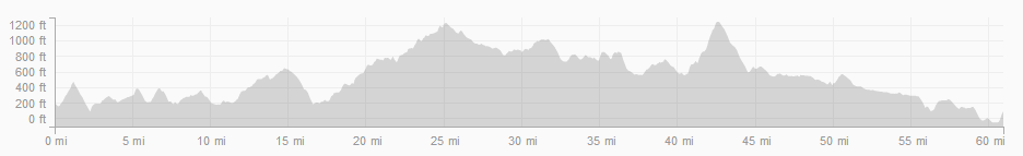
The top of Bostock Mountain was the high elevation of the ride, but unfortunately the road is on the back side of the summit and wooded, so no breathtaking vistas. A fast descent leads back to Route 28, thankfully less than a mile from Reservoir Road, which crosses the Ashokan Reservoir, and leads to the maximally scenic path along the south side. Plenty of mountain vistas here, including a spectacular view of the Burroughs Range. At least 6 of the Catskills high peaks are visible in this photo, including Slide Mountain dead center, the highest peak of all.

reservoir

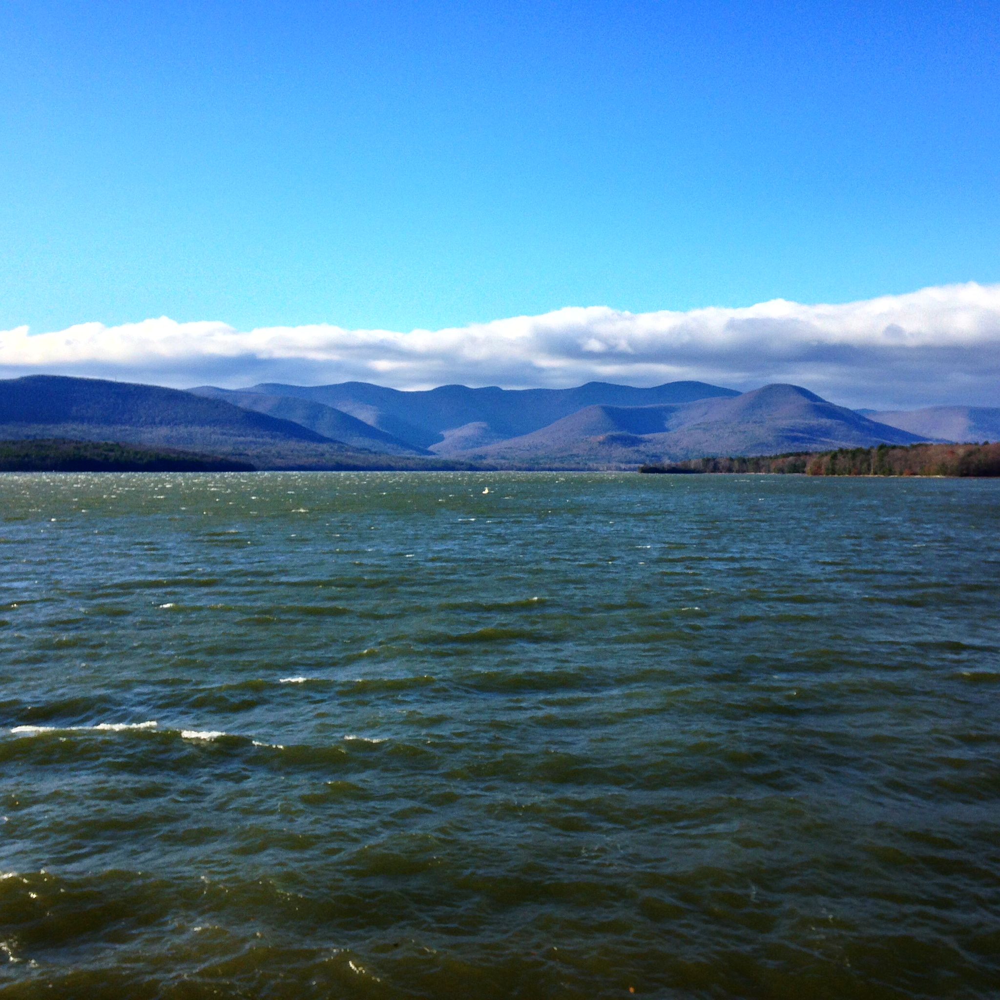
Also visible are whitecaps on the reservoir. It was a very windy day!

After I took that photo I turned around to find a young deer nonchalantly grazing behind me. I could have reached out and pet it if I wanted to. I give this adorable road hazard about 3 weeks to learn what cars are, or else result in a bad day for somebody.

deer

From there, it was a familiar and mostly downhill roll home.

One thing I like about this ride along the edge of the Catskills is its roundness. As I mentioned earlier, cyclists tend to avoid out-and-back routes. A corollary, I suppose, is that especially round routes are extra appealing, at least to me. Maybe that’s weird.

Capture

Alternate route starting in New Paltz here, raw GPX file here.

— John S, aka globecanvas

A planned, mostly vetted, Delaware County 130k Masterpiece

Somervillain here.

I love planning routes in RideWithGPS (link to my routes). When charting out new territory, RideWithGPS allows one to zoom in to a road, in satellite view, and get a glimpse of what it’s like– is it dirt or paved? Is it shaded by overarching trees?  Does it pass through farms? If it looks interesting, I just click on it and there it is, incorporated into a growing route. Using this method I’ve discovered many of what have become my favorite dirt roads, and Delaware County harbors a trove of remote dirt carriage roads and mountain passes still waiting to be discovered.

I’ve reported on three routes I’ve ridden in Delaware County (here, here and here), but the longest of these was only 45 miles and 5500′ of elevation gain. Sometime next year I plan to ride an amalgam of all three routes, merging the best of each while making sure services and facilities are never too far away. I’ve mapped these onto one 81 mile loop, and I’m so tickled with the resulting route I can’t wait to ride it! Since I know this won’t happen until at least next summer given the long winters and my only occasional presence there, I am presenting it here for anyone who wants an 80-ish mile ride with almost 10,000 ft of elevation gain. If anyone is familiar with D2R2, this route fits nicely in between the two intermediate D2R2 route lengths (74mi/8,200ft and 99mi/11,600ft). Having ridden the 74 and 62 mile D2R2 routes, my opinion of this Catskills route is that it’s even more bucolic and pastoral than D2R2, but with similar intense hills and a familiar rural New England-y feel and flavor.

The yellow pins mark food stops, and the start/end point in Delhi has plenty of food options. Look at that elevation profile!!!

Some noteworthy features of this route:

  • Total of 8 dirt segments, some of which are single-lane carriage paths, totaling 34 miles, or 42% of the overall route.
  • Two historic covered wooden bridges.
  • 9 significant climbs.
  • One fast 5-mile paved descent and two other nearly continuous 6-mile descents– mostly without interruption.
  • Less than 1 mile of highway.
  • 6 well-spaced services/facilities, and none of them are convenience stores/fast food chains. The longest distance between any two is 24 miles.
  • I’ve ridden 74 of the 81 miles of this route personally at different times

So if anyone is looking for a long Catskills route that takes in stunning country scenery, charming villages, lots of dirt roads, a shark tooth elevation profile, thrilling descents, and well spaced food offerings, this route should be just the ticket.

If you’re coming from NYC or points south, the most logical starting point would be Andes as opposed to Delhi. Andes is only a 15 minute drive west of Margaretville, the starting point of several of the rides John has written about. There’s plenty of parking along Main St./Rt 28, as well as several places to eat. Honestly, any of the pinned villages would make decent starting points, but regardless where you start, the route really begs to be ridden counterclockwise to enjoy the two prolonged descents.

One other thing to consider if riding up here during the week is that most area cafes are closed on Mondays, which will narrow your food options. So avoid Mondays unless you’re prepared to ride in a self-sufficient manner.

Here are some “stock” photos that didn’t make it into my previous posts; they were taken at different times from various points on this route, and are in no particular order. Some of these may date back over a year, but they give you an idea of what this route has to offer.

Enjoy!

–Somervillain

Riding the Gunks?

Globecanvas has been so prolific that it has been tough to post here, as I don’t want to top post one of his carefully crafted posts with my garbage. Remember to click on Worth the Trip to get right to the cycling.

Guys, feel free to top post this whenever.

I’m happy to announce that Riding the Catskills is number 1 on Google for searches for Catskills cycling these days–above even the Tour of the Catskills! But it looks like with Globecanvas’ contributions and my impending move, we’re going to have a shift in focus around here.

There’s not enough change in focus to change the title of the blog, because I’m sure we’ll all be Riding the Catskills whenever possible, but I’ve just signed a contract for a house in Gardiner, New York, only about 5 minutes south of New Paltz. That puts me just a few miles from Minnewaska Park and the Shawangunk Ridge, and less than 4 miles from the entry to the park described in Globecanvas’ contribution here.  Riding the Catskills proper will turn into more of a weekend ride for me rather than a daily event, as to get there I’ll have to ride over the ridge. However, Somervillain will still be covering Delaware County intermittently and Doug H, hopefully, will be covering northern Ulster and Greene. I’ve also invited George from the Hudson Valley Randonneur to cross post if he sees fit.

The Shawangunk ridge—which is also known as the Shawangunk Mountains or just The Gunks, is a ridge running from Orange County, through Sullivan County, and pretty much terminating near Rosendale, where Globecanvas lives. My understanding is that The Gunks are the continuation of the easternmost ridge of the Appalachian Mountains. Based on a little research (thanks Wikipedia!) the name of the ridge essentially means “in the smoky air”, and refers to the burning of a fort by the Dutch in 1663.

Globecanvas was saying that he has trouble capturing the vistas around here. The secret is to load yourself down with something more than an iPhone 🙂

A}{A

So, the house: I am relieved to be staying in the area. We went through an unusual process when purchasing the house. How do I explain this? I had contacted a prominent and well-regarded local architect to give us some ideas and an estimate on a house we almost purchased in Stone Ridge. We subsequently found out that he was selling his personal home in Gardiner. Skipping all the details, I ended up negotiating directly with him on the purchase and came to a great win-win situation for everyone involved (including the respective brokers); in fact, we consider him a friend now. He clearly loves his house, and has gone far above and beyond what most sellers would do to ensure the house is perfect when we move in—a benefit of buying an architect’s personal home and having a good relationship with the seller! The house inspection only revealed a few minor issues—the kind of stuff that would be expected in even a new house—and some other stuff that would be considered upgrades. Well, the seller is taking care of both the minor issues and many of the noncritical upgrades, many of which we didn’t even ask for but he decided to manage proactively.

We have a few unusual provisions in the contract, for example, he asked for a right of first refusal if we ever decide to sell, meaning we will contact him or his children first to offer them the house before putting it on the market. He’s also staying in the house 4 months beyond when we purchase it.

All in all, the way a house should be sold. I hope to extend the same courtesy to his children if we ever move.

I know I’ve said this before, but now I can get back to riding. My neck is feeling much better, and I’m off for a quick 30-mile ride right now. Like Globecanvas, I’m hoping for big miles this winter!

John F

medicalwriter.net

Hot Rocks: the Best of the Mohonk Preserve

Hi, Globecanvas again.

Today’s ride is not a hidden gem. It’s a gem that is in plain view.

Between the Mohonk Preserve, Mohonk Mountain House, and Minnewaska State Park, there are thousands of acres of contiguous preserved open space, and over 100 miles of interconnected carriage roads and trails. Every inch is worth the trip.

This is a popular tourist destination for cyclists, hikers, leaf peepers and rock climbers, so it’s hardly a secret backwoods passage. But even on a perfect late fall day like today, with sunny skies and temperatures in the 50s, we saw only a handful of people all day — a couple of rock climbers, a few hikers, and a couple of cyclists.

In the fall, I ride these carriage roads at least once a week, sometimes more. The Nature Conservancy called this area one of Earth’s “Last Great Places,” and although that may sound like a marketing pitch, it’s easy to get rapturous while cycling through the seemingly endless beauty.

Once again, I met up with Newman at his shop. I ride a lot with Newman in the winter, partly because our schedules both permit regular weekday rides, but mostly because he just loves to ride. We’ll be doing almost an identical route tomorrow on the weekly Bicycle Depot Saturday morning group cyclocross ride, but honestly, it
never gets old.

Depending on where you are coming from and where you want to park, this loop can be joined from any of the Mohonk Preserve entry points. We came in through the old Mountain House gatehouse (mile 1.5), which will soon be an official entry point, but we rode past four other official entries: the Visitor Center (mile 8), West Trapps (mile 8.5), Spring Farm (mile 19), and Pine Road (mile 26).

A bit of prep work first: day passes for the Preserve are $17 for climbers and cyclists ($12 for boring hikers).  An annual cycling pass is $70. Trails are generally very well marked, but the free paper map given out at the various entries is useless. If you plan to spend any time in the backwoods here, the NY/NJ Trail Conference topo maps are a must. You can get the maps at the Preserve Visitor Center, or Rock & Snow in New Paltz.

For today’s ride, we tried to hit all of the best, most scenic, most fun carriage roads in the preserve. Although there is plenty of singletrack gnar to be found around here, for the purposes of this blog and this route we stuck exclusively to carriage roads (except for one short connection).

Just like we did on our previous ride, we entered the Preserve on Gatehouse Road.

01aaa32a1cb592d48b8b7ad5396832a2383eb65fea

Over the old stone bridge across Butterville Road (where landscape painters tend to congregate), up Lenape Lane to the Catskill Aqueduct.

The Catskill Aqueduct supplies about 40% of New York City’s famously high quality drinking water (no, “high quality” is not sarcasm), starting at the Ashokan Reservoir in Ulster County. Even in the preserve, the right-of-way over the buried aqueduct is New York City property, so you’re not allowed to hike or ride along it. But you can cross over it. It’s wild to be in the middle of the woods with 400 million gallons a day flowing beneath your tires, headed for sinks and bathtubs in the big city.

At the aqueduct, we cut left onto Duck Pond Trail, the only singletrack on the route. This is maybe 100 yards of rocky trail, climbing up to Duck Pond. In the background, just visible on the left edge of the distant cliff, you can see Skytop, the stone observation tower above Mohonk Lake. More about the tower later.

duck pond

All trails lead uphill from Duck Pond. We headed clockwise around the pond, up Glory Hill, a steep grassy climb.

glory hill

At the top of the hill, we bore left onto Oakwood Drive. This winds along the side of the ridge to Rhododendron Bridge. Across the bridge, we took the sharp left onto Undercliff Road, which leads right along the base of the Trapps, a 2 mile long, 300 foot tall crag that is one of the premier rock climbing destinations in North America. On a summer day, the air is filled with “On belay!  Rope!  Aargh!” and other calls of climbers in their natural habitat.  There were only a few climbers out today.

undercliff

At the top of the trail, we hooked right onto Overcliff Road, which offers expansive views of Clove Valley and the Catskills.  Although I am discovering that expansive views are about the hardest thing to capture in a simple photo.

overcliff

Overcliff looped us back to Rhododendron Bridge, where we once again took a sharp left, onto Laurel Ledge Road. This is one of my personal favorites, a steady 2-mile climb that winds up the ridge between giant boulders.

laurel ledge

The climb tops out at Copes Lookout and Humpty Dumpty Road, which winds along the edge of the cliff and provides a unique edge-on perspective to the ridge.

humpty dumpty

We then crossed over the top of the ridge on Long Woodland Drive, another favorite trail. Although it’s less than a mile from the Mountain House, this is one of the more remote places in the Preserve. We were circling the south end of Mohonk Lake, describing an arc around Skytop tower.

tower

Skytop is a stone observation tower, atop on the highest point on this part of the ridge. Weather observations have been made here continuously and systematically since the late 1800s, forming one of the most reliable weather data series in North America, an invaluable resource for climate scientists.

We then cut down to Home Farm Circle, the site of an old homestead that predates the Mountain House.

home farm

Finally, some descending: we ripped down Forest Drive, then connected over to North Lookout Road. Yet another expansive view of the Catskills.

lookout

We then hooked past Rock Rift, a wild out-of-the-way crevice full of trees, and down to Cedar Drive, one of the longest and best-maintained carriage roads in the preserve. This wound along the ridge to a small bridge over the main road.

bridge

Cedar Drive continues past the Spring Farm entry point, circling back around to climb the ridge again for about a mile.

cedar drive

The climb tops out at a 5-way intersection that is known unofficially as — wait for it — “the 5-way.” Left here leads to Bonticou Crag, one of the most interesting destinations in the Preserve. This photo shows only a small section of the crag, high above.

bonticou

If you are vertically inclined at all, the ascent trail up Bonticou is one of the most fun ways you can spend an afternoon. The difficulty level of this rock scramble is perfectly balanced right on the edge between “surprisingly challenging” and “doable without falling to your death.” I’ve seen 6 year old kids (including my own) scamper up like mountain goats, and I’ve seen grown men panic and back down the climb. It’s a 30-45 minute hike to this point from the Spring Farm entry. The whole experience is a top notch day trip.

We then headed up Guyot Hill. This climb is one of the least-traveled roads in the Preserve, and in fact we almost blew past the turn because it was so deeply covered in leaves. This half-mile climb brought us to the highest elevation of our ride, although the views are limited because it’s woodsy all the way. From here it would be all downhill for the next 6 miles.

guyot

The back side of Guyot Hill dropped us onto the Mountain House golf course, which is always a bit surreal, but of course it’s not in use in winter. We circled the golf course and crossed over the small wooden bridge to the Mountain House gatehouse, then shot down Lenape Lane, Oakwood Drive, and back down to Duck Pond. This section of the Preserve is rarely traveled.

hairpin

duck pond trail 2

tower 2

Back onto the short singletrack connector, which we followed out to the Pine Road entry. Pine Road descends past horse farms, heading back toward New Paltz.  Spot the horsey!

pine road

As we turned off Pine Road, we ran into Jim, a local legend who often rides with us. He was just heading up into the Preserve to start his ride. I said we were doing a Mohonk Greatest Hits ride, and of course he immediately asked if we did Godzilla or the Duck Pond Road climb. Well no, we didn’t do Godzilla (a very sharp climb straight up the ridge), and we descended the Duck Pond Road climb. So this route is hardly exhaustive.

There are very few carriage roads in the whole Mohonk Preserve/Mountain House/Minnewaska network that wouldn’t be on somebody’s list of highlights. Depending on your predisposition, you might like to follow the route below, or you might just want to bike into the preserve and see where the spirit takes you.

Capture

Raw GPX file here.

— John S, aka globecanvas

The Awosting Reserve

Hi, Globecanvas here.  How about a five star ride that has everything? Scenic history, a huge gravel climb, woodsy grottos, sky lakes, clifftop vistas, waterfalls, winding carriage roads, horse farms, and seldom traveled country roads.

I started today’s ride from the Bicycle Depot in New Paltz, because I was riding with Newman, and his cyclocross bike was there. Newman owns the shop, which I recommend highly for all of your bicycle needs, or for any beta you may need on local roads. There isn’t a road within 100 miles that Newman hasn’t ridden.

The first few miles out of town, heading toward the ridge, are highly exposed and the wind was whipping across the razed farm fields. Once we pushed through that section, we couldn’t resist riding through the old Mohonk gatehouse.

gatehouse

The Mohonk Mountain House is the last surviving mountain house resort from the glory days of the Catskills, a century ago. (Other jewels of the era, like the Overlook Mountain House in Woodstock or the Catskill Mountain House in Palenville, still exist as tourist curiosities — but they are either hollowed-out ruins or completely burned to the ground.) A hundred years ago, New York City society swells would ride their horse-drawn carriages through the gatehouse and up to the resort, three miles distant. The gatehouse and surrounding land are now owned by the Mohonk Preserve, which is in the process of converting the old gatehouse to a preserve entry point.

The gatehouse, and the old gatehouse road, can’t be beat for scenic beauty. My photos of the gatehouse road today were blurry, but here’s a shot Newman took last week, on a sunnier day.

lenape fixed

From there, we rode down 299 to the Mountain Deli, the de facto meetup location for rock climbers before and after assaulting the Trapps.  We also passed the Mountain Brauhaus, home of the best post-ride food and drink in the universe.  Then we left the world of cars and wound our way along the base of the Near Trapps and Millbrook.

aumick

There are plenty of climbs in the Gunks and Catskills, but only a handful are inarguably in the top tier of difficulty — climbs like Platte Clove/Devil’s Kitchen, Sugarloaf, Meads Mountain. The Awosting Reserve climb, although much less well-known than the others, is firmly in the top tier. By the numbers, the climb is 2.1 miles at 9.5% average, which is followed by another mile at 6.5%. The climb is also 100% gravel and dirt.

The Awosting Reserve trail head isn’t marked on Google Maps. It’s off Aumick Road, below the Millbrook section of the Shawangunk ridge. Here’s a wide view of the climb (in blue).  It climbs the ridge just southwest of the Millbrook crag (the sharp southeast-facing cliff on the terrain map).  Looking at the crag from a distance, there is no pass or seam there.  The climb just goes right up the ridge.

Capture

The trail head.

trail head

The first mile and a half of the climb is a well maintained carriage road, with big looping switchbacks. The grade is sustained but not brutal. There are a couple of false trails to the left and right through this section.

At 1.5 miles from the trail head, the trail gets prettier, but things get ugly. The trail splits; take the sharp, steep right turn. The next half mile is sharp stairsteps, well over 20% grade, that will challenge your ability to keep the wheels down and gripping. This is still a carriage road, not singletrack, but thanks to the extreme grade it’s much rougher than the earlier part of the climb. Newman easily outpaced me on this section, quickly disappearing up the hill.

climb

I struggled up behind.

climb 2

After 2.1 miles of sustained climbing, the trail mercifully turns downhill, but only briefly.  Watch out for more false trails on both sides here — just keep going straight.  At the bottom of the downhill section, a singletrack trail heads off to the right. A small wooden sign a short way down the trail marks it as Spruce Glen footpath. The singletrack is short and mostly rideable. After a stream crossing, the trail widens into a gorgeous grotto of hemlocks and cliffs.

grotto

We couldn’t stop taking photos here. It’s the sort of viewscape where you expect Mr. Tumnus to come prancing along.

grotto photo1

grotto photo2

Another few hundred yards, and suddenly you’re at Lake Awosting, one of the Shawangunk sky lakes. Because the lake basin is formed by conglomerate bedrock, not dirt, it is very clear, but too acidic to support fish.

awosting

awosting 2

Going right along the edge of the lake, the trail passes the lovely Awosting “beach”, an expanse of flat bedrock that angles into the lake. Take the next right hand turn to head up toward Castle Point.

After about another mile of climbing, the trail summits at Castle Point.  This is a world-class vista, and my humble snapshots can’t do it any sort of justice. Here is looking south, toward Hamilton Point.

castle pt 1

North, toward the Catskills.

castle pt 2

This is the high point of the ride in elevation. This is also where we realized we had a problem.

When we left New Paltz, temperatures were in the high 30s, and up to this point we had been climbing almost constantly, over 3000 feet in 18 miles. We were plenty warm, until we stopped to admire the view. Here at elevation, temperatures were in the 20s, and the wind was howling. There were patches of ice along the trail, and our bottles were frozen. We got cold fast, and we knew we had a good hour of descending ahead of us.  We struggled into all of our previously shedded layers.

castle pt 3

We rolled along the Castle Point carriage road, following the very edge of the cliff, toward Lake Minnewaska. This is a beautiful trail, but unforgiving of numb hands. We knew the trail well enough to descend at a good clip, but we had several discussions about how washing out on certain turns would leave you about a thousand feet below where you started.

By the time we got to Lake Minnewaska, we had to stop to try to get some feeling back in our hands.

minnewaska

From Lake Minnewaska, we followed the very fun switchbacky access road down to the park gatehouse, where we hopped onto the Awosting Falls carriage road, stopping at the falls to once again try to get some blood moving through our frozen hands.

falls

That would be the end of the photography, because it became impossible to operate my camera with what felt like frozen steaks attached to the ends of my arms.

From the falls, the trail continues to descend gradually. To keep from shivering, we had to ride hard enough to generate some body heat, but that also generated more headwind. I wouldn’t call it hammering, but we were moving along at a solid head-down tempo pace, after hours of climbing and then shivering. I had to shift by sight, because I couldn’t feel the levers.

At the Trapps (no rock climbers today), we continued onto the Mohonk Preserve carriage roads. (The thought of descending at high speed on the paved road was deeply unappealing.) These carriage roads are some of the most beautiful cycling in the world, but you’ll just have to take my word for it today, because I didn’t have enough sensation in my fingers to unzip my vest, much less operate the camera.

As we rode down Glory Hill and past Duck Pond, we finally gave back enough elevation that we started to warm up a bit, joke around and swap stories about previous adventures getting stuck out in the cold. We exited the preserve at Pine Road, said hi to the horses, and rolled the last 3 miles into New Paltz.

I can’t recommend this route highly enough.  If ever a ride was worth the trip, this one is.  It has a little bit of everything unique that the area has to offer. The climb is very challenging, and the rewards are great.  But, you know, layer up.

CaptureFor those who are not Stravafied, the raw GPX file is here.

— John S, aka globecanvas

A History of Industry

Gangblog! Globecanvas here. I’m a local cyclist, local as in the Shawangunks and Catskills. John has graciously offered me the keys to the shop while he works on his geographical conundrum. Why “globecanvas”? Because in the early 1990s, the first time I ever had to make up an internet username, I happened to be sitting next to my Globe Canvas bike messenger bag. If that means anything to you, it means street cred. Which is now country cred, I guess. Anyway…

I’ll be putting in a lot of miles this winter, and I’ll do my best to record some epic journeys and show off some of the nooks and crannies of the Gunks and Catskills. But after a busy riding and racing season, I took a month off, and today was my first ride back, as well as my first try at contributing to Riding the Catskills, so I thought I’d start out small. Like, really small.

A couple of months ago, about 7 miles of new rail trail between Rosendale and Kingston opened to the public. This is an especially charismatic corridor, not your typical suburban multi-use path.

Until the new section opened, the Wallkill Valley Rail Trail, a popular recreation and commuting path through the towns of Gardiner and New Paltz, ended at the Rosendale trestle, an 1870 span high across the Rondout Creek, shown here in a 1910 image displayed at the Rosendale Library.

Rosendale_trestle_postcard

Thanks to some epic fundraising and volunteer labor efforts, the trestle is now decked, safe, and open to the public all the way across, for the first time ever. From the south side, the trestle leads into a canopy of oaks, sycamores, and tulip trees, then launches out into space toward Joppenbergh Mountain, on the far side of the creek.

joppenbergh

[begin digression]

Joppenbergh is an imposing jumble of limestone, quite different from the famous Gunks conglomerate that forms the popular climbing crags immediately to the south. In the late 19th century, the mountain was the center of a booming cement mining industry. The mountain, and much of the town, was deeply mined with enormous, crisscrossing shafts.

Rosendale_Wallkill_Valley_Railroad_Bridge_1888

In 1899, the dangerously undermined mountain literally collapsed on itself, leaving an unstable pile of talus that continued to degenerate for another 10 years, before settling into a sort of equilibrium. Today, trails lead to the top of the mountain from Willow Kiln park behind Rosendale’s Main Street, and the views from the summit are remarkable. I climbed up with my kids last weekend.

jberg kids 1

jberg kids 2

[end digression]

Continuing north beyond the trestle, remnants of the century-dead cement industry are visible along the trail. Brick kilns where limestone was fired into cement are visible through the woods, mostly reclaimed by the forest.

kilns

The trail passes through the Williams Lake area, formerly the site of a blue-collar family resort, now vacant. A fancy Canyon Ranch style eco-spa is planned on the site, so it may not look like this much longer. Luckily, the rail trail is a permanent easement.

williams lake

lakes

The trail passes right next to several abandoned “room and pillar” mines, some of which are huge.

mine 1

mine 3

[begin digression]

These mines are home to massive colonies of bats. In the olden days, bats would hibernate in small groups all over the place, under the bark of big trees, in small caves, and so on. Habitat fragmentation has put an end to that old-fashioned practice. Now essentially all of the bats in a given area hibernate in just a few places, and abandoned mines are perfect for them. Unfortunately, these bat megaslums are also perfect for breeding disease, which places the bats at risk. In the past five years, a fungus that may have been introduced by humans, right here in the Hudson Valley, has wiped out an estimated 6 million bats, with a mortality rate of 95% in some species. So even though they look awesome, please don’t explore the caves. Unless you want mosquitos to take over the world.

[end digression]

After a few miles and a few road crossings, the trail gradually becomes less and less interesting, and ends with a whimper on the outskirts of the city of Kingston.

end

However, the county government has ambitious plans to extend and connect this trail to the Catskill Railroad right-of-way along the north side of the Ashokan reservoir, and from there right through the heart of the Catskills, all the way up to the Belleayre ski area. Bike to ski, cool.

So that’s it, a humble 13-mile out and back on the rail trail, just off the northern end of the Shawangunks, in the shadow of the Catskills. Here’s the route, such as it is:

Capture

See you next time.

— John S, aka globecanvas