Tag Archives: Cycling photography

To the Hudson!

Hi all! I know the blog has been pretty dead recently; John S says he doesn’t want to “contaminate” the blog with racing reports (although I told him to go ahead), and of course Anton isn’t a full-time Catskills resident, so he only posts when he’s here. I’ve been traveling, working, and riding a lot, but no major adventures. Mostly daily 20 to 40 mile rides, and you don’t need to hear about that, do you?

However, I had an amazing ride today. Only 30 miles (with getting lost), 27 actual miles. I expected the ride to, well, suck but it turned out to be one of the most beautiful rides I’ve been on in the last few years. I’ll let the pictures speak for themselves. Sure, it lacks the isolation and majesty of the Catskills proper, but the views are lovely, the traffic mostly absent, and there’s only about 1700 feet of climbing. I recommend it highly if you’re in New Paltz and want a shorter ride, or if you want to incorporate it into a longer segment.

full2 1 8 7 6 5 4 3

And don’t forget, all of my routes are here. I went through the effort of deleting (most) of the bad ones, so you really can’t go wrong. Sort by distance and pick!

Also: As much as I hate promoting Dutchess County over Ulster, if you live in NYC you’re missing out if you don’t do the summer classic. I perfected this route over about 10 or 12 repeats, and it’s the most fun you can have on two wheels, I promise. One of the few things I miss about living in the city.

John

medicalwriter.net

Dark, Wet, and Muddy

I wrote this a few days ago, but quickly took it down when I realized that I had rudely top-posted Globecanvas’ most recent post. Apologies to all of you who received a new post e-mail, only to stop by and see nothing new!

The ideal ride.

Yes, I’ve finally gotten back on the horse after a few months of house hunting and then an inconveniently timed neck injury. I went for a 20-mile ride yesterday; on today’s ride, I decided to see how many dirt roads I could hit within 30 miles of my house, and I found out that, if you plan carefully, you can do a ride that is approximately one-third dirt in that distance. Route here.

I mean, mud, not dirt.

SDIM0365_pe

SDIM0364_pe

Red mud. My poor shoes.

SDIM0367_pe

It was drizzling at the beginning of the ride, and it started to pour about halfway through, so I didn’t get too many pictures. Here are a few.

SDIM0370_pe

SDIM0375_pe

SDIM0361_pe

SDIM0374_pe

SDIM0378_pe

SDIM0372_pe

SDIM0363_pe

I’m sure the few people in cars who passed me felt sorry for me. What they don’t know is that I do this by choice. Nothing feels as good as a wet, muddy, freezing, foggy ride in the dark!

John

medicalwriter.net

A planned, mostly vetted, Delaware County 130k Masterpiece

Somervillain here.

I love planning routes in RideWithGPS (link to my routes). When charting out new territory, RideWithGPS allows one to zoom in to a road, in satellite view, and get a glimpse of what it’s like– is it dirt or paved? Is it shaded by overarching trees?  Does it pass through farms? If it looks interesting, I just click on it and there it is, incorporated into a growing route. Using this method I’ve discovered many of what have become my favorite dirt roads, and Delaware County harbors a trove of remote dirt carriage roads and mountain passes still waiting to be discovered.

I’ve reported on three routes I’ve ridden in Delaware County (here, here and here), but the longest of these was only 45 miles and 5500′ of elevation gain. Sometime next year I plan to ride an amalgam of all three routes, merging the best of each while making sure services and facilities are never too far away. I’ve mapped these onto one 81 mile loop, and I’m so tickled with the resulting route I can’t wait to ride it! Since I know this won’t happen until at least next summer given the long winters and my only occasional presence there, I am presenting it here for anyone who wants an 80-ish mile ride with almost 10,000 ft of elevation gain. If anyone is familiar with D2R2, this route fits nicely in between the two intermediate D2R2 route lengths (74mi/8,200ft and 99mi/11,600ft). Having ridden the 74 and 62 mile D2R2 routes, my opinion of this Catskills route is that it’s even more bucolic and pastoral than D2R2, but with similar intense hills and a familiar rural New England-y feel and flavor.

The yellow pins mark food stops, and the start/end point in Delhi has plenty of food options. Look at that elevation profile!!!

Some noteworthy features of this route:

  • Total of 8 dirt segments, some of which are single-lane carriage paths, totaling 34 miles, or 42% of the overall route.
  • Two historic covered wooden bridges.
  • 9 significant climbs.
  • One fast 5-mile paved descent and two other nearly continuous 6-mile descents– mostly without interruption.
  • Less than 1 mile of highway.
  • 6 well-spaced services/facilities, and none of them are convenience stores/fast food chains. The longest distance between any two is 24 miles.
  • I’ve ridden 74 of the 81 miles of this route personally at different times

So if anyone is looking for a long Catskills route that takes in stunning country scenery, charming villages, lots of dirt roads, a shark tooth elevation profile, thrilling descents, and well spaced food offerings, this route should be just the ticket.

If you’re coming from NYC or points south, the most logical starting point would be Andes as opposed to Delhi. Andes is only a 15 minute drive west of Margaretville, the starting point of several of the rides John has written about. There’s plenty of parking along Main St./Rt 28, as well as several places to eat. Honestly, any of the pinned villages would make decent starting points, but regardless where you start, the route really begs to be ridden counterclockwise to enjoy the two prolonged descents.

One other thing to consider if riding up here during the week is that most area cafes are closed on Mondays, which will narrow your food options. So avoid Mondays unless you’re prepared to ride in a self-sufficient manner.

Here are some “stock” photos that didn’t make it into my previous posts; they were taken at different times from various points on this route, and are in no particular order. Some of these may date back over a year, but they give you an idea of what this route has to offer.

Enjoy!

–Somervillain

A Columbus Day Ramble in Autumnal Delaware County

First I’d like to express thanks to John for making me a contributing author on Riding the Catskills. Since I’m only up in the Catskills occasionally between spring and fall, I won’t be contributing regularly… but my aim is to eventually document all the best dirt road mountain passes that Delaware County–my childhood and now seasonal stomping ground in the northwestern Catskills–has to offer, with routes of 35-75 miles with heavy doses of bucolic dirt roads, steep climbs, fast descents and an obsessional avoidance of highways and traffic, designed to bring wide smiles to anyone who rides them. I may also occasionally post planned, partially vetted routes of up to 100 miles, stitching together segments I’ve already ridden with new ones, that may be too long for me to tackle in the near term but may be appealing to more ardent long distance cyclists. Below is a post about my Columbus Day Catskills ride in which I continued to find some absolutely stunning dirt roads.

–Anton, aka somervillain

Columbus Day weekend is a big tourist weekend in the Catskills, with travelers descending from afar to enjoy the fall foliage. Being a holiday weekend, I, too, often make the trip out here from Boston. Typically, the colors in the Northwestern Catskills are at peak vibrancy this weekend–several weeks ahead of eastern Massachusetts–and holiday or not, it’s a great excuse to come out this way just to be a leaf peeper. To the disappointment of many who made the trip here for the rich colorful palette that marks this weekend (I met one couple here from Colorado; Aspens get boring after awhile, they told me), the week prior saw an intense windstorm that stripped many of the leaves that weren’t quite ready to let go. Alas. But not all the leaves had fallen, there was still some fall color left.

I was here for an extended weekend with my family, but I just had to get a ride in, however short it had to be to maintain family commitments. The loop I settled on was 36 miles, relatively short compared to John’s routes. But with 3800 feet of elevation gain (3000 ft in the first 20 miles alone), there were enough climbs and descents to keep it interesting, another exercise in pass hunting.

The route started and ended in Delhi (pronounced “Dell-Hi”), the county seat and nice little historic town, about nine miles from my home in Bloomville.

Delhil Village Hall

From Delhi, the counterclockwise route immediately took me over a steep hill, Belle Hill. Normally I don’t like to start off with a hard climb, not having the chance to warm up first.  Doing the loop in reverse would have avoided it, but I really wanted to do the loop this way, because it includes a five mile descent I had been eagerly waiting to do. As with so many hills around here, the peaks are punctuated, so by the time your rear wheel reaches the top, your front wheel is practically heading down the other side. As I reached the top of Belle Hill, not quite warmed up, the pavement turned to dirt, and I enjoyed the first of many lovely descents.

Dick Mason Rd, Delhi

At the bottom, I followed the valley out of Delhi to Meredith along Peaks Brook Rd, a quiet paved road with a slight but steady uphill grade. After a couple of miles, it turns to dirt, and after a few more miles of gentle climbing, another three miles of descending on dirt.

Peaks Brook Rd, Delhi

Peaks Brook Rd, Meredith

At this point, I mistakenly turned onto Warren Rd, thinking it was a continuation of Peaks Brook Rd. This led me north toward Treadwell, a cute hamlet that John passed through on his Delaware 85 route he posted about this past summer (his masterpiece!).

Warren Rd

Cow warning, heading into Treadwell

Oddly, despite growing up here, I hadn’t ever passed through Treadwell. I was glad I had made the wrong turn, giving me the excuse to finally see it– it boasts an adorable general store that has been continuously run since 1841. I highly recommend working Treadwell into any local routes– there aren’t many places in the area with food and facilities, and here you can get sandwiches, fresh baked goods and roofing nails. The atmosphere is infinitely more charming and welcoming than any gas station/convenience store you might find, and it’s a fun step back in time. I returned to Treadwell with my family the next day, my kids bought penny candy!

Barlow’s General Store, Treadwell

From Treadwell, I headed back south on County Highway 16 towards Hamden– as John did. But shortly outside Treadwell, I detoured off onto Douglas Hall Rd, which wound around some farms as it climbed steadily.

Cows, Douglas Hall Rd

A surprise awaited me when I reached the four-way junction on top. I had originally planned to turn onto Snake Hill Rd (which I would have been on had I not detoured into Treadwell), but when I saw the single-lane dirt road straight ahead, with the sign: Seasonal Limited Use Highway. No maintenance Dec 1 – April 1, I had to change course once again… whenever you see that sign in this area, it’s a promise of a worthwhile investigation.

Ridge Rd, Hamden

Unlike most back roads in the area that seem to go up or down, Ridge Rd, as its name implies, follows the top of a ridge for five miles. It’s mostly tree lined, passing through woods, every so often affording a spectacular vista from atop the ridge. Let me be blunt: this road qualifies as a must ride; just let the photos speak for themselves:

At one point I had to stop and consult a map; the road split, and signs were conspicuously absent. I felt a sense of déjà vu: the fork felt eerily similar to the one in the final scene in the Jim Jarmusch film Down by Law. Who knew the Catskills could look so much like rural Louisiana? See for yourself:

Ridge road ended, and pavement resumed. From here, Launt Hollow Rd whisked me down a continuous five mile descent (the one I had been eyeing) to State Rt 10 in the village of Hamden. (The next route I have planned in this area includes a continuous 10 mile descent from Hamden to the Pepacton reservoir).

Five mile descent to Hamden on Launt Hollow Rd

Rt 10 is a busy highway, but at least in the village the speed limit is tamed down. And just after the turn onto Rt 10 is one of my favorite eateries– Lucky Dog Farm Store. Another charming cafe and locavore farm store, they serve up artisanal sandwiches and lunches. Worth a stop, but their hours are more limited than Barlow’s in Treadwell (Lucky Dog was closed when I was there).

Lucky Dog Farm Store, Hamden

I designed the route to take in the Launt Hollow descent and Lucky Dog while avoiding Rt 10 at all costs. I stayed on Rt 10 for only a half a mile before I turned right to cross the Delaware River, West Branch, over a covered wooden bridge. This took me to Back River road, a gently rolling, quiet paved road that follows Rt 10 but on the opposite side of the river. It heads all the way back to Delhi, which John also passed through on his Delaware 85 route, although John followed Rt 10 from Hamden to Delhi.

Hamden Covered Bridge

Back River Rd, Hamden

Back River Rd, Hamden

There are plenty of facilities in Delhi. I won’t mention the several repugnant fast food chains. Sure, they’re welcome in an emergency, but on most days there are better options, and my pick would be Good Cheap Food, another locavore market. Plus there are several indie cafes and bookshops along Main St, so designing a route to include Delhi is a smart bet.

Main St (Rt 10), Delhi

County Clerk’s Office, Delhi

Given that this route and John’s route intersect at Treadwell and again at Delhi, it’s possible to merge the best portions of each and come up with an another dirt road stunner of just about any desired length.

Labor Day Slide

I attempted this ride solo on the day after I returned from Holland–Labor Day. Unfortunately, I got about 10-15 miles into the ride and the skies opened up with the worst thunderstorm I’ve ever seen. Now, I don’t mind riding in the rain, even in a relatively heavy downpour. But this storm was a whole different order of magnitude from anything I’ve ever seen before. And keep in mind that I grew up in the Midwest, where severe thunderstorms and tornadoes are relatively common. In any case, after taking shelter for a bit, I rode back home, figuring that riding in the high Catskills in the middle of this weather was far from advisable. So it wasn’t until yesterday that I got around to a longer ride, although I did manage 70 fast miles during the week on various rides.

My friend Luis joined me for the ride. He’s 10 years older than me, but still manages to destroy me handily on climbs, even when I’m feeling 100%. Here’s the route, and the GPS is here.

route-3253473-map-full

Slide Mountain is not particularly challenging compared with some of the rides we have done recently; however, I was suffering from a cold (or allergies) and I was definitely not on my game. I suspect it’s allergies, because the second I got off the plane from Holland I started sneezing.

A few pictures from the lead-in to the big climb. If you look at the ride profile on Ride With GPS, you’ll see that it looks like a pretty miserable 36 miles to get to the top of the climb. Really, it’s not so bad. Keep in mind the scale. Yes, you’re going gently uphil for all 36 miles, but for the most part, it’s barely detectable. (I just started riding with Luis…I don’t think that by riding with me he has implicitly signed a release to be the star of my photographs!)

L1020849_pe

L1020852_pe

The climb up Slide is a bit of a grind, but Luis and I agreed that, despite the fact that it is a bigger climb, it is generally easier than Peekamoose. Your opinion may differ. The important thing is to pace yourself, because it is a long, slow climb. When you reach the lake, you’ve finished the climb. Here’s the proof of completion.

L1020856_pe

Frost Valley Rd might be one of the nicest roads in the Catskills to ride. First, there is virtually no traffic whatsoever. We probably saw 10 cars total, in both directions, during our time on this road. Second, once you get to the top it’s an easy 20+ mph almost all the way home. Third, it has to be one of the most beautiful roads around. The road runs through a high mountain valley, and you can see for miles. Here’s the famous Frost Valley YMCA, a huge mansion set in the middle of nowhere.

L1020859_pe

And a few more photos from Frost Valley Road. Keep in mind that the whole thing slopes slightly downward, so with even a little effort you can haul ass through this segment (while enjoying the view, of course). The road can be a little rough in spots, so be careful.

L1020861_pe

L1020866_pe_pe

And my favorite part of the ride, again on Frost Valley Rd. The road becomes really rough around here. It looks like they might be in the middle of paving it; the last time I was through here the gravel portion was a few miles, now it’s only about 750 feet.

L1020871_pe

L1020873_pe_pe_pe

And that was all for this week for long rides. Looking forward to a couple more centuries later this week (one on Wednesday and one on Sunday), so there will be more new routes coming soon!

John

medicalwriter.net

Peekamoose Times Two

You may have noticed that I am not adhering to my twice weekly posting schedule. There are a couple of reasons for that. This blog is not meant to be my personal diary; instead, it’s meant to first be a resource for intermediate- to long-distance cycling routes in the Catskills, and second to provide real-world reviews of cycling products from the perspective of a rider who likes distance, dirt, and inclement weather (yes, I actually enjoy riding through rain, sleet, and snow!) There are very real differences between brands of bib shorts, shoes or even tires that don’t become evident until you ride a century with them. A great example of this was some Pearl Izumi bib shorts that seemed fine until a 150-mile ride, when poor fit and a rough seam conspired to saw a bleeding hole in my thigh.

I am especially careful about random posts because so many people are now getting update e-mails every time I post, and I don’t want to waste anyone’s time. That said, you will be getting a few pet picture posts over the winter. No complaints, please.

I’ve spent considerable time over the past few weeks reprising the old standbys. Yesterday marked my twentieth time over Peekamoose since we moved here last year–that’s about 1200 miles on this route alone. Next week I’m planning to ride Slide Mountain again. I will document that trip and write a full post since I haven’t yet been over Slide in the summer.

Over the next week, I’m going to review Rapha’s Grand Tour shoes, bib shorts for distance riders, and follow up on my long-term review of the Rivet saddle. And, if I can find my chain tool to shorten my chain on the English 700C, I’ll provide some initial impressions of the new Grand Bois Extra Leger 26 mm tires. And of course you’ll get the Slide Mountain post.

Until then, here’s the GPS for a new 72-mile Peekamoose route and a few pictures.

Untitled

L1020835_pe

L1020834_pe

L1020833_pe

L1020831_pe

John

medicalwriter.net

Four-County Ramble, Courtesty of Henry

I apologize for not posting more frequently over the past few weeks. Truth is, work has been draining all signs of life from me, and it shows no sign of letting up any time soon. That said, I’ve still been able to get in 100 to 150 miles every week, although they have not generally been quality miles.

However…

We did manage to get out for a 104-mile adventure out of Woodstock. My companions: Doug and Henry. The initial plan was to do the flattest possible 200k, starting from Doug’s place in Woodstock and riding far into Dutchess county, which–believe it or not–is much flatter than Ulster, Greene, Delaware, or even Sullivan. But as I was putting my front wheel back on, Henry asked if we’d like to take a “real” ride, which around here means climbin’ mountains.

With some trepidation, I agreed. The trepidation was because I had absolutely no idea what was coming up; thus, I had no idea how to pace myself, how long the ride would be, or whether I’d be home in time to do some work. It all worked out fine, in the end.

I don’t have a lot of energy to write, so let’s make this post more about pictures than words, shall we? Here’s the route.

Route

Simple. Start in Woodstock, ride up 28, and then head for the hills. And there were some good hills! The two best climbs on this route are Vega Mountain Road and Dimmick Mountain Road, the later of which is a pretty decent climb, even for out here in the Catskills. It isn’t long, but it is steep.

So, some pictures and I’ll leave it at that. I’d suggest clicking on some of these for full size, some are quite lovely.

L1020830_pe_DxOFP

L1020823_pe_DxOFP

L1020822_pe_DxOFP

L1020821_pe_DxOFP

L1020818_pe_DxOFP L1020817_pe_DxOFP  L1020814_pe_DxOFP

L1020813_pe_DxOFP

L1020812_pe_DxOFP

This, in case you are wondering, is Cross-Mountain Road in Delaware County. Magical dirt road.

L1020806_pe_DxOFP

L1020803_pe_DxOFP

L1020800_pe_DxOFP

L1020799_pe_DxOFP_pe

L1020798_pe_DxOFP

L1020796_pe_DxOFP

L1020795_pe_DxOFP

L1020793_pe_DxOFP

Henry was the only one brave enough to cross this bridge. The boards on the bridge deck were actually popping out. I’m surprised that the county doesn’t either repair it or block it off.

L1020791_pe_DxOFP

Some cross-country action.

L1020784_pe_DxOFP

L1020783_pe_DxOFP    L1020774_pe_DxOFP

And finally, a baby goat. I don’t think nature has made a cuter creature. It might even be cuter than a puppy.

L1020829_pe_DxOFP

L1020827_pe_DxOFP

And that’s all for now. Off to California, and then Holland. I thought, when I moved out here to the Catskills, that I’d maybe work a little less, enjoy life a little more. As it’s turned out…well, let’s just say I’m burning the candle at both ends!

John

medicalwriter.net

New Route: Delaware 85

Do you like climbing? Do you like gravel? Do you have no sense of self-preservation? If you answered yes to all 3 questions, you’ll enjoy this route. Deliberately designed to be the toughest sub-century in the Catskills, it is 85 miles, has about 9000 feet of climbing, and covers at least 30-40 miles of some of the most isolated gravel roads you can find out here. It is, at least thus far, my masterpiece. If you can an excuse to get up to Delaware County, do it now and ride this route. It’s not just worth the trip, it’s worth a pilgrimage.

That said, I’m *really* tired, so this story won’t do justice to the route. In a few days, however, I’ll try to come back and add what will, doubtlessly, be highly amusing anecdotes and antics of grown men on bicycles. Just enjoy the photos for now; in fact, I’d suggest that you click on them to see them full size. My camera, which I’ve been riding with for 3 years now, is dying in a most appealing way–some of the images are quite beautiful.

Also, please keep in mind that I very well may be misplacing the pictures. I don’t keep a diary of where I’m taking shots while I’m riding; in fact, my photos usually involve me trying to ride one- or no-handed over potholes, while randomly clicking because it’s too bright to see the LCD on the back. So take these pictures as a general overview of the route rather than specific views you’ll see at certain points.

I was inspired to create the route by Anton’s magnificent posts on his rides in Delaware County, which can be found here and here. Unfortunately, I never got the chance to go up to his place and ride.

This is the actual route.

Map

We had planned on doing it in the reverse direction from what is shown here, but, because the start and end points were the same, there was no indication on our Garmins whether we should go in a clockwise or counterclockwise direction, and I had failed to look at a map closely before leaving. So, we ended up doing the entire route backwards. In retrospect, this might have been a good decision, because the descent in town at the end of the ride, as we did it, would be absolutely murderous to start out with.

Here’s the elevation profile.

ele_profile

If you have time to inspect the route further on Ride With GPS, you’ll see that all of those climbs have significant 12% to 18% sections. Many of them on dirt. Each of the 9 major climbs on this route could be a highlight for any ride—like the Peekamoose or Slide Mountain climbs. I just decided it would be a good idea to have 9 highlights.

It starts in Margaretville, which I’ll probably misspell in half a dozen ways throughout this post. There is a convenient parking lot right across from the grocery store where you can leave your car all day at no charge (at least we did without issues).

You head out of town on the appropriately named Cemetery Road—a 700-foot climb, but nothing terrible or unmanageable. After a few moments on Route 30, you’ll take a left on West Hubbel Hill Rd. I tried to include every road with the name “Hill” or “Mountain” in them on this route, but I did manage to miss a few. This is the first major climb of the route. It’s about 1100 feet, with significant sections of up to 16%. At least it’s paved!

L1020689_pe_DxOFP_pe

The view from the top of Hubbel Hill Road is great, but there are better views to be had in just a few miles.

L1020691_pe_DxOFP

L1020690_pe_DxOFP

L1020697_pe_DxOFP

Continuing on, Roxbury Mountain Road offers the first gravel segment of the route. As you’ll see, the gravel here ranges from pale pink to a quite bright red. I did some 30-mph fishtailing on this road, which reminded me to be cautious.

L1020701_pe_DxOFP

L1020698_pe_DxOFP

You’ll continue into South Kortright. Unfortunately, South Kortright has no amenties, eg, no place to buy stuff. This turned into a major problem, as the first place we hit to buy liquids and food was just past mile 40–under normal conditions, not a big problem, but keep in mind that by mile 40 we already had 4500 feet of climbing under out belts. So word of warning: bring lots of water or do this route in cooler weather. A few more images of the paved portion of this segment:

L1020724_pe_DxOFP

L1020723_pe_DxOFP

L1020719_pe_DxOFP_pe

L1020717_pe_DxOFP_pe

L1020716_pe_DxOFP

After a moment on a “major” road–Doonan’s Corners Rd, we turned off onto Turnpike Road. More gravel!

L1020729_pe_DxOFP

L1020731_pe_DxOFP_pe

L1020732_pe_DxOFP

L1020739_pe_DxOFP

Which ended on a nice big descent. Note that there is significant washboard at the end of this descent. I was riding 650B at 45 psi and I almost lost a filling.

L1020746_pe_DxOFP

I believe this is Houghtailing Hollow Rd, around mile 39. When a road says it’s seasonal, you know something good (or very, very bad) is coming up. As it turns out, it was beautiful but nothing painful. However, the climb leading up to this road is a brute, I believe 18%+ on gravel. I’m never sure on those types of climbs whether it is better to keep the weight on the rear wheel, risking a wheelie but maintaining traction, or to slide a little more forward. It can be a delicate balance.

L1020750_pe_DxOFP

L1020751_pe_DxOFP

And another massive climb. You know you’ve reached the top of something when you see the radio tower (it might be a cellular tower, who knows?). My camera lens is getting messed up enough after 3 years of riding with it that my photos are starting to look pre-instagrammed. I’ve tried cleaning the lens with a lens pen, but it’s not helping.

L1020758_pe_DxOFP

L1020754_pe_DxOFP

L1020756_pe_DxOFP_pe

L1020755_pe_DxOFP_pe

Around mile 48, you’ll ride into the tiny town of Treadwell. It’s a lovely little town, made even more lovely by an *open* general store with that sells Gatoraide and all of the other essentials. Note that they are only open until 3 pm on Sundays; I believe they are open until 6 every other day. Make sure you arrive before closing, otherwise you have a long haul to Delhi to refuel. Delhi has at least a McDonald’s and a Pizza Hut that are open reasonable hours, there may be more appetizing options in the village with less predictable hours.

The toughest part of this ride is the 3 “bumps”, beginning at about mile 65, when you’re already exhausted. The first is terrible, the second–on New Kingston Rd–is truly brutal. The third, Margaretville Mountain Rd, isn’t terrible, but at this point, if you’ve put any effort at all into the ride, you’re probably hurting! Some images from the last 20 miles:

L1020771_pe_DxOFP

L1020770_pe_DxOFP

Now…time for bed. This ride really exhausted me…in part, that’s my own fault because–at least for the first 70 miles–I did a lot of sprinting up to the top of hills ahead of my companion so I’d have time to take pictures! This route represents my finest achievement to date on Ride With GPS. If you can make any excuse to get out to Margaretville, try this, you won’t regret it. Unless, of course, you’re opposed to fun.

And a few more photos. Even though the placement of the photos above is vague at best, I really have no idea where I took these. But I like them, so here they are:

L1020707_pe_DxOFP

L1020706_pe_DxOFP

And let’s not forget the covered bridge in Delhi…

L1020763_pe_DxOFP

John

medicalwriter.net

Tale of Three Hamlets: An Adventure in Delaware County, New York

Today, we have another amazing guest post from Anton (aka Somervillain). As before, I’m going to leave this at the top of the page for 4 or 5 days, but rest assured, I have lots to report (albeit less eloquently!)

I grew up spending summers in Bloomville, in Delaware County, NY. Although I never lived here full-time and now only spend a couple of weeks here each year, it nevertheless occupies a special place in my heart: I’ve known it since infancy, it has left an indelible mark on my development. Summer entertainment revolved around goings-on in the nearby villages: the county fair, the town barbecue, local farm auctions.

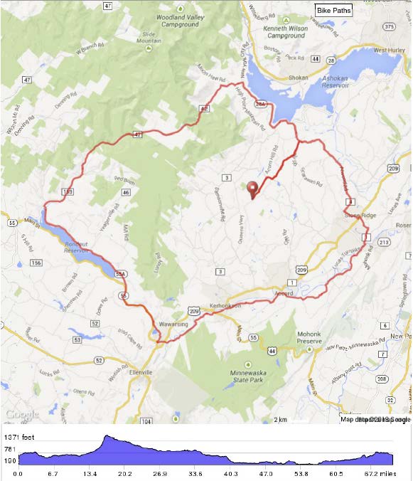
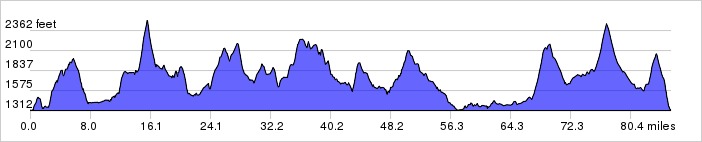
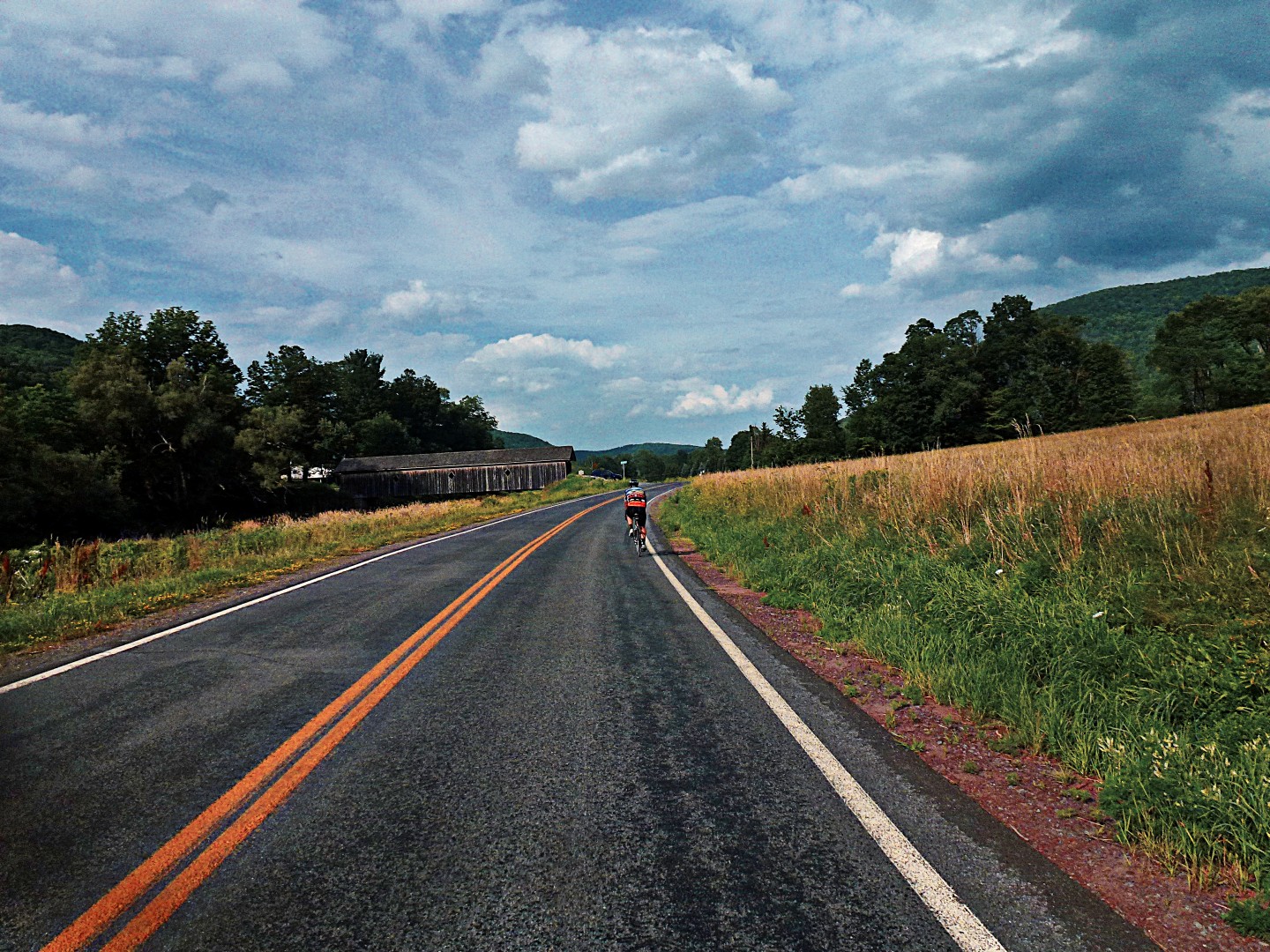
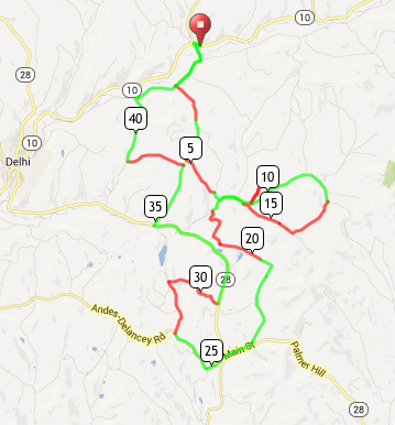
I recently rode a hilly 45-mile route that connects three neighboring villages to retrace childhood memories; each holds fond memories for me. But more relevant to this post, cycling between these villages is a fun adventure in pass hunting– the sport of riding over mountain passes towards a goal of having completed a defined number of passes within a region. Popular in France (rules of the game), it’s gaining popularity here in the US. It’s sort of the cycling equivalent of hiking clubs, where the goal is to have hiked over a defined group of mountain peaks. So instead of following major roads between the villages that skirt around and thereby avoid the mountains, I opt to ride up and over the mountains along the most remote, least traveled mountain passes and carriage roads I can find, choosing dirt over pavement wherever possible.

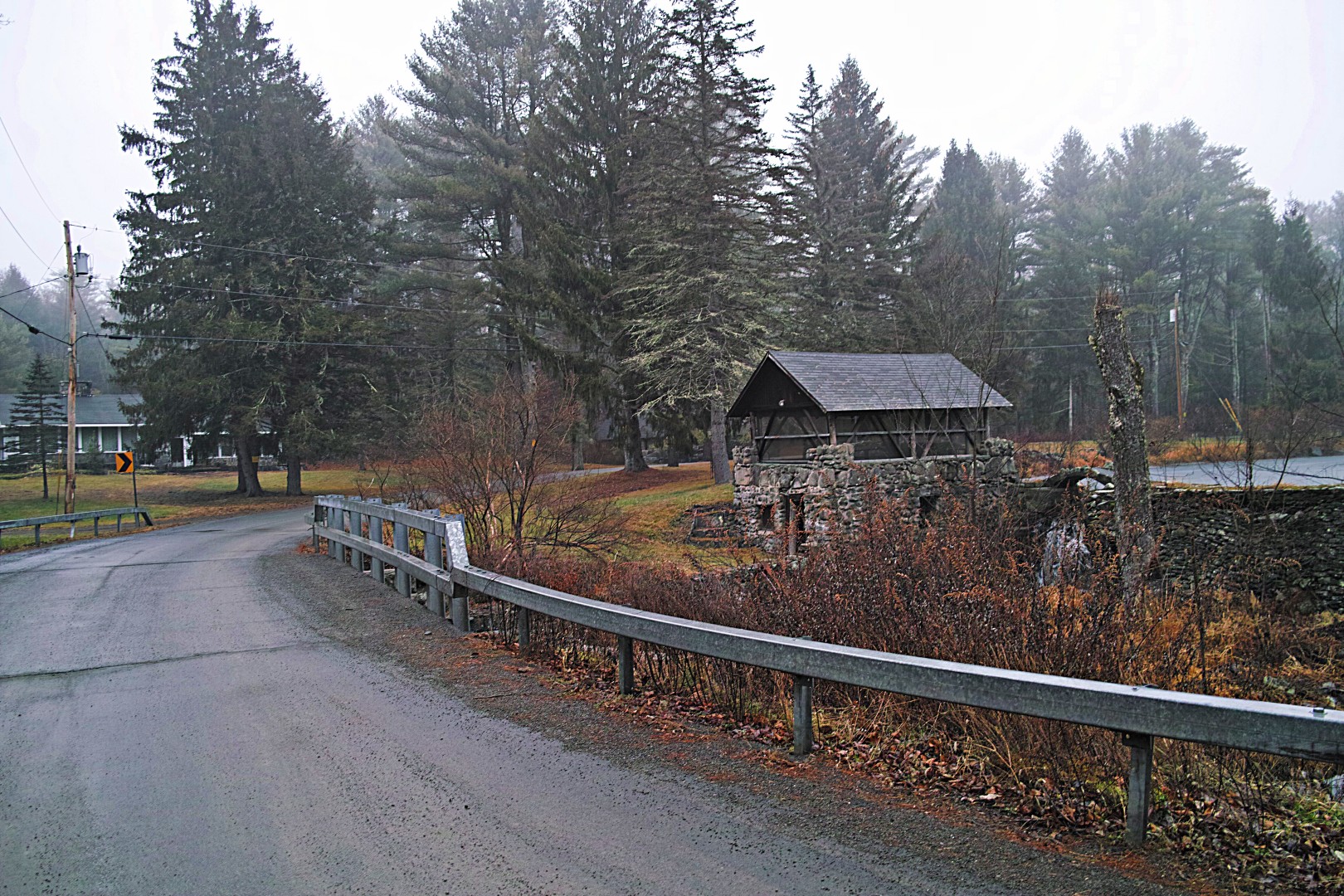
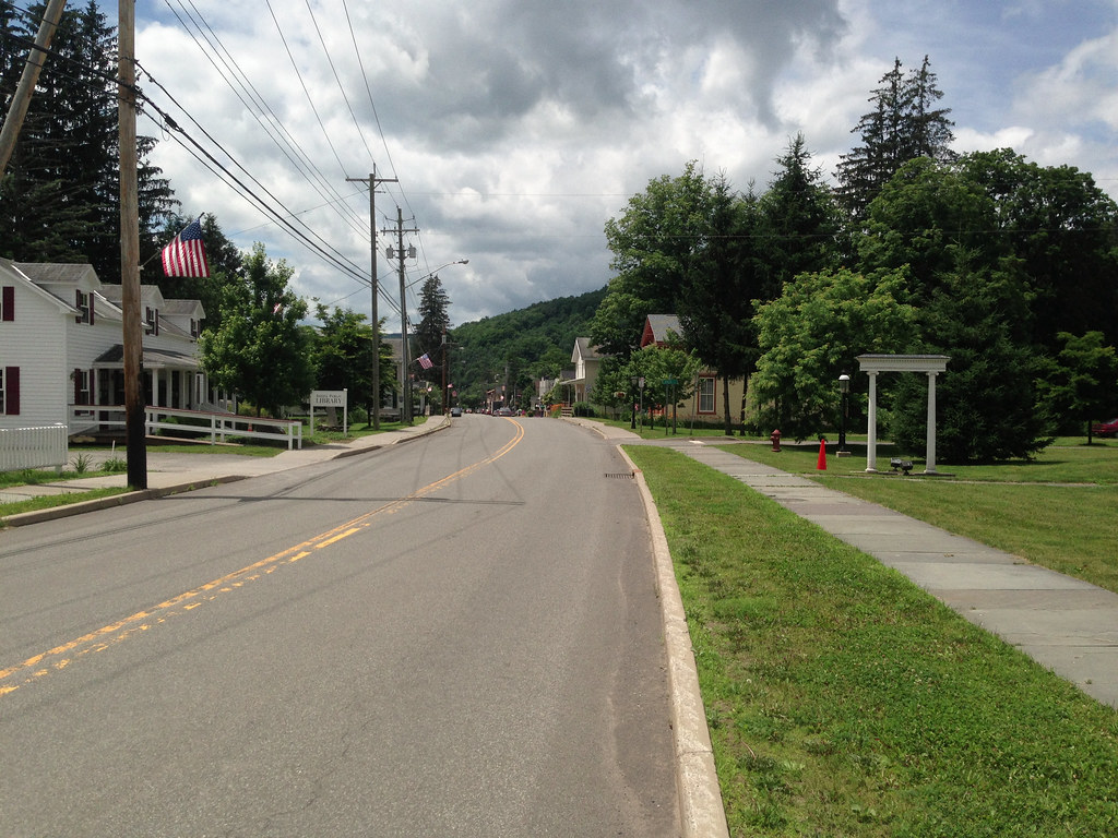
The route starts, like my previously described route, at the trail head of the Catskill Scenic Trail in Bloomville, a convenient location because of the parking and the proximity to the village center where one can find food and beverage. But unlike the previous route I described which takes in some of the trail and dirt roads north of it, this route doesn’t include any of the trail. Instead, I head the few hundred feet on NYS Rt 10 into the village. Bloomville was once a bustling town with a thriving economy, fueled by the regional dairy economy, the railroad that ran through the village, and the mill powered by Wright’s Brook, which also runs through the village. Bloomville had several imposing hotels.

The passenger railroad station is long gone. A second railway depot used for transporting food and grain was shuttered decades ago, the structure still stands today. The mill had closed long before the railroad. The town steadily declined and what remains now is not much more than a crossroads with crumbling buildings with fading facades, skeletal reminders of its industrious past. But Bloomville, and the Catskills, may be experiencing a form of economic revival, but more on that later.

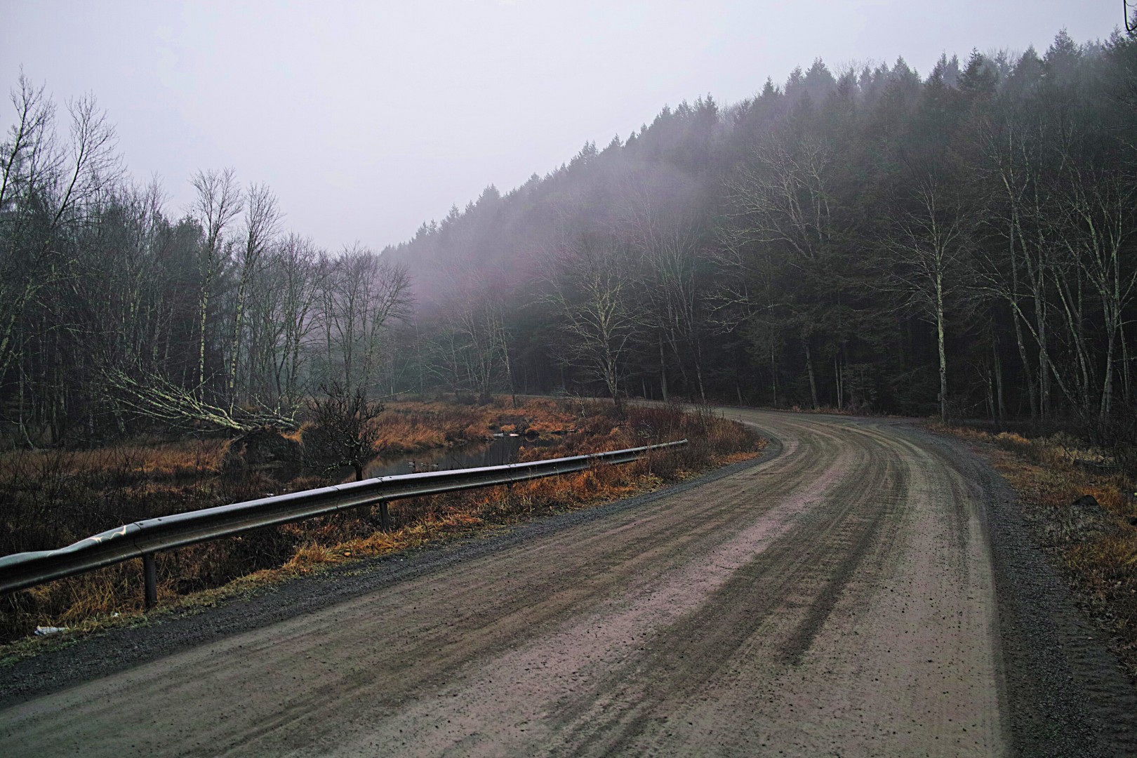
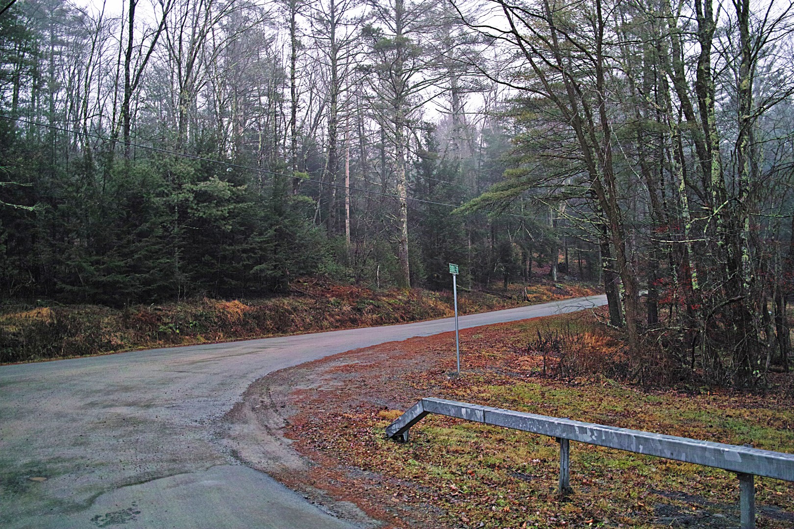
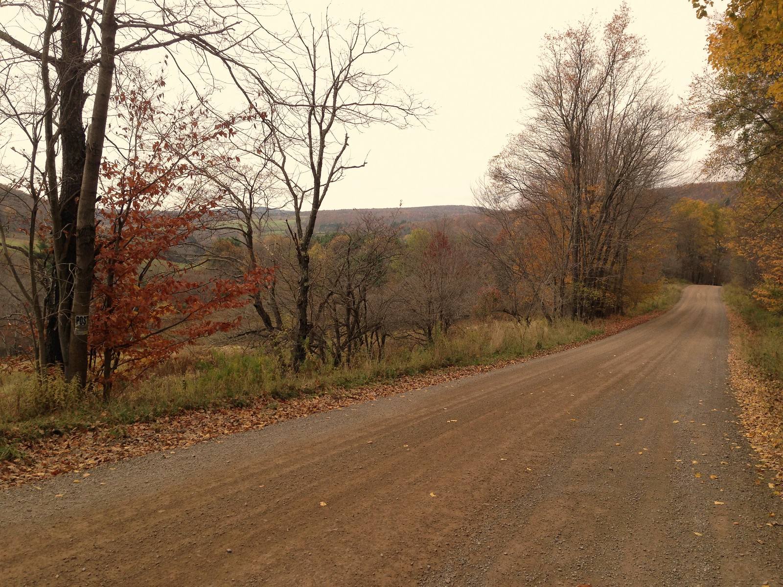
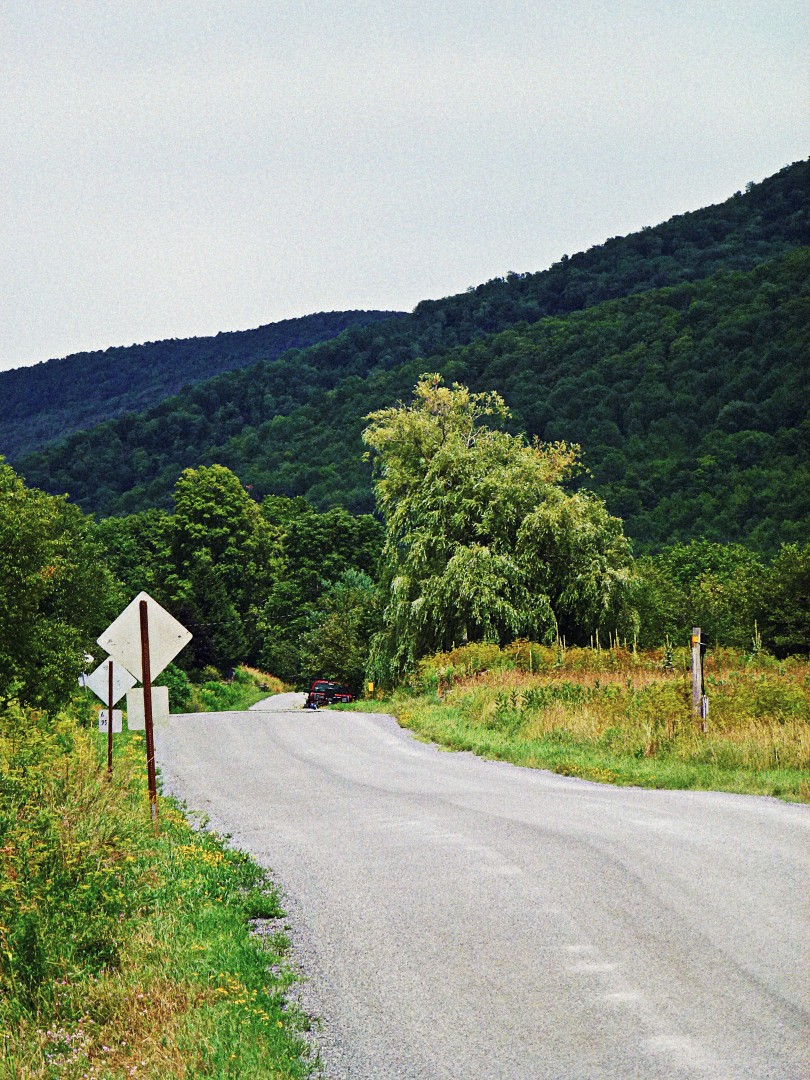
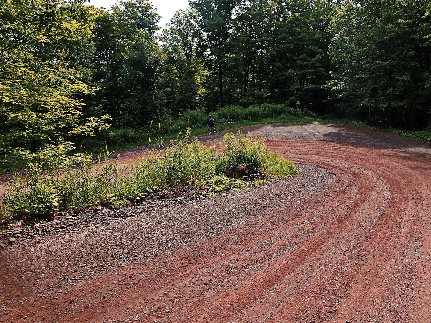
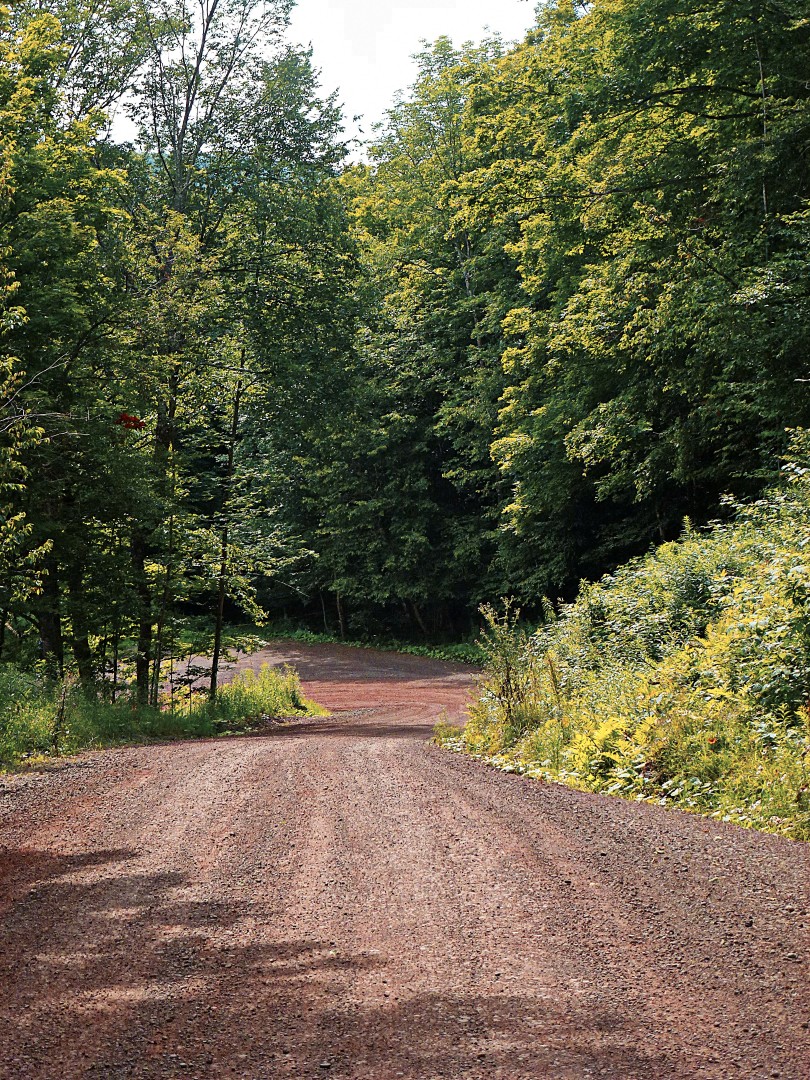
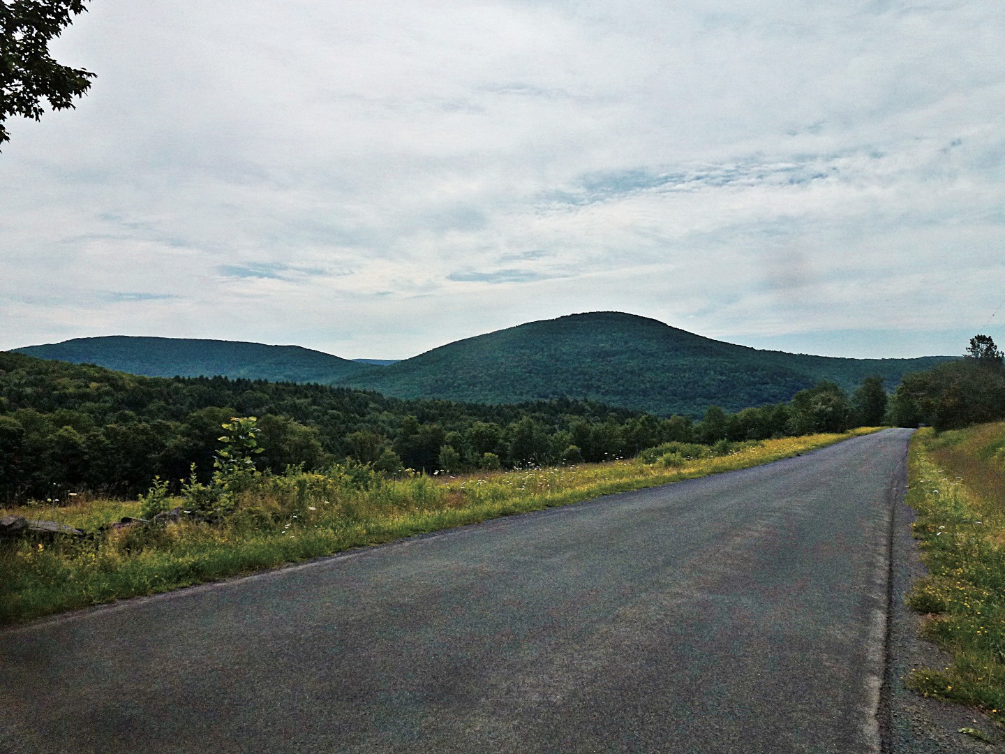
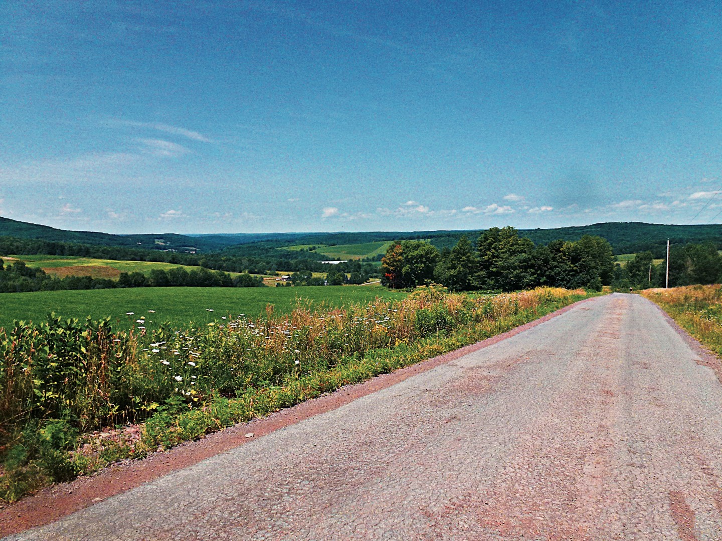
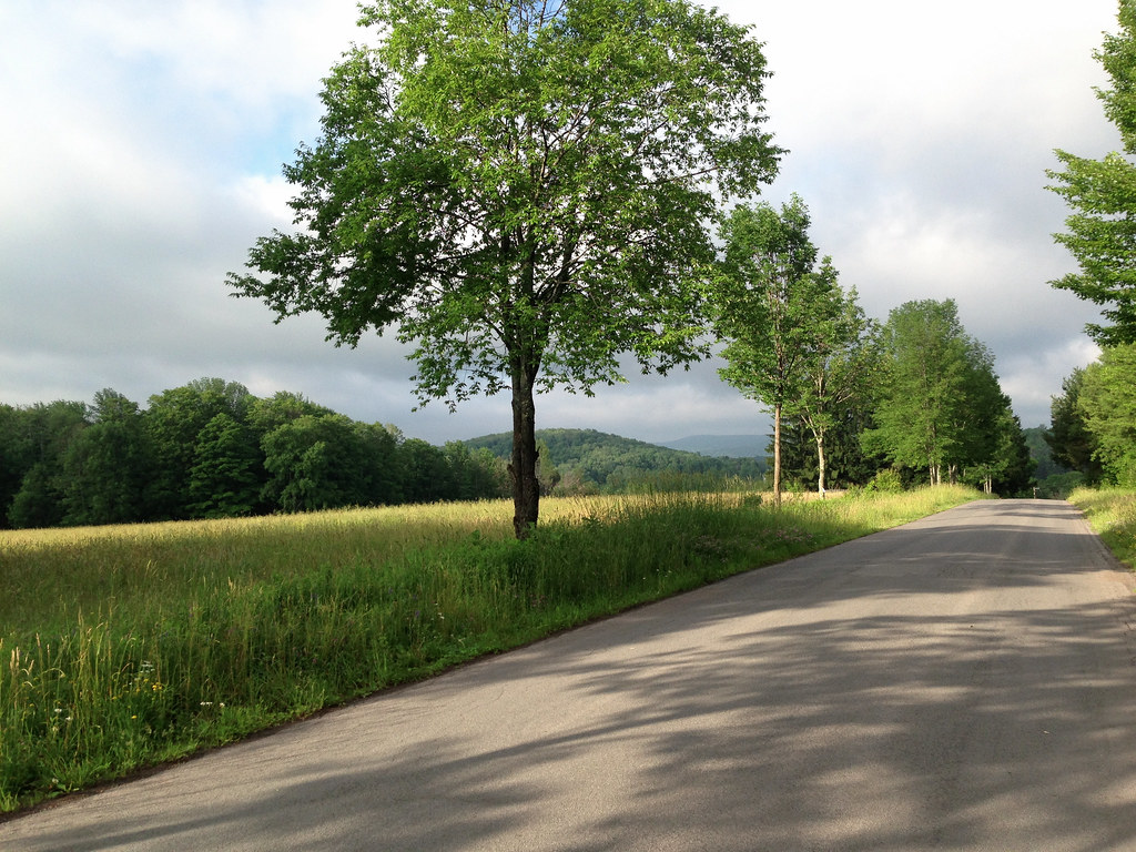
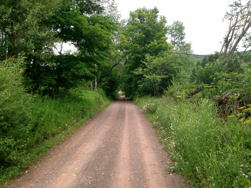
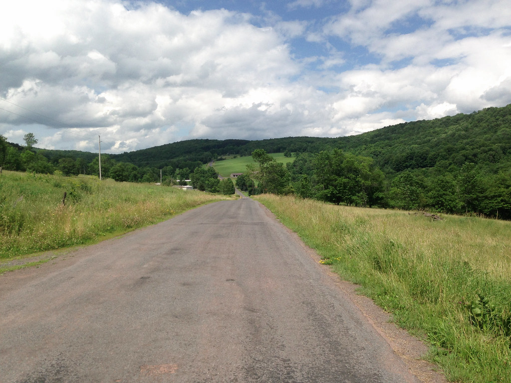
From Bloomville I head past the cemetery and across the river to County Highway 18 (Back River Rd), the gently rolling road dotted with roadside farm stands that follows the West Branch of the Delaware River. I turn onto Bramley Mountain Rd, a steep dirt road that takes me up Bramley Mountain into Bovina. At the top, the road becomes paved, views dominated by hilltop pastureland. I turn left onto Miller Ave and follow a long and delightful dirt road descent all the way into Bovina Center.

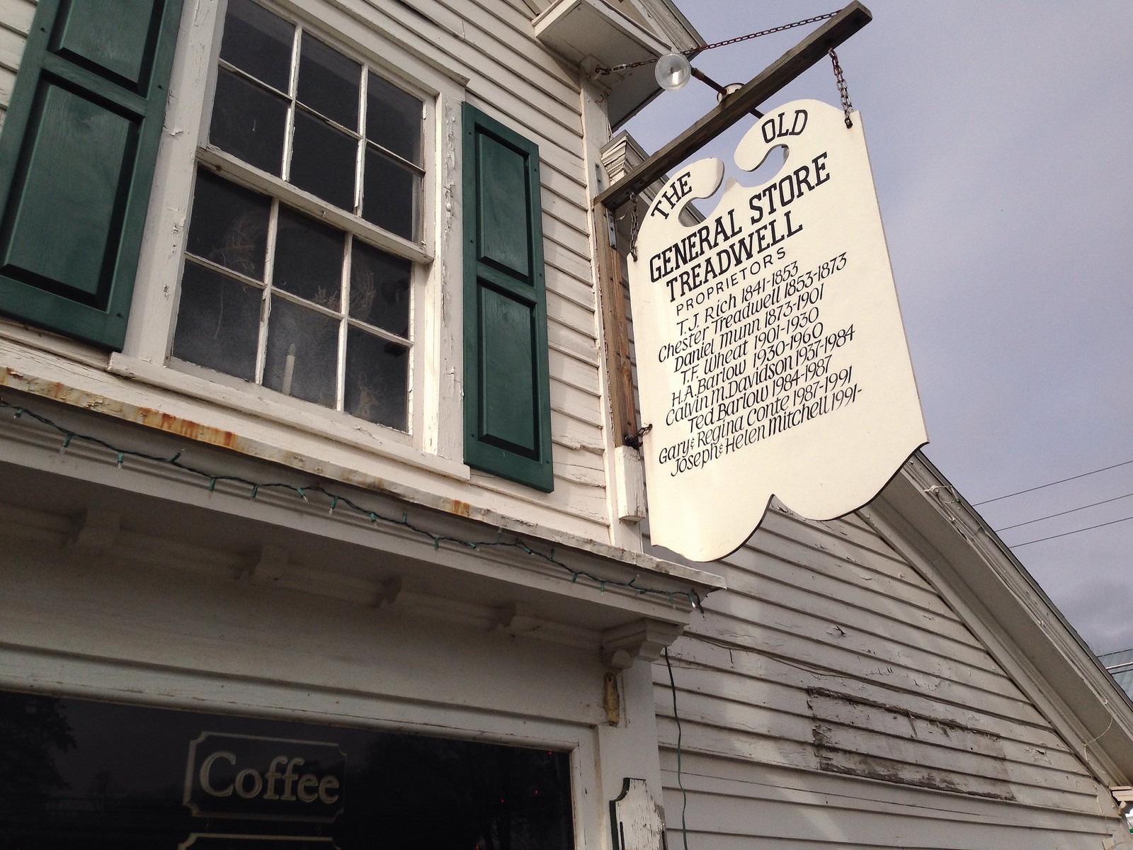
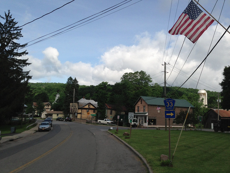
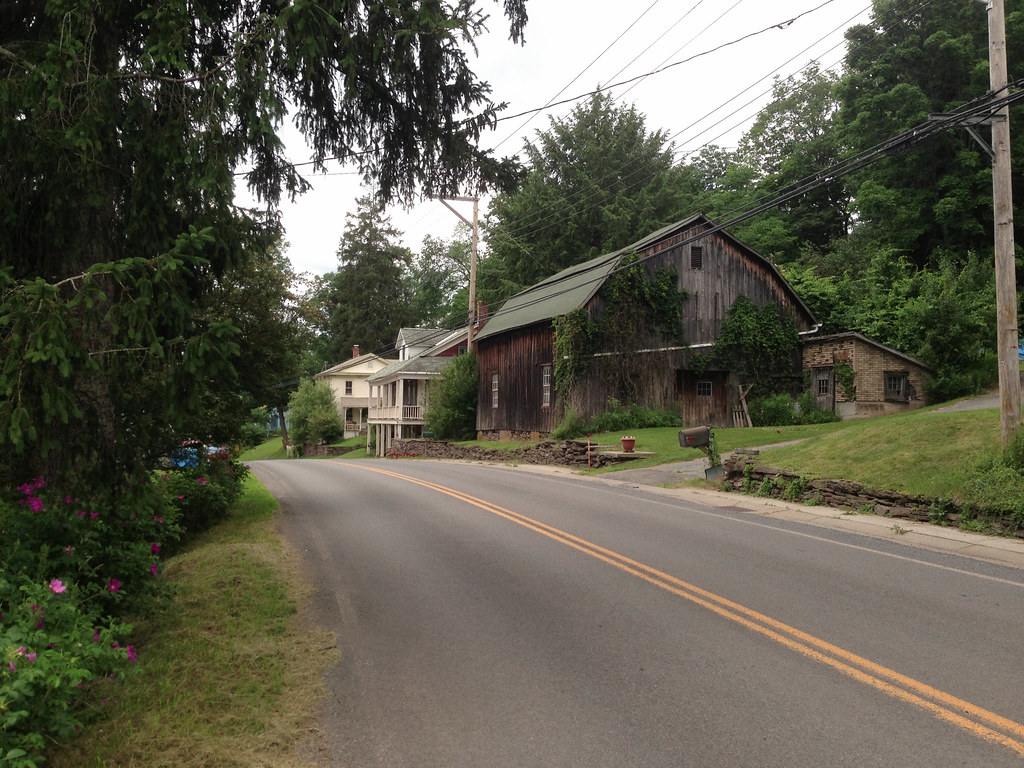
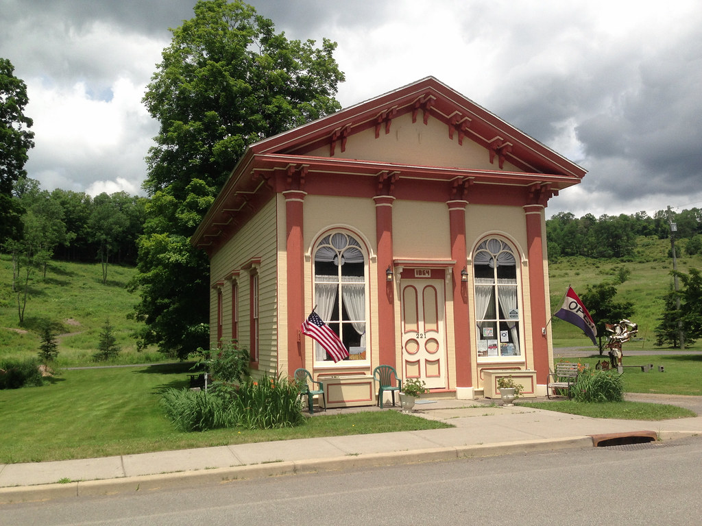
Like most of Delaware County, Bovina was predominantly (and is still, to a limited extent) a dairy farming town, with its village center spread along County Highway 6. The white one-room building on the left in the picture below is the Bovina museum, which was closed when I passed by; I had wanted to stop in and learn more about the town’s history. At the other end of the village is Russell’s Store, a general store and eatery that dates back to 1823, with its current name dating back to 1919. It appears as though little has changed since then except the contents of its shelves. On Saturdays they host a Farmer’s Market.

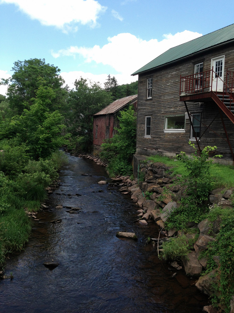
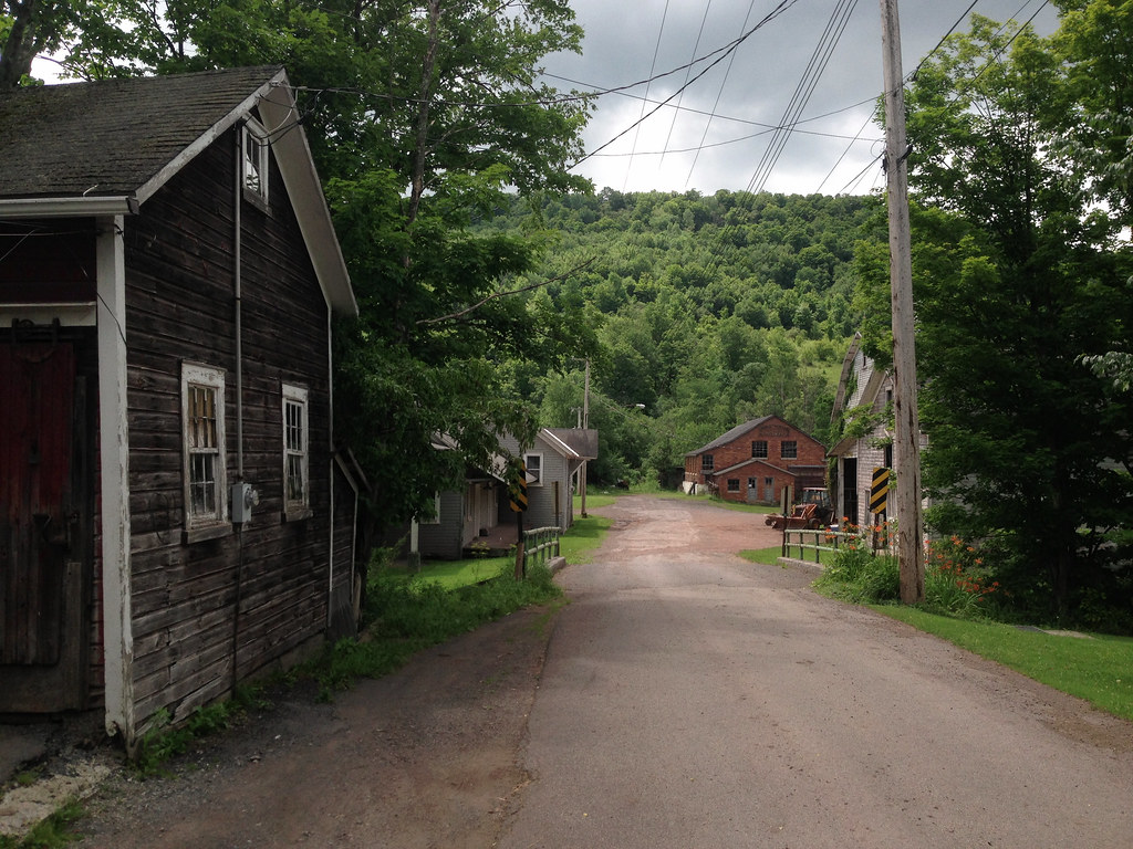
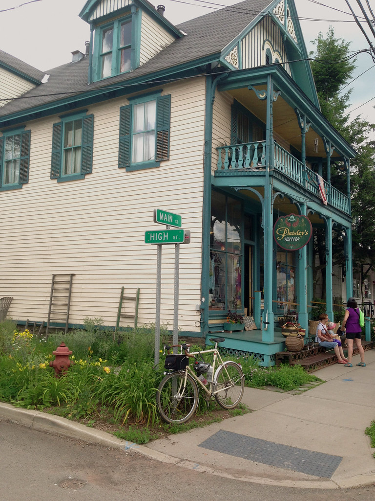
Speaking of Saturdays, that was the big night out for my family. My mother was an obsessional antiques collector, and Saturday’s were when the weekly auction took place in Bovina Center. Held in a former creamery building on Creamery Rd just off of Main St (the orange brick building at the end of the road in the photo below), it was the biggest shindig in town. For many years the creamery was the main clearinghouse for the local auctioneer, every square inch of wall space was taken up by things that never sold– tacky flea market art, crushed velvet portraiture in baroque plastic frames, that sort of stuff. It bordered on surreal, an epicenter of kitsch. In the anteroom in front, you could buy hot dogs and chips along with your $1 entry ticket. Auction goers sat in old wooden school chairs, resting their hotdog boats on the built-in writing tablets. The auctioneer, as if deity, had his own raised pulpit, from which he would deliver his own sermon, the auctioneer’s shtick. Sadly, years ago the business relocated to another village, and the funky vibe got lost in the move. At least it’s good to know the business is being carried on by the next generation.

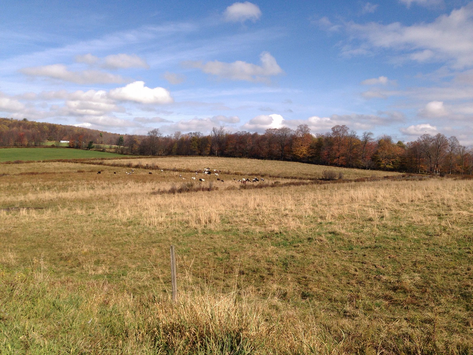
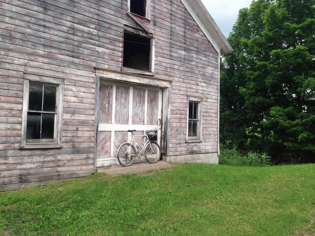
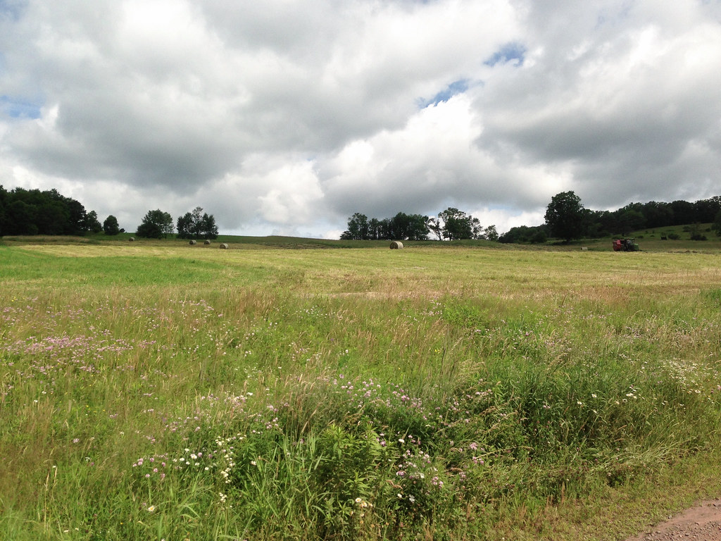
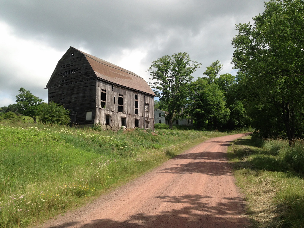
I head out of the village in the opposite direction of the next town on my route to take in one of my favorite dead-end dirt roads, Reinertsen Hill Rd. I know I’ll have to double back and head through Bovina Center again but I can’t resist the views. It twists up a steep hill testing the traction limits of my 650B Hetres. I come upon a field where a tractor is bailing freshly cut hay. Past it, an abandoned barn. The road narrows, tree crowns converge and provide a welcome canopy. A clearing emerges, and the road dead-ends at a farmhouse. Cows graze in a field.

Turning around and heading back down the hill, a new vista unfolds with every turn. I could devote an entire post to this short dead-end road, but I’ll stop here.

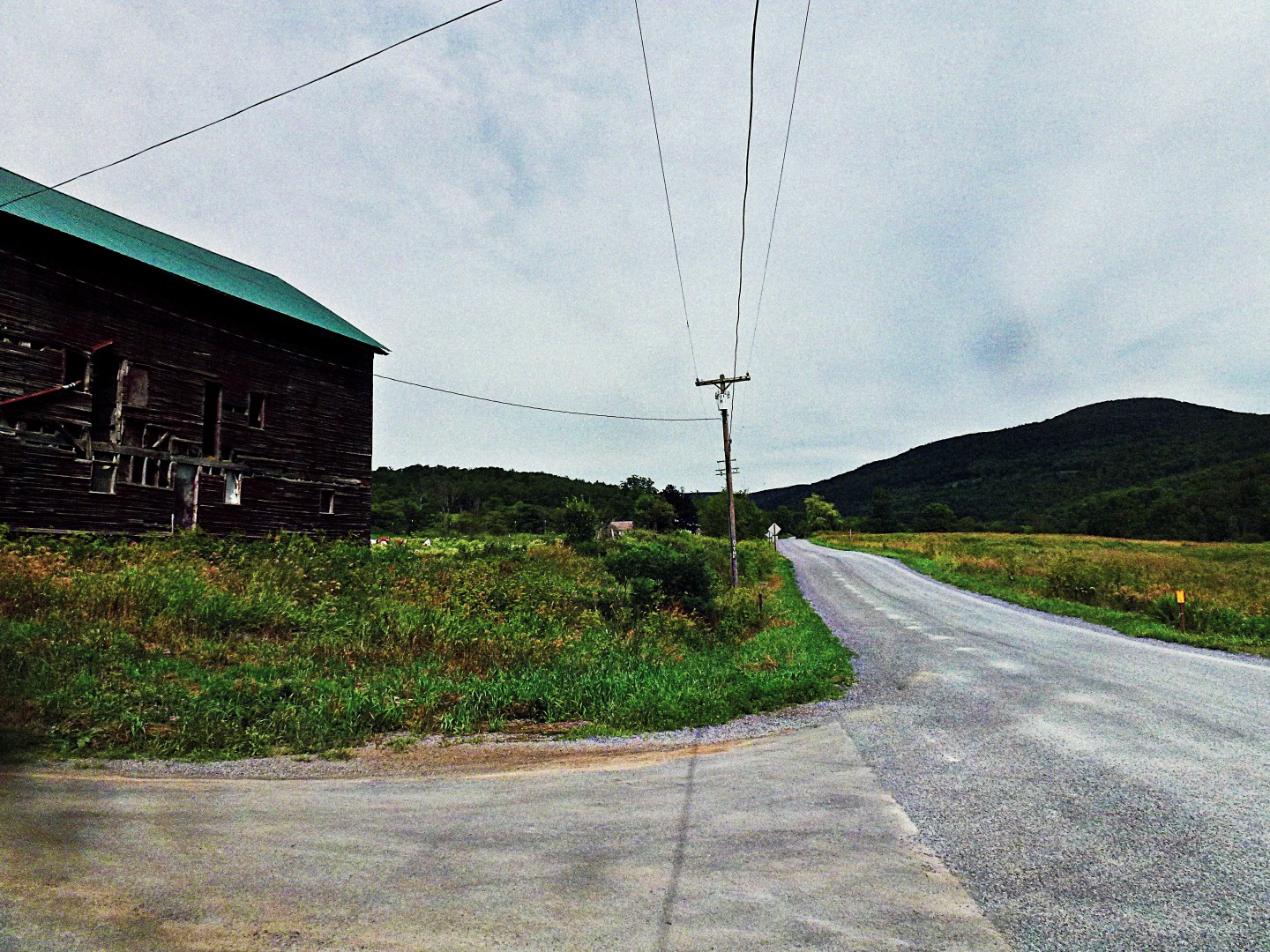
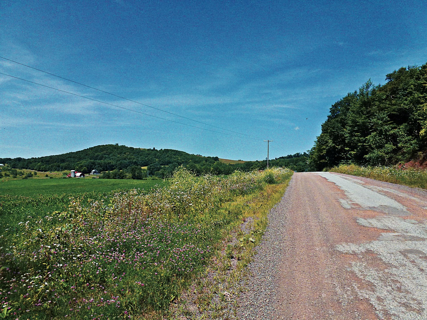
Back at the bottom of the hill, I continue away from Bovina Center on County Highway 6 toward another favorite dirt loop, Coulter Brook Rd. Highway 6 has gentle rollers with more of the usual views– farms and barns, in various states of decay. I pass one barn that has collapsed to rubble, a sad but common site around here (our family barn suffered the same fate, after decades of “deferred maintenance”).

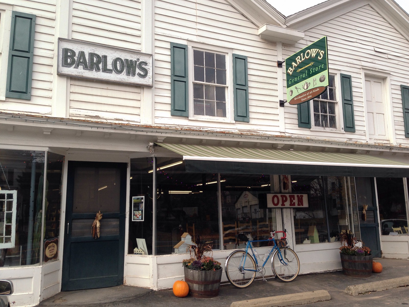
I turn onto Coulter Brook Rd, which loops back to Bovina Center. On my way back through the village, I stop at Russell’s store and refill my water bottles. For anyone riding this route, Russell’s may be a good food stop, and there’s also the swankier bakery/cafe on the other end of the village. More opportunities for food and drink lay ahead in the next village on the route.

It’s July 6th, and American flags vye with barns for iconic dominance.

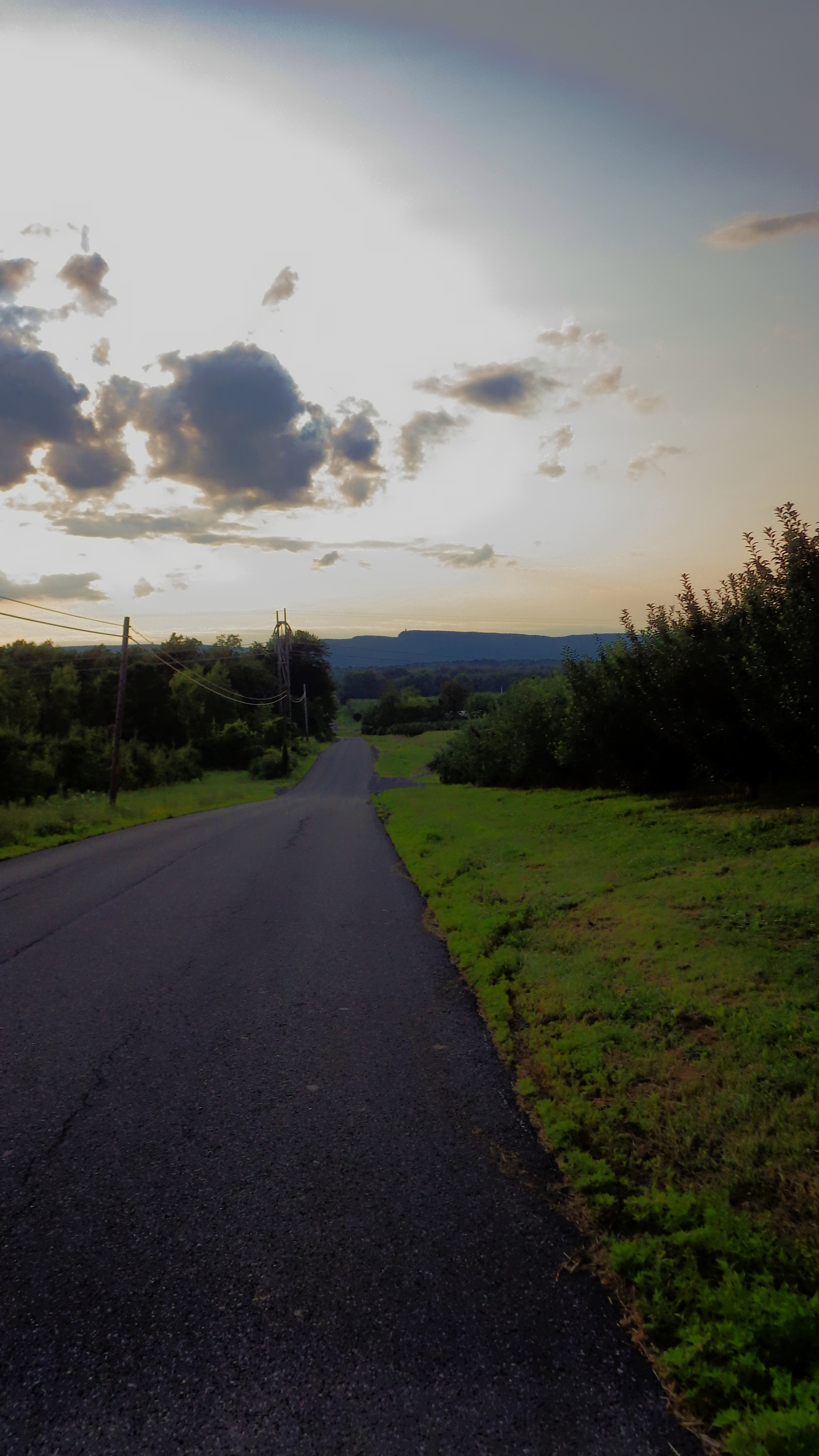
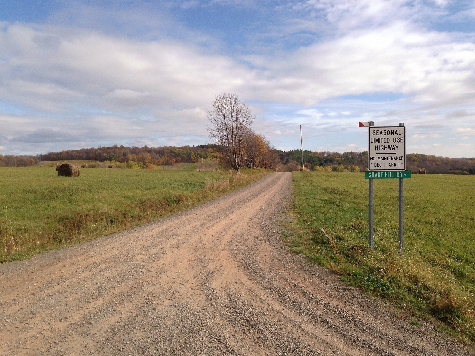
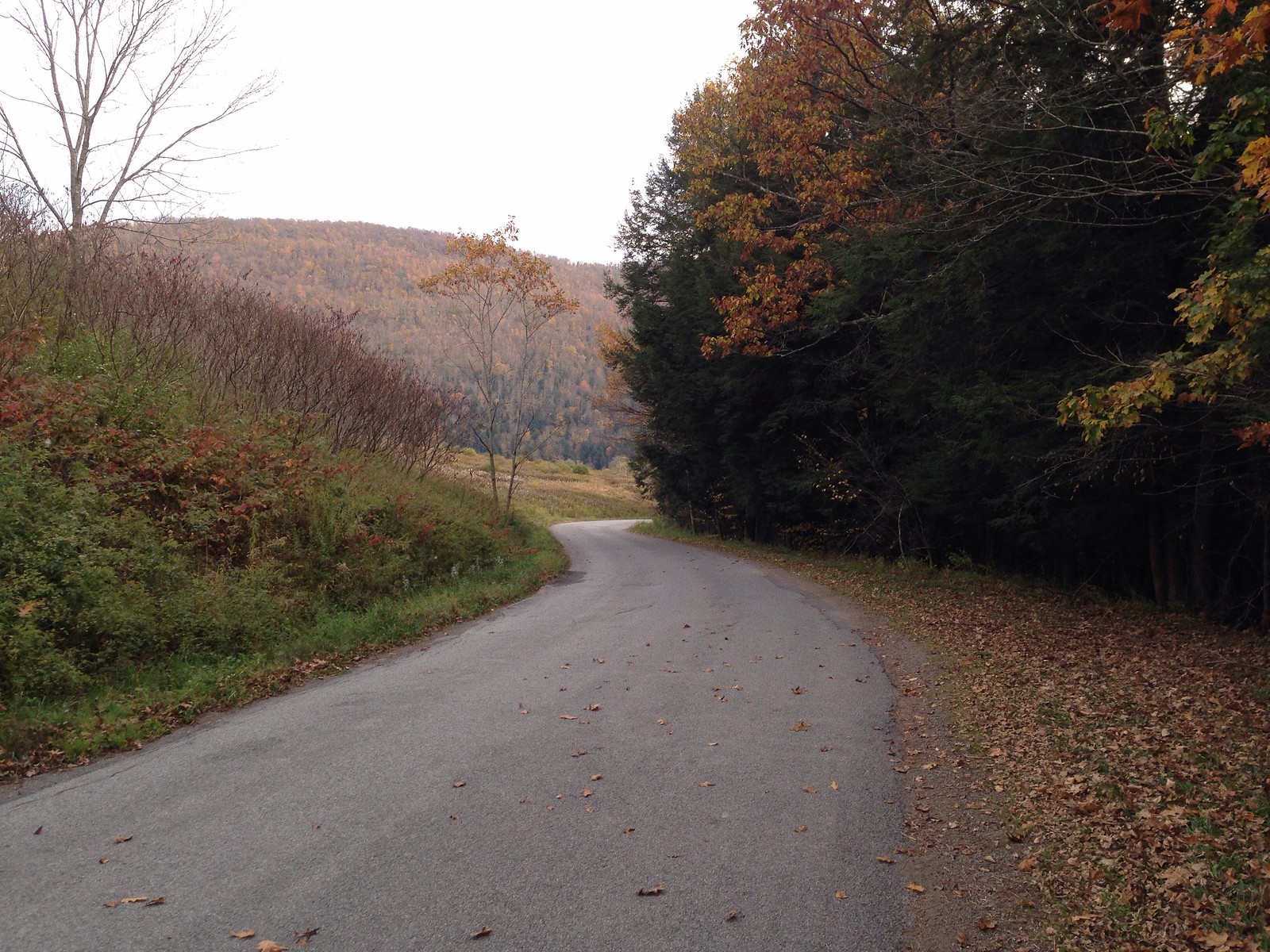
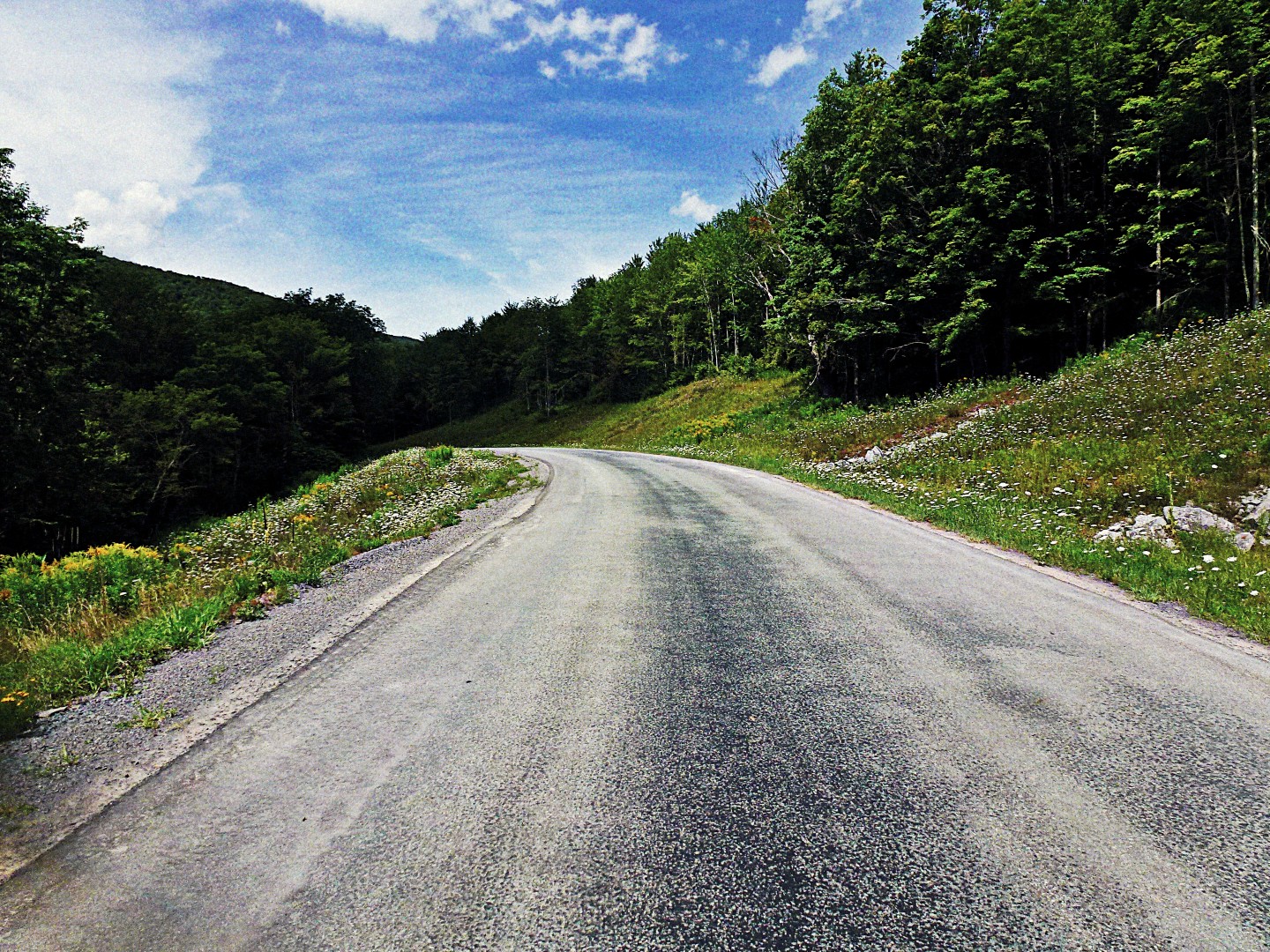
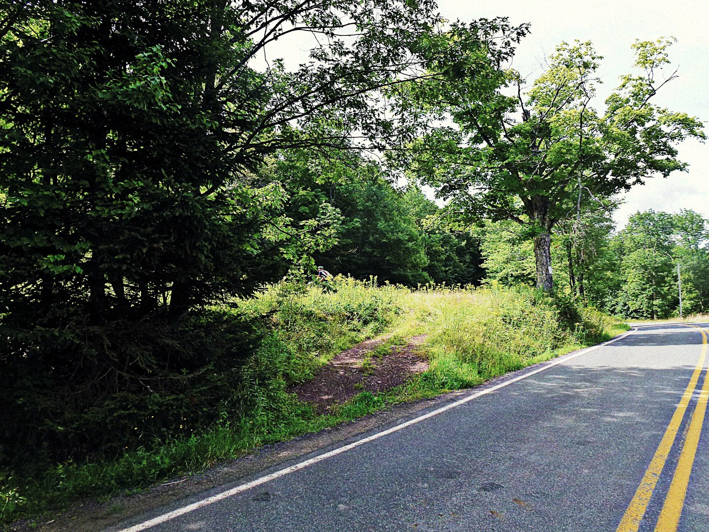
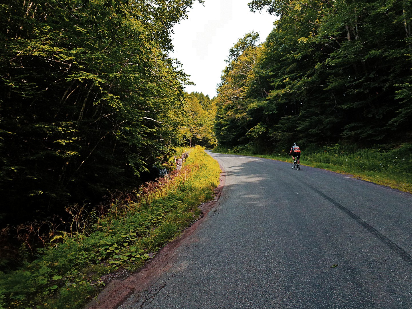
Outside the village center, I turn onto Russell Hill Rd. This dirt road winds its way up a steep road that will take me to the next hamlet, Andes. As I crest Russell Hill Rd, cows pasture on the hilltop. I enjoy a long, steady descent down the other side. At first I believe I’m heading down the hill to what must be Andes, but I soon discover I have many short but steep climbs to tackle before I make the final descent into Andes. I noted in my previous post that the sound of water was pervasive. This week it was less so, as we hadn’t gotten any significant rain for the better part of a week. But as rain gave way to sunshine, wildflowers flourished, decorating the sides of the road like confetti.

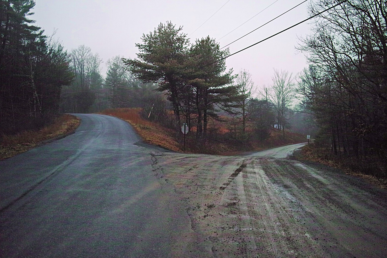
I’m supposed to fork left at Doig Hollow Rd, but I miss the turn, there are no markings. But I’m also going at a good clip, intoxicated by the breeze and by the unique sound of the voluminous Hetres swiftly rolling over packed dirt (imagine the sound that briefly lingers after a basketball bounces, but imagine it lingering indefinitely). I blow past the fork, which in retrospect should have been impossible to miss. This costs me precious hill climbing reserve: I descend a good 1/4 mile before realizing my mistake. As I ride I have no idea how much elevation gain this route has, I hadn’t mapped it online first (no internet access at my summer house). I was old-schooling it with a paper map from 1974. I do know, this far into the route, that it’s hilly! (I later learn when mapping it online that the 45 mile route has 5500 ft of elevation gain– see route link at the end).

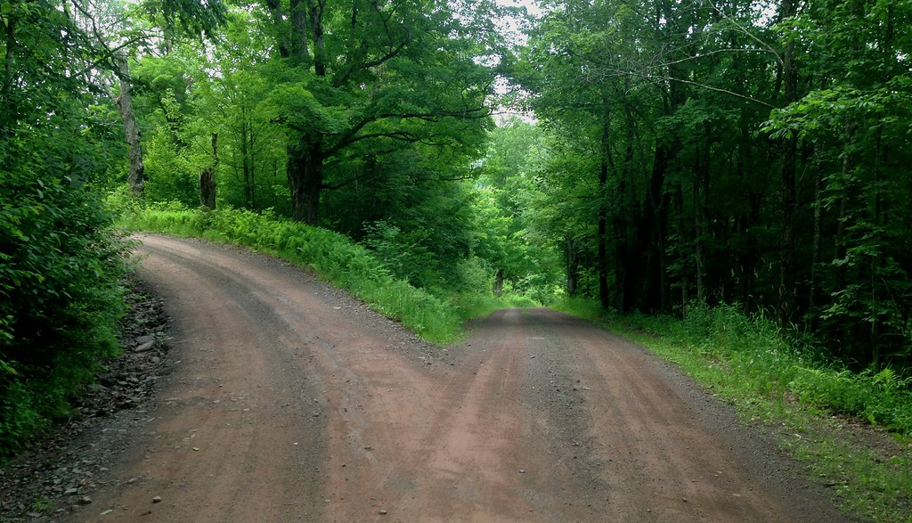
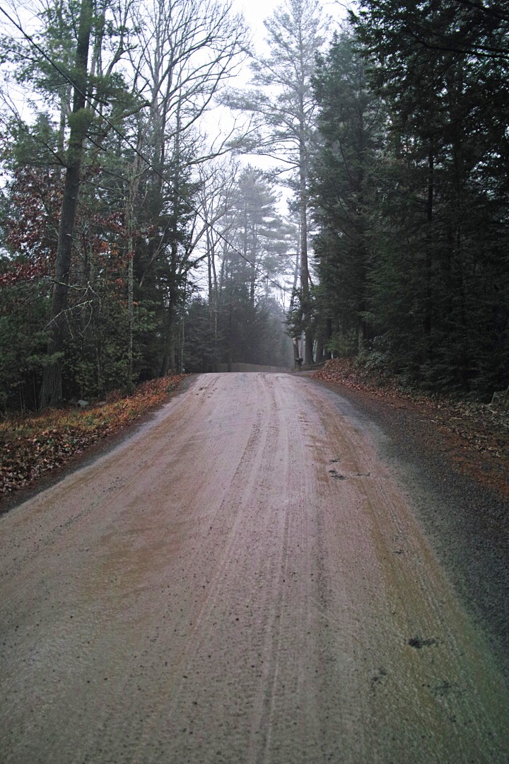
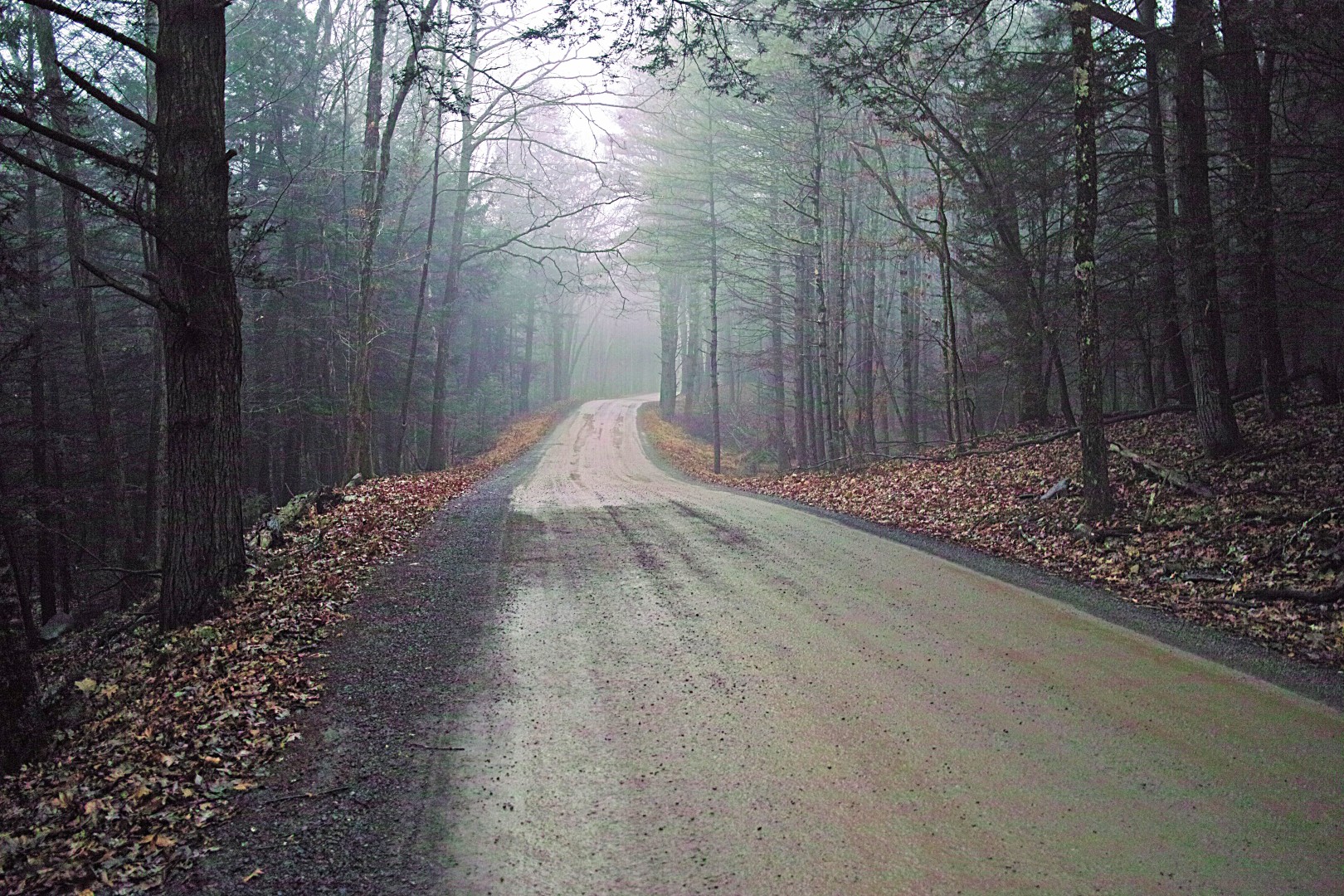
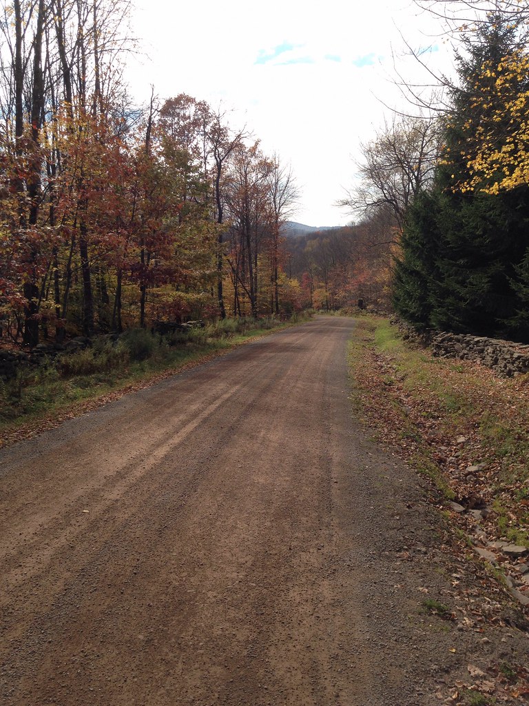
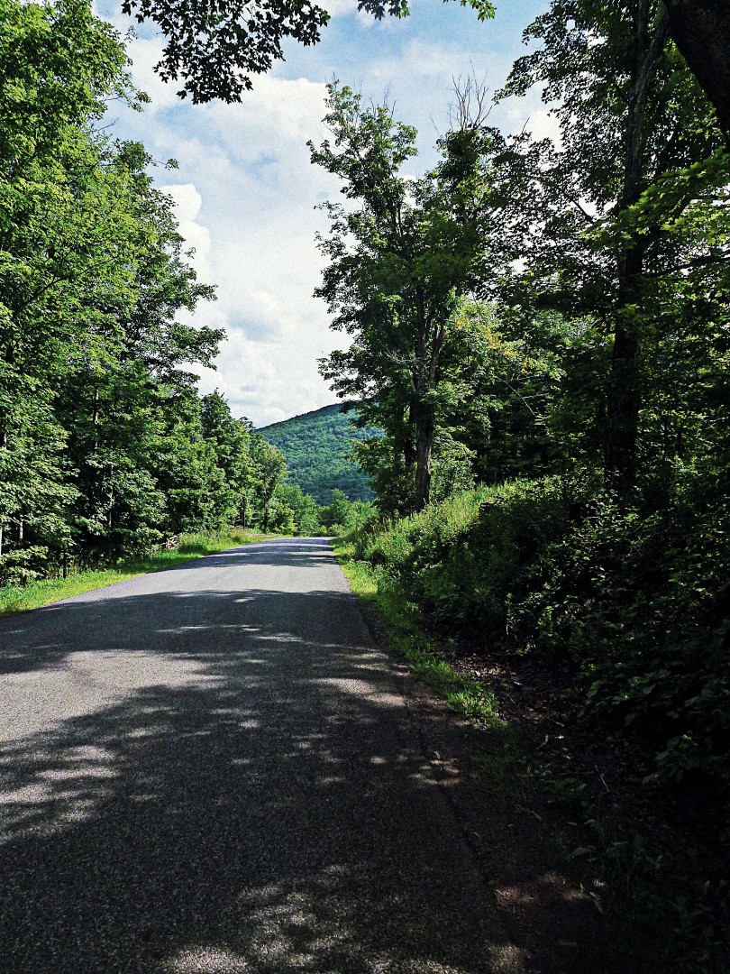
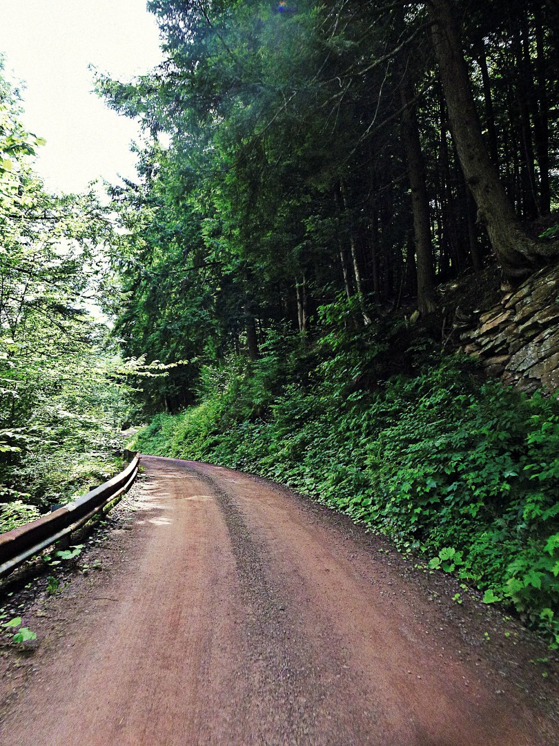
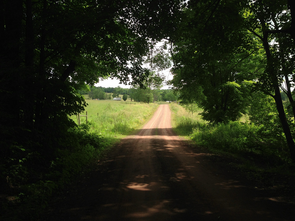
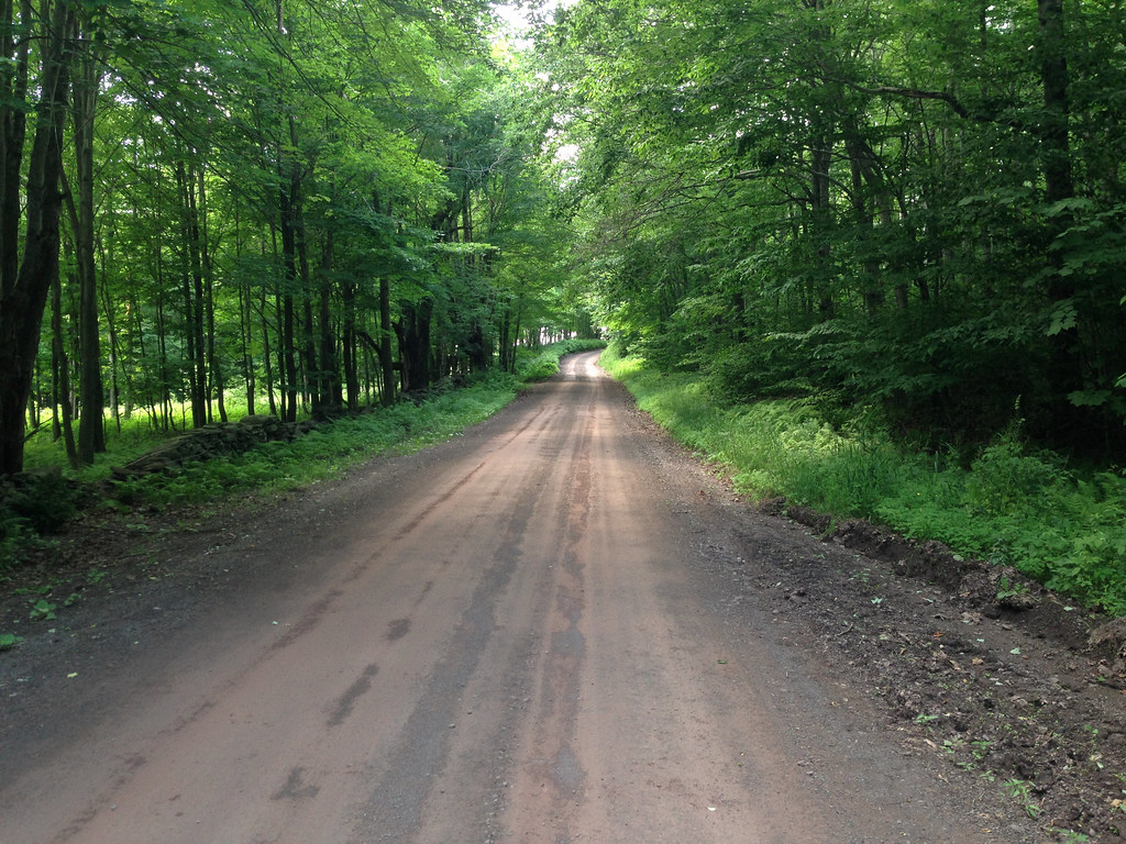
Doig Hollow Rd is a gem. Lined with sagging, mossy stone walls, tall ferns and century old trees, the shade is more than welcome– it’s needed. It’s high noon and I’ll later learn that it’s 87 degrees. I take a break, have a bite, a drink. I’m a fan of front rack-mounted randonneur style bags, and mine holds enough food and supplies for a day in the saddle. But I’m nearly out of water and I’m still not certain how much more elevation I’ll have to deal with before I descend into Andes.

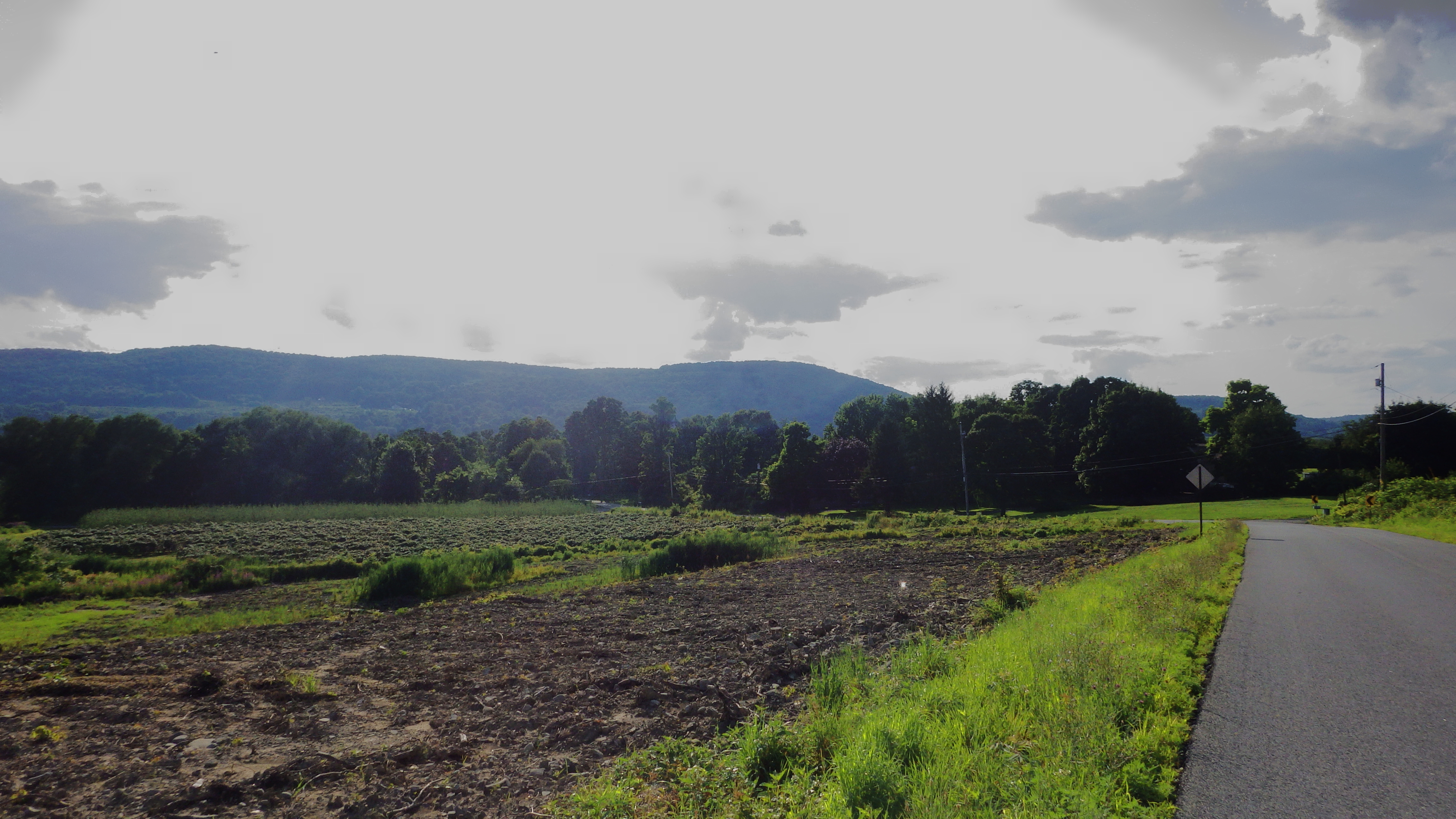
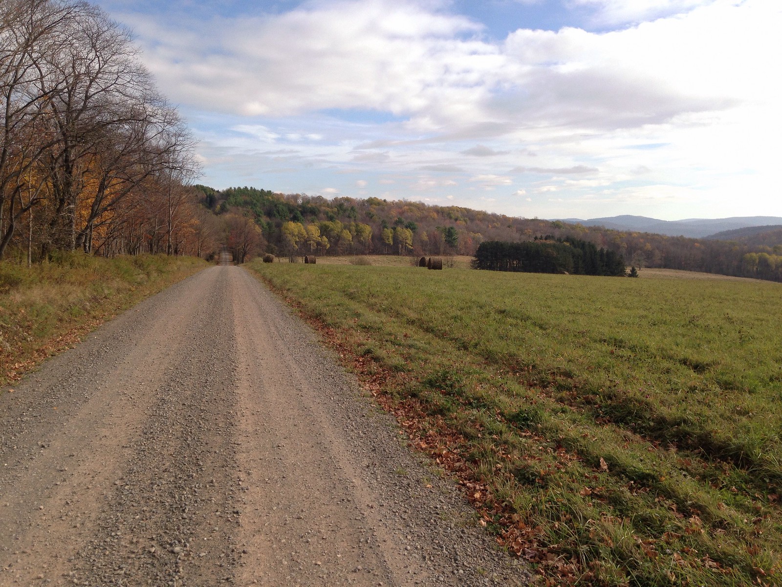
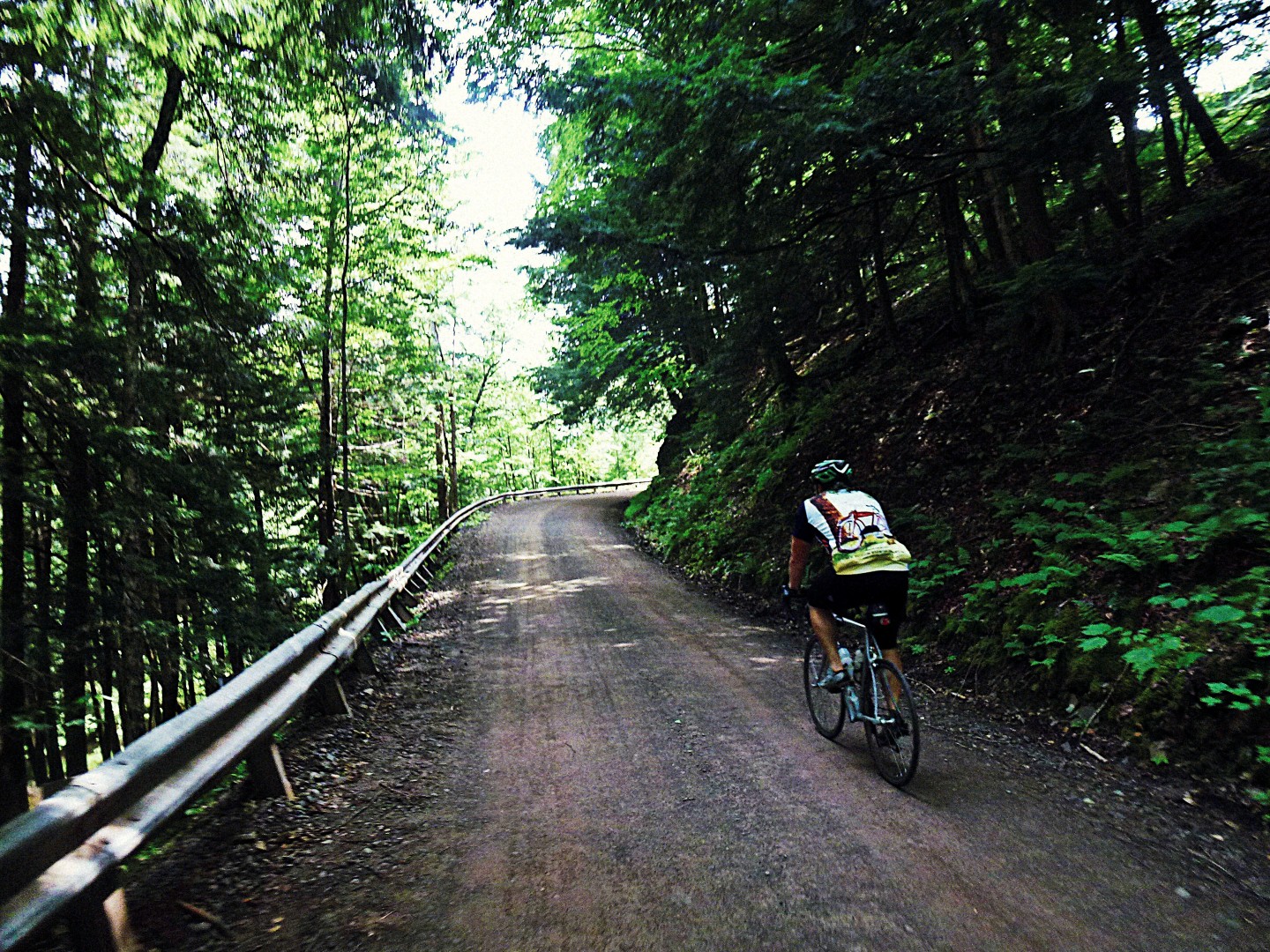
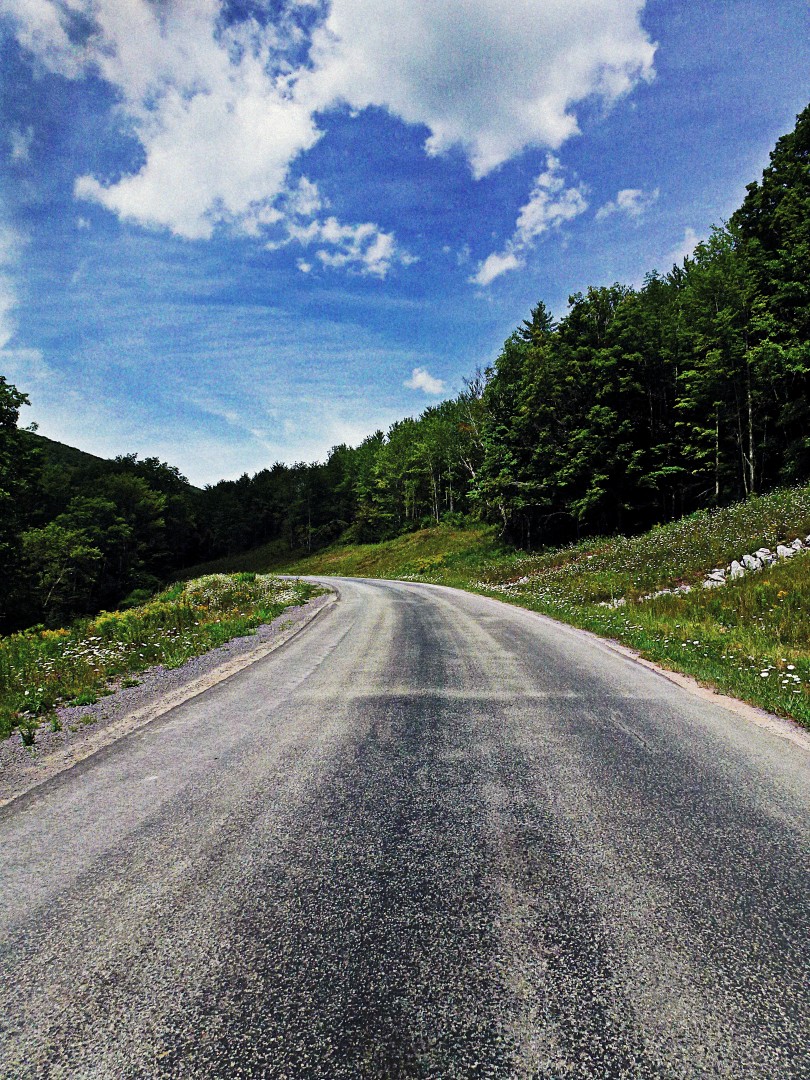
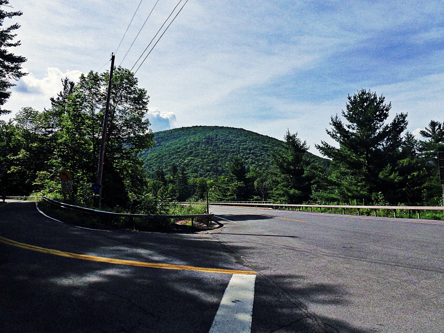
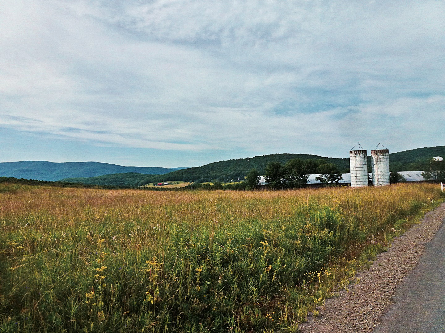
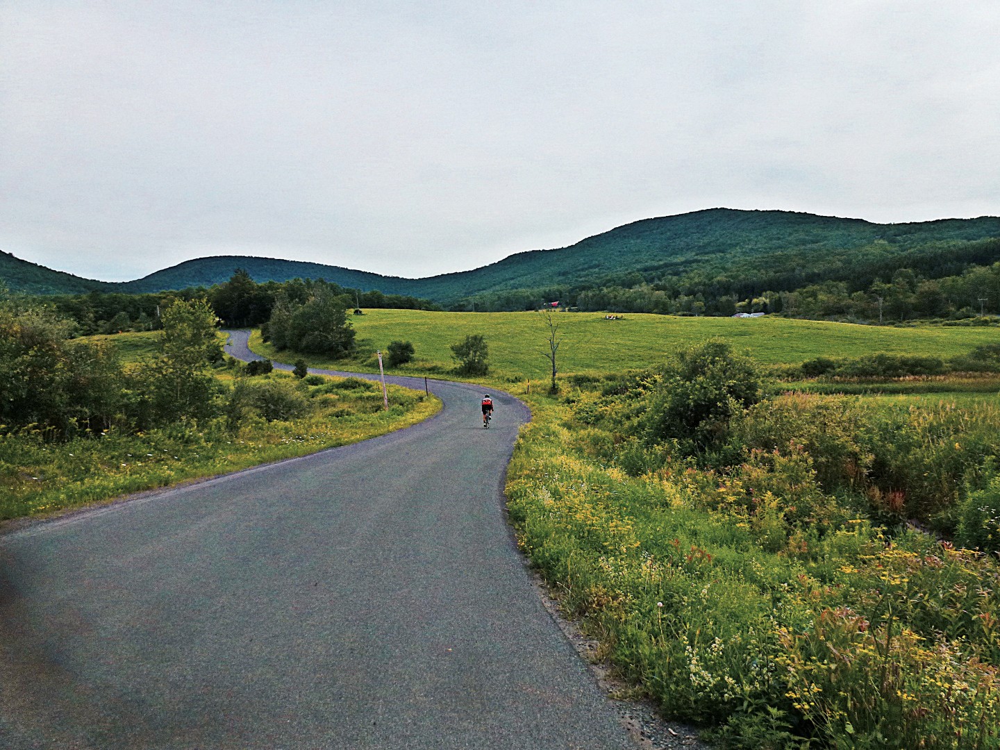
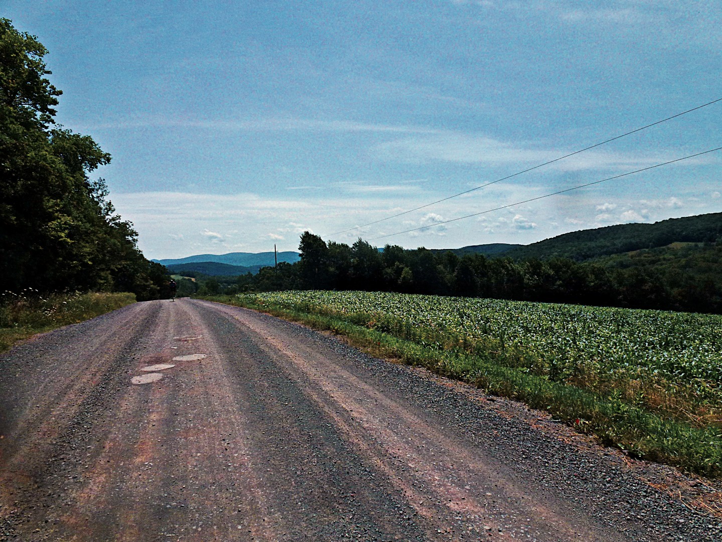
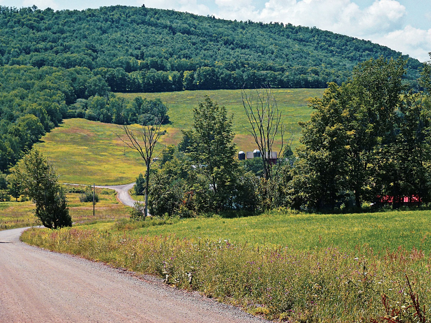
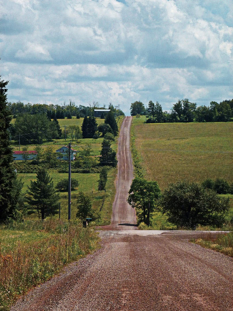
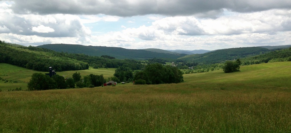
Doig Hollow Rd went on like this for a while, then after a few milder climbs over two miles, it seems like the world is unfolding in front of me: a panorama presents that literally forces me to stop and take a deep breath. In the photo below, you can see the village of Andes in the distance. All down hill from here. The dirt changes to pavement, I hit 43 mph. I think, technically, I am speeding.

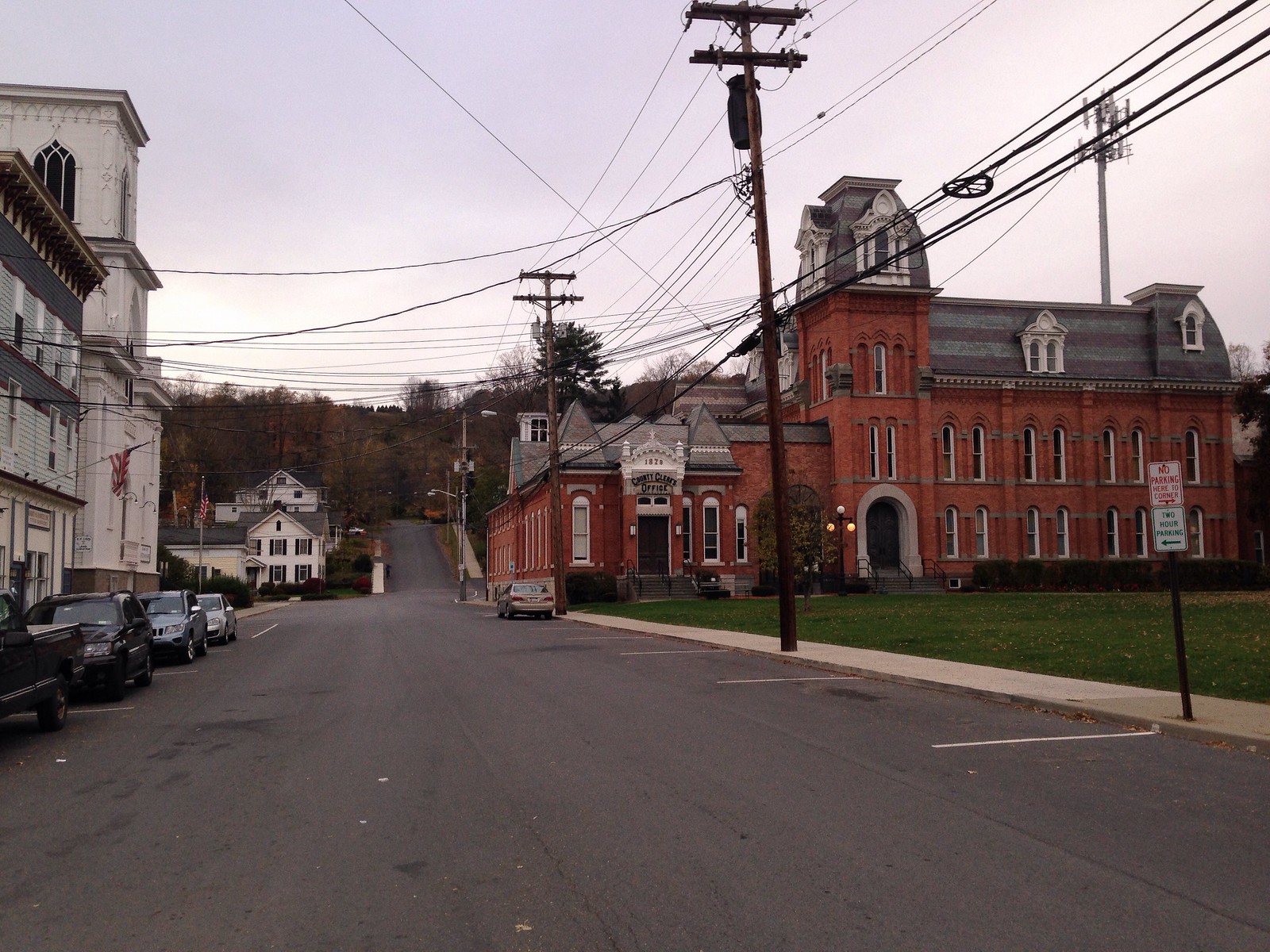
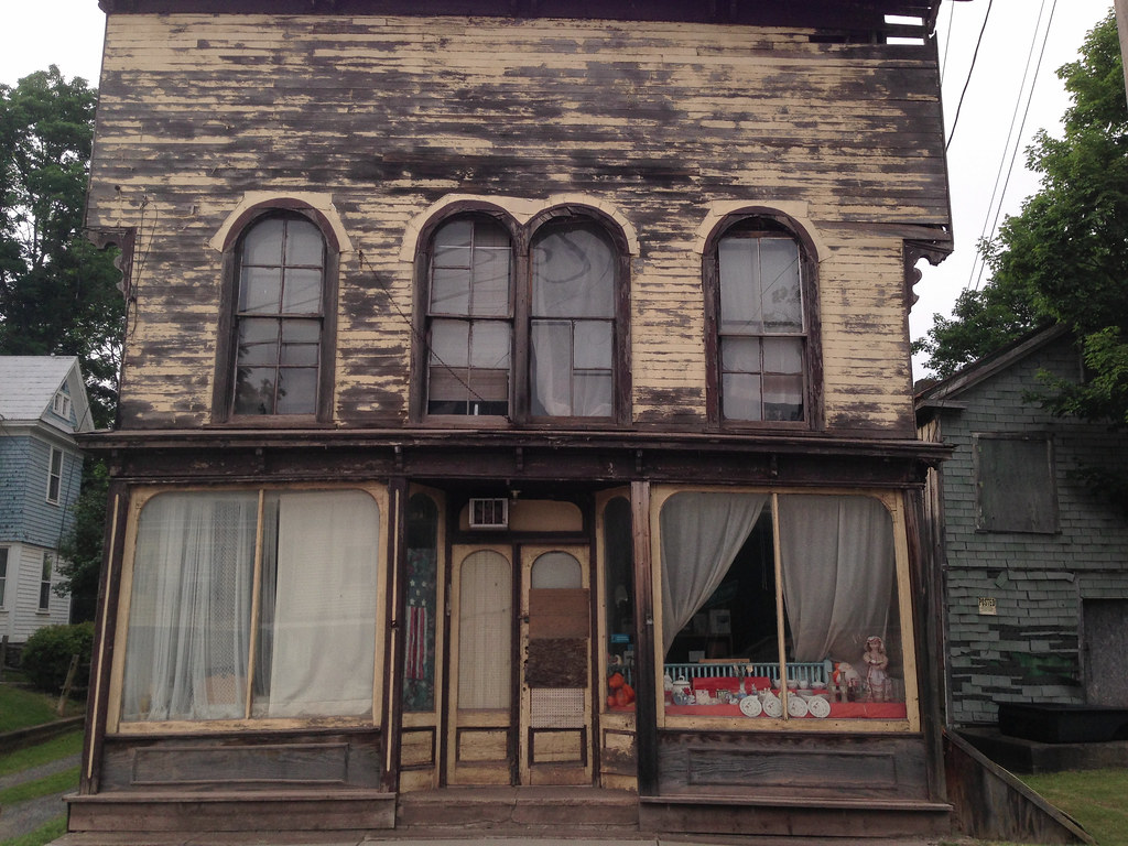
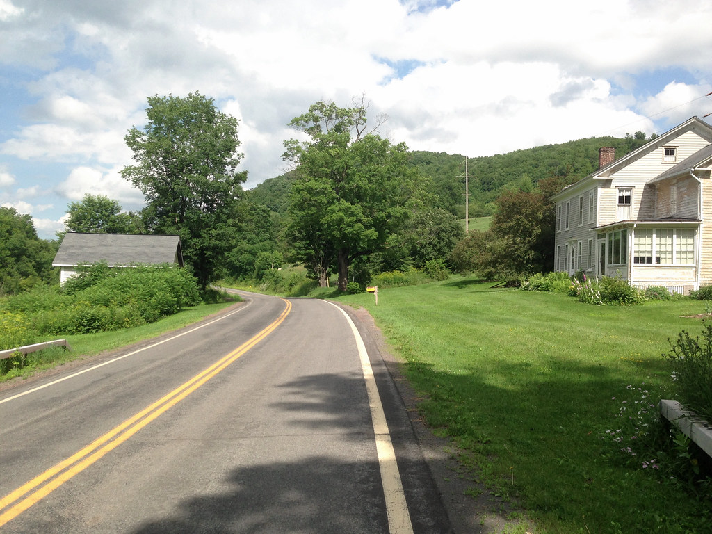
The road terminates at NYS Rt 28, the major corridor through Delaware County. Fortunately, I join Rt 28 just as it enters the village and slows to 30 mph. Rt 28, which runs right through the village of Andes, is its main street. New Yorkers heading into the Northern and Western Catskills pass through Andes, and in the past 20 years it has become a tourist’s haven. What were once feed stores or small engine repair shops are now antique shops or art galleries. We once bought a used lawn mower in Andes for $20. Today I can buy an early American pine farm table for $1200. I stop at Woody’s Country Kitchen for ice cream. I remember it from decades ago when it had a different name (Patty’s Pantry), and I discover that although the name had changed, the interior decor hadn’t.

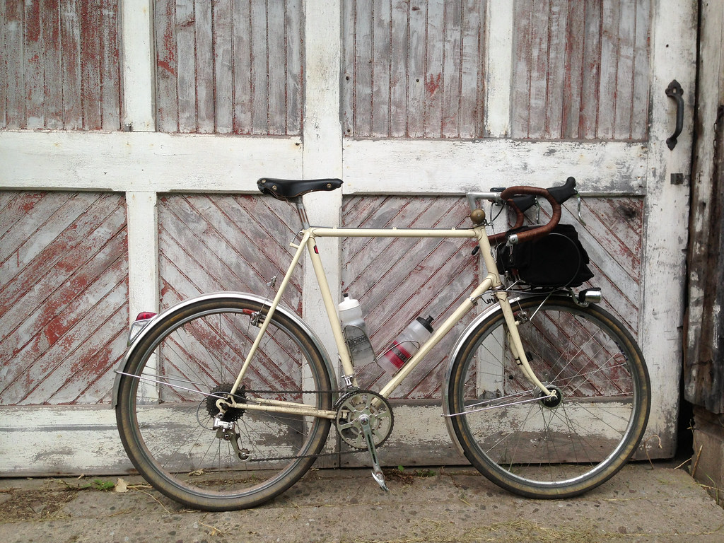
Next door is a boutique shop, the proprietors of which my family has known for years. I stop in to say Hi, in what has become an annual ritual. Inside, I meet a fellow who seeks me out as the owner of the bike resting against a post outside. He notes my Gilles Berthoud saddle– both he and the saddle are French. He’s a cyclist, grew up not far from the Alex Singer shop in a suburb of Paris, and happens to own an Alex Singer… and a Rene Herse. And he lives, as the crow flies, less than two miles from my house in Bloomville. Amazing.

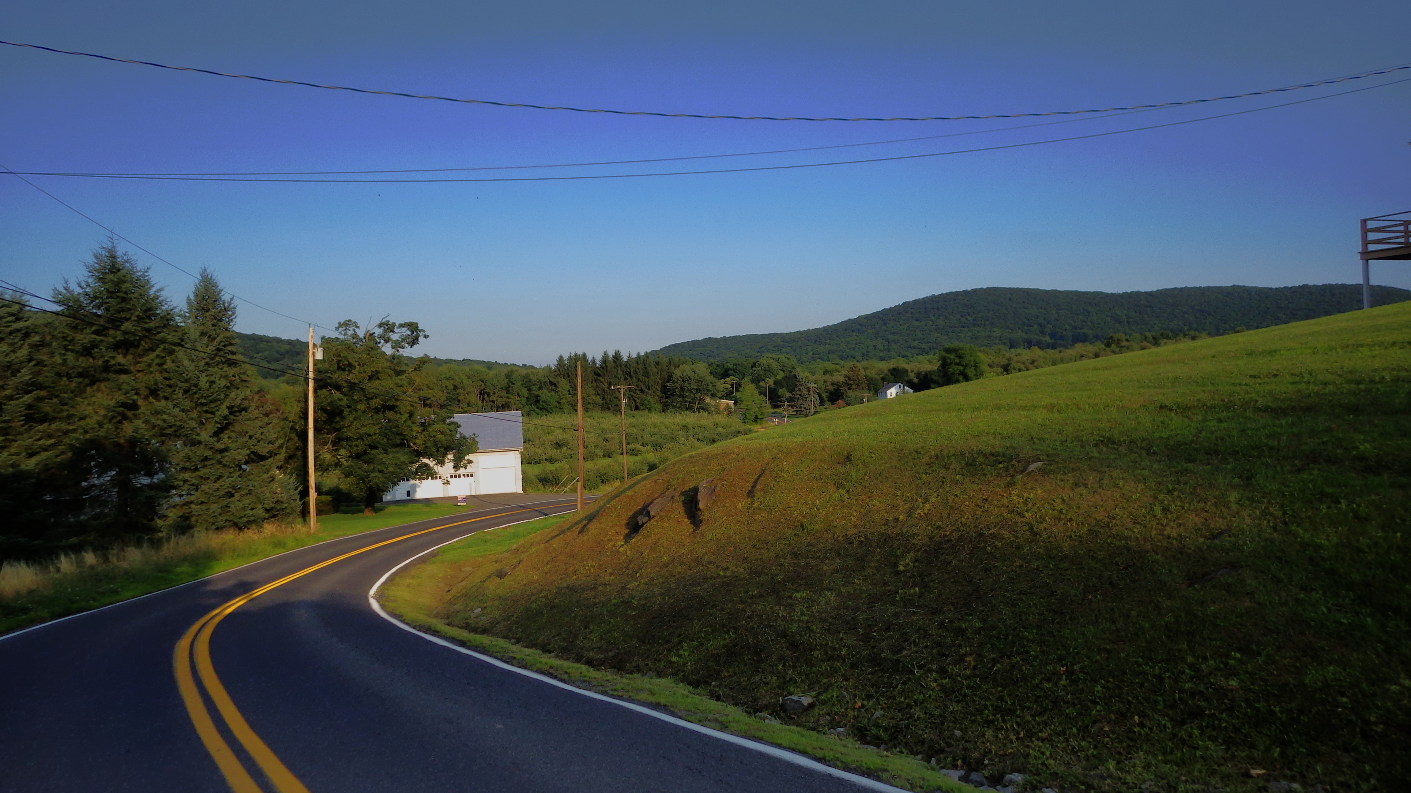
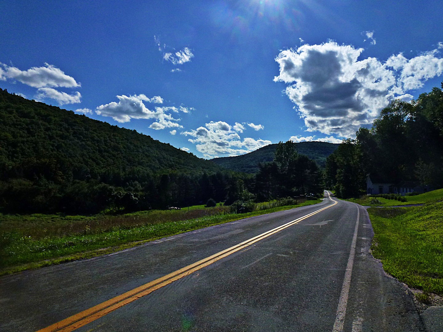
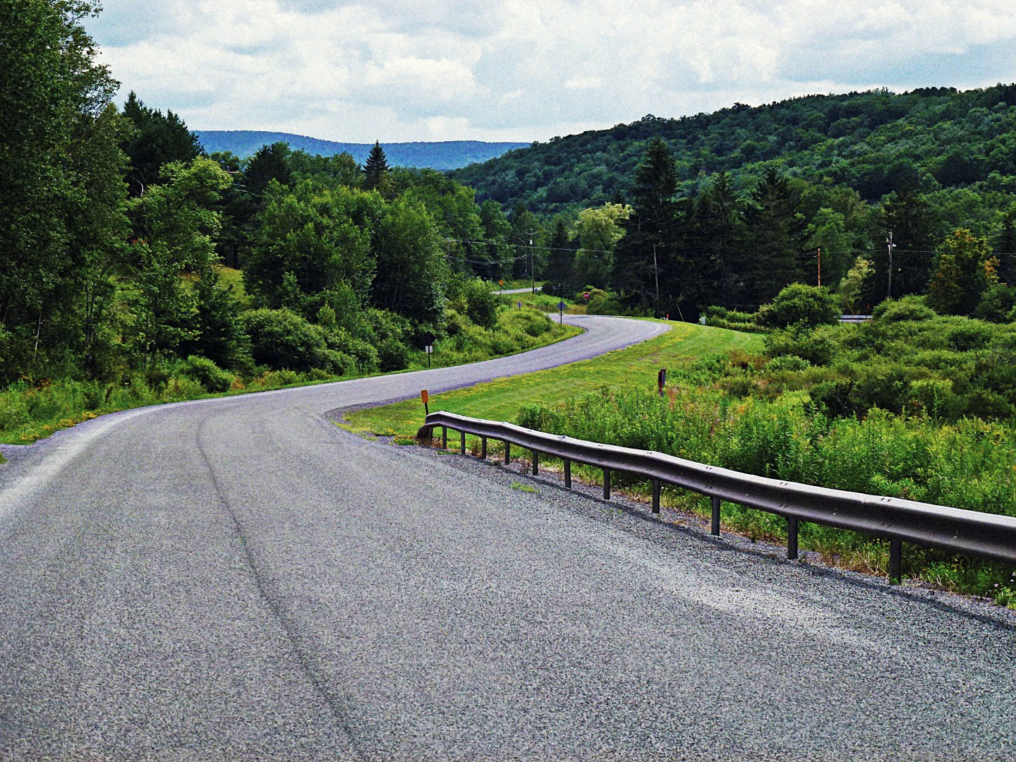
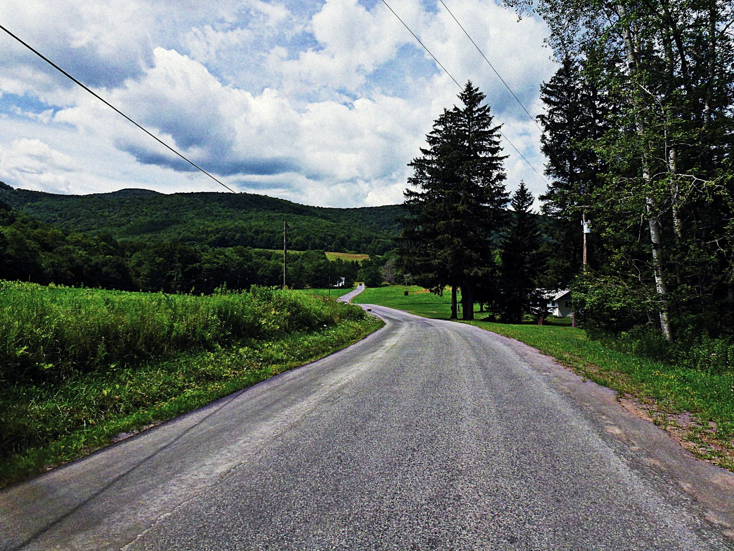
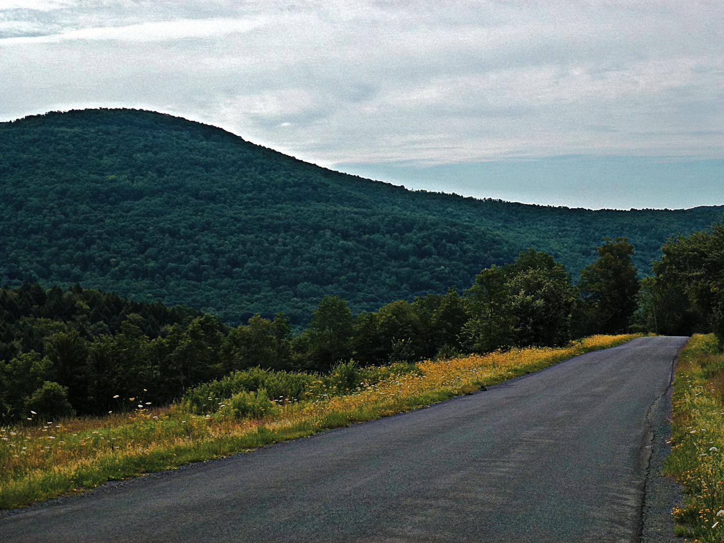
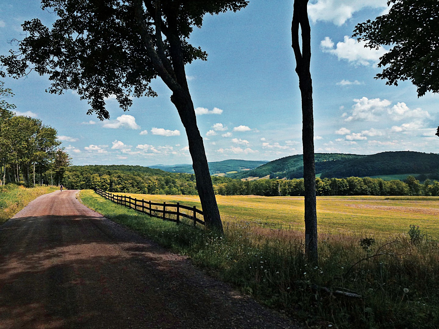
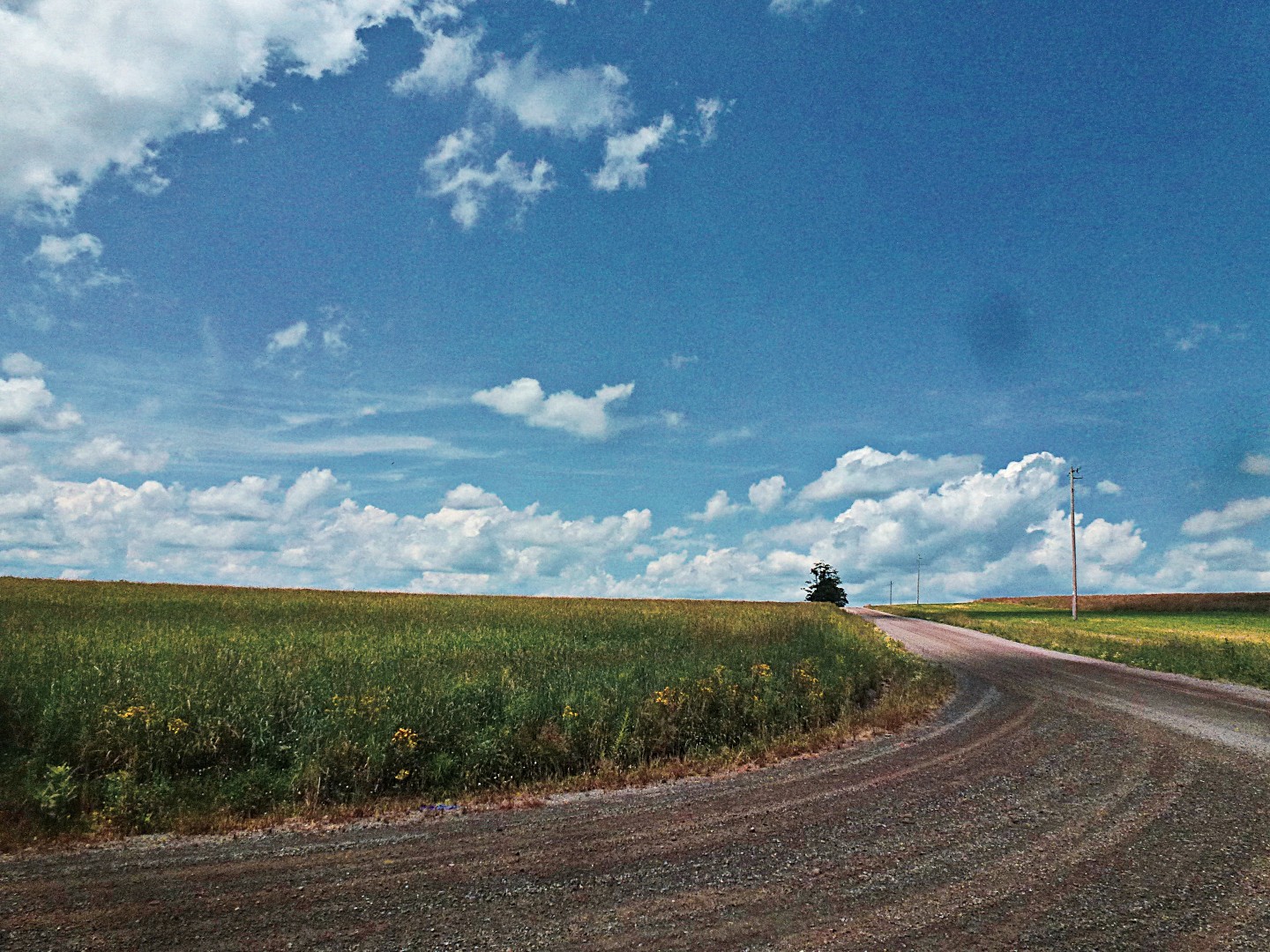
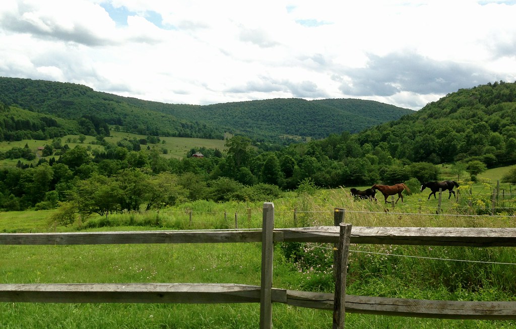
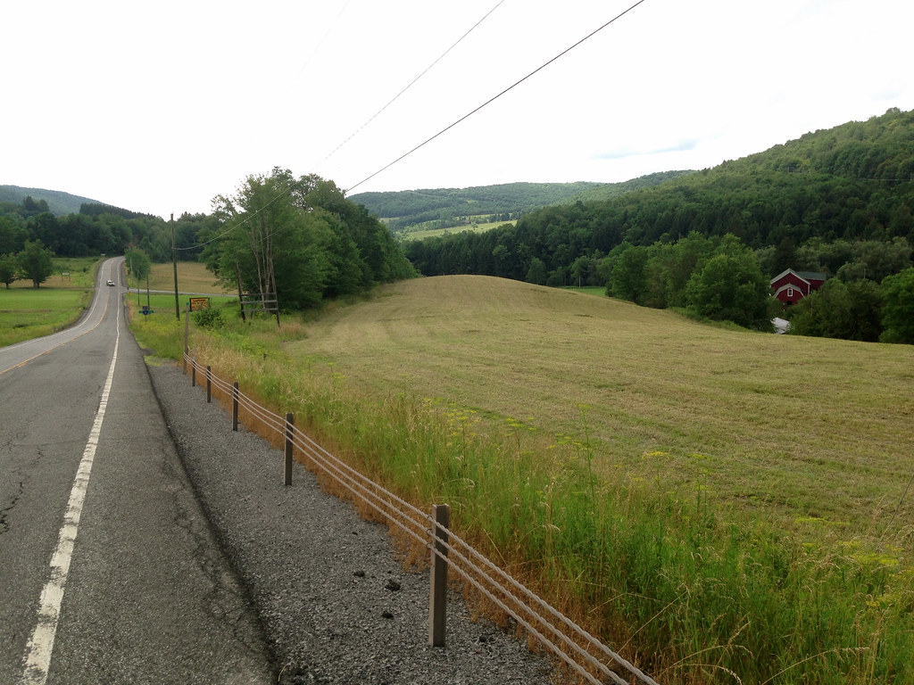
To complete the loop from Andes back to Bloomville avoiding the traffic of Rt 28, I head west out of Andes on County Highway 2, also known as Cabin Hill Rd, with the intention of hooking up with two separate passes, delivering me back to Back River Rd near Bloomville. Highway 2 is a paved, rolling road with a 55 mph limit, but traffic is very light, the scenery bucolic. One initial hard climb out of the village, and familiar views open up: fields, barns and distant hills, a horse farm on my left.

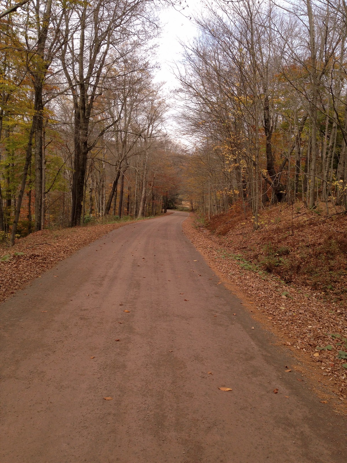
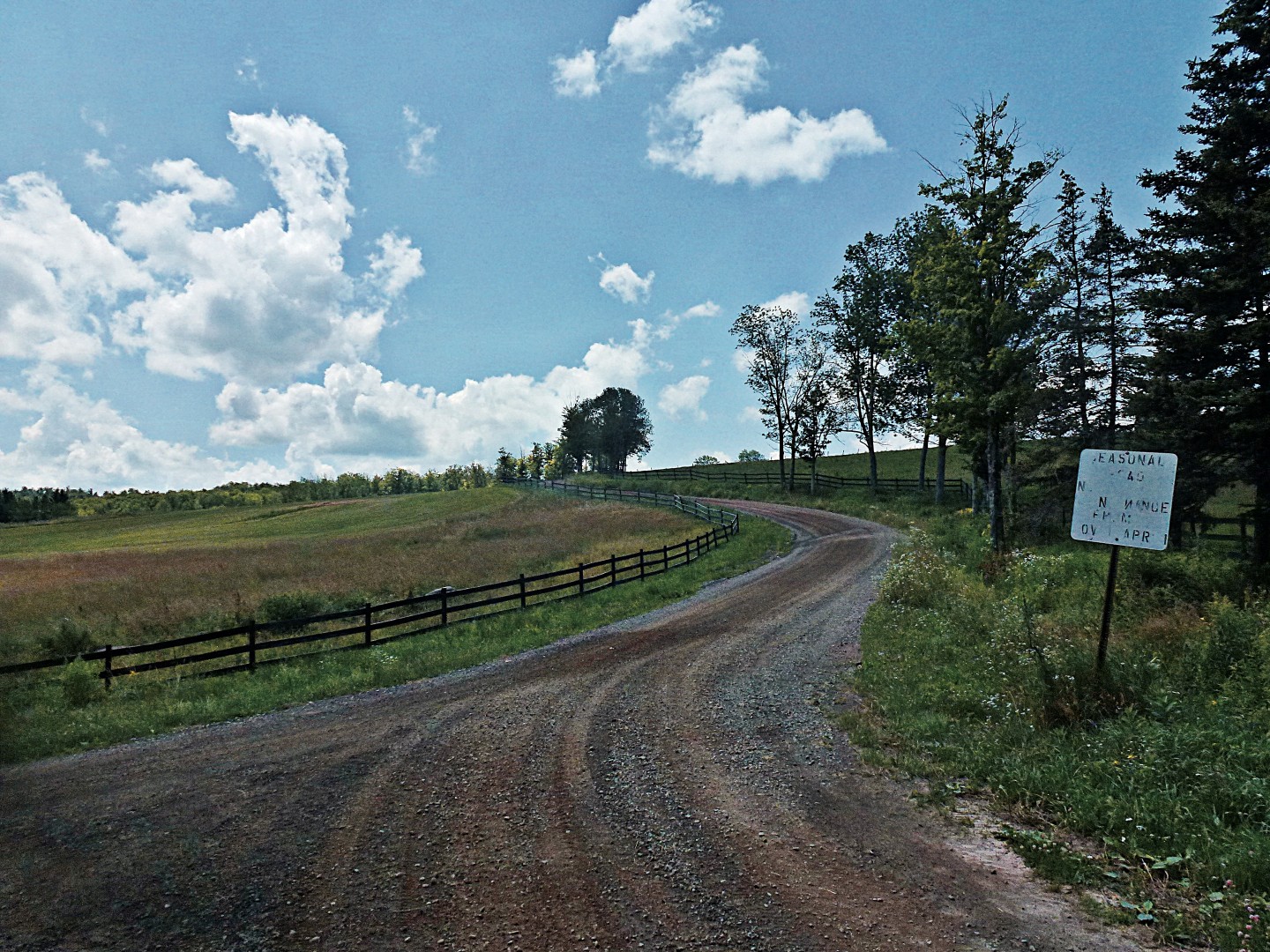
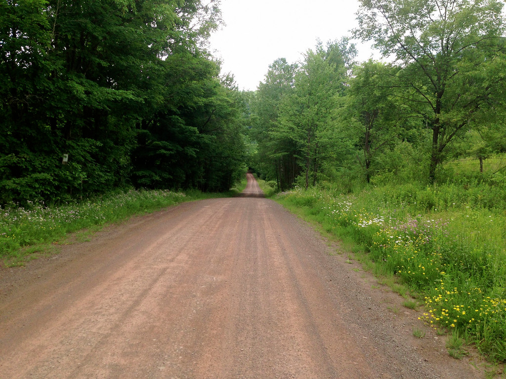
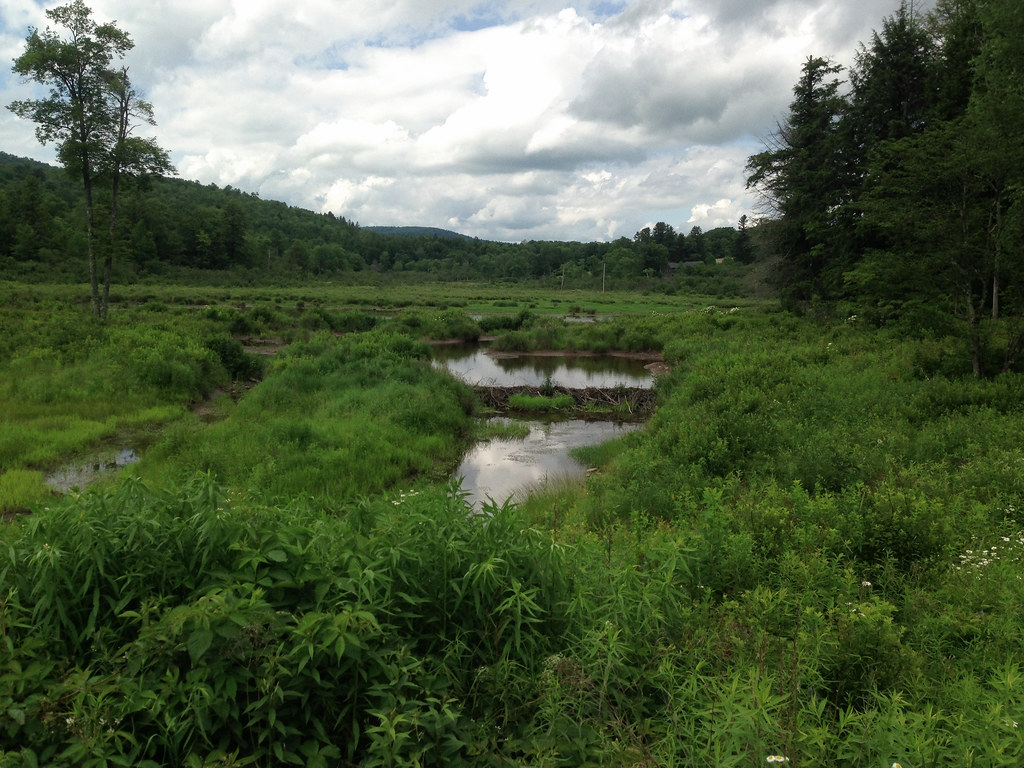
I turn onto the first of what I think will be two carriage roads on my return to Bloomville: Bigger Hollow Rd. Narrow, double track in places, it reminds me of Doig Hollow Rd. The road follows Bigger Brook, and at one point I lose track of the stream as it transitions into marshland. Upon closer inspection, I see that the change in the stream’s character is the results of a beaver dam. (Years ago, we had a massive beaver dam on our property, and it permanently altered the path of the brook.)

The only building I encounter is a caving barn. The pitch steepens and I enter a hairpin turn. I can continue straight ahead as my map indicates, but there are signs that say Private Way. Instead of continuing with my original plan, I follow the hairpin (a 15% climb on loose gravel), barely maintaining traction. The road straightens out and I enjoy a brief respite from climbing. This is my second mistake: I think I’m still on Bigger Hollow Road heading north toward Bloomville, but the hairpin turns into Calhoun Hill Rd, which banks east back towards Andes! I had hoped Bigger Hollow Rd would take me to Rt 28 just a few hundred feet from the next mountain pass, but instead Calhoun Hill Rd dumps me onto Rt 28 about four miles south of where I thought I’d join it. It turns out the direct route that would take me north, avoiding Rt 28, is in fact a private way, but my map does not make the distinction.

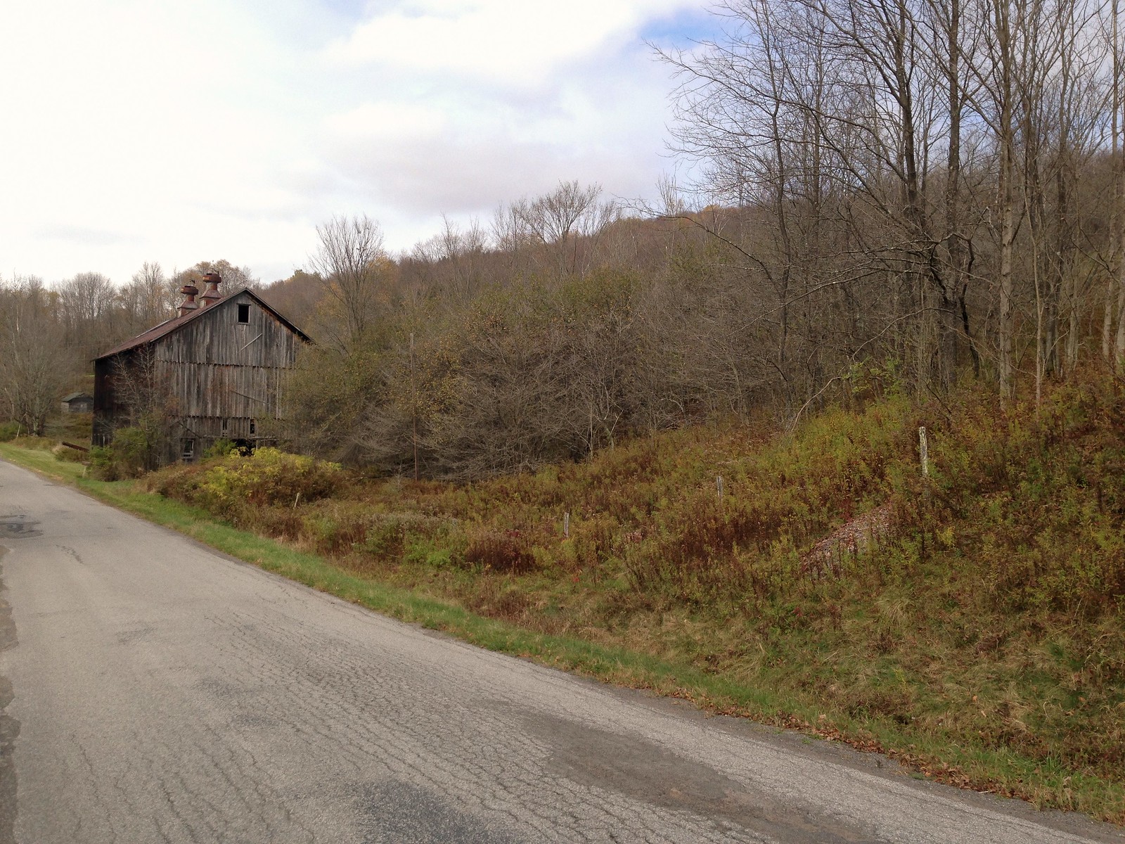
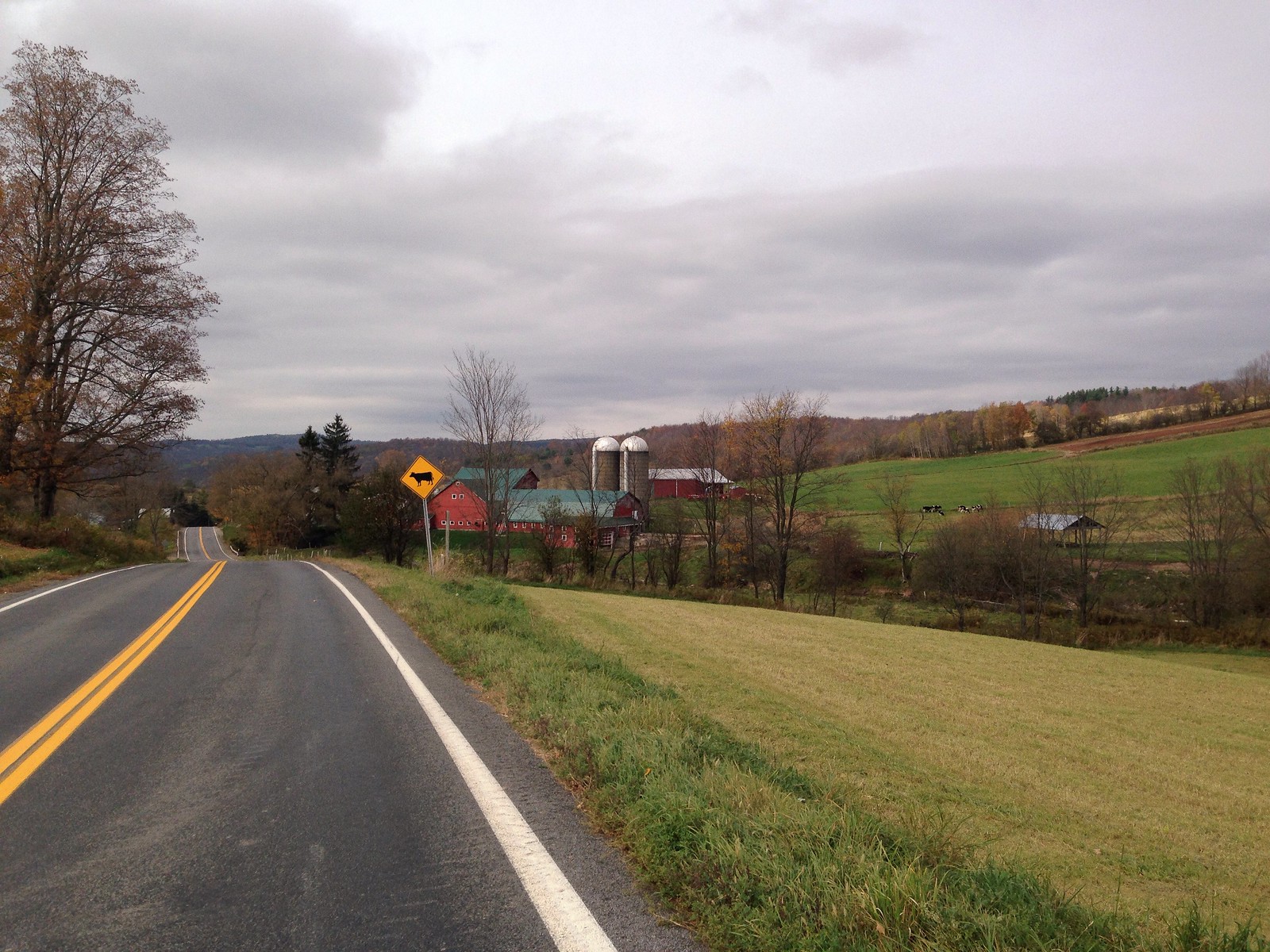
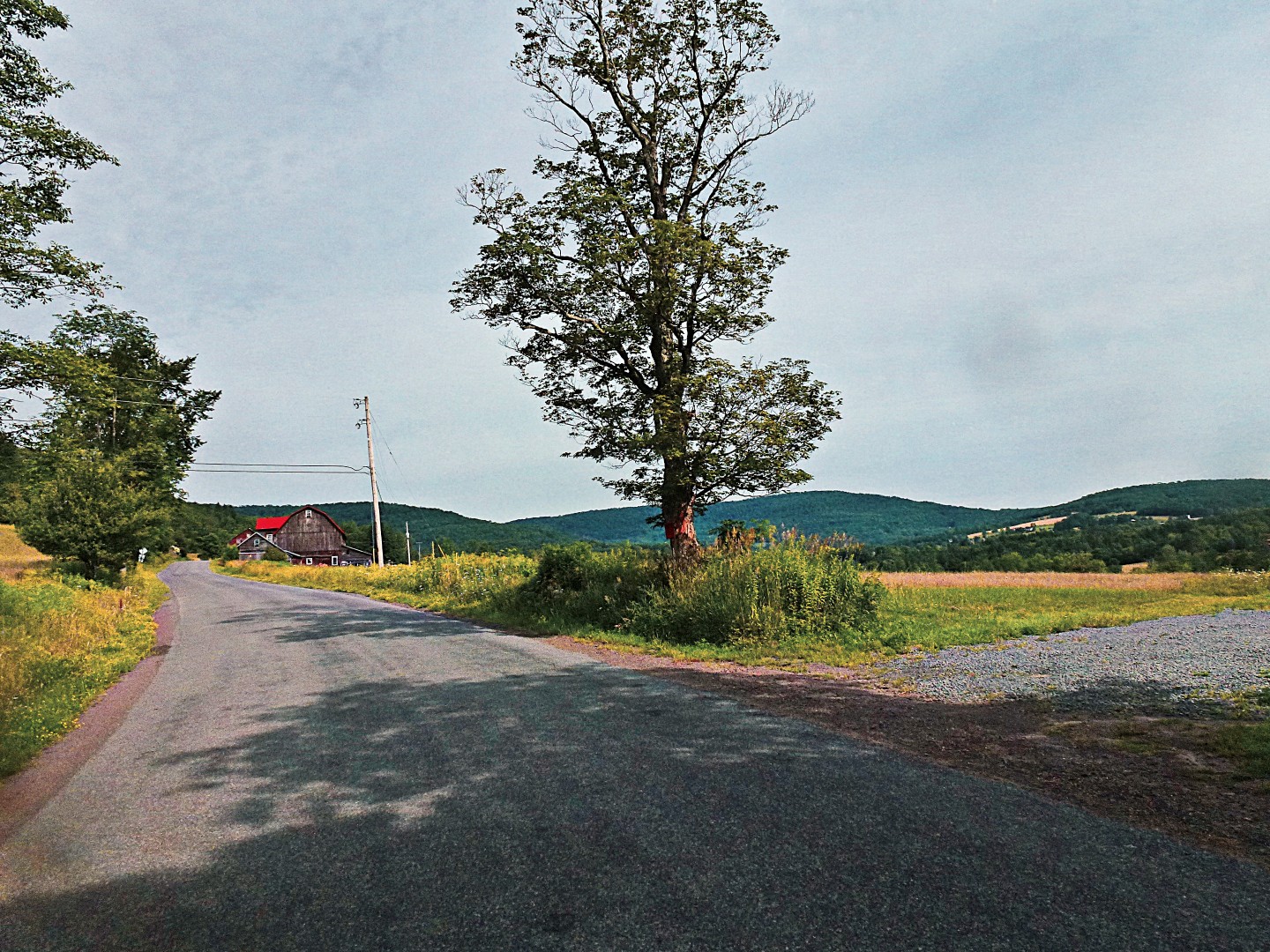
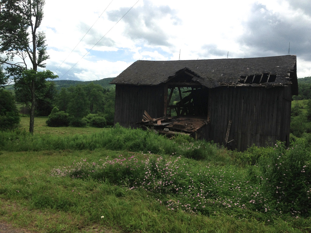
Oh well, I’ll just take Rt 28 north to Lee Hollow Rd, the last mountain pass of the route. Rt 28 is actually quite scenic, but it’s littered with billboards, has lots of truck traffic, and the shoulders are narrow. I don’t recommend cycling on it for extended stretches, not when there are so many better alternatives. The red barn in the photo below, taken from the shoulder of Rt 28, is part of a farm in its fourth generation of operation. The previous generation’s owner, in addition to being a farmer, was also a real estate broker, and it was he who sold my parents their property. He and his wife thereafter remained close family friends, we used to see them at the weekly Bovina auction.

I follow Rt 28 to Lee Hollow Rd, which I believe to be the final pass before Bloomville. This one’s paved, the climb up it is hard, and the westerly sun is searing my back. It occurs to me that pavement radiates more absorbed heat than dirt, and I feel it. As I reach the top, I see in the distance that, in fact, there’s still another hard climb awaiting me. That’s got to be the last one, I think– I’m getting tired at this point. I reach it, and look forward to another short carriage road which, according to my map, runs fairly flat along the top of Bramley Mountain, and connects to Glen Burnie Rd, following another mountain pass that will take me back down Bramley Mountain to Back River Rd.

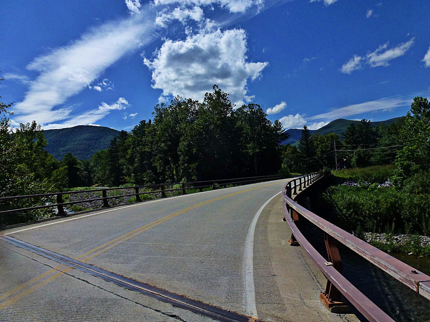
I make the turn onto Huff Rd, the connector at the top of the mountain. Another gem. Shady, narrow, tall ferns, a joy. But why am I going downhill in the opposite direction?! This shouldn’t be. Well, the thrill of the descent overwhelms me and I bomb down it anyway. It T-intersects Glen Burnie Rd as expected, but now I have to climb up a short stretch of Glen Burnie before starting the descent to Back River Rd. Glen Burnie is in rough shape. Originally dirt, at some point it got paved, but now it’s crumbling, pothole ridden, the underlying red dirt layer blistering through the broken pavement like flesh wounds. I’m exhausted by this point, and lack the confidence to bomb down it. I have to brake hard the entire way down, and my fingers are aching and weak. Glen Burnie reaches its steepest—over 16% grade—just as it T-intersects Back River Rd. The KoolStop brake pads are squealing as the bike lumbers to a stop. The front rim is hot to the touch.

The climbing is over. Finally back on Back River Rd, I regain my bearings and leisurely head back into Bloomville. The Delaware on one side; fertile, rolling farmland on the other. The gentle rollers help me cool off, a good way to wind down the ride. This final stretch provides a sort of catharsis for me.

Back in Bloomville, the rustic cafe/inn that opened last year at the crossroads of the village, where I hope to get a cold drink, has closed for the day. It’s in a tall old house, vacant for decades, possibly a generation, its windows like tired eyes overlooking the heart of the village. The new owners are giving it the rejuvenation it deserves. The cafe espouses a collaborative business model, sourcing its seasonal menu locally and hosting periodic food-related workshops and a weekly farmer’s market. While not an entirely unique model–it’s sprouting elsewhere in the Catskills as well–I’m happy to see the new movement taking root in my village, I hope it helps reinvigorate the local farming community. And its proximity to the Catskill Scenic Trail makes it a perfect stop before or after the ride.

And once again a thoroughly dirty bike. She’ll get a proper wash back in Boston next week.

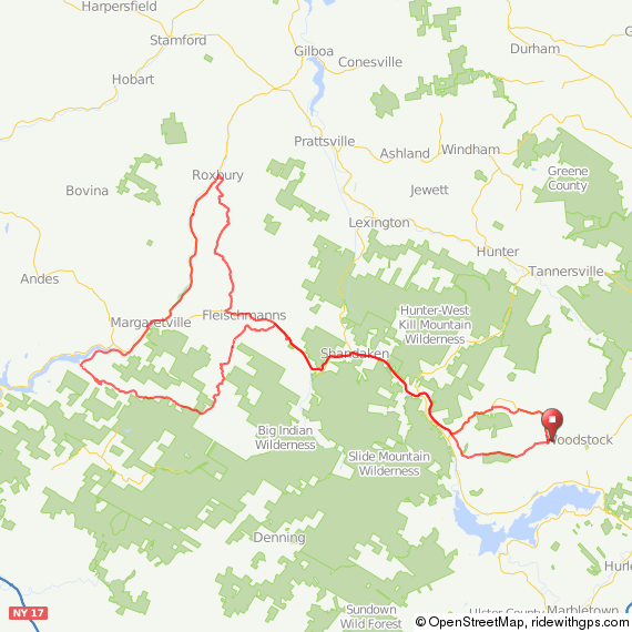
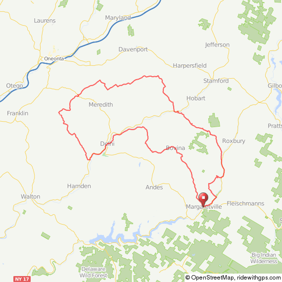
Full route here, with dirt sections drawn in red.

–Somervillain

My Dumbass Adventure

I’ve hypothesized for a while that I could get from my area, just south of the Catskills, over to Yeagerville Rd—and from there, to Peekamoose Rd, by taking a little road called Trails End (no apostrophe, thanks).

Trails Endl

On maps, Trails End Rd terminates unceremoniously a few miles from the terminus of Yeagerville Rd. Yet I knew that there was a gravel path that headed over the mountains that was unmarked on maps. I just didn’t know where it ended.

Today, I decided to find out. I won’t bore you with the 10-mile trip to and from, so let’s start at the base of Trails End Rd. I knew that I had a good-sized climb ahead of me, about 1000 feet in just a few miles. Mostly on gravel.

L1020670_pe

As expected, the road ends and gravel begins…

L1020671_pe

There’s nothing like 12% to 15% climbs on loose gravel. I had to get off my bike for a moment and walk about 100 feet, pursued by clouds of hungry mosquitos.

L1020672_pe

About a mile in, you have two choices: There’s a path that is apparently for hikers…

L1020676_pe

Which really doesn’t work well on a bike, even one with fat 650B tires. Too many large rocks. I suppose someone with really good cyclocross skills could navigate it, but that’s definitely not me.

L1020674_pe

However, if you turn around, as I eventually did, there’s a snowmobile trail leading up, up, up.

L1020677_pe

Which leads to some nice, but very loose, gravel roads.

L1020678_pe

L1020679_pe

L1020680_pe L1020681_pe L1020682_pe L1020683_pe

L1020684_pe

It was pretty clear as I reached the apex of the ride that I was actually going over a mountain. As I entered a brief clearing, I couldn’t see any peaks around me–an unusual occurrence. Thus, I made it to the very top of something, but I know not what.

Unfortunately, I did not make it to the end of the path today. A storm was closing in, and there was thunder and lightning off in the distance. I figured it wouldn’t be a good idea to be caught on top of a mountain in the middle of thunderstorm. So I very cautiously picked my way back down the road and returned home. Indeed, within about a mile of my place, the skies opened up!

In retrospect, this was fun, albeit extremely strenuous, but kind of dumb. I went out on a road that is not marked on any map, in an area that has no cell phone service, and climbed over a mountain on loose gravel with inclement weather threatening. I also decided to do it on the fly, so I didn’t inform anyone where I was going to be.

Some day, hopefully this year, I’ll find out what lies on the other end of this path. Preferably with a companion next time!

John

medicalwriter.net