Category Archives: 650B

New route: Meridale Forty-Three

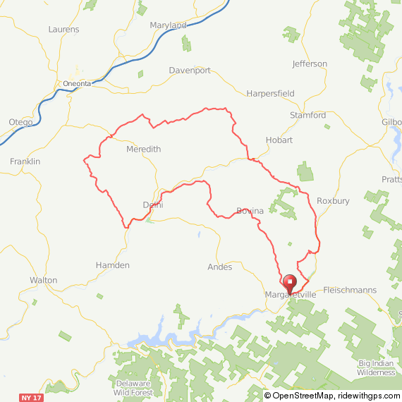
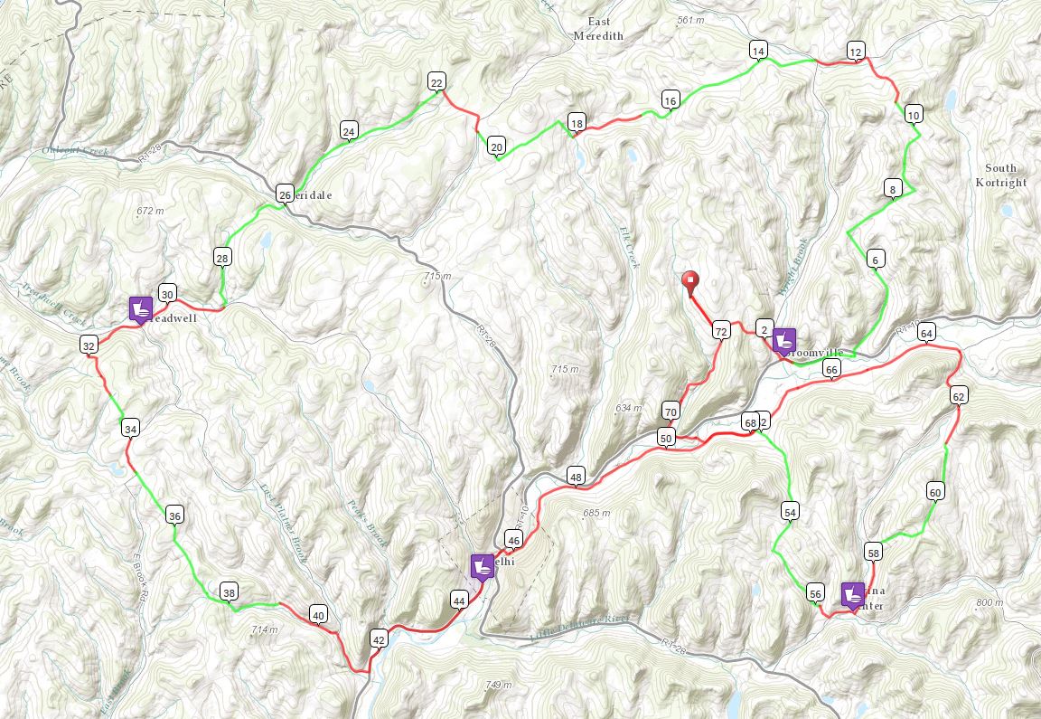
I’m in the Western Catskills for a couple of weeks, and continuing to discover dirt road cycling gems. Before embarking on vacation, I discovered that Bing maps has this wonderful undocumented feature of distinguishing paved and unpaved roads when zoomed in to 1000ft scale and closer. Unpaved roads are traced in brown (how appropriate!) while paved roads are in white. What a valuable resource for charting out dirt/gravel roads!  To test the accuracy of this feature, I focused on an area just west of my home that I’m not familiar with, one which I’ve driven through once or twice but never ridden.  All new cycling territory.  I made note of all the roads marked as unpaved in Bing maps, then went into ridewithgps and charted out a loop of 43 miles roughly bounded by the towns of Franklin, Walton and Delhi, taking in as many of those roads that would fit in the loop, and at least one place to stop for food and water.  This region is particularly secluded, so options for provisions are slim.

route

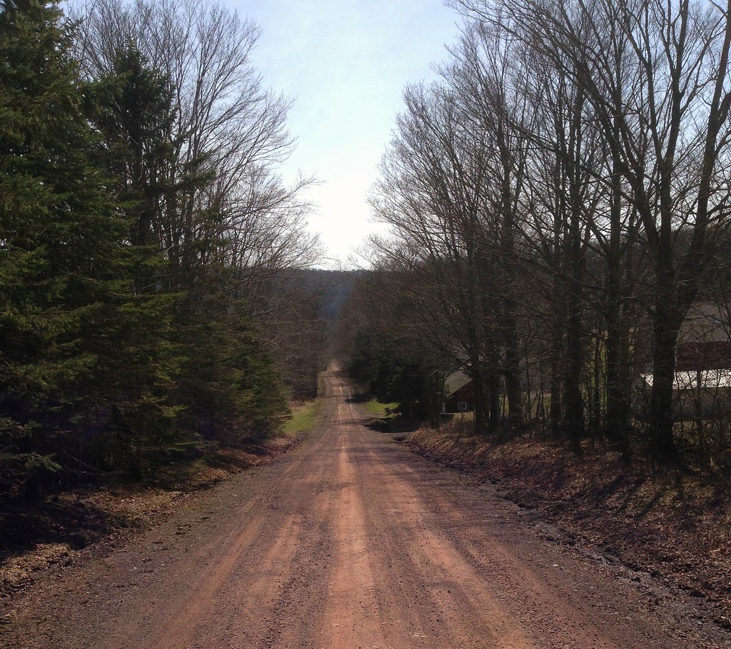
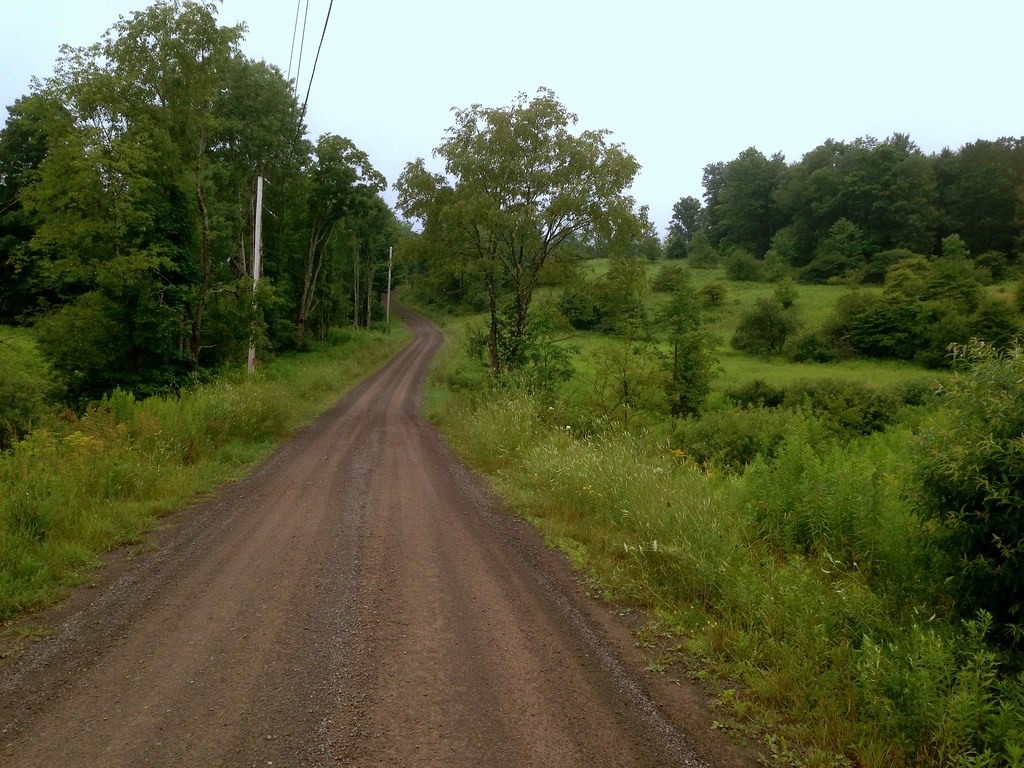
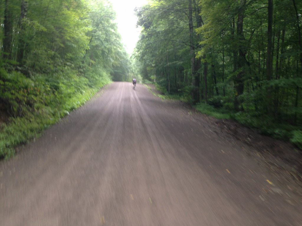
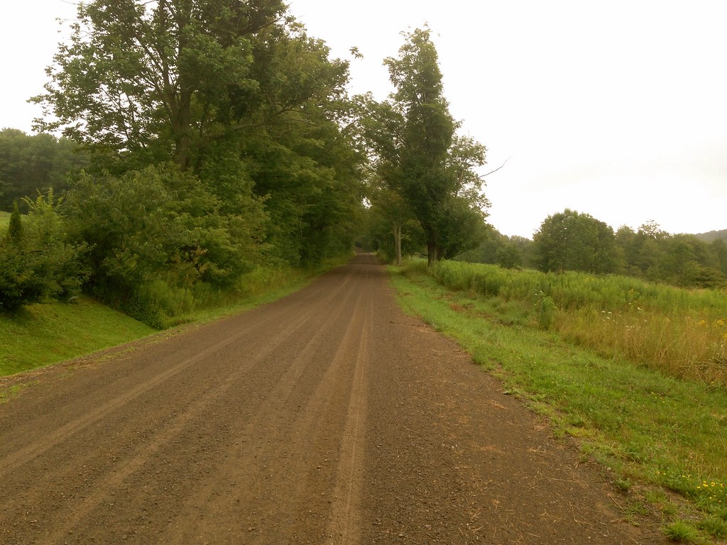
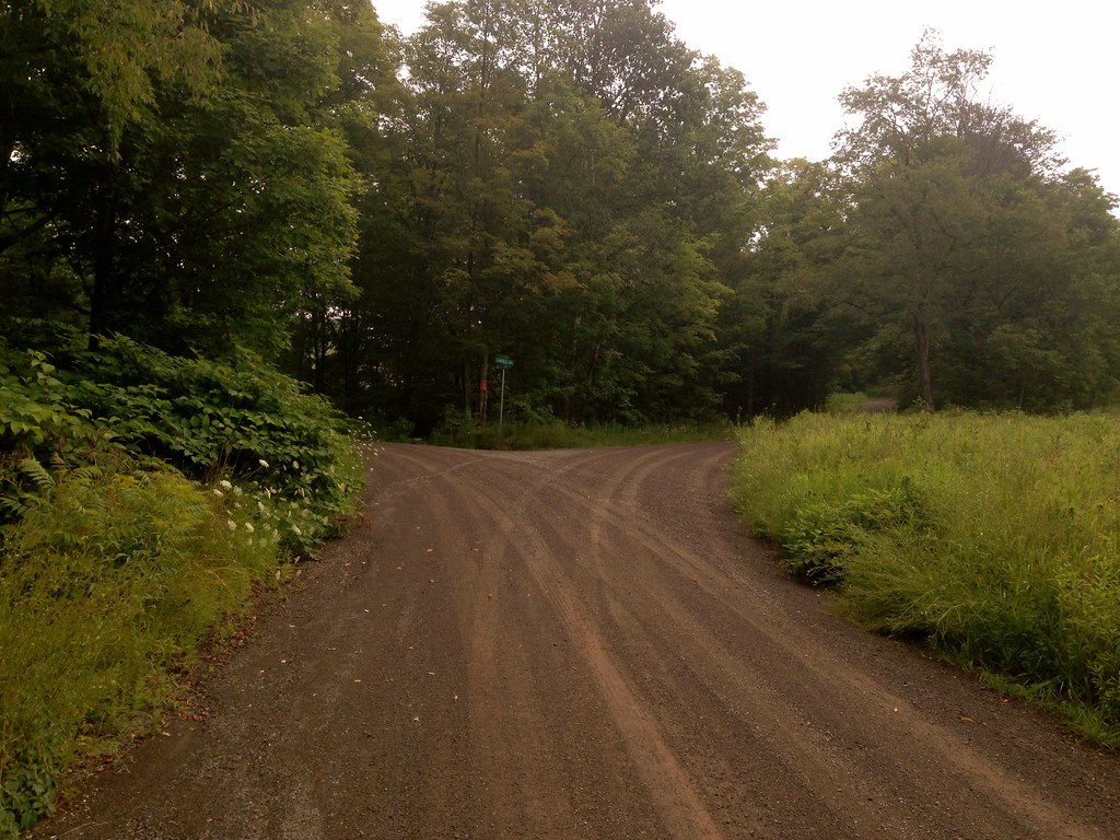
To my delight, Bing delivered with impressive accuracy! And unlike some of my other routes which take in sporadic stretches of dirt roads, this route spreads them out evenly, alternating dirt and quiet paved segments with regular periodicity (dirt segments are shown in green).  I was never on pavement for too long before another delicious stretch of dirt road presented itself in front of me. And even more enjoyable, many of these dirt stretches were little more than old carriage trails, narrow, tree-lined, isolated.

The route starts and ends at the Dutch Deli, a small deli and convenience store nestled in the valley village of Meridale, on Route 28 halfway between Delhi and Oneonta. The owner, speaking with a Dutch accent, kindly agreed to let me park my car in the lot for a few hours. Out of courtesy, I would recommend to anyone contemplating doing this route to check in with the owner to confirm that this is okay.

A few days before doing the ride, a Riding the Catskills reader contacted me to inform me he was going to be in the area and would like to do a ride.  Our schedules worked out, so Ben and I met in Meridale to ride the loop together.

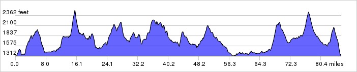
From the parking lot, the climbing starts immediately– the route has 4600 feet of climbing in 43 miles, with very few flat segments. The shark-tooth elevation profile illustrates this:


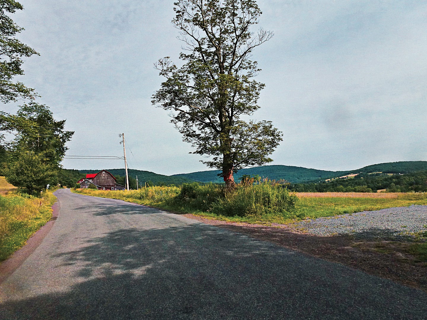
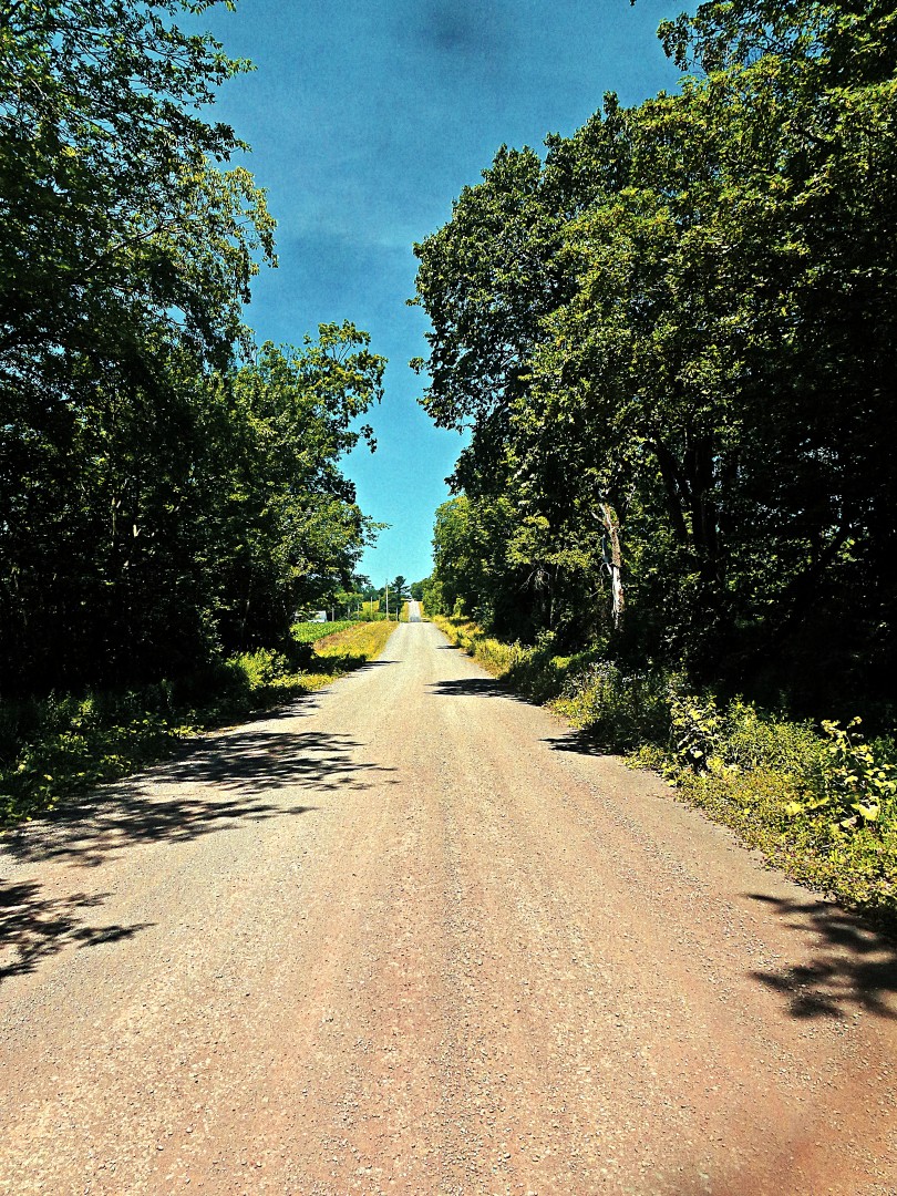
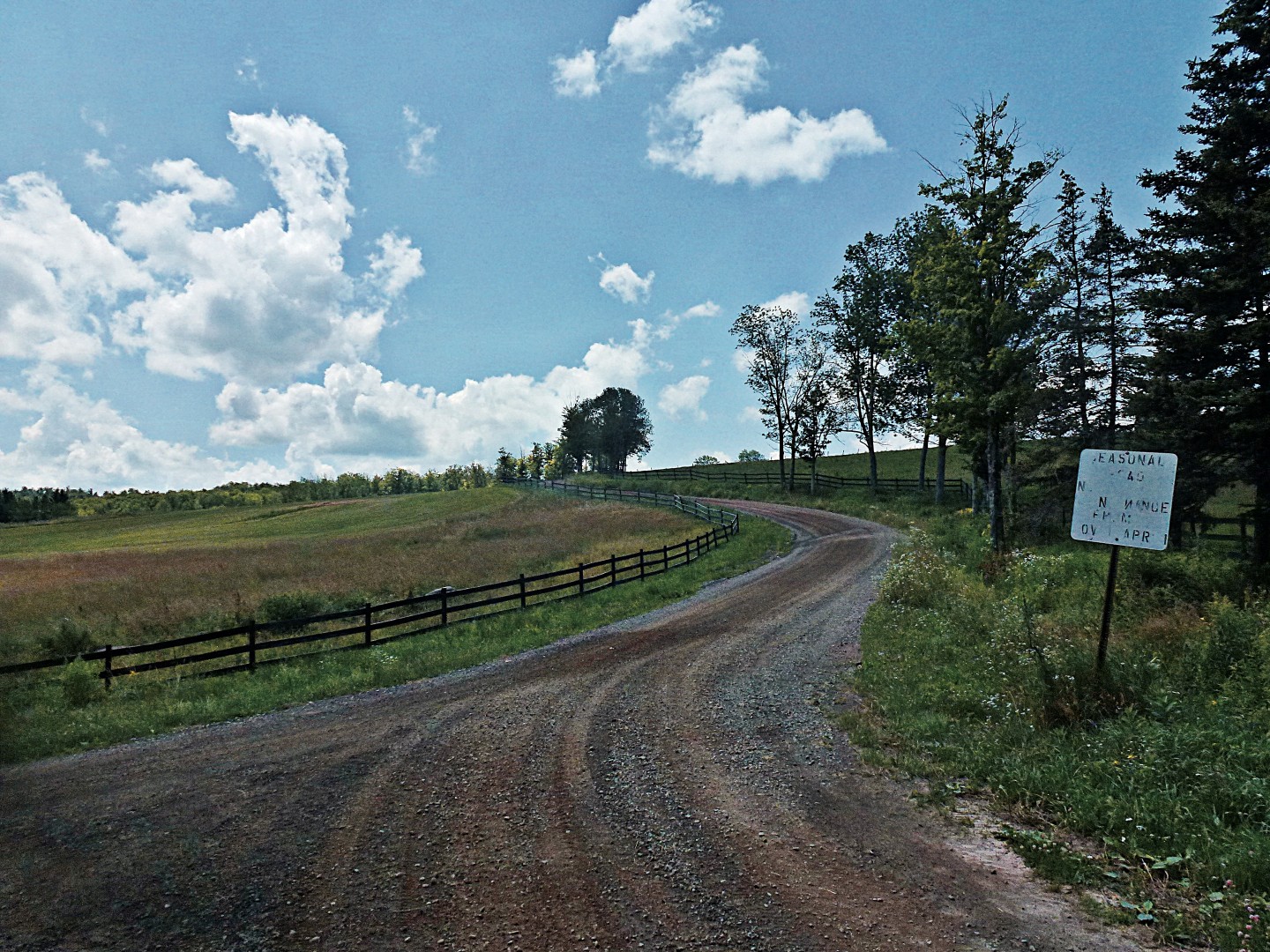
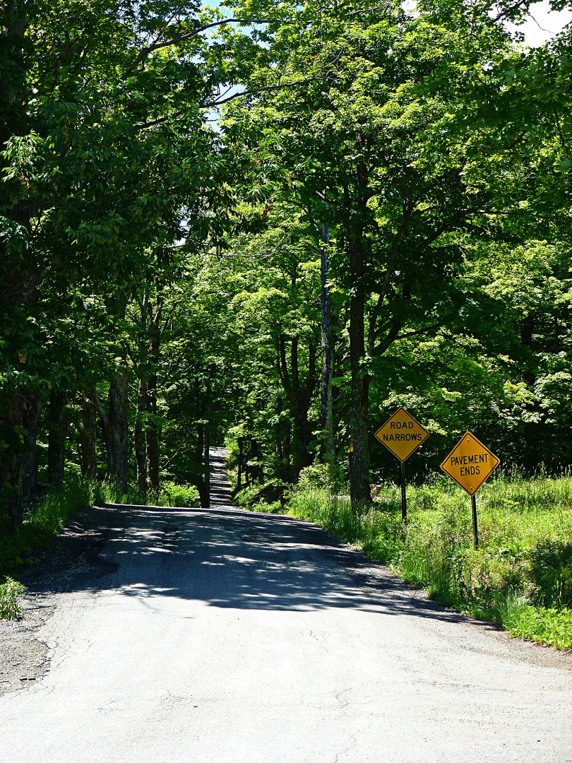
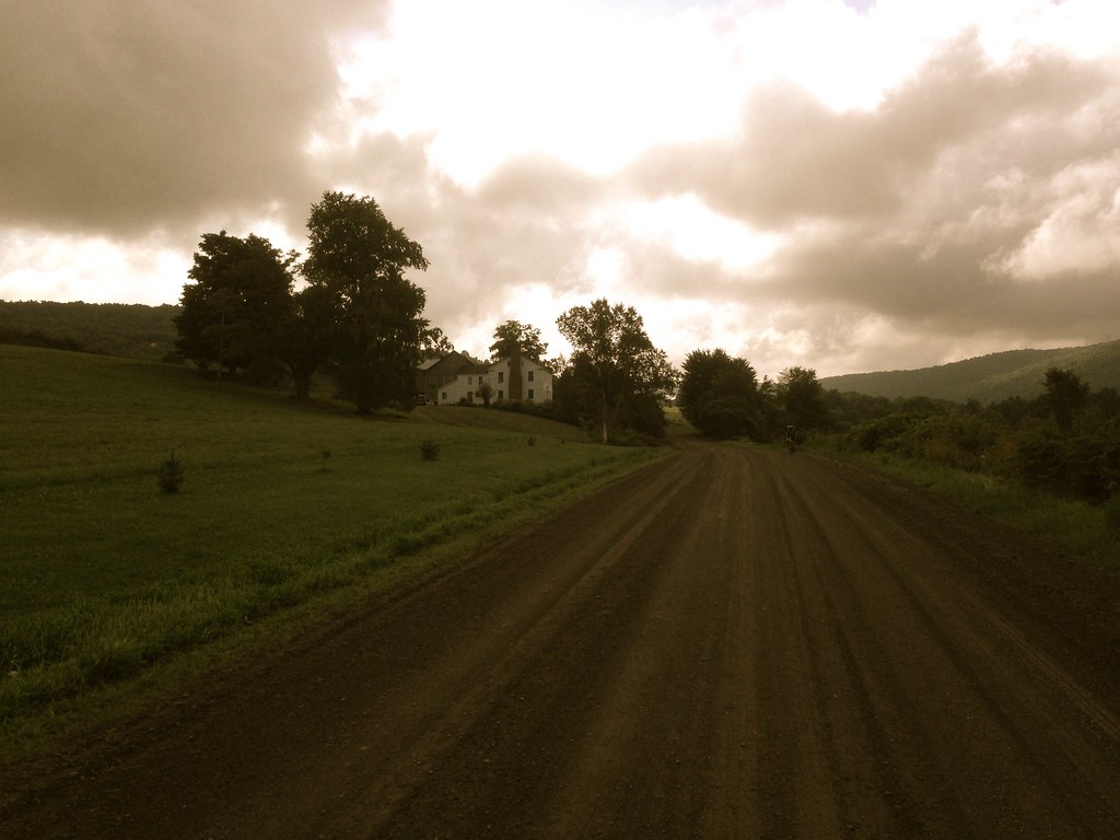
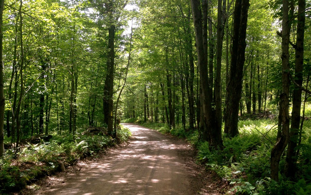
Not two miles into the ride, we experience the first dirt road, Sutherland Rd. As it climbs to the top, it narrows into a tree-lined, single lane road with cut pastures on either side.

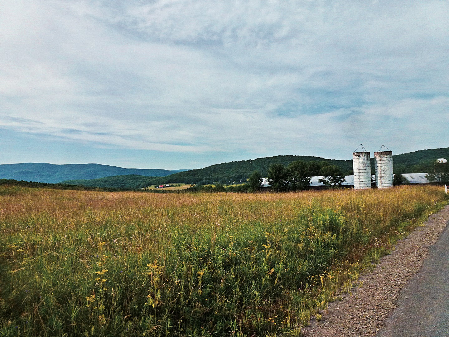
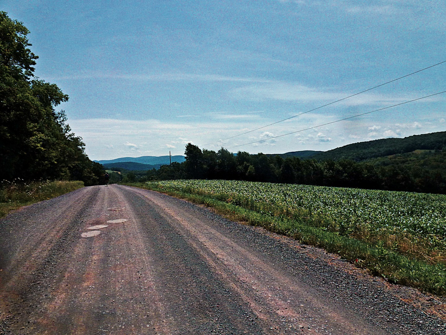
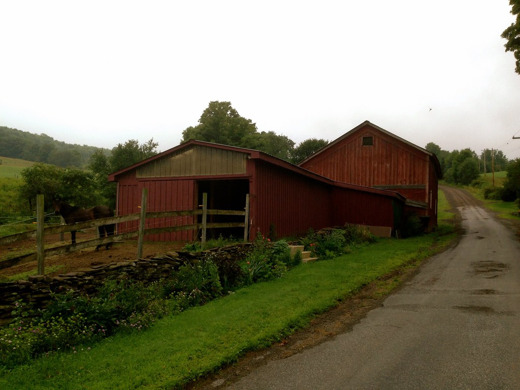
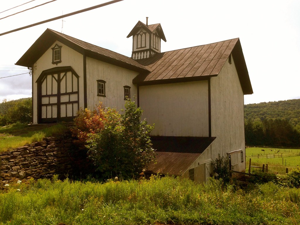
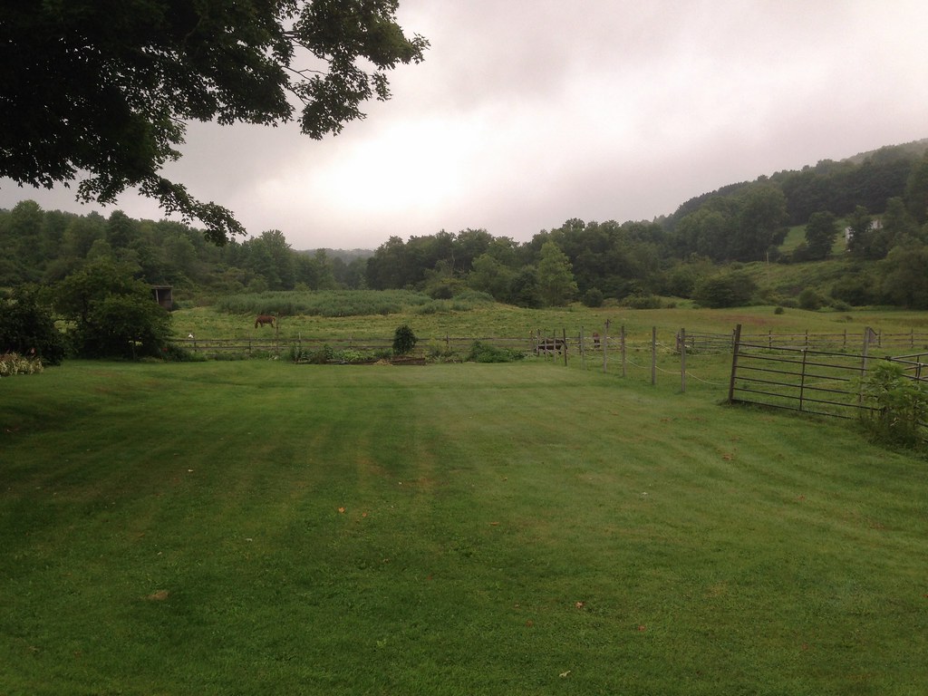
Notably, there were more working farms, and less abandoned barns, on this route compared to other areas I’ve reported on.

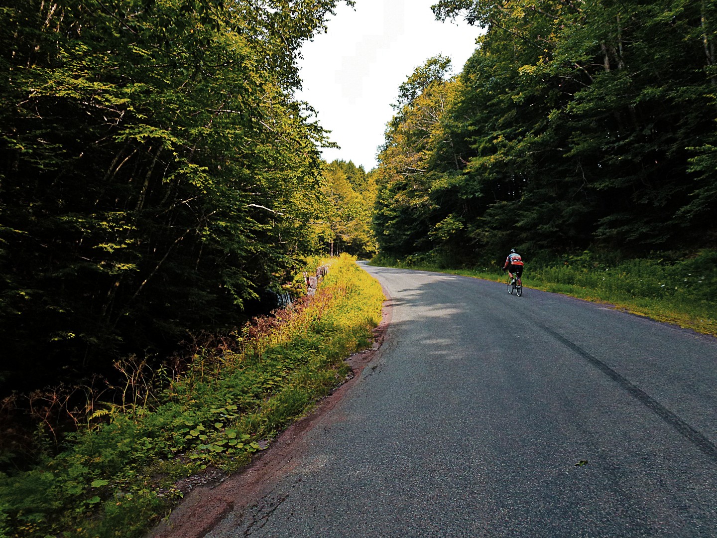
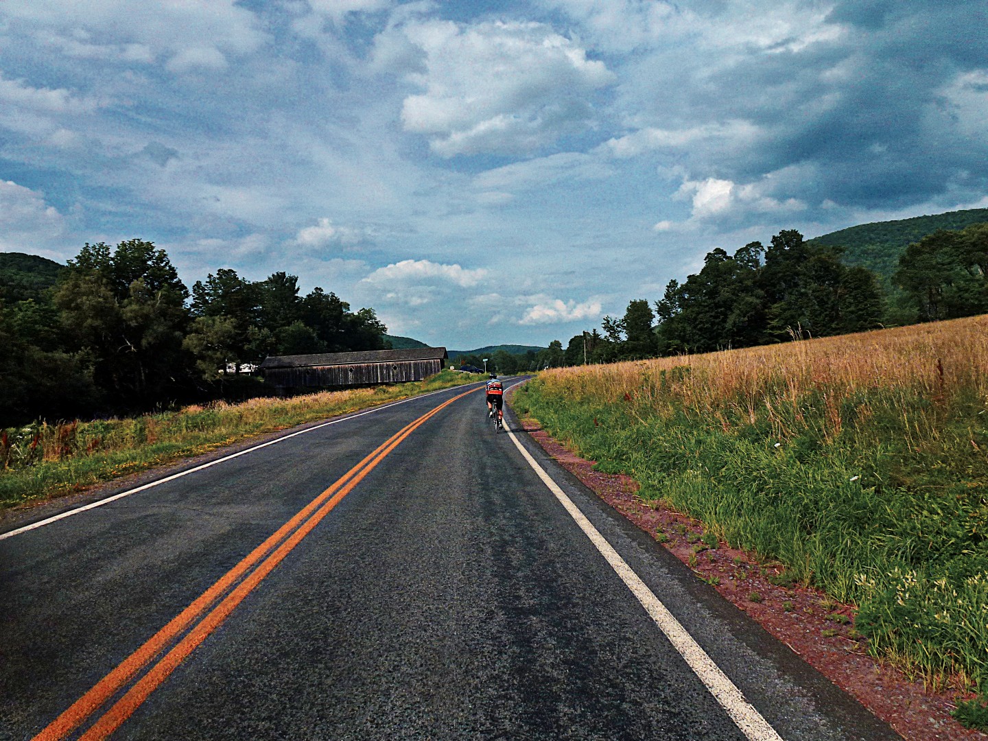
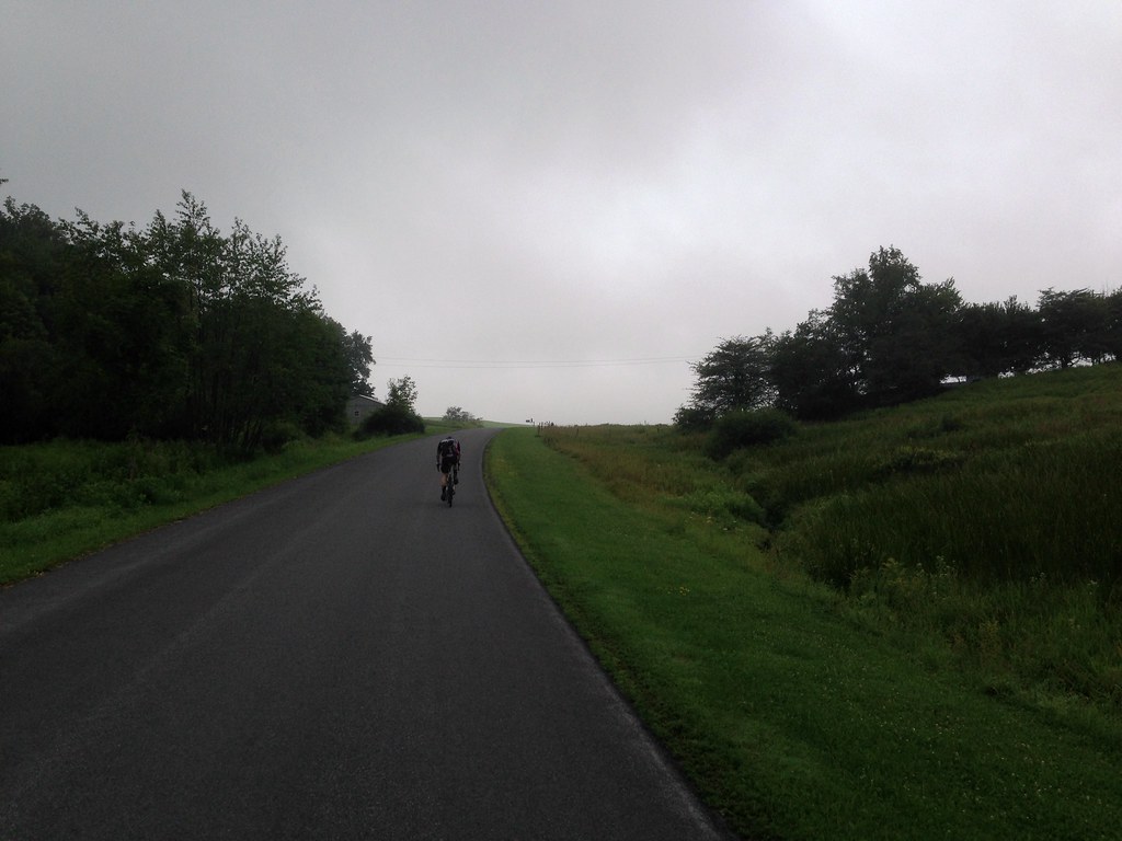
The other regular site for me, besides dirt roads and barns, was Ben, who, being a stronger climber than I, was always ahead of me in the climbs.

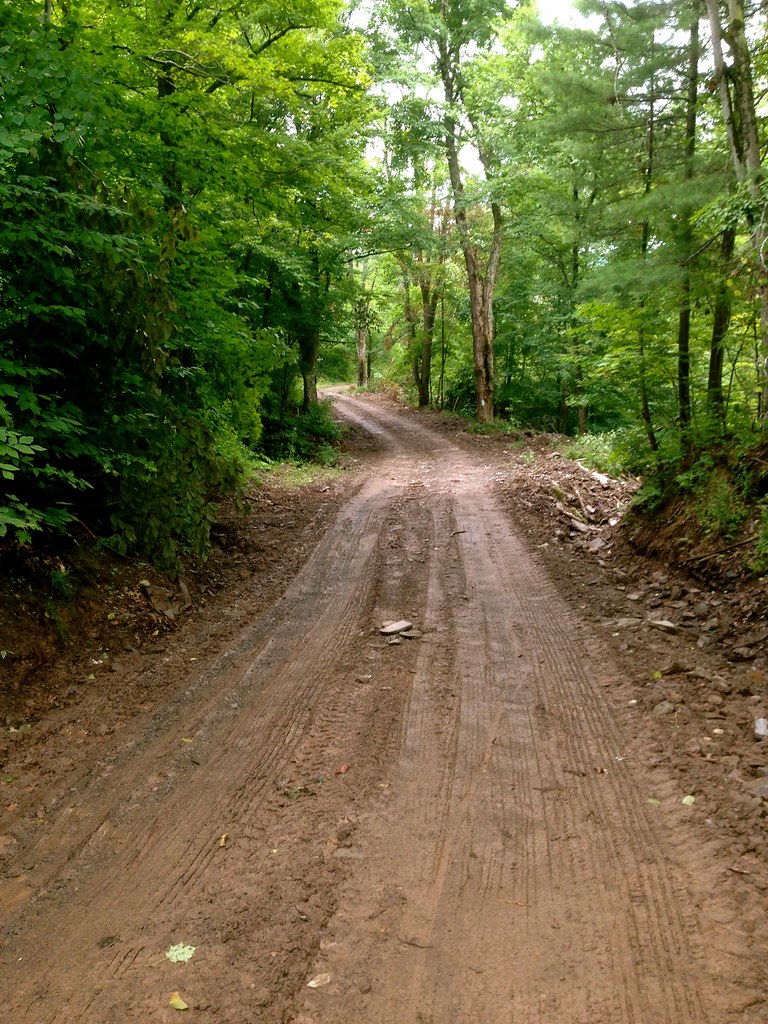
The only road that seriously tested the traction limits of my Compass Babyshoe Pass tires was Pomeroy Rd in Treadwell.  Here, the usual smoothly graded dirt turned first to rocky double track, and then to muddy logging trail, which continued upward for what seemed like a long time. At one point I had to walk as the smooth tire tread began to sink and spin in the mud.

From Pomeroy Rd, a smooth and fast paved descent whooshed us down into the adorable village of Treadwell, the first and only rest stop along the route (and indeed, the only village along the route other than Meridale).

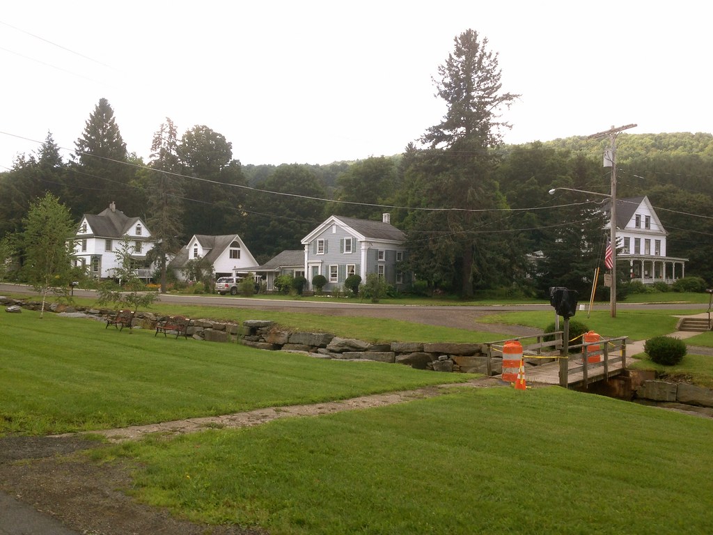
If you’re in Treadwell, be sure to stop in at Barlow’s general store and try their incredibly good homemade donuts! From Treadwell there were two more dirt segments before merging onto Rt 28 for the last mile back into Meridale. (This was the only stretch of state highway in the entire route!).

This cute abandoned storefront could be something wonderful… too bad it’s literally a couple of feet from the highway.

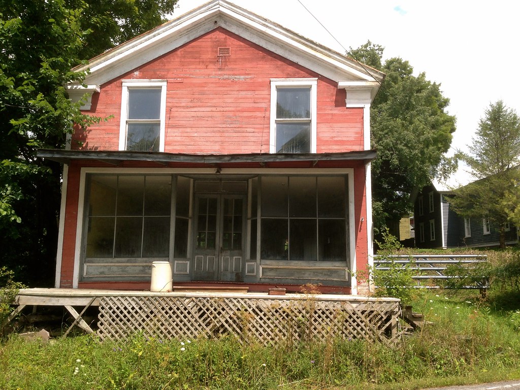
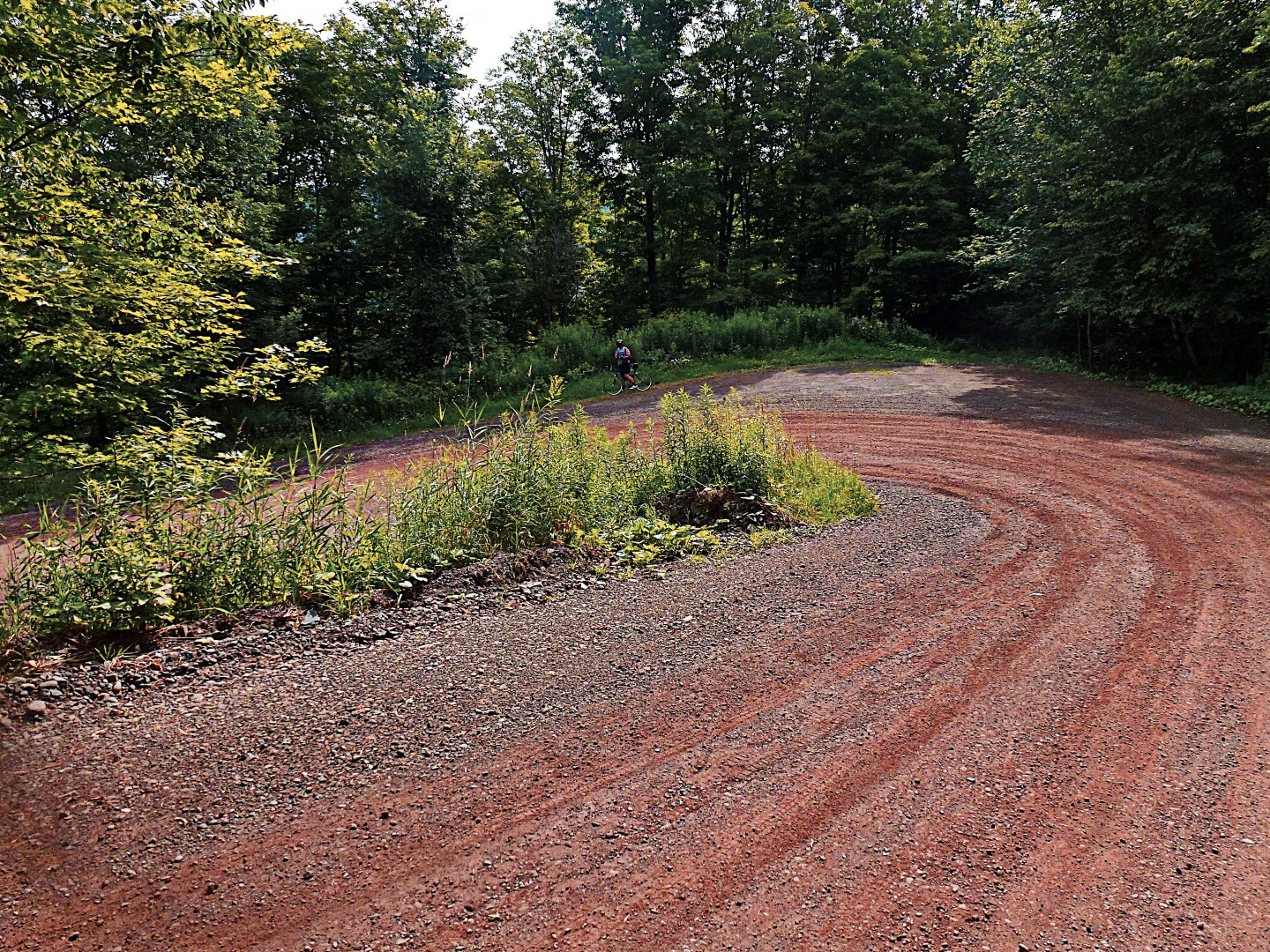
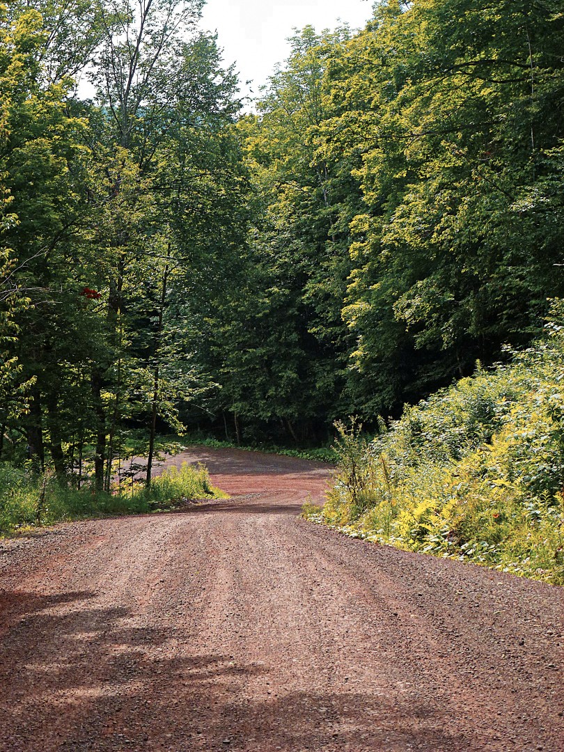
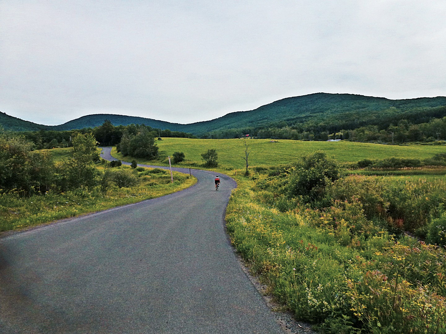
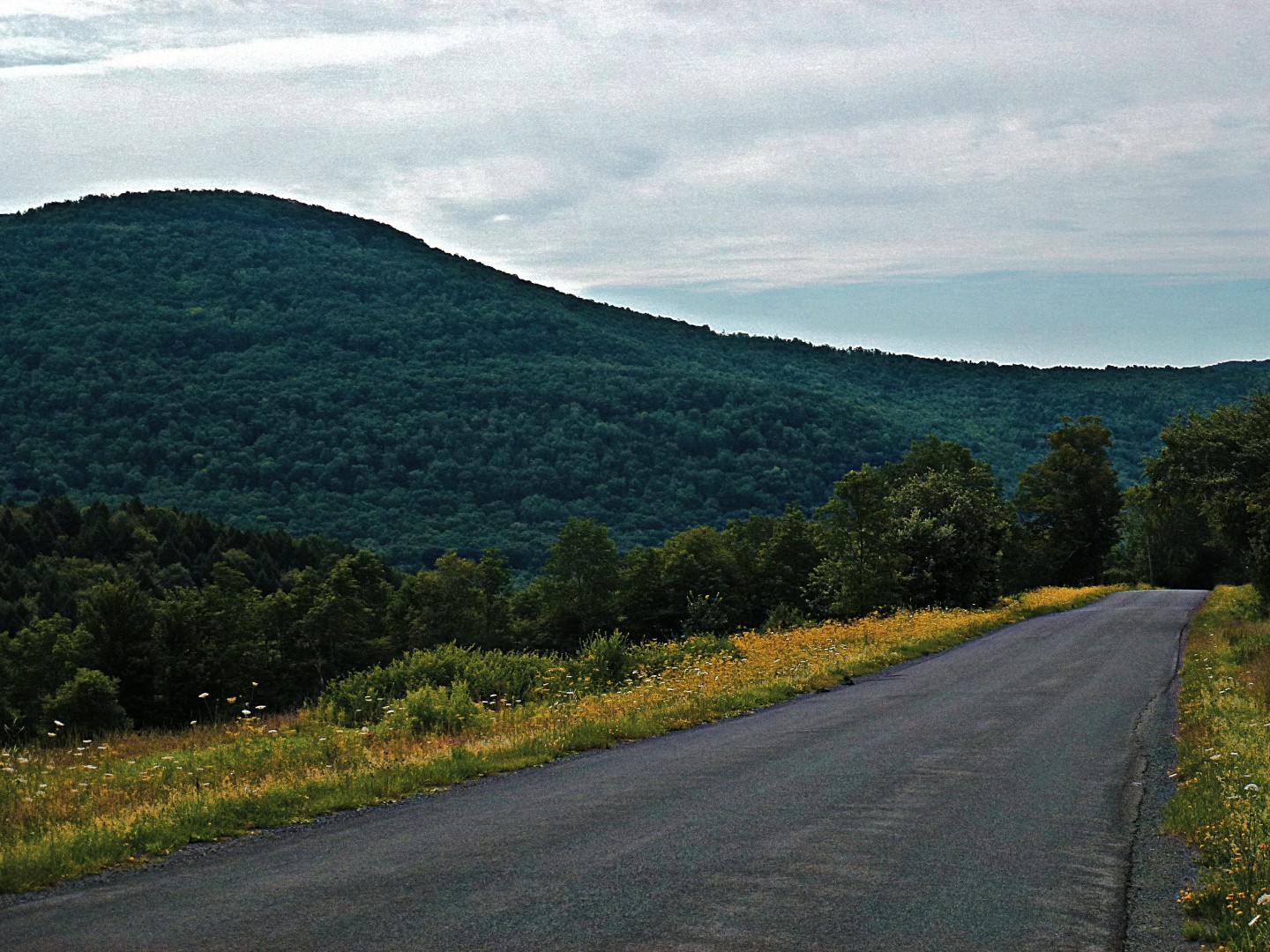
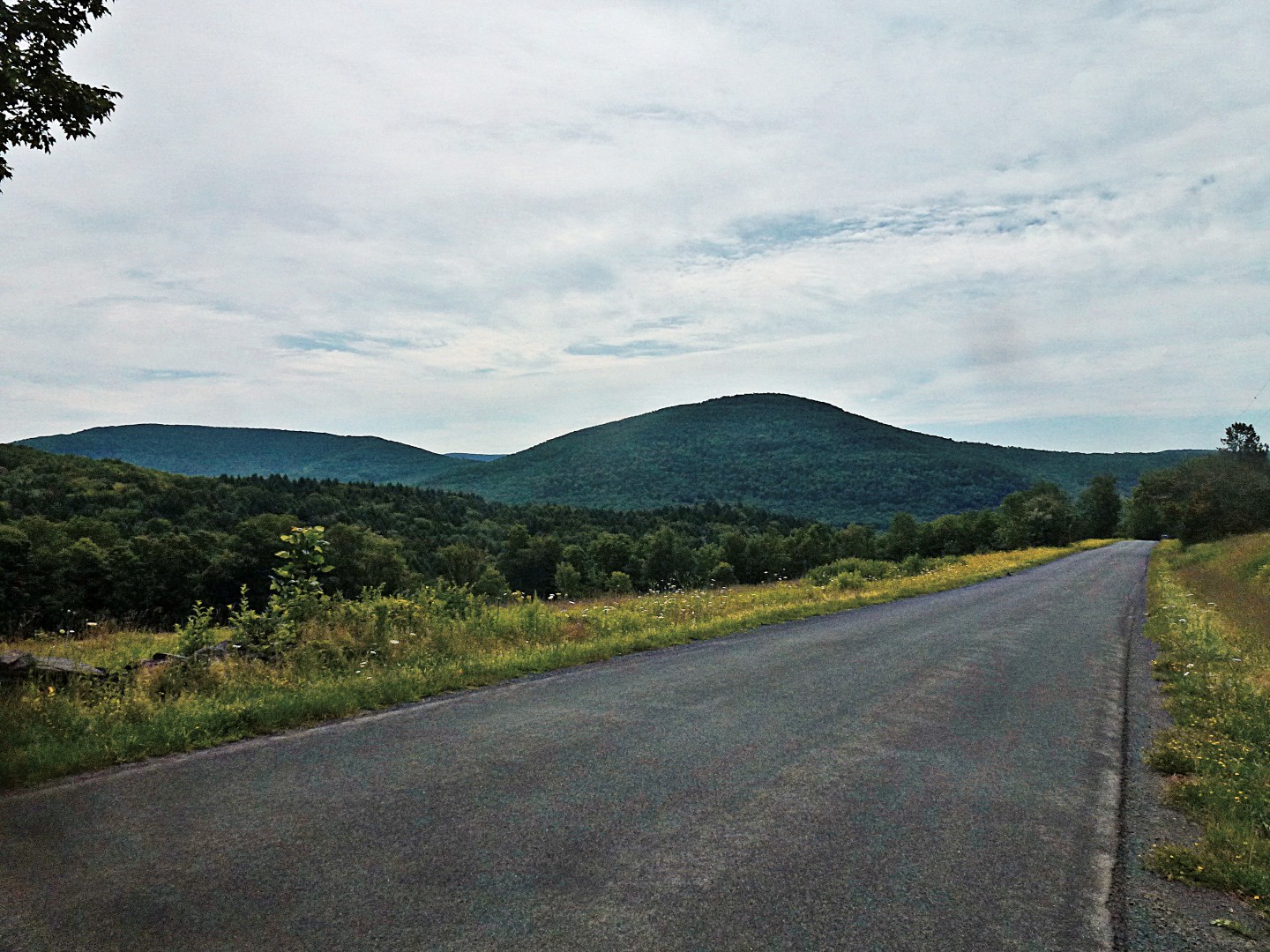
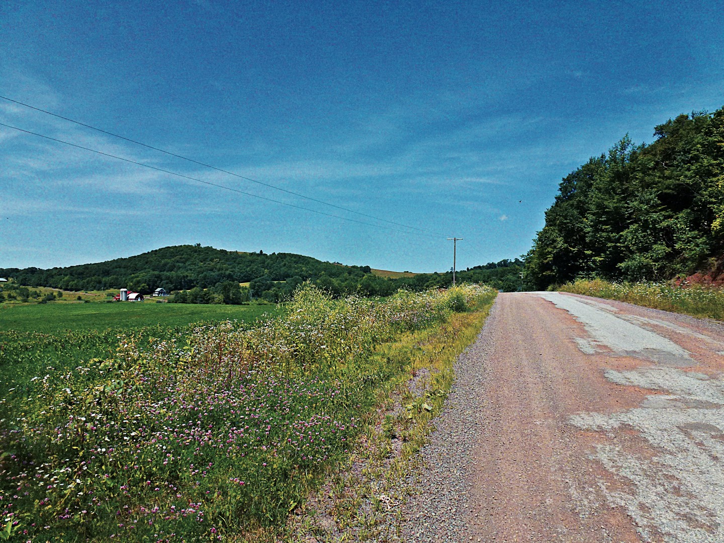
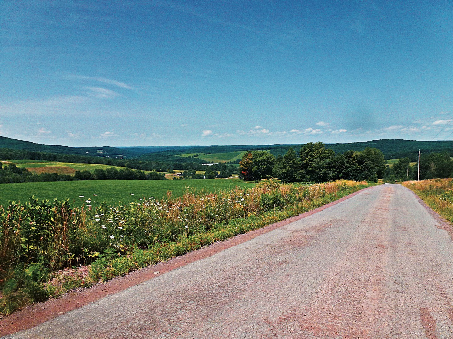
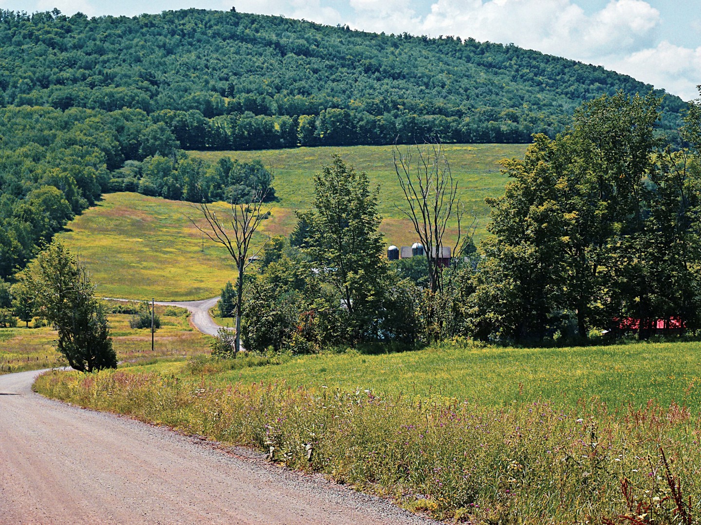
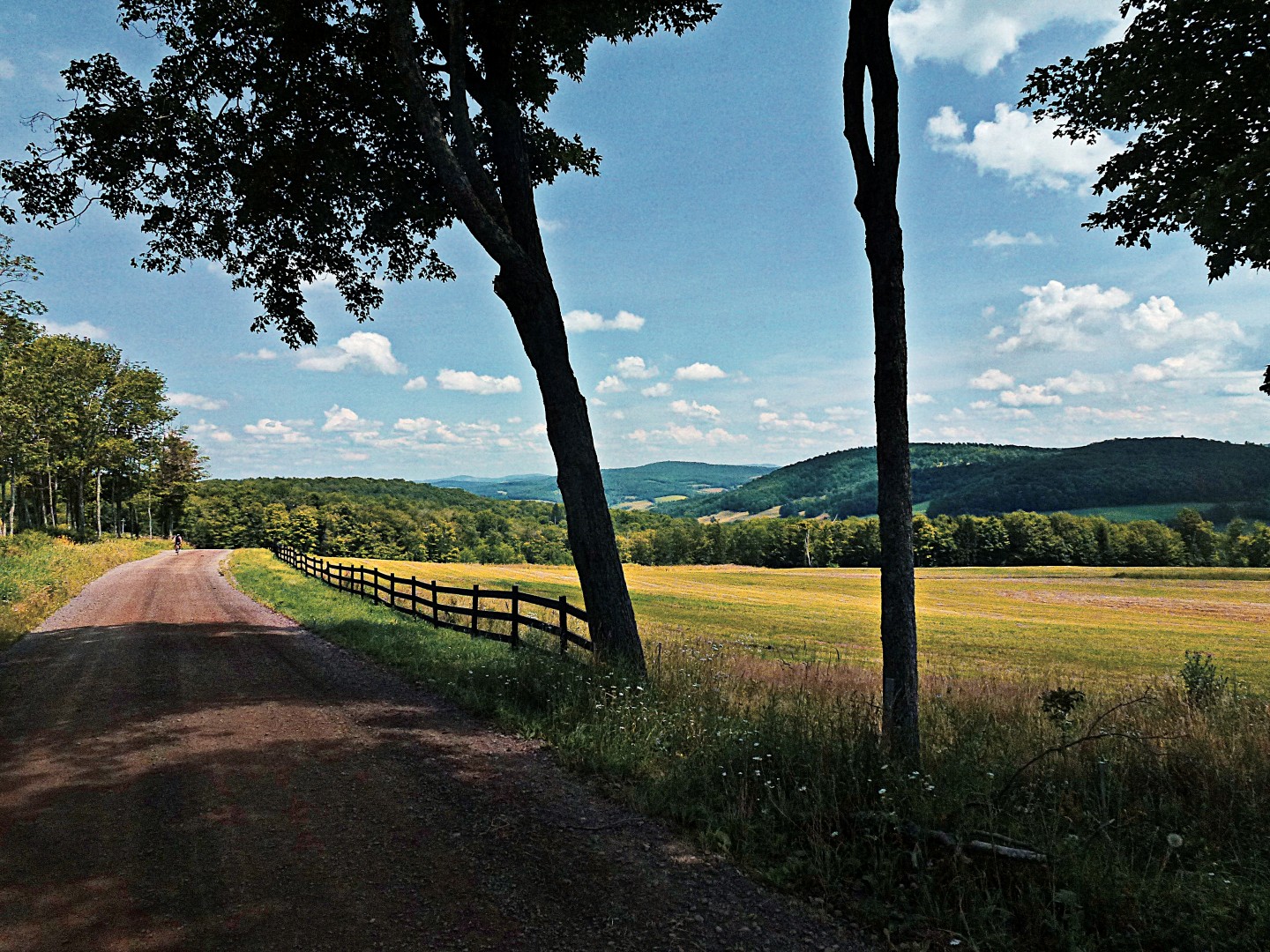
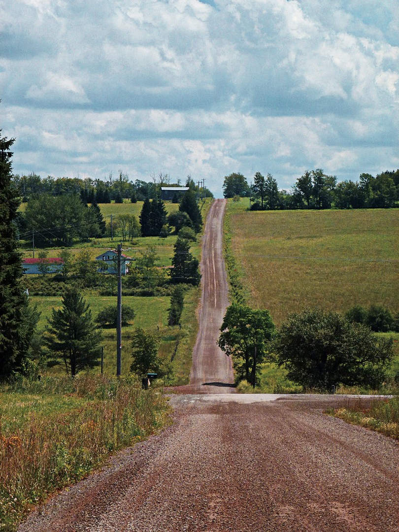
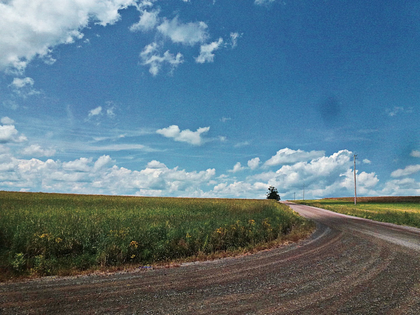
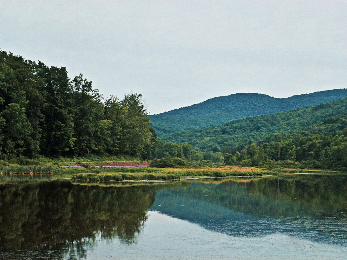
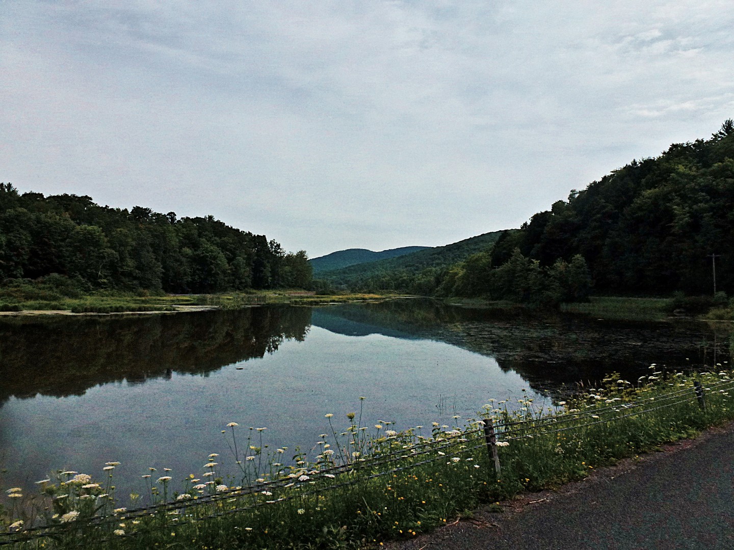
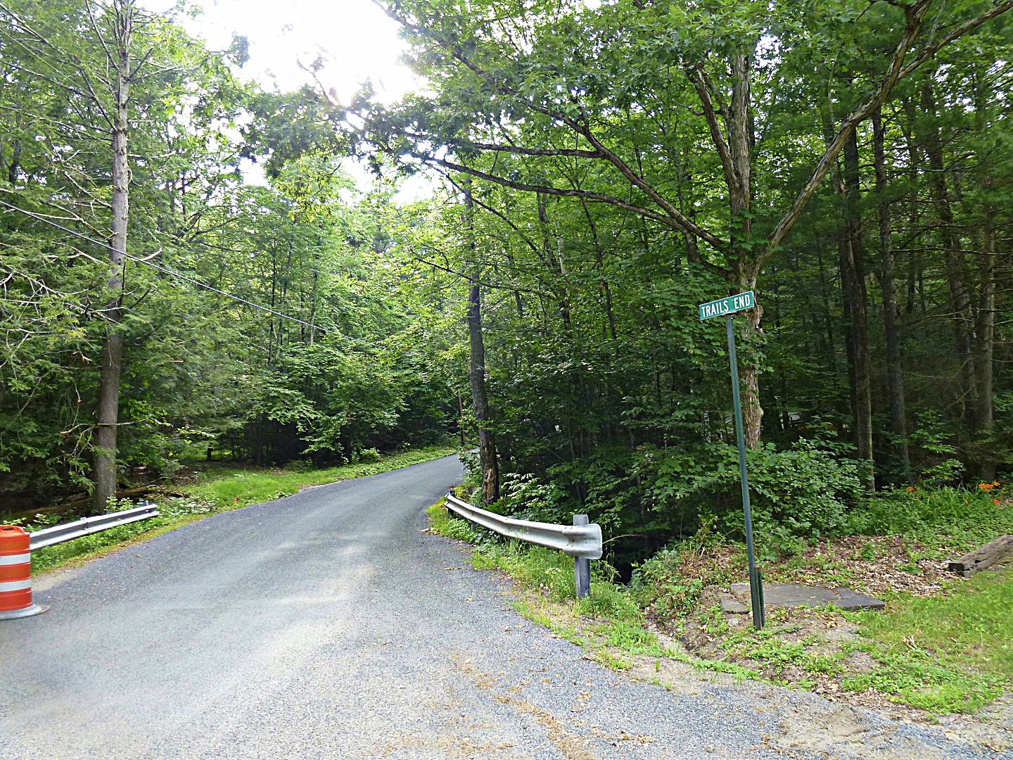
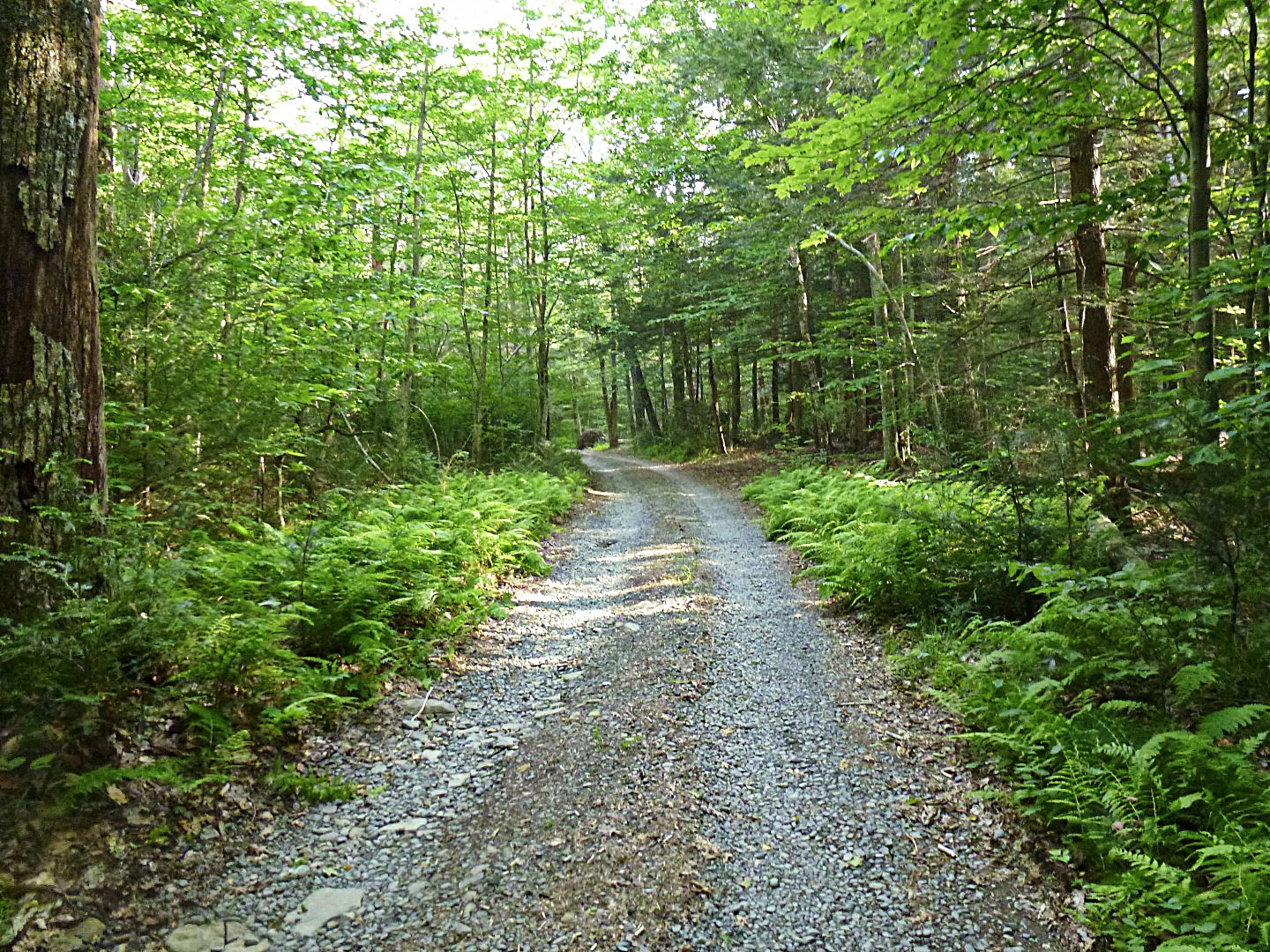
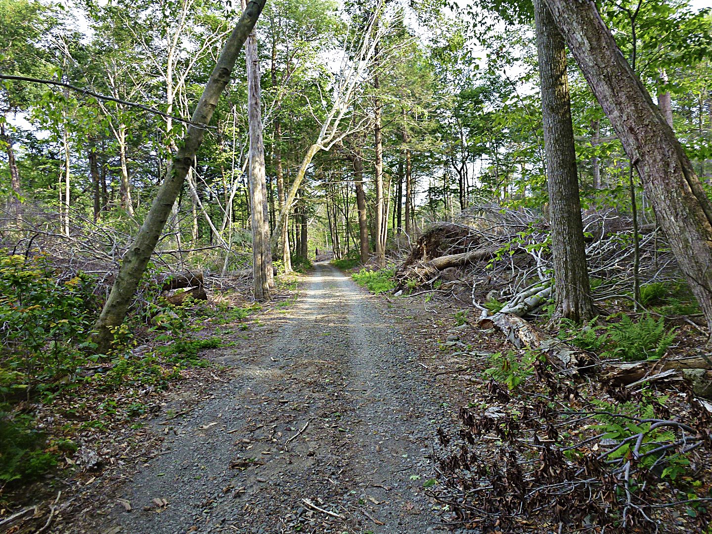
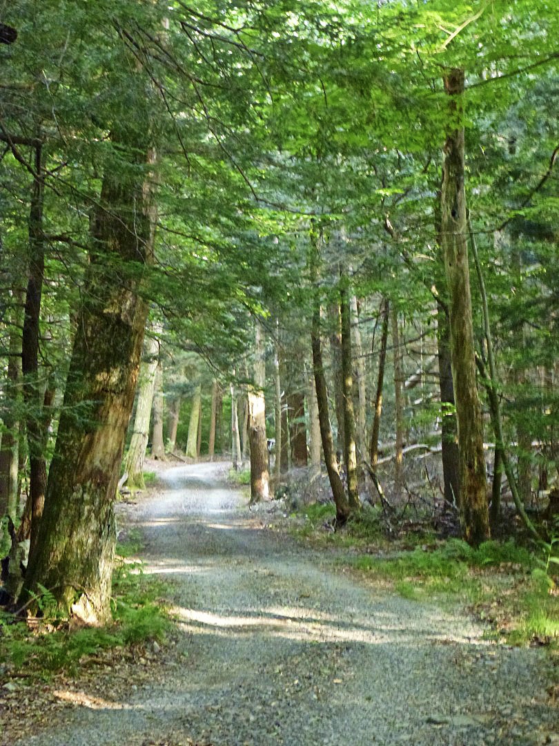
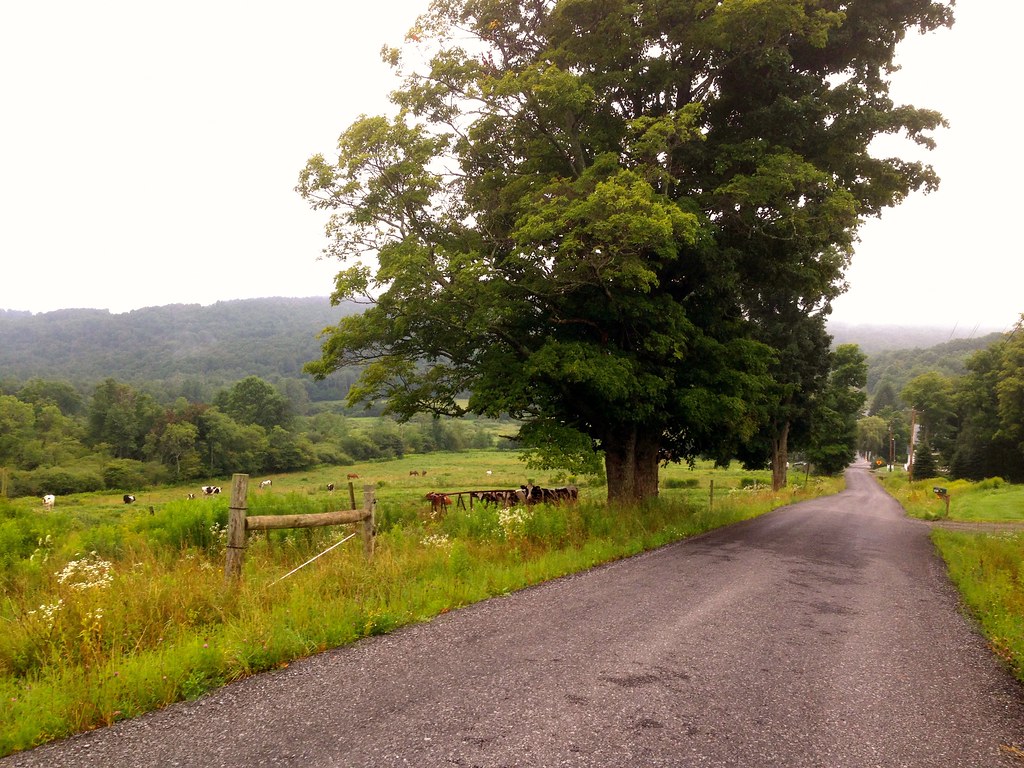
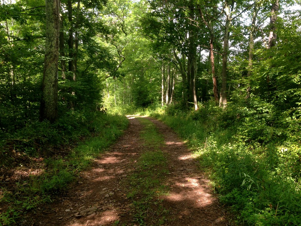
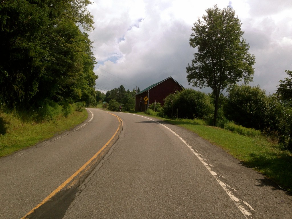
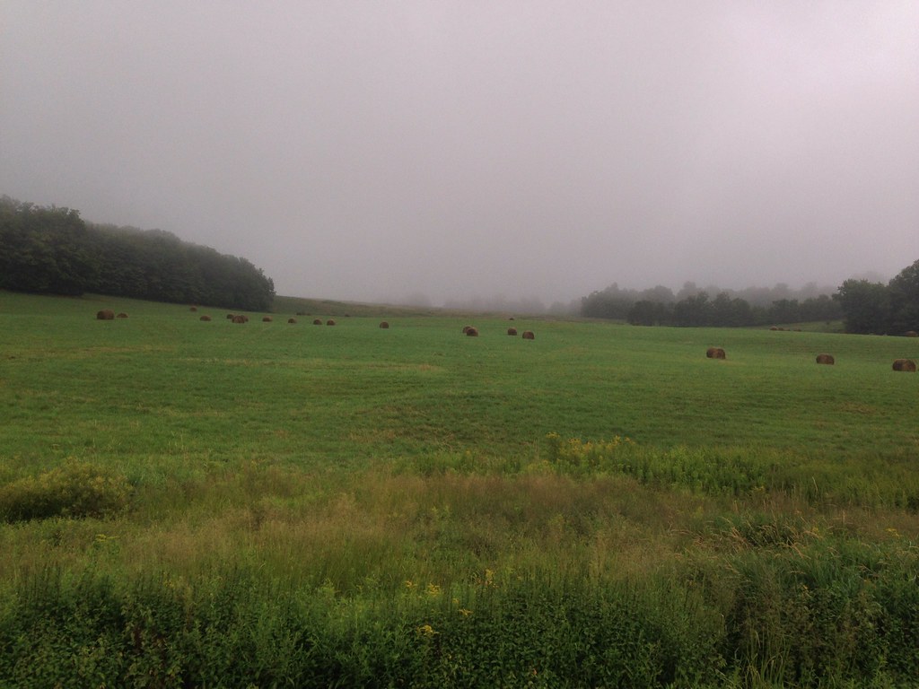
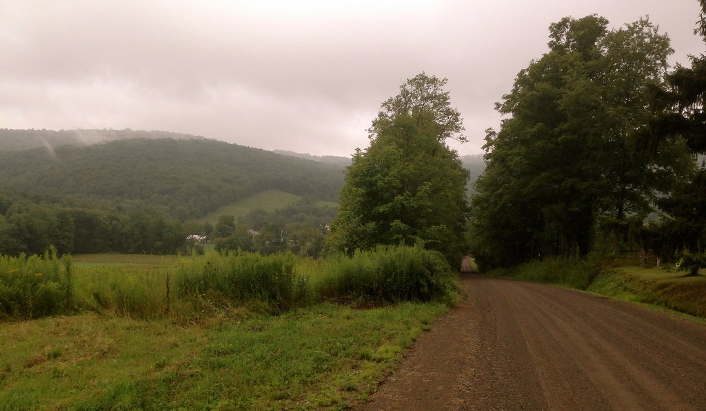
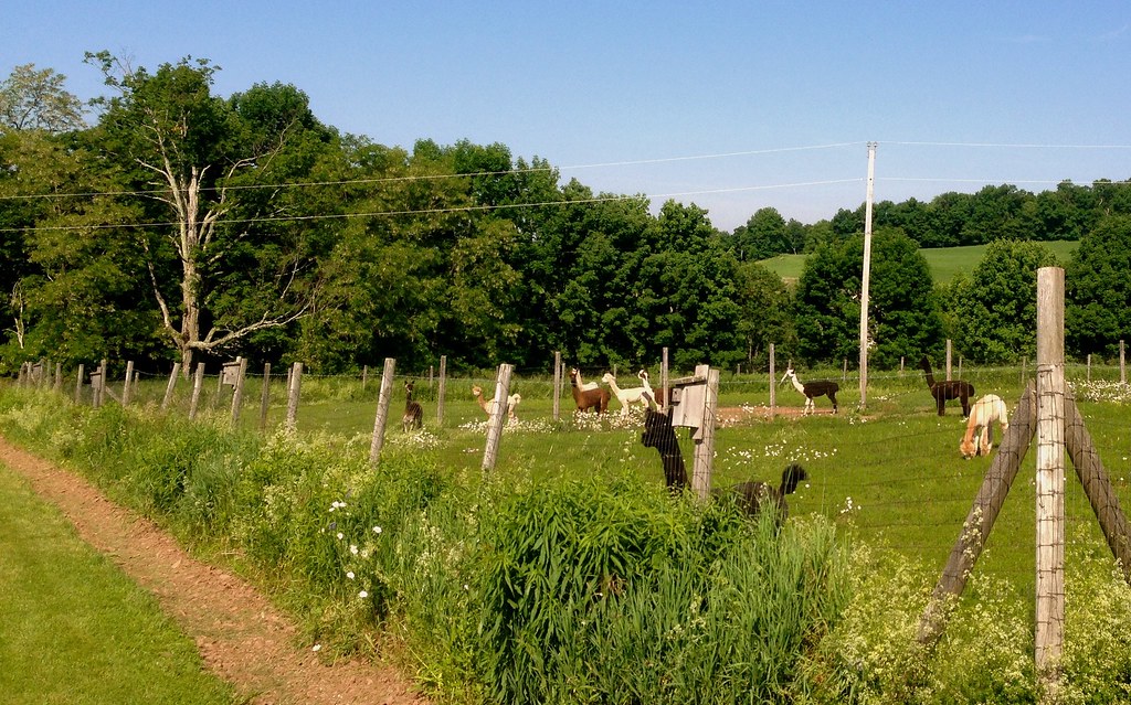
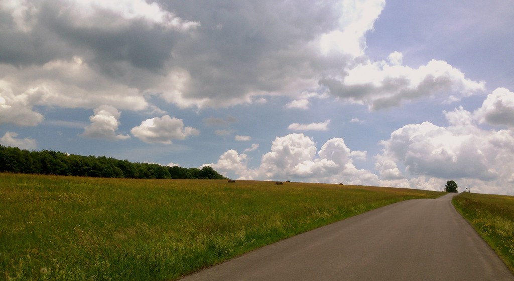
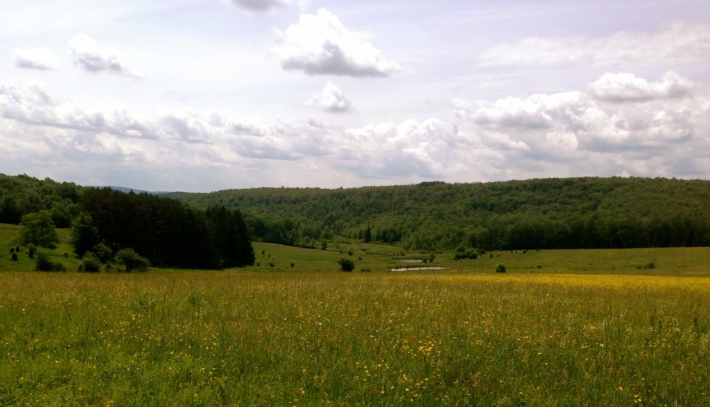
Admittedly, while engaged in good conversation with Ben throughout the ride, I didn’t pay much attention to where I took these shots, so here are just a bunch of random scenes from the ride, in no particular order:

I’d definitely consider this route a ‘must ride’ for anyone in the area.  And finding another wealth of dirt roads and amazing cycling in another little corner of the Catskills just over from mine reminds me just how much more remains to be discovered.  I’ve barely scratched the surface.

Delaware County Summer Solstice Dirt Classic (D2S2C2)

In what’s becoming an annual ritual, we grabbed the kids out of school a couple of days before school was officially out (our district’s school year ends late compared to most), loaded up the car until the suspension protested and sagged, and headed for the hills. For the past few years we’ve done this the weather has been perfect for ushering in summer– warm and sunny, green and lush. This year was no exception.

Building on my previous loops around my summer home, I set out on my most ambitious Catskills ride yet. I had planned it for months. I mapped out a 150k loop that would take in my favorite roads from previous, shorter loops, while exploring a few new ones. It would take in three covered bridges, 70k of dirt roads, seven major climbs, and it would have strategically placed rest stops at well-spaced intervals to enjoy excellent food in pleasant, rustic village settings.

Alas, that plan got derailed midway into the ride, but I still managed to make this my longest Catskills ride yet, at 116k, or 73 miles, with 6500 feet of elevation gain. And it was still an amazing ride, the kind that resonates in my mind for days after and keeps me yearning to come back for more (which, thankfully, will happen soon… I’m returning in August).

I started out from my house atop a steep hill in Bloomville, and within five minutes I was bombing down the first of many 40+ mph descents, a speed easily attainable on most of the descents around here since I’ve switched to the new Compass Babyshoe Pass “Extralight” 650x42B tires. These are the third 650B tires I’ve experienced, and clearly the fastest. Highly recommended!

From Bloomville, I headed onto the Catskill Scenic Trail–one of the common launching points for my Delaware County rides–for a short mile, getting off at Kiff Brook Road via the tractor path shortcut off the trail. First climb of the ride.

Onto MacArthur Hill Road, past the former one-room schoolhouse-turned-private residence, past the Alpaca farm, onto a couple more dirt roads before the rapid descent down Braehead Road into Doonan’s Corners.

From Doonan’s Corners, the next climb is Turnpike Road, another favorite road with some spectacular views.

Turnpike Road takes me down into West Kortright and Meredith, with another steep climb up Ehlermann Rd before a deliciously steady and continuous four mile descent down Houghtaling Road, a dirt road I hadn’t yet ridden (John F had, in his Delaware 85 ride from last year).

Dirt roads are common here, but 4-way dirt intersections are less so.

I wonder how long this VW microbus has been here?

Dilapidated farm structures, vestiges of a dried up dairy economy, are iconic around here.

One more steep climb up Warner Hill Road before descending into Treadwell, a tiny village I discovered last year and fell in love with.

One of the things I love about Treadwell is its charming old general store, where I’ve gotten lunch before (I mentioned Barlow’s in my Columbus Day ride report from last year). To my dismay, they were closed! This was the first of several setbacks leading to the shortening of my planned route… I had a limited amount of food with me and had planned on stopping.  Not a big deal, yet, but I did need to refill my water bottles.  Across the street I spotted a sweet old 19th century neoclassical building with intriguing sculptures in the yard. The front doors were swung open invitingly, and I noticed the unassuming sign propped up against the mailbox post: “Art Gallery Open”. Great! I could stop in, look around, and get my water bottles refilled.

Upon entering, I was blown away by the prolific collection of sculpture and paintings. A magazine stand filled with years of newspaper clippings, essays and photocopied reviews of the artist’s work revealed him to be Joe Kurhajec, an internationally renowned sculptor who’s lived in Treadwell for 43 years. Here’s a YouTube interview with him, and his work will be on exhibit at the West Kortright Centre from July 18-August 25.

After a chat with Mr. Kurhajec, I was back on my way, heading up the hill to an area known as Arabia, with stunning mountaintop views.

At the top, Douglas Hall Road ends, and Ridge Road, a narrow dirt road, follows the ridge along the top of the hill for miles.

This is where the second setback occurred. Road crews were rebuilding the road, dumping truckloads of fresh dirt down before grading and compacting. The un-compacted dirt was several inches thick, and too difficult to pedal through with the fine tire treads of the Compass tires– knobbies or cyclocross tires would have been more appropriate here. One of the men yelled to another, “Hey, there’s a guy on a BIKE over there. You think he rode up the mountain?!” I yelled back that I had, but that my tires weren’t optimized for soft dirt, and how far down the road did the fresh dirt extend? 1/2 mile, he replied, and I decided I didn’t want to schlep it.  The next stop would be Hamden, with a farm store/cafe I could stop in for food, but now I’d have to detour.

Fortuitously, the road work started at an intersection with Gray Road, another dirt road I hadn’t been on, but which had been on my radar for awhile. Gray Road would be my detour to Hamden, although it would eventually lead me to Route 10 closer to Delhi.  I’d have to ride on Route 10 for four miles back to Hamden–much less desirable than the planned route along Ridge Road to Launt Hollow Road, which would whisk me down five miles of smooth pavement all the way down to Hamden, avoiding the highway. Route 10 is hostile to cycling. A major 55-mph highway through the northern Catskills, it sees lots of truck traffic, and the shoulders are usually in rough shape, sections of which are completely unridable. Fist-sized chunks of broken asphalt litter the crumbling shoulder. When you see that fully laden logging truck fast approaching in your helmet-mounted rear-view, the idea of ‘taking the lane‘ is not very appealing! (I conjured this image a few minutes before arriving at Route 10, and sure enough– within a minute of turning onto 10, a loaded logging truck came barreling down the road, albeit in the opposite direction.)

As I approached Route 10 between Delhi and Hamden, I realized the third setback of the day, the coup de grâce to my original route plan– I had forgotten my cash and credit card at home!  No chance of stopping for food in Hamden, or Delhi, or anywhere for that matter.  With only 41 miles covered, I’d have another 53 to go with only one Clif bar left.  So instead of heading west toward Hamden, I detoured east to Delhi on Route 10, in the direction of my home, cutting 35 miles off the route. If I felt up to it, I could add another loop closer to home to recoup some of the lost miles.

I stopped in Delhi to refill my water bottles again, and to finish my last Clif bar. Delhi has some wonderful old store fronts, like their beloved Dubben Bros. Hardware, chock full from floor to ceiling with vintage artifacts and ephemera:

Past Main Street, Delhi, I continued on the flat Back River Road and past Fitch’s Bridge, toward Bloomville (at least I got one of the three planned covered bridges in this ride!)

Re-energized by the last Clif bar, I felt I could take on another loop before heading up the last climb back to my house.  So before Bloomville, I turned onto Bramley Mountain Road to cross the mountain to Bovina. This would give me some more lovely dirt roads and another 15 miles– a fair compromise between the original 94 miles and the abbreviated 58. I’ve written about Bovina before, so I’ll just show you some of the delightful views I enjoyed from this loop:

Pink Road provides a really smooth, fast descent back into Bloomville (before I have to tackle the final climb to my house).  Thanks to the Compass tires (a stable bike helps, too), I hit a new personal speed record of 49 mph!

In all, the route clocked in at 73 miles with 6500 feet of elevation gain.  Although a big chunk of my planned route got deleted (I’ll reattempt the full 150k version in August), the ride was nonetheless magical. The only highway segment was the short Route 10 detour to Delhi, and despite the heavy traffic and dicey shoulder maneuvering, the views were still sublime.

Detoured route, including the additional Bovina loop. Food stops are indicated. Dirt segments are shown in green:

D2S2C2_map

–Anton

The Land of Meh

Today marks my 6-week anniversary at the new house. Compared with Olivebridge, pretty much everything is better. We’re much closer to town but still in an extremely rural setting (in fact, cattle graze just behind our house). We have real internet, and not that crappy satellite internet that only worked 75% of the time, and then slowly. Our cell phones work. So everything is great.

Sadly, the riding just isn’t as good out here as it was up in the Catskills. Don’t get me wrong, this is grade-A cycling country, and I think the vast majority of cyclists would probably prefer it to the Catskills. But I miss the mountains, extreme isolation, and adventure of riding in the high Catskills. Then again, it’s nice to know that I won’t necessarily die undiscovered of extended exposure if I end up in a ditch some day.

The Catskills are still easily accessible, it’s just a minimum of a 60-mile round trip to get up there–not really feasible for a weekday ride.

So…I’ll stop complaining. Really I am blessed.

Here’s a short and fun route for you. You can start out of New Paltz or Gardiner.

full

My camera is pretty much dead, but I did manage to get a few non-blurry photos of the route (Amazon says my new camera will be here by June 5). The route mostly passes through farm country, and there’s a convenient stop around mile 20 in Walden, which has a range of options for food. This route is easy as can be: Only about 1300 feet of climbing over 31 miles. Take a moment at mile 9.5 to go down the dirt road on the left to the Shawangunk Grasslands National Wildlife Reserve. It’s beautiful.

9  7 6

This picture is from a previous ride. This is the Aumick Road entrance to the Shawangunk Reserve, a park that John S has written eloquently about. If you’re interested in riding up there, I’ve mapped a route to the entrance for you here.

8

Aumick Rd Entrance

That’s all for now. New routes should be coming fast and furious in short order. Also coming soon: The return of Rene!

Rene

John F

medicalwriter.net

Water? Yeah, we’ve got that

– By Somervillain

After a brutally long, cold and snowy winter, I had been itching to get back to cycling. I bike commuted the short distance to work through most of the winter, but that type of cycling is insignificant and serves little more than utility. It doesn’t count. Cycling for the sake of cycling largely ceases during winter in New England, and I was eager to get back into doing long distances, to take in scenery, to have no deadline to be someplace, to explore. I happened to be up at our Catskills home for the weekend for other reasons, and the weather was promising to be perfect for a spring ride.

I had been wanting to try a new route that I mapped last year, which would take me to the Pepacton reservoir. It would take me over a couple of mountainous dirt roads which I’ve ridden before, but other than them it would be mostly new territory. I was keen on doing this route not because I was particularly drawn to seeing the reservoir, but because the route takes in a 10-mile, continuous descent, and the thrill of the descent is, primarily, what compels me to climb hills.

I had done only one long ride this season, just last week, so I wasn’t in good enough shape to tackle a mountainous ride of too much distance, not this early, but I wanted to get in 100k. Typically my Catskills routes average 1000 ft of elevation gain per 10 miles, but 6200 ft would be too much this early in the year– that’s like D2R2, a ride I spend all summer preparing for! So I cut some of the mountains out of the route, and incorporated 10-15 flat miles on either end, leaving some pronounced hills in the middle (and that 10-mile descent!) for a more reasonable 5000 ft overall elevation gain:

I started out in Bloomville, after having an excellent breakfast at Table On Ten, just down the hill from my house:

From there I followed the Delaware River, West Branch, along the flat Back River Road for 15 miles through Delhi to Hamden. But the flatness ends abruptly with the turn onto Basin Clove Rd, which takes you over the mountain separating Hamden from Downsville, shown in this photo:

Tapped sugar maples line Back River Road:

On to Basin Clove Rd, the first major climb: cat 3 with an average grade of 9.5% for more than two miles.

I’m never good at capturing the intensity of a climb looking up a hill, it always appears more accurately steep looking down it, so this is what it looked like behind me:

Initially, I lamented the lack of flourishing tree buds and other signs of sprouting greenery that mark the progression of spring.  A little early for that in these parts. I’d have to settle for the residual shades of grays and browns from a retreating winter. But I soon realized that early spring in the Catskills is the season of water– equally beautiful in its own right, and what I missed in terms of emerging spring color was made up for by the tumbling kinetics and sounds of water, everywhere and all around me. Mountainsides turn into waterfalls, drain ditches into mini rapids. It occurred to me that it was perhaps most appropriate that I was riding this route in early spring, because the visual (and audible!) cues to just how impactful this region is to New York City’s water supply were unavoidable.  You see, NYC gets its water from a network of man-made reservoirs located in the Catskills, built between the 1940s and the 1950s. The Pepacton is the largest of these. The water from the reservoirs is channeled through a network of aquaducts and tunnels to the city more than 100 miles away. NYC prides itself in its water, routinely judged among the finest municipal waters in the nation, and the city goes to great lengths to ensure the quality of its water is maintained through extensive land conservation efforts.

And it was here, climbing up Basin Clove Rd, that I first realized how much water drains down the mountains.  This is what the drain ditches looked like:

The sound of running water created a soothing wall of white noise, which helped me settle in to that meditative zen-like state you need to get into to help you focus on getting up the mountain.  Of course, stopping every so often for a break to take photos helps, too.

Eventually I reached the top of Basin Clove Rd, and got to enjoy a similar view to what I just showed you, only this was taken without turning my head backwards: the start of the 10-mile descent down, down, down Gregory Hollow Rd to Downsville:

More water along the way.

Did I mention water?

The sound of water was so pronounced, I took a recording of it:

Eventually the descent ended in Downsville, a small village with a convenience store, convenient for filling up my water bottles and using the restroom. The Pepacton reservoir’s western tip is in Downsville, less than a mile from the Downsville covered bridge.

From the Pepacton, there’s no way to get back to Bloomville without going over another mountain with at least one cat 3 climb. For the return I took Huntley Hollow Rd to Fall Clove Rd to Maggie Hoag Rd– each of these roads is a milder climb than Basin Clove Rd, but the first two still qualify separately as cat 3 climbs and collectively the three roads accounted for 2/3 of the total climbing, in just 1/3 the total distance of the route.

Fall Clove Rd is a beauty. Long and winding, with lots of moderate ups and downs, none too intense, and lots of pleasant pastureland views.

Maggie Hoag Rd, the last dirt segment and last climb of the route, was hard. Not according to the elevation profile, but because by now I had exhausted my reserves. Here it is (head turned backwards again):

Back in Bloomville, I realized that in just a few more weeks the dreary remains of winter will have finally vanished, having yielded to spring’s new growth, and by the time I get another ride in, everything will look different. And just as slowly as spring marches on toward summer, the sound of water will diminish.  And I’ll miss it.

Full route, with dirt sections in red.

pepacton

A Review of TRP Spyre Disc Brakes

Edit Dec 7 2013: TRP “has identified a potential safety issue in the lab with the Spyre and Spyre SLC mechanical disc brakes and, as a responsible company, has issued a “stop sell”  notice to our OEM customers and distributors until we have a solution in place. We are working hard on the issue and anticipate a solution very shortly. More information will be forthcoming as soon as possible.”

I’ve removed my Spyres from the English for now. Back to BB7 hell.

This summer has been tough. Lots of work and travel, and not enough time on the bike. I like to put in a minimum of 15 hours a week on the bike, but I’ve been in more of the 10 to 12 hour zone, and a lot of that hasn’t been quality time—just quick dashes around the neighborhood. Good for exercise, but not a lot of fun.

A bright spot, though, was the delivery of my English 650B bike in June. Since June 20th, I’ve put 1375 miles on the bike, and it has revolutionized my back-road riding experience. It handles precisely like a road bike, it is much more comfortable on the rough stuff and no slower on the flats. An unexpected bonus has been being able to descend more quickly. Instead of panic braking and hopping over obstacles—and slowing down because that shadow on the road might be hiding a pothole, I just sail over everything.

Have doubts? Just try a 650B bike, if you can. The only thing that might be difficult is that most are built as vintage reenactment machines, so if you’re used to a modern road bike, it’s a different experience. (I want to note that there’s absolutely nothing wrong with vintage reenactment bikes—I have a few myself and love them. But I realize they’re not for everyone, or even the majority of riders).

Anyway…this wasn’t supposed to be about my English. Instead, I’d like to tell you about my experience with TRP Spyre brakes. Keep in mind that this is an honest, unbiased review–I’m not paid for posts, nor do I reprocess press releases like so many other bike blogs do.

Spyres

I’ve always been of the opinion that disc brakes confer no benefits on a road bike. As many have argued before, the rim of a wheel represents the largest possible rotor, and thus offers great braking performance. I support that position: there is no rational need for disc brakes on a road bike. At least not mechanical disc brakes.

However: If you’re riding a nontraditional road bike—say something with fat tires, like my 650B, or even a cross bike with 32s or 35s, disc brakes are a handy solution. The long-reach brakes that are available now are heavy and not very high quality. Thus, disc brakes represent a reasonable option.

My previous experience with disc brakes was with mechanical Avid BB7s on my winter cross bike, a Lynskey Procross. Awful. Truly awful. They went out of adjustment every other ride, they shuddered and shook, and squealed like crazy when they got even a little bit wet. I guess if you’re a professional mechanic they would be okay, but I don’t have the time or skills to adjust my brakes every few days. Like many other mechanical tasks on a bicycle, I can adjust the brakes to perfection, it just takes me forever. I’d rather be riding my bike, y’know?

Enter the TRP Spyres. After some initial frustration getting them set up right—I like my brakes relatively “stiff”—they have performed admirably. They are simple to adjust, and they do not squeal even when wet. They offer at least equivalent braking performance to BB7s; in fact, on average they offer better braking performance because they don’t require continuous readjustment. Keep in mind that this is from the perspective of someone who flies down mountains almost daily, often in inclement weather (a blessing and a curse, because I also have to climb up those mountains!)

One word of advice: Toss the rotors they come with, or at least hold them in reserve for an emergency, and buy some Shimano Ice Tech rotors. The braking performance is improved considerably and there is little to no squeal. With the Ice Tech rotors, the braking performance is, dare I say it, even better than well-adjusted rim brakes. Again, I’m riding in extreme conditions, the stock rotors may very well be okay for regular use.

The best part? The only adjustments they require is an occasional tweak to make up for pad wear. A matter of a few seconds.

The “power curve” for these brakes is different from rim brakes. I’ve now had a chance to ride this bike, with the Spyres installed, in a paceline with people using conventional rim brakes. I’m happy to say that the modulation is good enough for the occasional feather touch when soft-pedaling or sitting up won’t do. Don’t run out and ride in a fast paceline the day you install the brakes, though.

So…have TRP Spyres made me change my mind about disc brakes on a road bike? No, not really. If you’re buying a new conventional road bike, you don’t need them and, even though the Spyres are low maintenance and perform well, they are still more trouble than a rim brake for not a lot of additional benefit.

If you’re buying a cross bike or any other type of bike that may not fit regular road brakes without going to long-reach calipers, they are an acceptable alternative. If you insist on ordering a bike with mechanical disc brakes, insist on Spyres. OEMs would be crazy to specify BB7s instead of Spyres–they are that much better!

I’ve purchased a set of the HY/RD hybrid hydraulic brakes for my winter bike to replace the god-awful BB7s. I’ll report on those later in the year.

BB&

John

medicalwriter.net

New Route: Delaware 85

Do you like climbing? Do you like gravel? Do you have no sense of self-preservation? If you answered yes to all 3 questions, you’ll enjoy this route. Deliberately designed to be the toughest sub-century in the Catskills, it is 85 miles, has about 9000 feet of climbing, and covers at least 30-40 miles of some of the most isolated gravel roads you can find out here. It is, at least thus far, my masterpiece. If you can an excuse to get up to Delaware County, do it now and ride this route. It’s not just worth the trip, it’s worth a pilgrimage.

That said, I’m *really* tired, so this story won’t do justice to the route. In a few days, however, I’ll try to come back and add what will, doubtlessly, be highly amusing anecdotes and antics of grown men on bicycles. Just enjoy the photos for now; in fact, I’d suggest that you click on them to see them full size. My camera, which I’ve been riding with for 3 years now, is dying in a most appealing way–some of the images are quite beautiful.

Also, please keep in mind that I very well may be misplacing the pictures. I don’t keep a diary of where I’m taking shots while I’m riding; in fact, my photos usually involve me trying to ride one- or no-handed over potholes, while randomly clicking because it’s too bright to see the LCD on the back. So take these pictures as a general overview of the route rather than specific views you’ll see at certain points.

I was inspired to create the route by Anton’s magnificent posts on his rides in Delaware County, which can be found here and here. Unfortunately, I never got the chance to go up to his place and ride.

This is the actual route.

Map

We had planned on doing it in the reverse direction from what is shown here, but, because the start and end points were the same, there was no indication on our Garmins whether we should go in a clockwise or counterclockwise direction, and I had failed to look at a map closely before leaving. So, we ended up doing the entire route backwards. In retrospect, this might have been a good decision, because the descent in town at the end of the ride, as we did it, would be absolutely murderous to start out with.

Here’s the elevation profile.

ele_profile

If you have time to inspect the route further on Ride With GPS, you’ll see that all of those climbs have significant 12% to 18% sections. Many of them on dirt. Each of the 9 major climbs on this route could be a highlight for any ride—like the Peekamoose or Slide Mountain climbs. I just decided it would be a good idea to have 9 highlights.

It starts in Margaretville, which I’ll probably misspell in half a dozen ways throughout this post. There is a convenient parking lot right across from the grocery store where you can leave your car all day at no charge (at least we did without issues).

You head out of town on the appropriately named Cemetery Road—a 700-foot climb, but nothing terrible or unmanageable. After a few moments on Route 30, you’ll take a left on West Hubbel Hill Rd. I tried to include every road with the name “Hill” or “Mountain” in them on this route, but I did manage to miss a few. This is the first major climb of the route. It’s about 1100 feet, with significant sections of up to 16%. At least it’s paved!

L1020689_pe_DxOFP_pe

The view from the top of Hubbel Hill Road is great, but there are better views to be had in just a few miles.

L1020691_pe_DxOFP

L1020690_pe_DxOFP

L1020697_pe_DxOFP

Continuing on, Roxbury Mountain Road offers the first gravel segment of the route. As you’ll see, the gravel here ranges from pale pink to a quite bright red. I did some 30-mph fishtailing on this road, which reminded me to be cautious.

L1020701_pe_DxOFP

L1020698_pe_DxOFP

You’ll continue into South Kortright. Unfortunately, South Kortright has no amenties, eg, no place to buy stuff. This turned into a major problem, as the first place we hit to buy liquids and food was just past mile 40–under normal conditions, not a big problem, but keep in mind that by mile 40 we already had 4500 feet of climbing under out belts. So word of warning: bring lots of water or do this route in cooler weather. A few more images of the paved portion of this segment:

L1020724_pe_DxOFP

L1020723_pe_DxOFP

L1020719_pe_DxOFP_pe

L1020717_pe_DxOFP_pe

L1020716_pe_DxOFP

After a moment on a “major” road–Doonan’s Corners Rd, we turned off onto Turnpike Road. More gravel!

L1020729_pe_DxOFP

L1020731_pe_DxOFP_pe

L1020732_pe_DxOFP

L1020739_pe_DxOFP

Which ended on a nice big descent. Note that there is significant washboard at the end of this descent. I was riding 650B at 45 psi and I almost lost a filling.

L1020746_pe_DxOFP

I believe this is Houghtailing Hollow Rd, around mile 39. When a road says it’s seasonal, you know something good (or very, very bad) is coming up. As it turns out, it was beautiful but nothing painful. However, the climb leading up to this road is a brute, I believe 18%+ on gravel. I’m never sure on those types of climbs whether it is better to keep the weight on the rear wheel, risking a wheelie but maintaining traction, or to slide a little more forward. It can be a delicate balance.

L1020750_pe_DxOFP

L1020751_pe_DxOFP

And another massive climb. You know you’ve reached the top of something when you see the radio tower (it might be a cellular tower, who knows?). My camera lens is getting messed up enough after 3 years of riding with it that my photos are starting to look pre-instagrammed. I’ve tried cleaning the lens with a lens pen, but it’s not helping.

L1020758_pe_DxOFP

L1020754_pe_DxOFP

L1020756_pe_DxOFP_pe

L1020755_pe_DxOFP_pe

Around mile 48, you’ll ride into the tiny town of Treadwell. It’s a lovely little town, made even more lovely by an *open* general store with that sells Gatoraide and all of the other essentials. Note that they are only open until 3 pm on Sundays; I believe they are open until 6 every other day. Make sure you arrive before closing, otherwise you have a long haul to Delhi to refuel. Delhi has at least a McDonald’s and a Pizza Hut that are open reasonable hours, there may be more appetizing options in the village with less predictable hours.

The toughest part of this ride is the 3 “bumps”, beginning at about mile 65, when you’re already exhausted. The first is terrible, the second–on New Kingston Rd–is truly brutal. The third, Margaretville Mountain Rd, isn’t terrible, but at this point, if you’ve put any effort at all into the ride, you’re probably hurting! Some images from the last 20 miles:

L1020771_pe_DxOFP

L1020770_pe_DxOFP

Now…time for bed. This ride really exhausted me…in part, that’s my own fault because–at least for the first 70 miles–I did a lot of sprinting up to the top of hills ahead of my companion so I’d have time to take pictures! This route represents my finest achievement to date on Ride With GPS. If you can make any excuse to get out to Margaretville, try this, you won’t regret it. Unless, of course, you’re opposed to fun.

And a few more photos. Even though the placement of the photos above is vague at best, I really have no idea where I took these. But I like them, so here they are:

L1020707_pe_DxOFP

L1020706_pe_DxOFP

And let’s not forget the covered bridge in Delhi…

L1020763_pe_DxOFP

John

medicalwriter.net

My Dumbass Adventure

I’ve hypothesized for a while that I could get from my area, just south of the Catskills, over to Yeagerville Rd—and from there, to Peekamoose Rd, by taking a little road called Trails End (no apostrophe, thanks).

Trails Endl

On maps, Trails End Rd terminates unceremoniously a few miles from the terminus of Yeagerville Rd. Yet I knew that there was a gravel path that headed over the mountains that was unmarked on maps. I just didn’t know where it ended.

Today, I decided to find out. I won’t bore you with the 10-mile trip to and from, so let’s start at the base of Trails End Rd. I knew that I had a good-sized climb ahead of me, about 1000 feet in just a few miles. Mostly on gravel.

L1020670_pe

As expected, the road ends and gravel begins…

L1020671_pe

There’s nothing like 12% to 15% climbs on loose gravel. I had to get off my bike for a moment and walk about 100 feet, pursued by clouds of hungry mosquitos.

L1020672_pe

About a mile in, you have two choices: There’s a path that is apparently for hikers…

L1020676_pe

Which really doesn’t work well on a bike, even one with fat 650B tires. Too many large rocks. I suppose someone with really good cyclocross skills could navigate it, but that’s definitely not me.

L1020674_pe

However, if you turn around, as I eventually did, there’s a snowmobile trail leading up, up, up.

L1020677_pe

Which leads to some nice, but very loose, gravel roads.

L1020678_pe

L1020679_pe

L1020680_pe L1020681_pe L1020682_pe L1020683_pe

L1020684_pe

It was pretty clear as I reached the apex of the ride that I was actually going over a mountain. As I entered a brief clearing, I couldn’t see any peaks around me–an unusual occurrence. Thus, I made it to the very top of something, but I know not what.

Unfortunately, I did not make it to the end of the path today. A storm was closing in, and there was thunder and lightning off in the distance. I figured it wouldn’t be a good idea to be caught on top of a mountain in the middle of thunderstorm. So I very cautiously picked my way back down the road and returned home. Indeed, within about a mile of my place, the skies opened up!

In retrospect, this was fun, albeit extremely strenuous, but kind of dumb. I went out on a road that is not marked on any map, in an area that has no cell phone service, and climbed over a mountain on loose gravel with inclement weather threatening. I also decided to do it on the fly, so I didn’t inform anyone where I was going to be.

Some day, hopefully this year, I’ll find out what lies on the other end of this path. Preferably with a companion next time!

John

medicalwriter.net

Should I?

You’re probably wondering where I am. I’m not neglecting the blog because I’m tired of it; instead, I’ve been traveling. First California, then Anguilla for the wedding, and now I’m back in California and waiting for my 7 pm meeting. I’m only out for a few days this time, although I’m not getting back until 3 am on Sunday morning.

From last Friday to yesterday, however, I managed to get in almost 150 miles of riding on the new English 650B. I took a few glamor shots of the bike. At least I thought they’d be glamor shots, but I took them with my iPhone and they ended up a little blurry. Here’s one photo, I’ll post the good ones when I return.

2

I got in a few rides with significant gravel segments. Nothing more than 40 miles, but it was a lot of fun on 650B. I’m taking it easy on my knee right now.

5

4

3

Speaking of my knee, it still hurts a little. I’m on my way to a second formal bike fitting on Wednesday to see if there’s anything I can do about it. There’s nothing that will change about my reach, which has been optimized through a fitting and long experience, but I’m hoping we can do a little work on optimizing my saddle height and, most importantly, cleat position. I clearly have a leg length discrepancy, because when I ride with a Brooks, only one side of the saddle collapses. The knee issues have only cropped up over the last month because of dramatic overuse–the week that my knee really started to fall apart I had ridden 300 miles with almost 30,000 feet of climbing. That’s a lot when you come from the flatlands of NYC.

I know you want to hear about the English. I can’t write a comparative review because I was off the bike for a week due to the knee injury, and then an additional 10 days because of the wedding. So a direct back-to-back comparison with the 700C English is impossible. I will say this, however: I am definitely much faster on descents on the 650B. My usual route into town has about 650 feet of descending on rough, potholed backroads and gravel. I’ve done it dozens of times, and it always takes me 21-23 minutes. I rode into town twice now with the 650B, and the trip took me 18 minutes the first time, and 19 minutes the second time.

This is entirely to be expected. Because the road is really rough, on the 700C bike with 25 mm tires, there’s lots of jumping, dodging, and panic braking. On the 650B, I just roll right over obstacles that would terminate my Clavicula fork or cause a pinch flat. The good part? The handling on this bike is not different from my 700C bike. Other than providing a lot of extra cushion, it really does not feel or act different, even when pushed relatively hard.

Going uphill isn’t faster (or slower, for that matter). But it is more pleasant because of the dramatically lower gearing on the 650B. I’m going to figure out a way to gear down the 700C bike, because grinding up 15% and even 20%+ grades in 34/25, while feasible, is certainly partly responsible for blowing out my knee.

The paint. Holy shit sparkles! It’s amazing. On one of my rides I stopped to eat, and I parked it by the window and stared at the sparkles instead of reading the paper as I had intended. It’s a lovely bike, at least if you’re not a traditionalist who thinks anything with a less than level top tube is ugly. My only regret is not going with something really bright. Oh well…next bike, if there ever is one, will be fluorescent pink with gold sparkles and a My Little Pony sticker on the headtube. Liberace on wheels.

A note about the Spyre brakes. I originally had weight weenies rotors on the bike. After only a few trips over the mountains, they were pulsing horribly. I replaced them with Shimano Ice Tech rotors, which seem more suitable for the type of riding I do.

What about the Spyres themselves? I regret to report that they have poor modulation at best. I thought it was a matter of getting used to them, but really they kind of suck. I’m going to try a few different models of brakes, starting with the HY/RD hydraulics, then I’ll try Shimano, and if all else fails, go back to BB7s. At least the latter work well, even though I hate them because they require a lot of messing around to keep them from squealing.

Regarding the title of this post: I’ve been seriously contemplating a 4-person team RAAM either next year or the following. If my knee is okay, I’ve decided it’s a go. We’ve got two team members so far (including me).

New and improved routes coming fast and furious starting at the end of next week…and, of course, don’t forget you can Win a Garmin! Now, off to do some stretching. I’m making a concerted effort to improve my flexibility.

John

medicalwriter.net