
Hi, Globecanvas here.
There are some spectacular dirt roads in Dutchess County, and somewhere out there in the ether is an excellent cycling loop that makes use of both the Walkway over the Hudson, in Poughkeepsie, and the Rhinecliff Bridge, north of Kingston. Yesterday I did not do that excellent loop. It was a nice ride, but not the sublime day that it should have been.
Although I have ridden plenty in Dutchess County, somewhere between Poughkeepsie and Rhinebeck there is a blank spot in my worldview, sort of like the “here be dragons” vagueness in old maps. On yesterday’s ride I managed to choose all of the least fun roads through this blank spot, making for an unsublime 12 miles in the middle of an otherwise great ride.
Sometime in the next week or two I’ll do this loop right. For now, though, I’ll just post a few photos.
The Rifton highlands, between New Paltz and the Hudson River, are one of my favorite areas to ride. This area is quite unlike the Gunks to the west. The signal feature of this terrain is long, swampy folds between low ridges. There’s very little traffic and the roads are generally excellent. It’s a great way to connect from Kingston to New Paltz or Poughkeepsie.

The Swarte Kill, or Black Creek, runs through here.

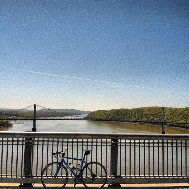
The Walkway over the Hudson is a tremendous local resource. Thanks to the determined efforts of a small group of local volunteers, we now have a state park spanning the Hudson River. On a summer day, literally thousands of people enjoy the incredible views, and throughout the year, the Walkway enables bicycle commutes and generally improves everyone’s quality of life.
Here’s the view from the Walkway, looking south toward Bear Mountain, on a clear day in May.
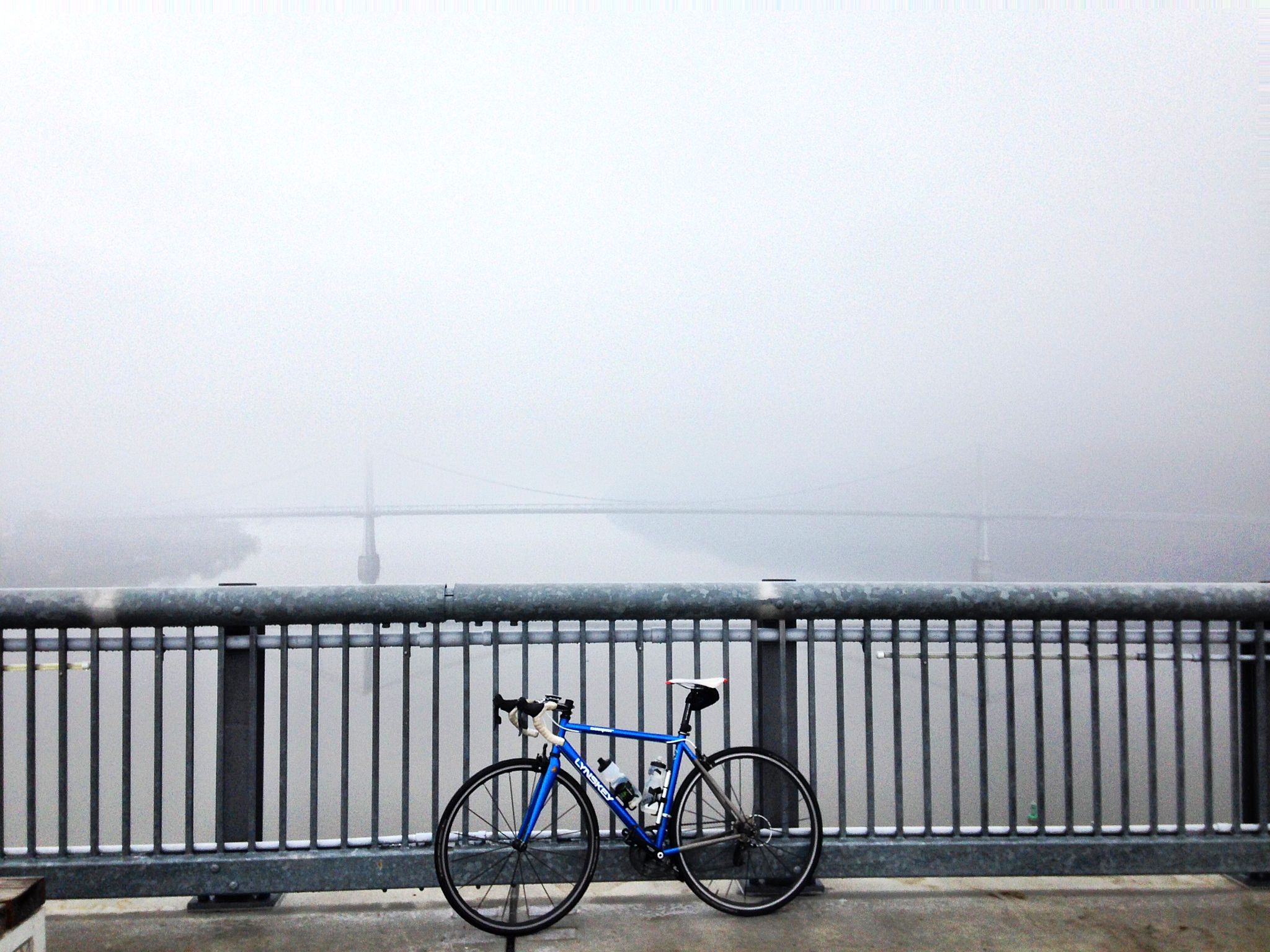
Yesterday the bridge was foggy and frozen.
Finally, the Esopus Meadows Lighthouse, seen from Rhinecliff Landing, as the fog was lifting at last.

Here’s the route, but miles 20-32 are suboptimal. I’ll post a real ride report on this route once I get it all worked out.

— John S, aka globecanvas

Don’t forget that the Walkway closes at dusk +/- 30 minutes. I always seem to hit it right at closing. Of course, if it is closed you can just take the bridge just to the south.
Glad to see some coverage of Duchess County. I only started riding in Ulster this past summer, largely inspired by this blog, and I will continue in 2014. That said, I’ve been riding for some years east of the river in Duchess and Columbia counties, and there is a lot of adventure to be had over there, too. While I can confidently say there isn’t much of note between Poughkeepsie and Rhinebeck (except for Mills Park and the lovely little Mill Road), there is an abundance of incredible riding further out in the direction of the NY-CT-MA tri-point. In the northeastern part of Duchess and the eastern part of Columbia counties, the foothills of the Taconic mountains and the abundance of backroads (both dirt and paved) combine to form miles and miles of excellent riding, with many historical and natural points of interest along the way. Here is the area I’m talking about: http://screencast.com/t/ed4Vw0TPwKmo
I generally start with one of the Bike Hudson Valley rides (e.g., http://cl.ly/0y2e2I3g0C25) and then veer off onto some irresistible unknown along the way. Maybe you already know the area, in which case I’d love to hear your thoughts.
Agreed Kolby, that area is brilliant! In fact, I think I’m overdue to do something like this ride, a big loop from Rhinebeck to Bash Bish:
http://app.strava.com/activities/1939201
The dirt roads in that part of Dutchess really can’t be beat. One of the rides I’m counting on writing about is the Dirty Dutchess, which is a weekly winter ride out of Vassar up into horse and cow country. (For example: http://app.strava.com/activities/41864426) The terrain is very similar to the legendary Battenkill, endless sharp dirt climbs and winding roads between farm fields.