
A few weeks ago, I posted on the 8 biggest climbs in the Catskills, some of which I have completed, and others that I plan to ride over the summer. I’ve only been getting out for brief rides because of the weather, so I’ve had plenty of time to waste on Ride With GPS to identify other big climbs.
I think I’ve found the best (read: most terrifying) one yet. This route takes you over Ski Run Road, which I believe is the highest through road in the Catskills. Maximum elevation, 3261 feet. Maximum grade, 33.6%. There may be dead end roads that go higher, but I haven’t found them yet.
I did some research online to find out if this was an actual road, or just a figment of Google’s imagination. I’ve had plenty of experiences around here where Google has shown a road, and it has turned out to be nothing more than the most faintly delineated path. For example, this is Rock Hill Road, just north of Minnewaska State Park:
And that was the part that looked most like a road. I ended up orienteering through the woods using my cell phone when the road disappeared completely.
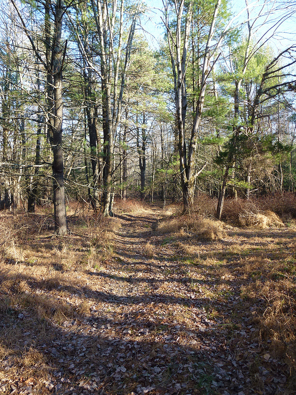
Back to the point…Ski Run Road is real, and it’s gravel, and it is occasionally used by mountain bikers. This is the best photo I was able to find of it:

And I found a report from Catskills Cycling (where the picture came from, hope you don’t mind!) about a ride on this road. Of course, they did it on mountain bikes. I’m not that smart.
Here’s the GPS route (with thanks to Catskills Cycling, I adapted it from their Strava trace) and a map.
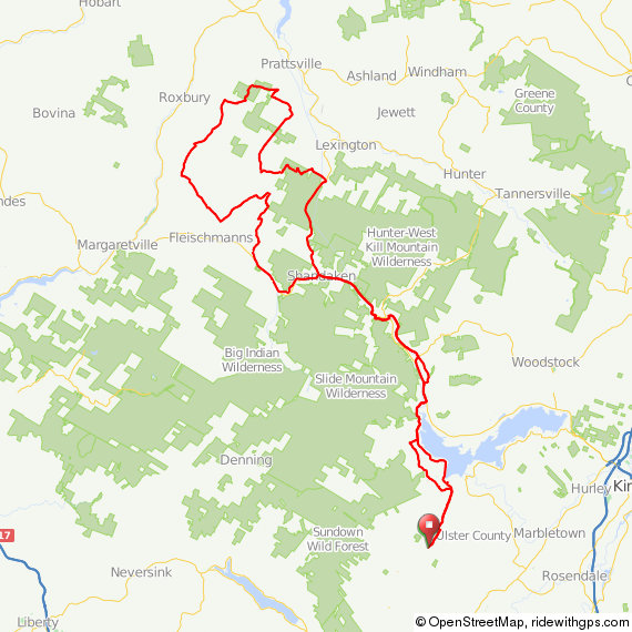
I’d categorize this one as a must do as soon as possible ride. However, I do have some common sense, so I’m not going to take a shot at this until April or later unless it warms up considerably. Gravel + snow + ice + 33% grade is not a good combination.
More climbs to come based on recommendations from friends and readers. And now I must finish my work, I’m off to Italy tomorrow morning.
John

I’ve been using Google Maps for scoping out routes too, and share the experience that the roads are quite weird at times. This has led me to suspect that there may be some image recognition of the satellite pics going on, for tracing the roads.
Hi John. If you’re looking for unpaved climbs you should also check out the Awosting Reserve climb, which goes from Aumick Road in Gardiner up to Lake Awosting. It’s an old carriage road, rideable on a cross bike, though there are parts where it’s steep enough that it’s hard to keep your wheels down.
It’s one of the most rewarding climbs around because at the top you come of the woods right at the lake which is breathtaking. You can then continue on carriage roads all the way up to Castle Point for even more postcard vistas.
You can then ride along the very top of the ridge to Lake Minnewaska, then down to Awosting Falls. From there you can ride down 44/55 toward Kerhonkson if you’re heading that way, or to get back to the base of the climb you can follow the carriage road back to the Trapps (the trail is washed out for a brief section but walkable), then on the road back to the trail head.
http://www.strava.com/segments/awosting-reserve-climb-1565216
Pingback: Spring Route Roundup: Come on Up, the Weather’s Fine! | Riding the Catskills
33% grade??!
I would probably keel over even without snow or ice!