Guy contributed a few pictures from this weekend’s ride. Here are a few rare pictures of me climbing up a hill. Not rare because I’m climbing a hill, rare because I’m usually the one taking the photographs!


John

Guy contributed a few pictures from this weekend’s ride. Here are a few rare pictures of me climbing up a hill. Not rare because I’m climbing a hill, rare because I’m usually the one taking the photographs!
John
On Friday, my long-time riding companion Guy came up for a ride. He was kind enough to ride from the Poughkeepsie train station to New Paltz, where I picked him up (did I mention that I got my driver’s license on Tuesday?) I made him drive us back because I remain a less than enthusiastic driver.
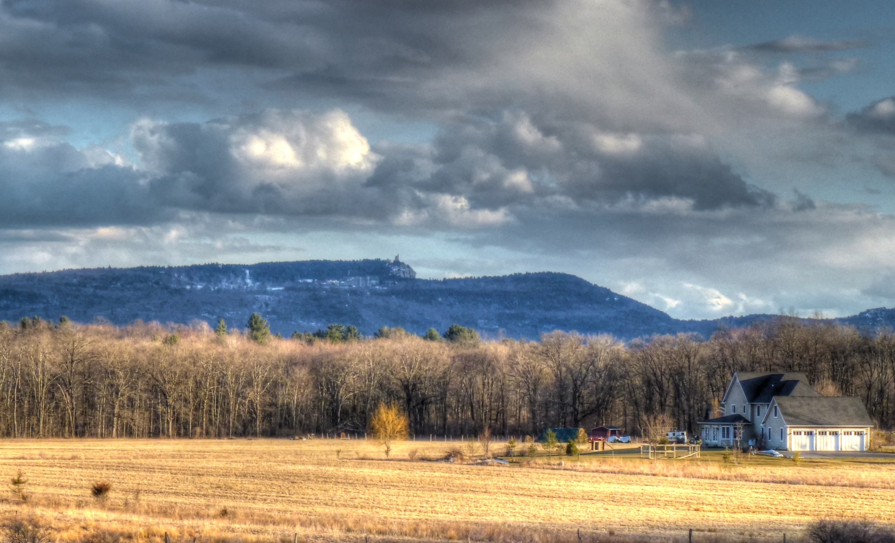
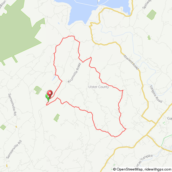
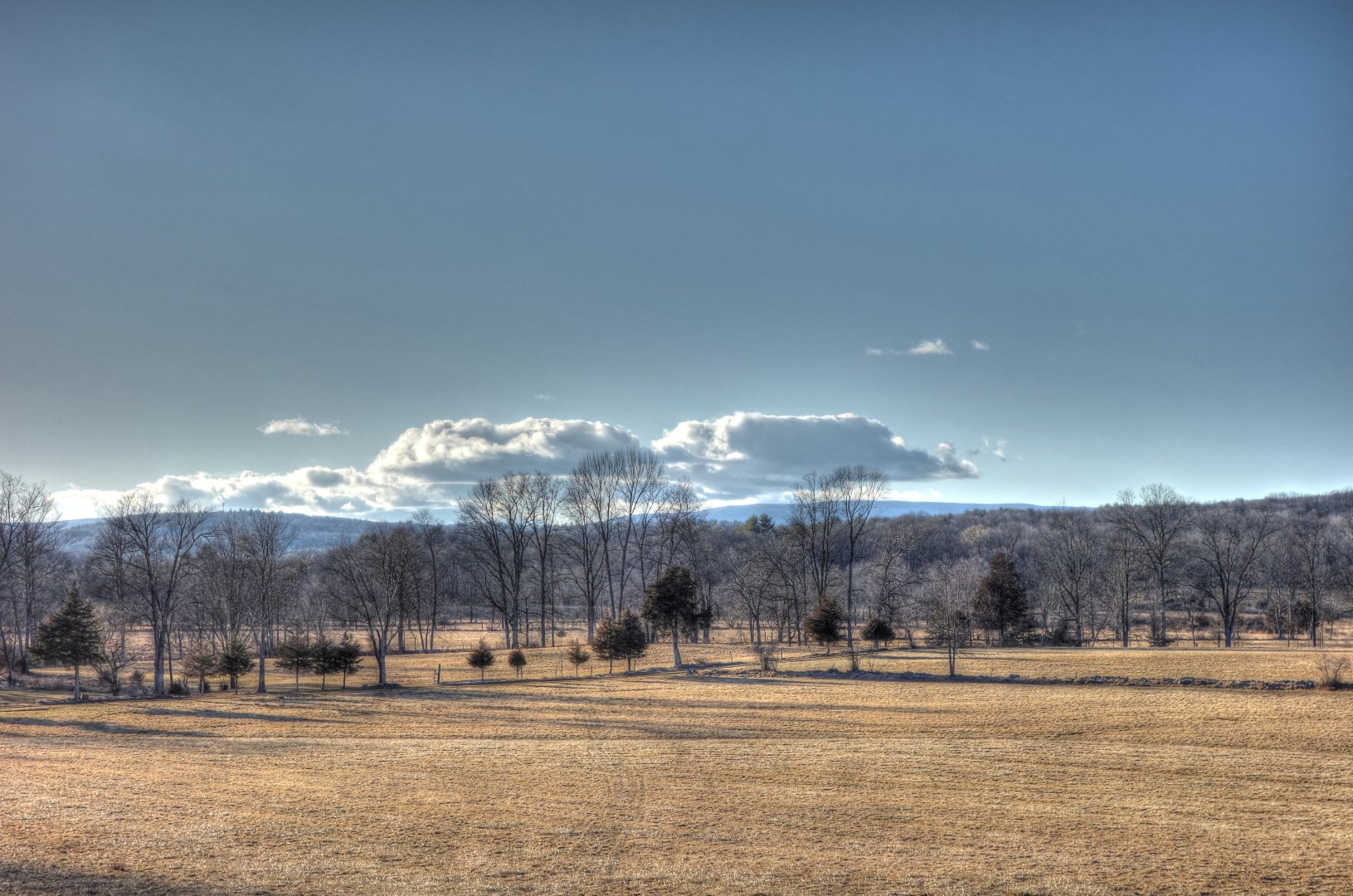
We got up bright and early the next day for our gentlemen’s ride. A gentlemen’s ride is when you don’t worry about time, stop when you want, and generally just have a relaxing day. Instead of frantically trying to fit X number of miles into a certain number of hours, we planned on taking the whole day for just 60 miles. We stopped for pictures. We stopped at the top of major climbs. We stopped for lunch. We stopped for dinner. It wasn’t really exercise, but it was good fun and a nice way to spend 8 hours. It was also nice because I overdid it in the previous 7 days, logging about 200 miles. Not much, but a lot for this early in the season after a winter that was bad enough that I didn’t manage to keep in optimal shape.
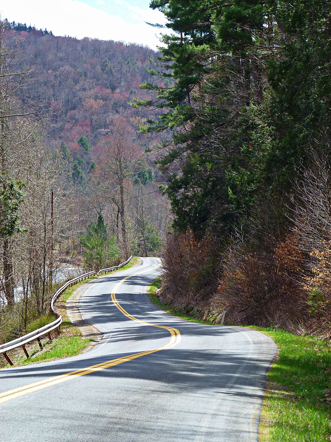
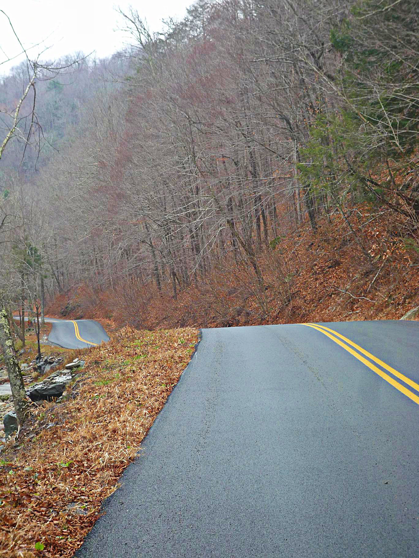
I won’t bore you with the details of the ride; suffice it to say we went over Peekamoose again. I was there just last week, but it is a really beautiful ride. Plus it is ideally suited to a gentlemen’s ride because 75 percent of the effort is concentrated in the first 15 miles (although the first climb is a brute). After that it’s mostly coasting and enjoying the day. The route is here if you are interested.
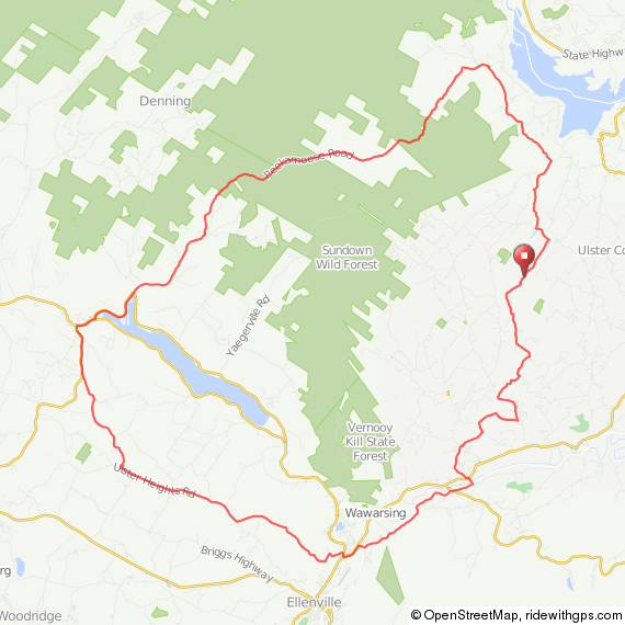
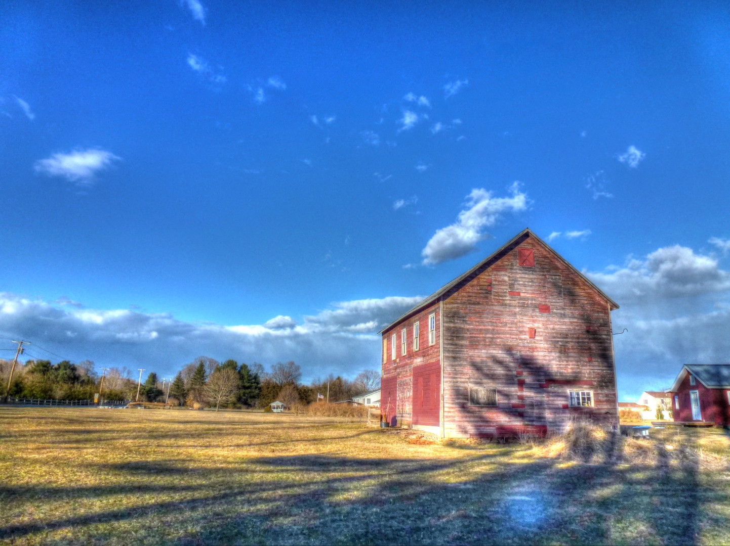
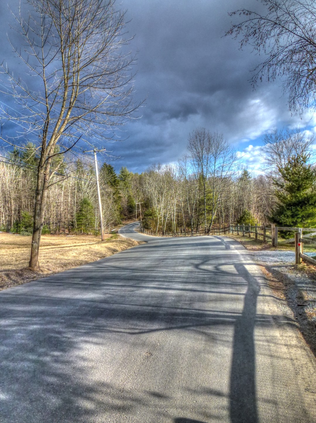
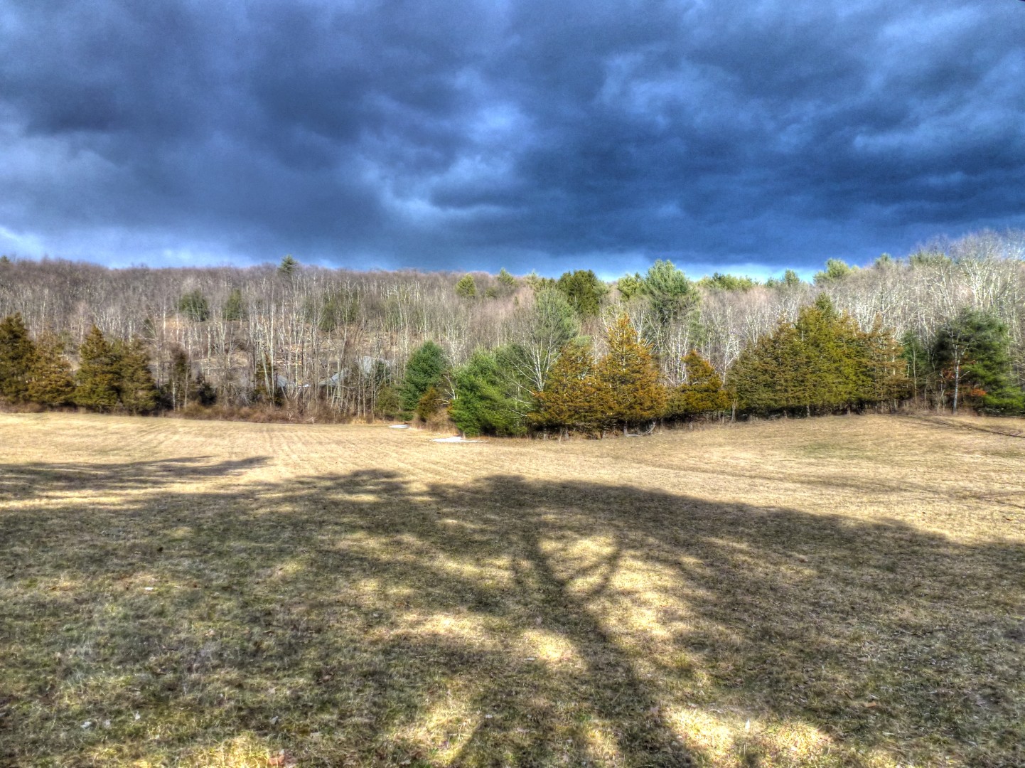
Some pictures.
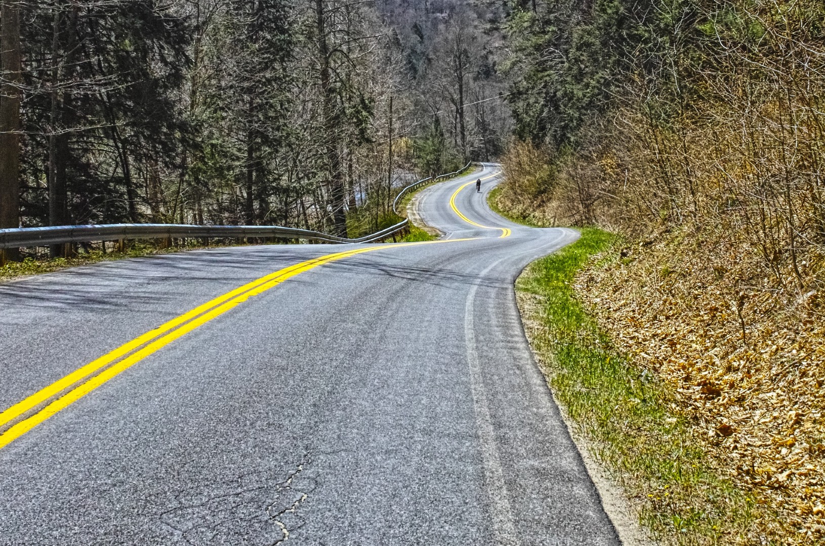
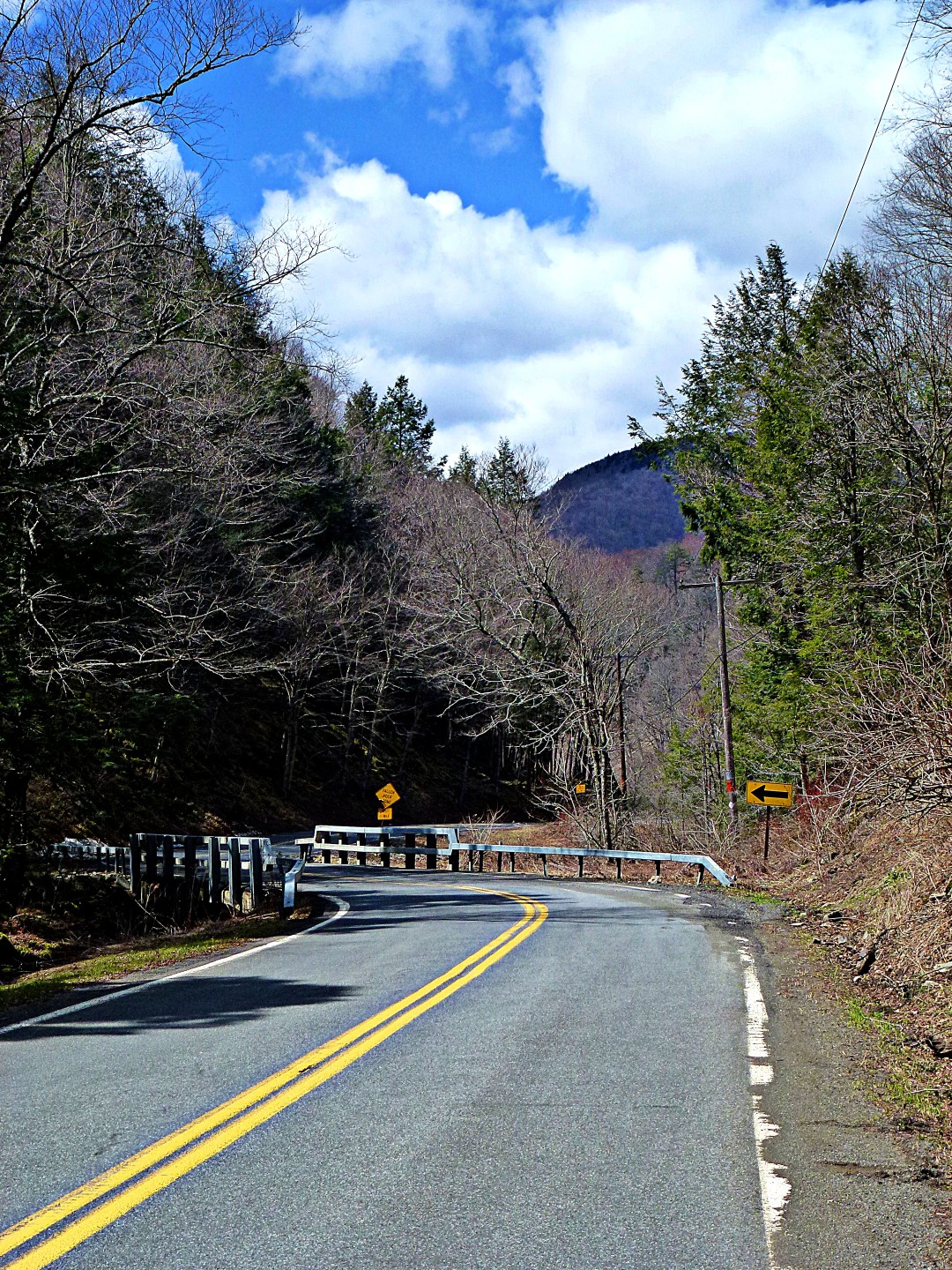
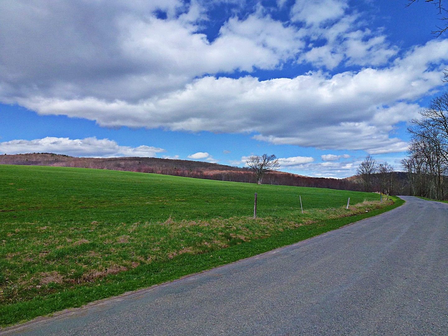
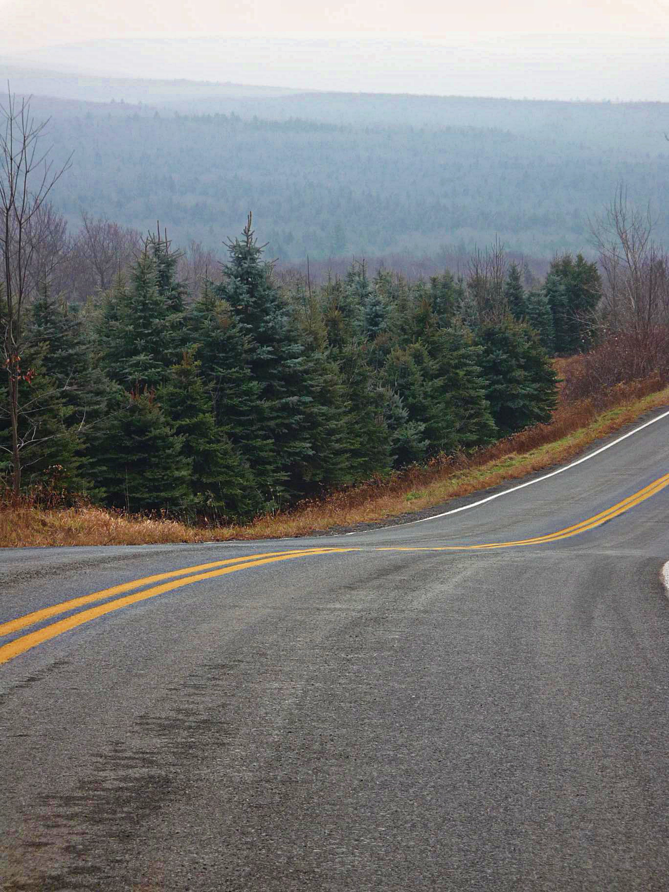
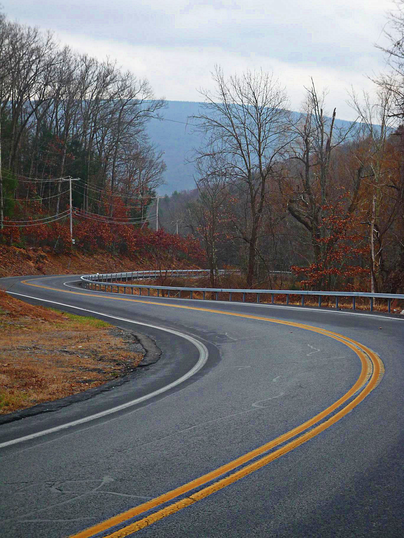
Headed into the major climb of the day: just 1000 feet, but it includes ramps of up to 16%.

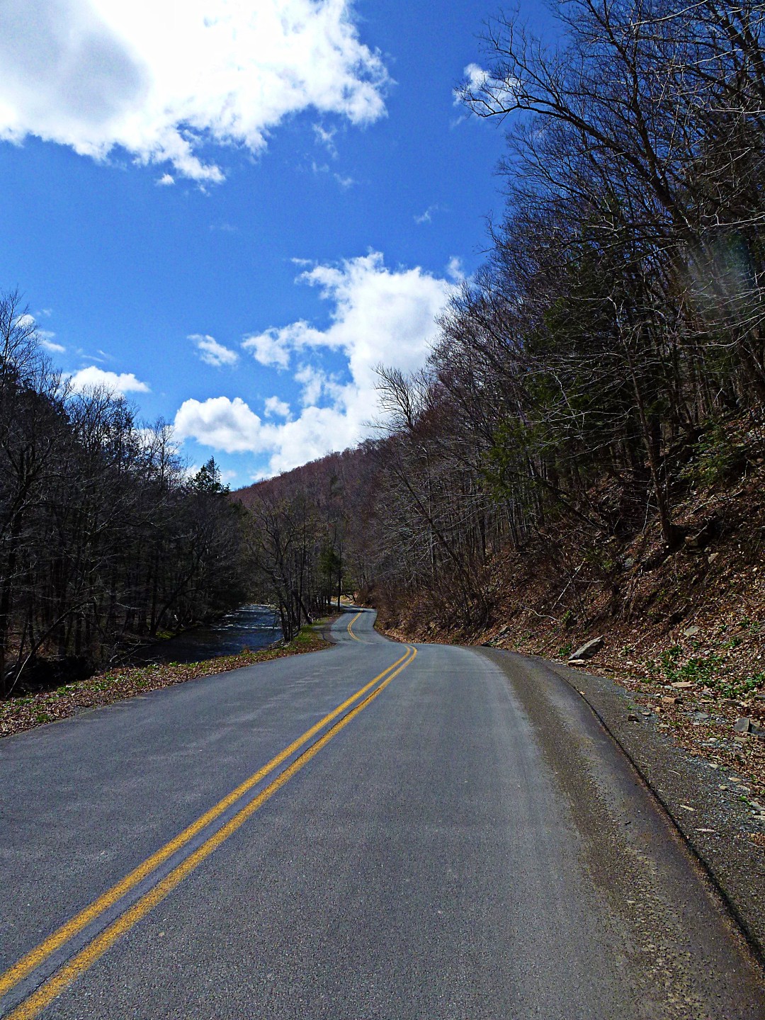
The long coast down off of Peekamoose. Spectacular as usual. Click on this one for full size.
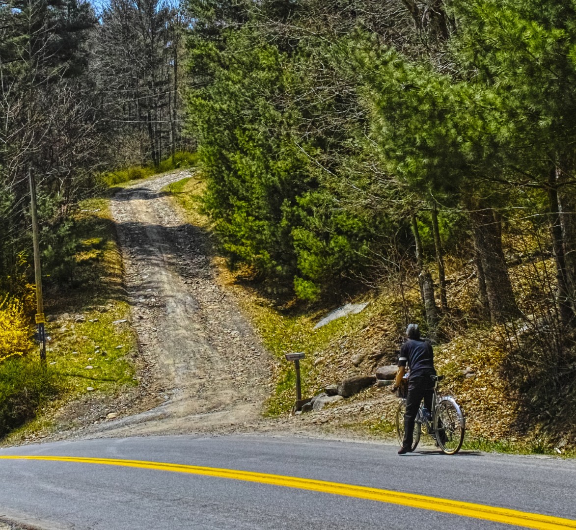
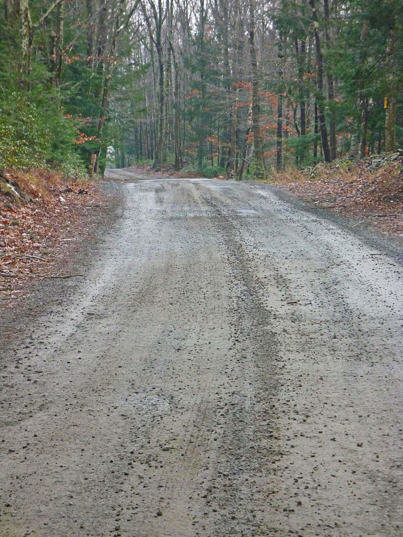
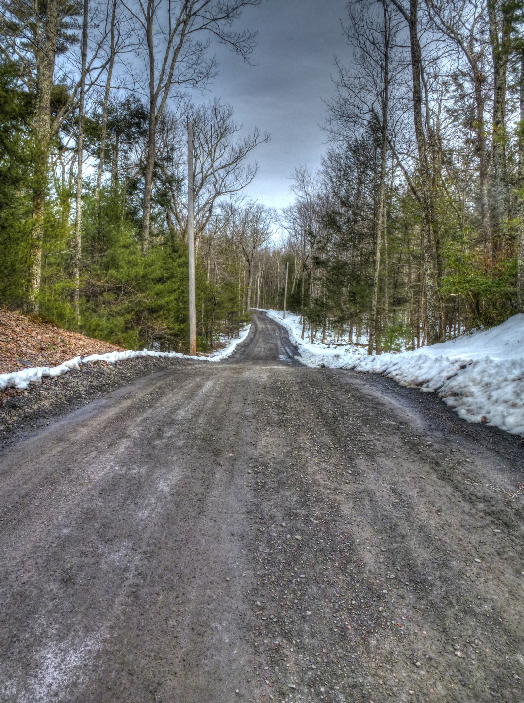
I tried to convince Guy to climb this gravel driveway/road. Just for fun.
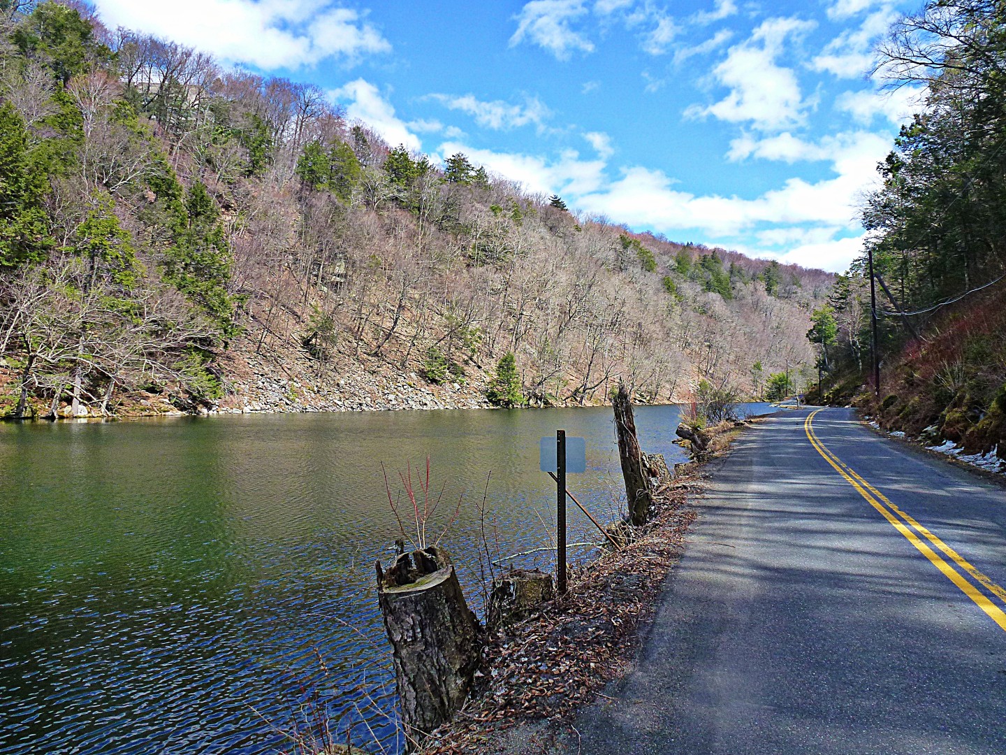
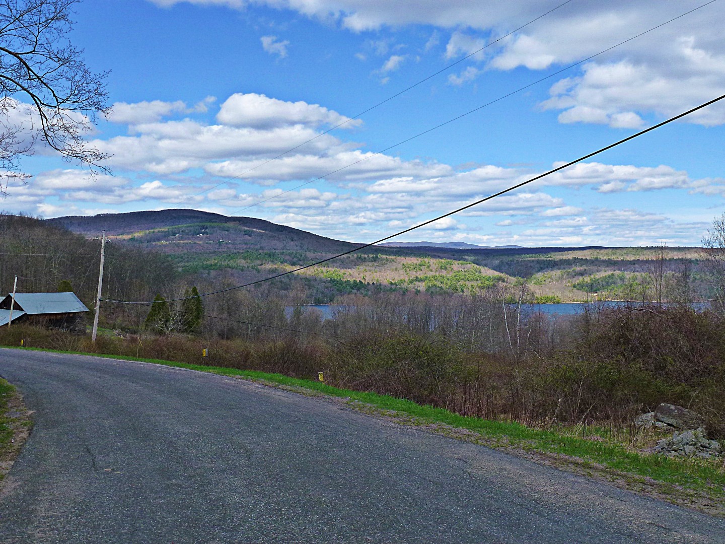
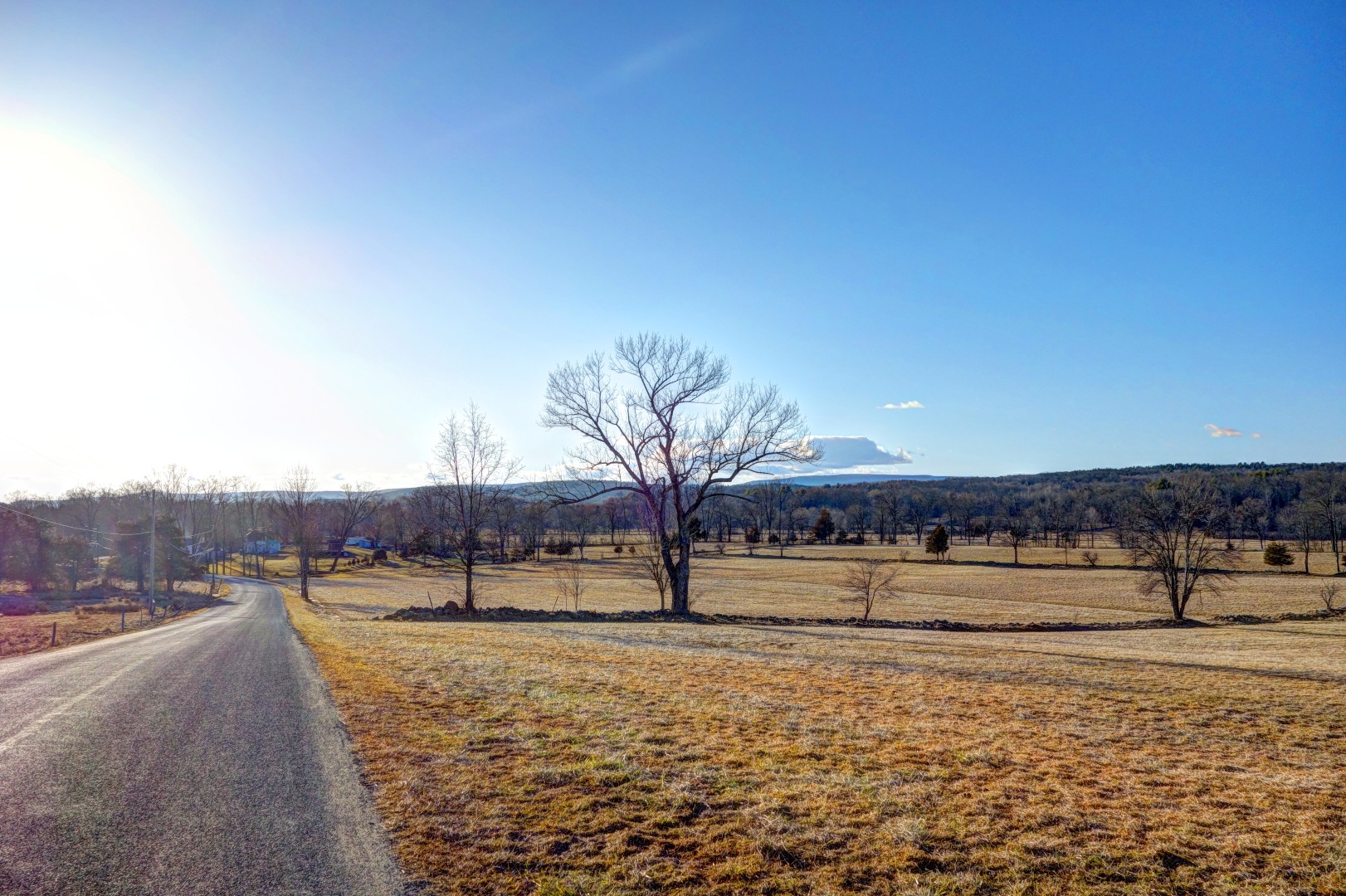
Rondout reservoir, at the base of Watson Hollow Road. We ran into some cyclists headed the other way up Peekamoose on a decidedly more serious expedition, which to me–even if I’m trying to get exercise–seems like an unpleasant route since it’s 12 miles of false flat and outright climbs, followed by a descent that is far too steep to enjoy. I’d rather do the massive climb at the beginning and then enjoy the high-speed run down the other side.

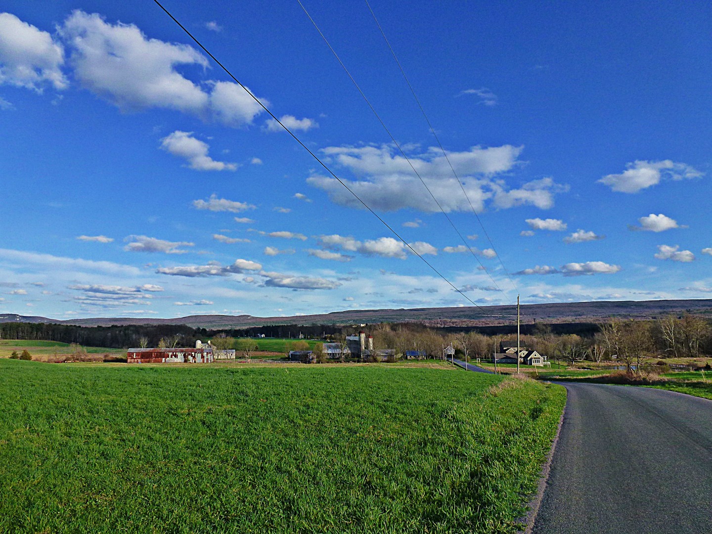
We stopped in Grahamsville for lunch. The deli there is actually quite good; if you have a chance plan a trip through town, it’s a good place to stop and very friendly.
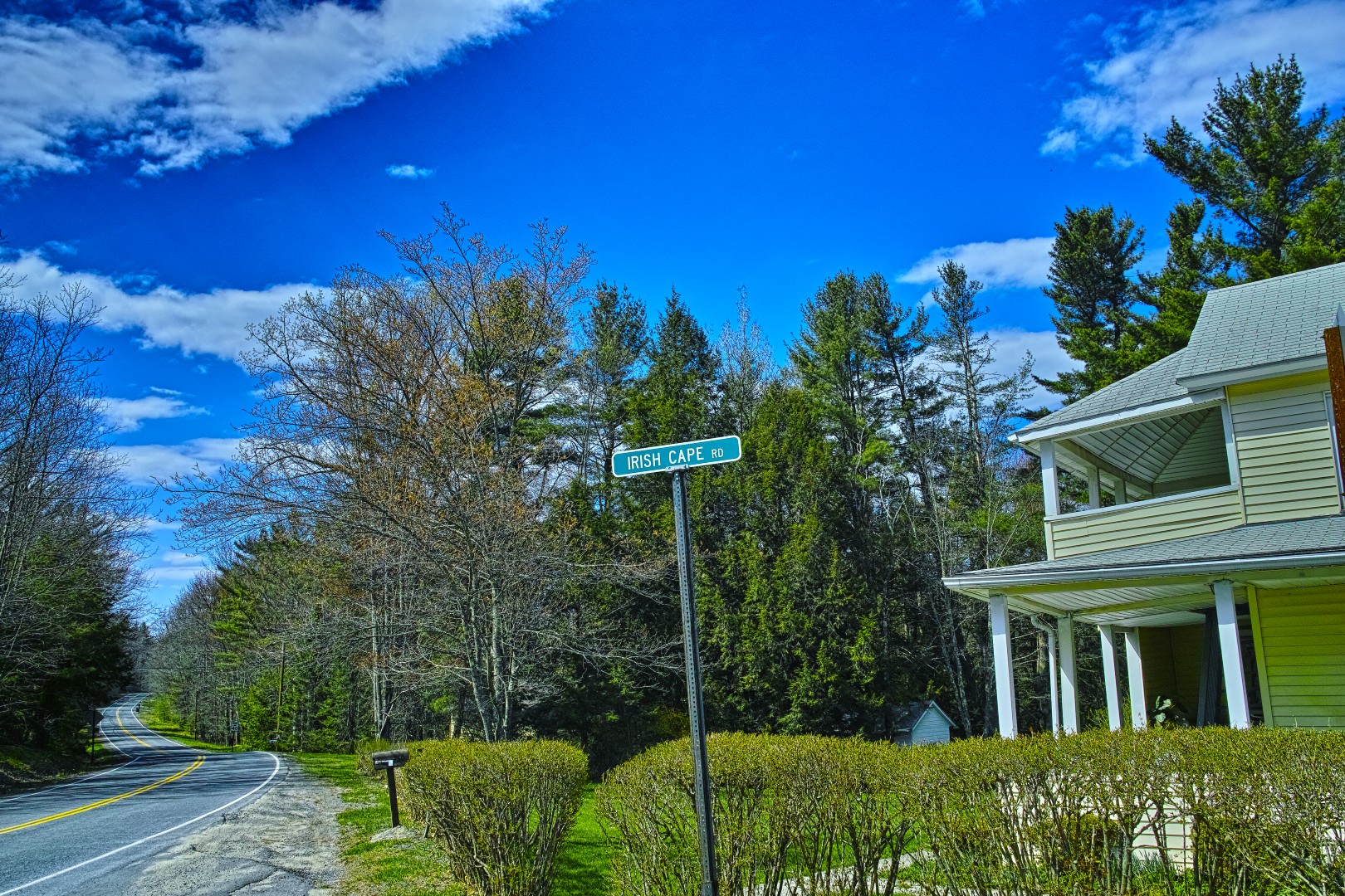
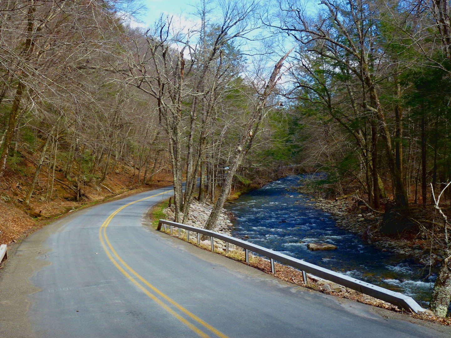
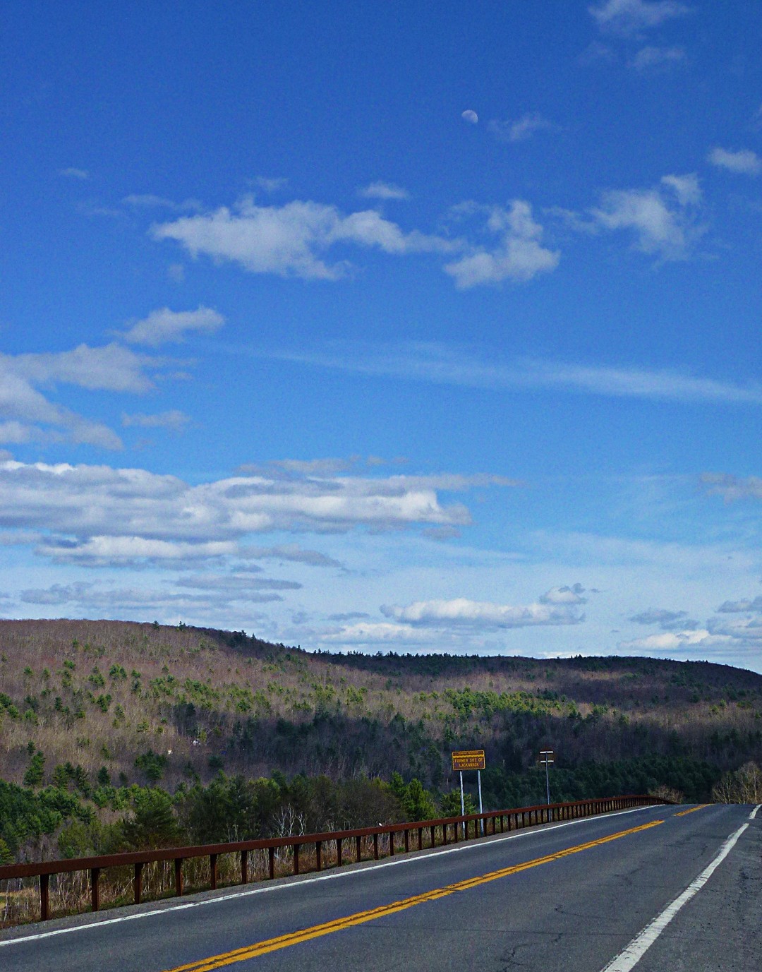
From there, we rode back on 42 crossed over to Ulster Heights Road, and then descended at very high speeds on Irish Cape Road.

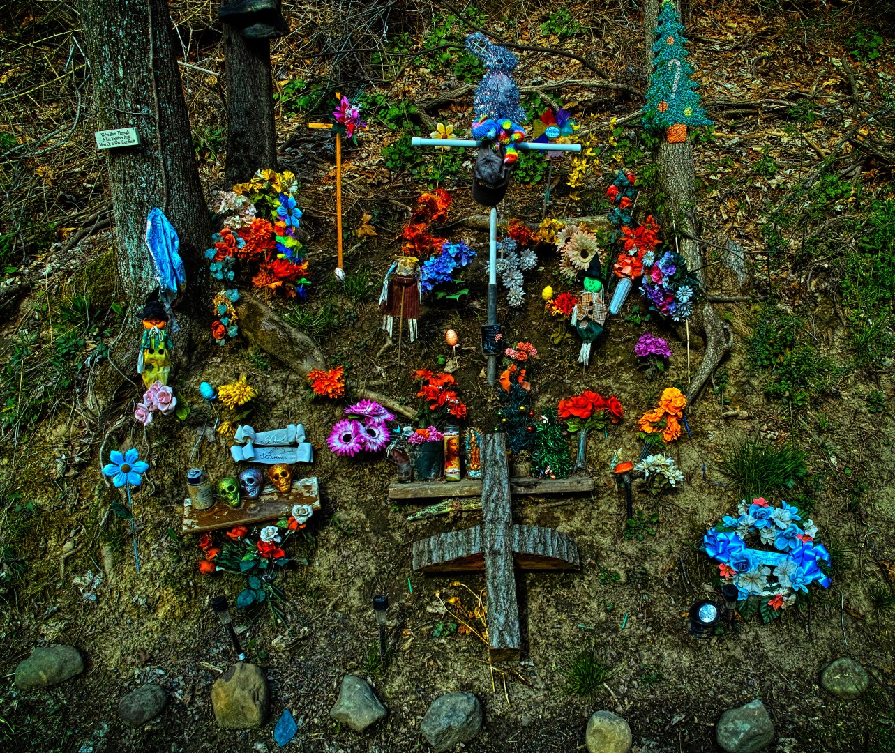
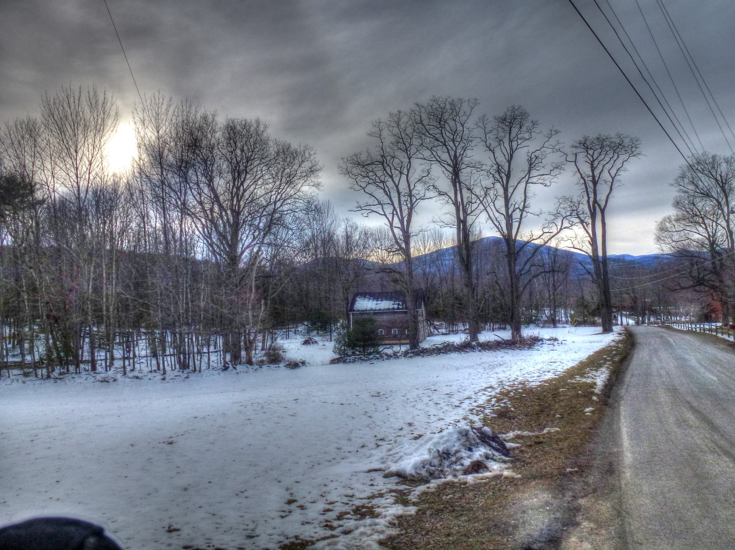
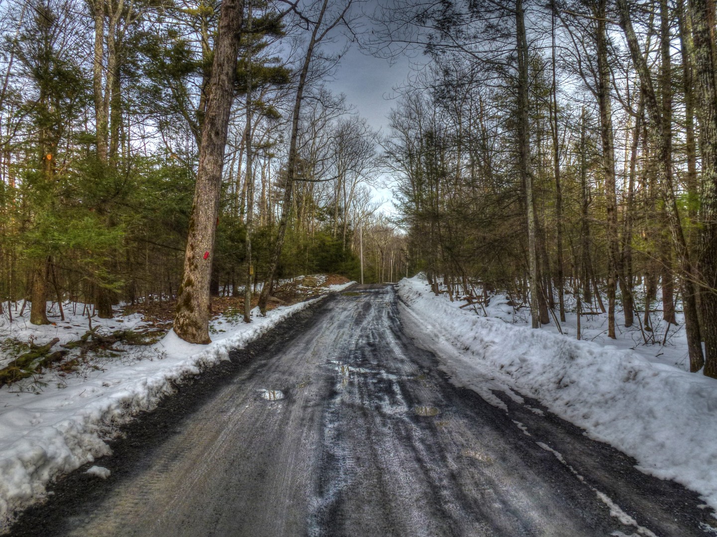
On the return trip from Ellenville, on Berme Road just past the prison, we ran into this roadside shrine. One hypothesis is that it was the scene of a fatal car accident, which would be odd because Berme Road is so torn up I can’t imagine anyone going fast enough to hurt themselves on it. (This picture also, incidentally, illustrates the resolving power of the Foveon sensor in the Sigma DP1 Merril. The second and third pictures are crops from the first).


From there, we did the climb back to my place. The countryside is lovely, but I’ve done it so many times now it’s left me wishing for a teleportation device.

And that’s all for this week. Short ride tomorrow, then off to Chicago for a couple days of meetings. I’m hoping to talk someone into a ride over Slide Mountain next week, or maybe Ferguson Road.
And one last bit of news: The 650B English is done and is off to paint. So maybe within the next two weeks the bicycle stork will be delivering something.
John
After weeks of 15 hour days, seven days a week–and only 30 minute to 1 hour daily rides–I finally told everyone to just leave me alone and took a day off. Clients, if you reading this, sorry! My efficiency is optimized when I can ride my bike. Days off are good for you and for me.
You’ll recall that, a while back, I wrote a post on the 8 biggest climbs in the Catskills. Peekamoose is just one, and it is the most accessible for me. I’ve done this route 6 times now, but this was the first time this year, and I took a new route.

Plus, this was the first time I’ve had a chance to ride the route in decent weather. Every time I’ve ridden it in the past, it’s been cold, foggy, and generally wet. I guess that goes with riding it in the fall.
The route starts at my place, as usual, but instead of taking Mountain Road, I opted to ride down to Route 213, which eventually joins up with Route 28A, which in turn takes you to the base of the climb. I spotted a cyclist headed the opposite direction on 28A, which is rare. Anyone I know?
Maybe it’s just me, but when I spot a cyclist in the distance I get in the drops and try to look serious, even if I’m just meandering along. I’m a poseur, I guess.
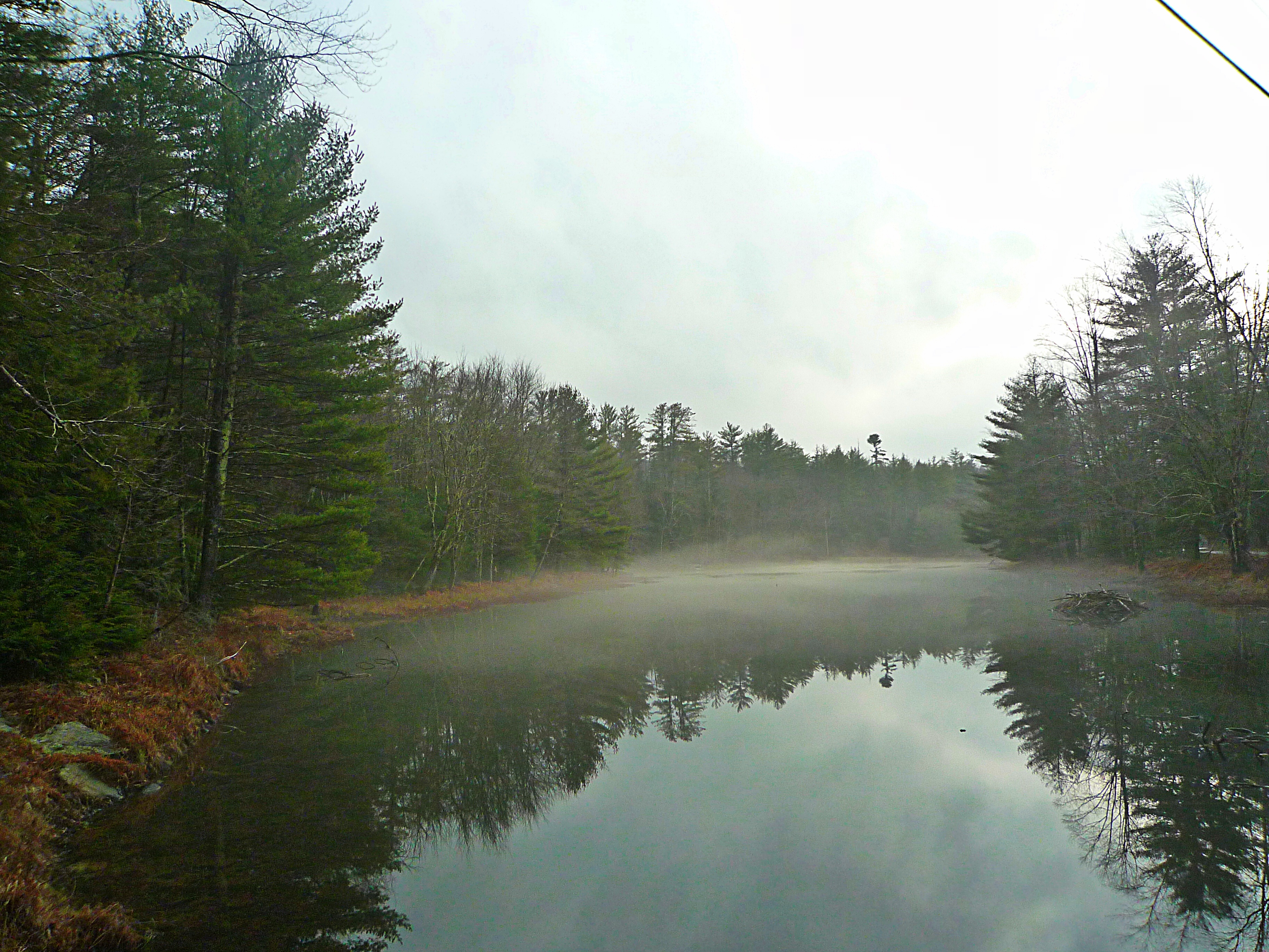
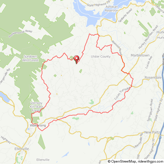
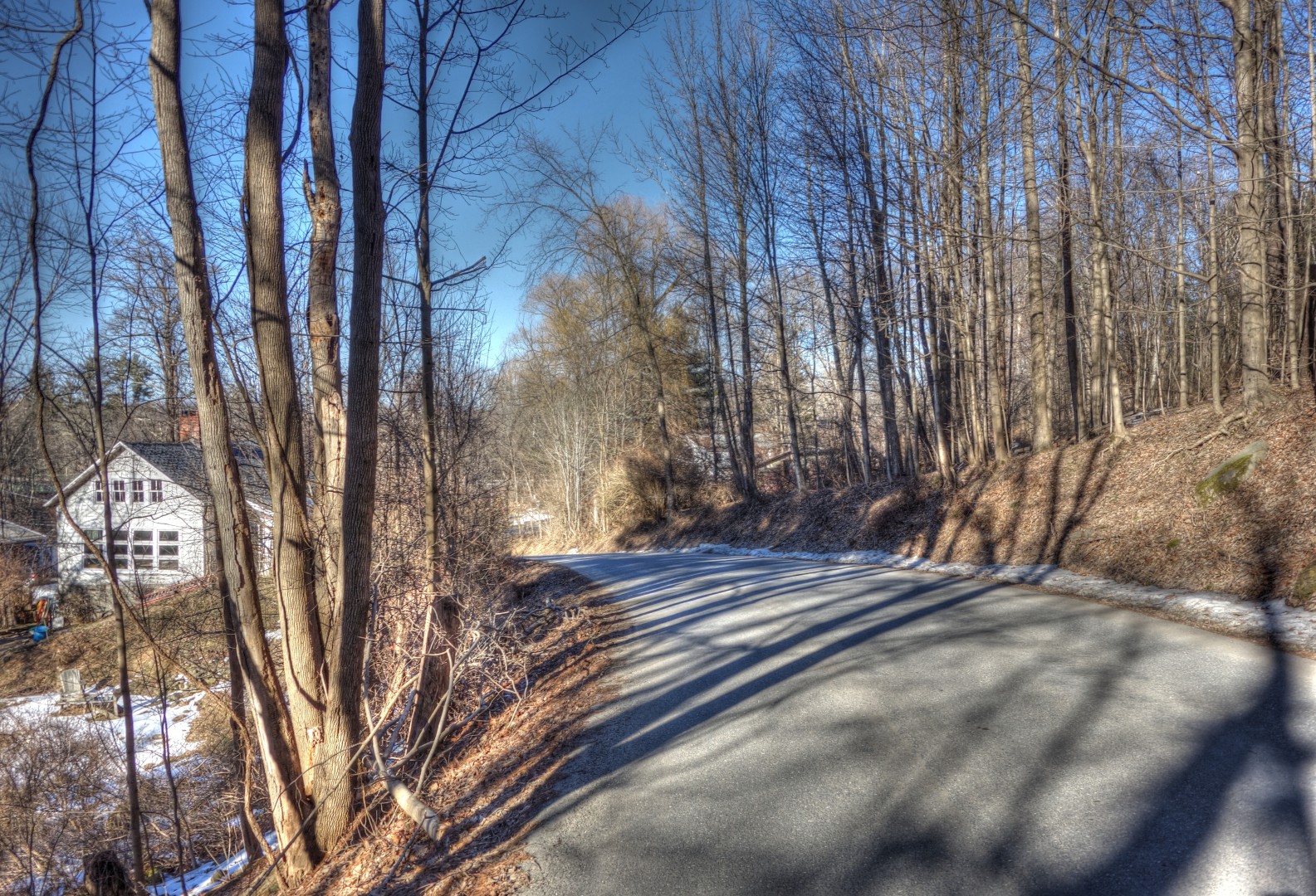
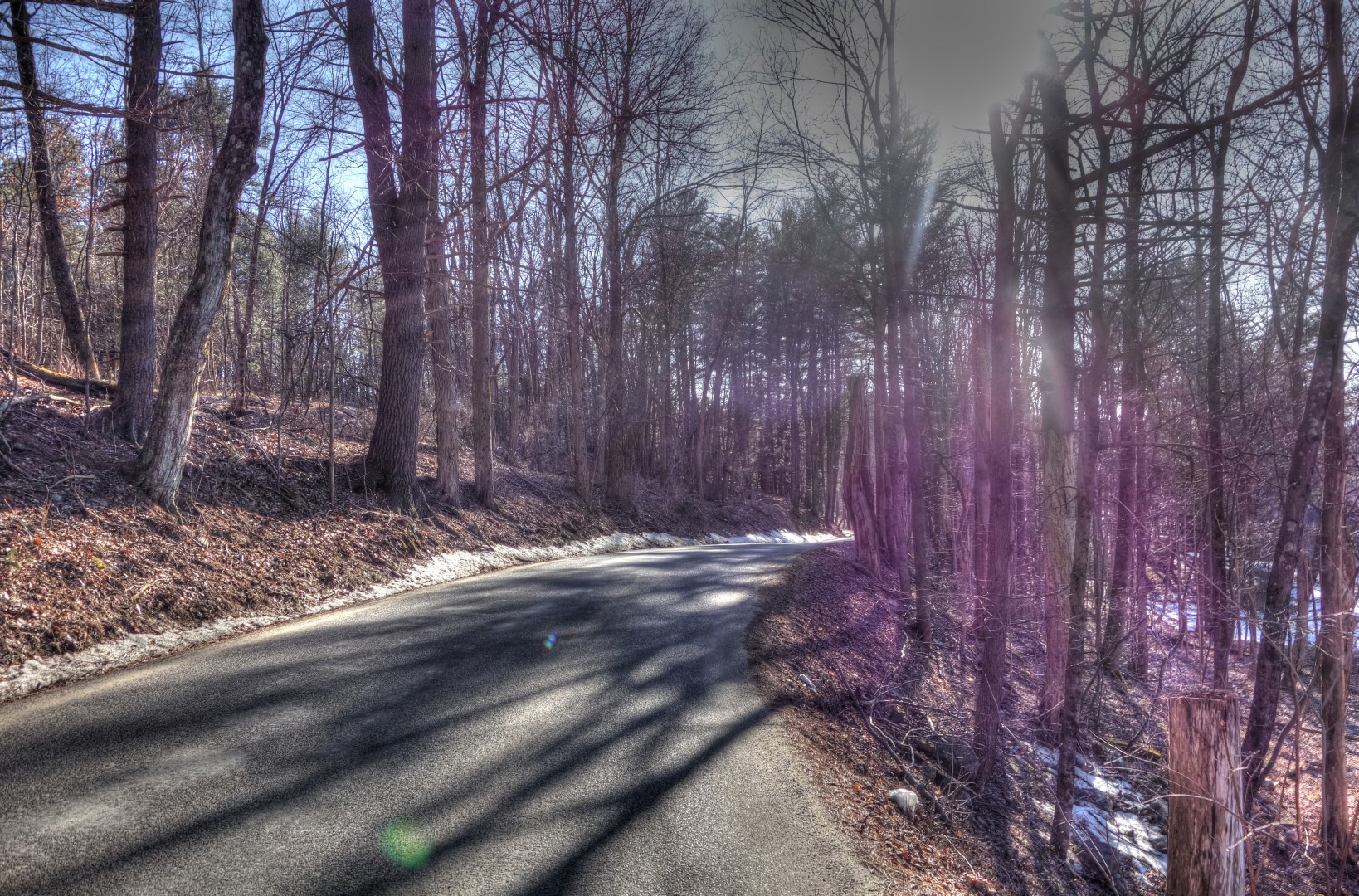
From 28A, I turned onto Watson Hollow Road, which is one of the most beautiful roads in the Catskills. Also known as Peekamoose Road on some maps.
The climb itself gets easier each time I do it. There are distinct landmarks along the climb, so I can easily recall where I felt like I was going to die on the previous ride. I’m making it to the top without too much suffering these days.
Once you make it to the hairpin at the top, you’re home free. Pretty much all downhill for the next 15 miles. My high-speed descent was spoiled by a high-velocity headwind; there was one point where I should have been going 30 mph where I was blown to about 12 mph for a moment. The following pictures are all Watson Hollow Road.

It’s really worthwhile to do this ride at least once a season. In the winter–or the spring before the leaves grow in, you see some truly majestic waterfalls on both sides of the road that I’ve heard many times before, but never seen. I tried to take a few pictures, but they really didn’t do justice to the subject, so you won’t see them here.
There are few places to stop for water between about mile 12 and mile 31 of this route, so make sure you carry everything you need, particularly in the summer. Unless, of course, you want to trust to the whims of whomever runs this shack, which is apparently open whenever the owner feels like it. In short, don’t depend on it being open when you need it.
Now, I made a choice. I advise everyone to continue on Watson Hollow, and eventually make a left on Greenville Road for a second climb that really takes you to some spectacular views. Here’s the decision point.
I took a right, which first led me past next week’s climb, Sugar Loaf.

And then led me to the Rondout Reservoir…

…and–eventually–Grahamville.

Grahamville hosts a nice deli if you want to stop. They have a full convenience store, plus they make sandwiches, etc.

After sitting in the parking lot for a while, soaking up the sun and having a nice, well, actually lukewarm, Coke, I turned onto Route 42. This is where things got interesting because it is territory I haven’t really covered before.


Ultimately, this route will take you back to 55A, and then to 55. I do not recommend traveling (south)east on 55A or 55. The pavement is extremely broken up, turning a nice descent into a white-knuckle bit of nastiness. The pavement in the opposite direction is fine. I have no idea why one side of the road is just awful, whereas the other side is nice clean pavement. It is, however, beautiful.

With that said, you might use this route instead, which keeps you off 55A and 55. I’ve done some of these roads, including Irish Cape Road. This route is equally beautiful.
The way home was just the usual. As always, regardless of which direction I travel I have 700 to 1000 feet of climbing to get back to my place.

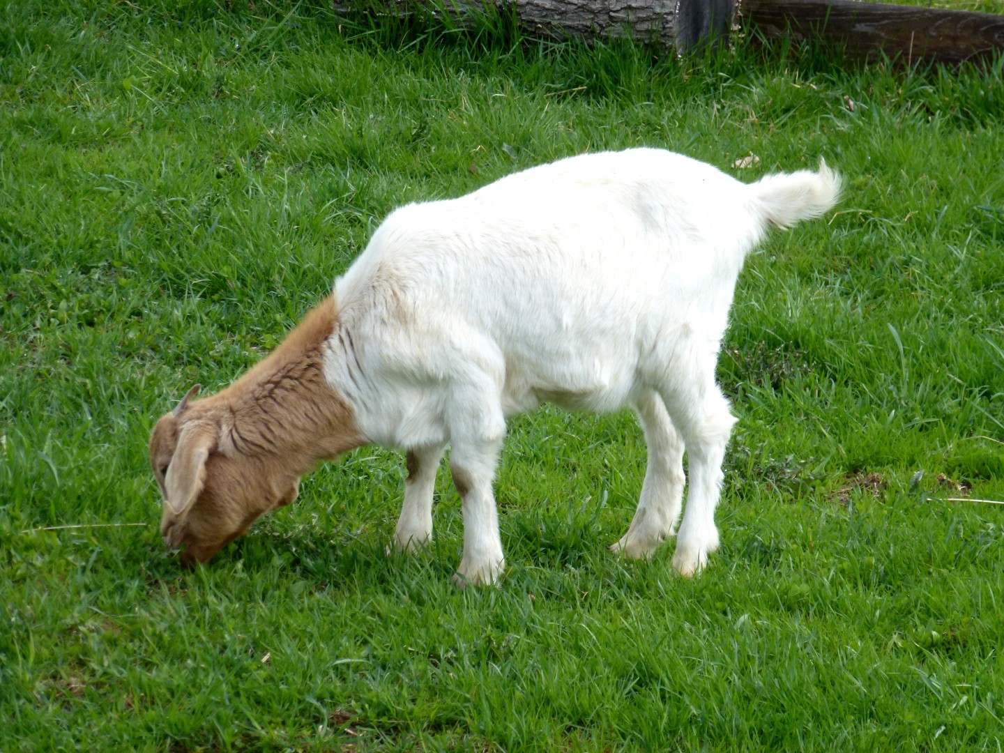
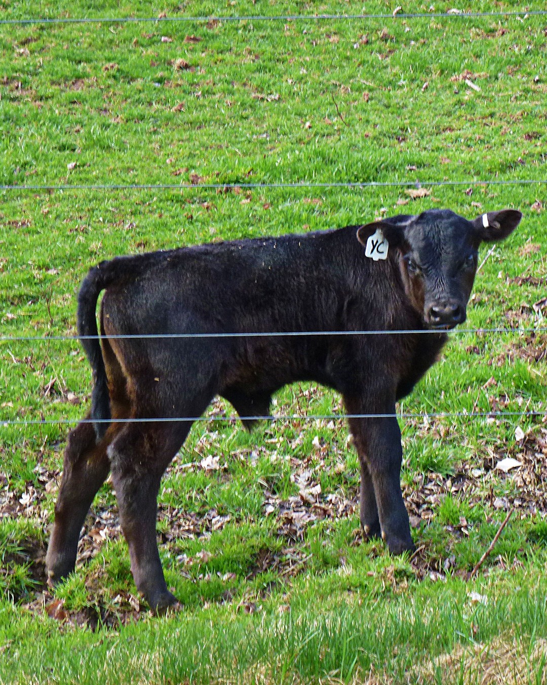
A few more pictures. First: Baby animals. Who doesn’t like baby animals? The goat was cute, the baby cow just looked plain irritated.
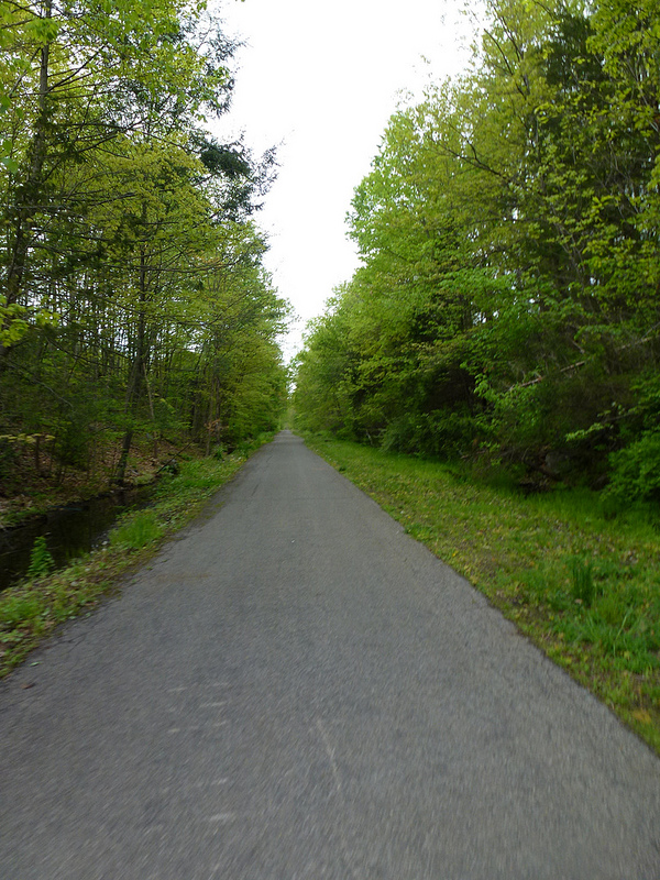
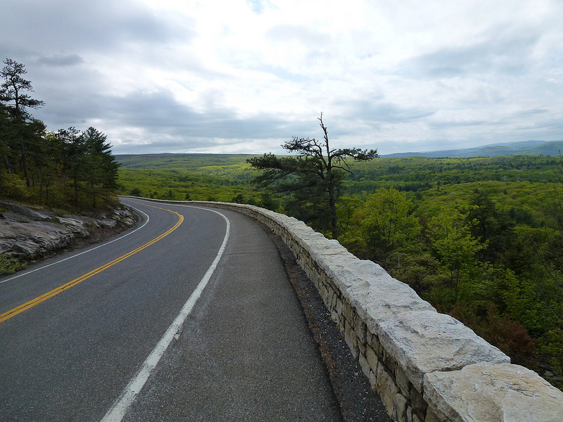
Next, a few “artistic” photos. I try and fail. The second one has nice colors, at least.


Next week: Sugar Loaf, provided the work gnomes can manage to leave me alone for an entire day. Have a good week!
John
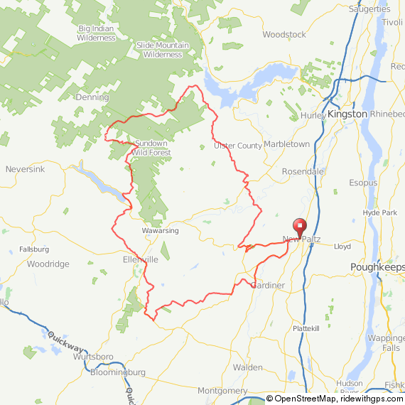
Last week, a reader asked me for advice on a killer route that would take him over several of the major climbs in the area, starting from New Paltz. He didn’t ask me to create GPS for him, in fact, he already had a good route in mind, but because I have an obsession with maps, I put together three options for Peekamoose.
First, a warning: These routes will challenge even experienced riders. Two of them include three of the finest climbs in the Catskills and Shawangunk Ridge, and one includes an additional climb which is well worth your time. If you’re an experienced rider looking for a capstone ride for your summer, one of these will fit the bill nicely, particularly if you want something in the century range.
Second, I obviously took these pictures at different seasons, and across several years. So think green!
Let’s get this party started by getting you from the train station in Poughkeepsie to the starting point in New Paltz. Don’t consider this part of your ride—it’s extremely fast with minimal effort, and it takes you on a bike path out of Poughkeepsie to Route 299.
There is considerable traffic on Route 299, but the shoulder is wide, so it is safe. Is it the prettiest way to get to New Paltz? No, but it’s the fastest way to get to the good stuff. This is what the route looks like, and the GPS can be found here. Don’t be scared by the elevation gain, it’s just because there’s a bridge on the route.

Here’s option 1. The route, excluding the transport segment to and from New Paltz, is 105 miles. You’ll begin in New Paltz by crossing the river and taking an immediate right on Mountain Rest Road. You can also go straight on 299, but this little jog to the northwest keeps you away from traffic a little longer.

Once you rejoin 299, you’ll head down to a hairpin turn which leads into the climb over the ridge on Route 55. At the base of the climb, you’ll see a German restaurant; across the street there’s a place to fill your bottles or get supplies, if needed.

Then, it’s all uphill for the next 5 miles. You’ll encounter some traffic on the way up—everyone is headed to the parking lot at the top of the ridge. Once you pass that parking lot, the traffic tapers off dramatically and you get to experience a fun 6-mile descent into Kerhonkson.
You can either continue onto 209, where there is a convenience store (take a left to rejoin the route), or—as shown on the route—you can take a left on Berme Road, which is considerably more pleasant than 209. Then, it’s on to a very short segment on 209 to take you to Lundy Road. Here, you’ll pass a nice swimming hole if you need to cool off, followed by a right on lovely Rogue Harbor Road. Lundy is extremely rough, and Rogue Harbor is outright gravel. I ride both regularly on a road bike with 25 mm tubulars, so you’ll survive, I’m sure.

Now we’re getting to the good part: the foothills of the Catskills. Cherrytown Road is lovely, and you’re going to hit some great gravel on Dug and Sundale Roads.

After that, you’ll pass by my house and head into the Catskills.
I have to warn you that although the whole section I just described is absolutely beautiful, it’s a long hard slog up a moderate incline. Trust me—I have to do it every time I ride into town!
Shortly thereafter, you’ll hit High Point Mountain Road, which will lead you to the second big climb of the day—Peekamoose! It’s a good climb to the top with transient 16% grades, but it is worth it. And here’s the bonus: An 8-mile continuous descent. That’s right, absolutely no uphill—all downhill.
Now, this route includes a second climb up starting on Red Bush/Greenville Road. You need to ride this even at the cost of all the additional effort. You’ll get this wonderful view:
Followed by a 13 mile descent with lots of gravel.
From there, you’ll follow 55 into Naponach, followed by another brief segment on 209, whereupon you’ll enter Ellenville. Stop for lunch because the worst (and best) is ahead.
From Ellenville, you’ll take South Gulley Road back over the Shawangunk Ridge. Here’s a view looking down South Gulley in the winter. You’ll be going up, sorry!

It’s apparently the biggest vertical climb in the Southern Hudson Valley. Afterward, you’ll descend on Vista Maria, and from there it’s all rolling farmland and forest back to New Paltz.
As you can tell, I endorse Route Number 1. But here are a few more options.
Route 2 will take you much the same way, but it is only 90 miles in length. On this route, you won’t climb over the ridge on 55; instead, you’ll take Mountain Rest Road over the ridge. In many ways, this is a better climb than 55, and there is much less traffic, but no views! So for all that struggle you get nothin’ at the top. From there, you’ll head into High Falls, and then up into the foothills…no, there’s no avoiding the slog up to the first climb, but again if you have to struggle you might as well do it in beautiful country, right?

You’ll go over Peekamoose, same as before, but instead of enjoying the second climb, you’ll head straight down onto 55, and then ride in back country to Ellenville. I’ve included a descent on Irish Cape Road just because it’s fun, but it does mean that you have to ride 2 miles on 209 to get back to Ellenville. Do it though, it’s worth it. From there, everything is materially the same.
Now, what about Route 3? This ~90-mile route takes you halfway up the Route 55 climb, but then takes Clove Road over, and you ultimately cross 209 to get to the foothills. This route includes the second Red Bush/Greenville climb and all the fun gravel. Again, after you hit Ellenville, you’ll be riding up South Gulley, descending Vista Maria, and then rolling farmland back to New Paltz.
I’ve covered every inch of these roads on various rides, and you really can’t go wrong with any of them. They will tax even the most experienced rider, but nearly every mile is worth the effort. I say nearly, because there are some very short segments on 209 (which really is much better than 9W, but it is the least pleasant road out here). Altogether, though, out of 90 to 100 miles less than 4 or 5 are on 209.
If you need any advice (or encouragement) my contact information is on my professional website…and check back a little later in the week: I’m putting together the Spring Route Roundup right now, and of course I’ll have a ride report for you.
John
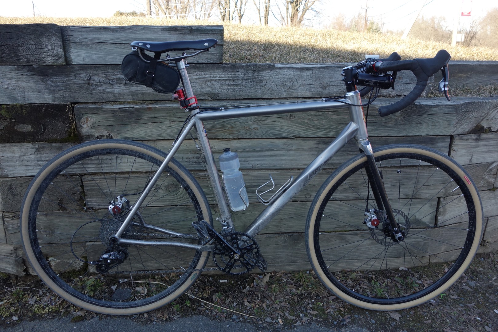
Not enough time to write a proper post, but I did get out for a 30-mile ride today. First time on the English this year. I forgot what it’s like to ride something tailored especially for me. It really is a perfect bike for my needs. I put the squealing creaky Lynskey in the basement (after removing all key components and greasing where necessary). It still has a creak despite all the work I did and a visit to the bike shop. I’ll deal with it in the fall. This was the first ride I’ve done this year that did not involve some degree of suffering due to weather.
The weather was perfect, the bike was perfect, and the ride was perfect. Looking forward to many more days of this now that the weather is improving and I’m back on the English.
So…I have plans for this week. My friend Guy is coming out on Thursday, and I’m going to take him on a ride over Peekamoose, Greenville Road, and other exciting climbs. Pictures to follow (no HDR…I’ve given up, I can take constructive criticism!)
I have plans for two posts. The first came about because Mike K asked me for advice on routes; I put together three killer routes for him that included Mountain Rest Road, Peekamoose, and South Gully Road. It sounds like he didn’t follow any of the three precisely, but hit most of the key roads anyway. Since I developed the routes I might as well publish them. Second, I’m going to write a spring route review to help guide people to the appropriate posts with good routes. Yes, you can do it by clicking on the Worth the Trip tag, but there’s also a lot of other stuff in there, and I want to write consolidated guidance.
Finally, this blog has no commercial or really any personal objectives; instead, it is intended to get people out here and riding on what are arguably some of the best and most scenic roads on the east coast (and only 1.5 hours from NYC by train, no less!) So do me a favor: If you use any of these routes, or even if you’ve used this blog as guidance for designing your own, send me a few good pictures, a few lines about your ride, and–if you designed your own route–the course. I’ll put it up on the blog. It’s nice to know that you’re doing something useful, and you’ll be helping everyone else out who follows you.
Have a great week!
John
I admit it: I like looking at pictures of bikes, I like talking about bikes, and I especially like riding bikes. Other than working, riding is the thing I do most. I don’t like working on my bikes, and when I do it, it is usually accompanied by paranoia that I’ve done something wrong and (for example) that I am going to die when my carbon fiber steerer cracks because I tightened the stem bolts without a torque wrench.
Anyway: you have to please your fellow bike obsessives, particularly those on the internet. The only way to do that is to post a picture of your bike with proper pro fit. Meaning stem slammed (or nearly so), at least 12 cm long, and plenty of drop.
Ladies and gentlemen, I bring you the semi-pro fit Lynskey. Semi-pro because my stem isn’t long enough, the sternum puncher is uncut, and I just realized that I may have the bars rotated too far up.
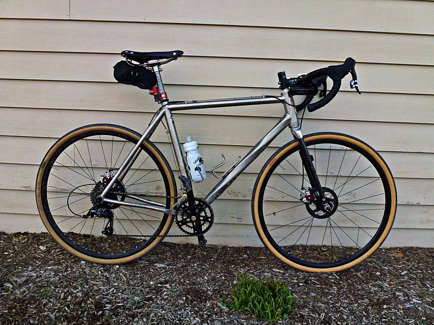
Seriously now: those of you who know me know that I suffered a serious neck injury in 2008. There were times since then where I couldn’t bend my neck back at all without my hands going numb. It was bad enough that I rode a recumbent for over a year. A low racer. In downtown Manhattan. That’s bad.
The injury required an upright, inefficient position on conventional bikes. It was frustrating because I am otherwise flexible, but the mechanical problem with my neck prevented me from assuming a more conventional position for someone who is otherwise a fit, experienced cyclist.
Well, it seems that my neck has finally healed, so I’ve been playing with my fit. I started with the most extreme position, with the intention of working back from there. But you know what? It works great: No neck pain, and riding seems easier/more efficient in this position.
I suspected this would be the case because I’ve been riding mostly in the drops for the last six months. I have a longer stem in the mail (and a torque wrench!), and once I get stem length sorted out I’ll cut the steerer.
In other news, I rode the non-boring boring loop 5 days straight, so I rewarded myself with a casual ride to Subway for a sub. Yes, Subway. Jared was haunting my dreams…
…and sometimes you just have to do it, right? That’s 120 miles in the last 6 days—pretty bad compared with this time last year, but last year we were nearly in summer in late March.
This was my route:

Here are some pictures. Click on the first one for full size, it’s pretty cool. That cliff you see in the center of the first picture is called Gertrude’s Nose, and that’s the Shawangunk Ridge. According to my local fact checker, John S, this picture actually shows Sky Top (with the tower) and Eagle Cliff to the right. Gertrude’s Nose is 5 miles to the Southwest.


I also had my first cyclist sighting this year (aside from the people I ride with). He was headed north on 213, and took a left on 209. Anyone I know?
John
I’m going to admit something: fitness and speed are really secondary objectives for me. I mostly ride to go interesting places under my own power, get outside, and take a few pictures. I don’t race, and I don’t want to. Not because I lack competitive drive, I just don’t want to be responsible for crashing other people out of the race.
I’m trying to get over my mindset that any ride of less than 50 miles is a waste of time. Frankly, my longer rides really don’t build fitness, they’re mostly for exploration and to satisfy my curiosity. It’s nice that I am in, by all accounts, extraordinary shape because of cycling, but it’s really just a side effect of my curiosity.
That said, speed and fitness are essential for getting where I want to go, particularly out here where 100 feet/mile of climbing is the norm. So I designed this, and I’ve been riding it daily for the last four days. I’m trying to bore myself into focusing on exercising, rather than being continuously distracted by my surroundings.
Twenty miles, 2100 feet of climbing, lots of gravel! It’s the least boring boring loop I could design. I decided to document it today, since it was day 4 of riding the loop and I was taking it a bit easier to recover. Some pictures for you:


It’s still quite cold out here, as you can tell by the pictures. I’m really tired of riding in the cold, so I’m keeping my rides <30 miles for the next week or two. Hopefully I’ll make up for that by getting out every day, though. Soon I hope to get back to exploration and route finding. Click on “Worth the Trip” to the right if you’re just here for the 50-100 mile routes.
John
A few weeks ago, I read a news report about a father and two sons who went out hiking and subsequently froze in 20-degree weather. A tragedy, to be sure, but I was curious how it’s possible to die of exposure in the 20s–after all, we regularly spend 12, 14, even 16 hours outside in that sort of weather with no problems.
Well, now I know…
I set out on a planned 40-mile ride. It was snowing lightly, but still above freezing at the start.
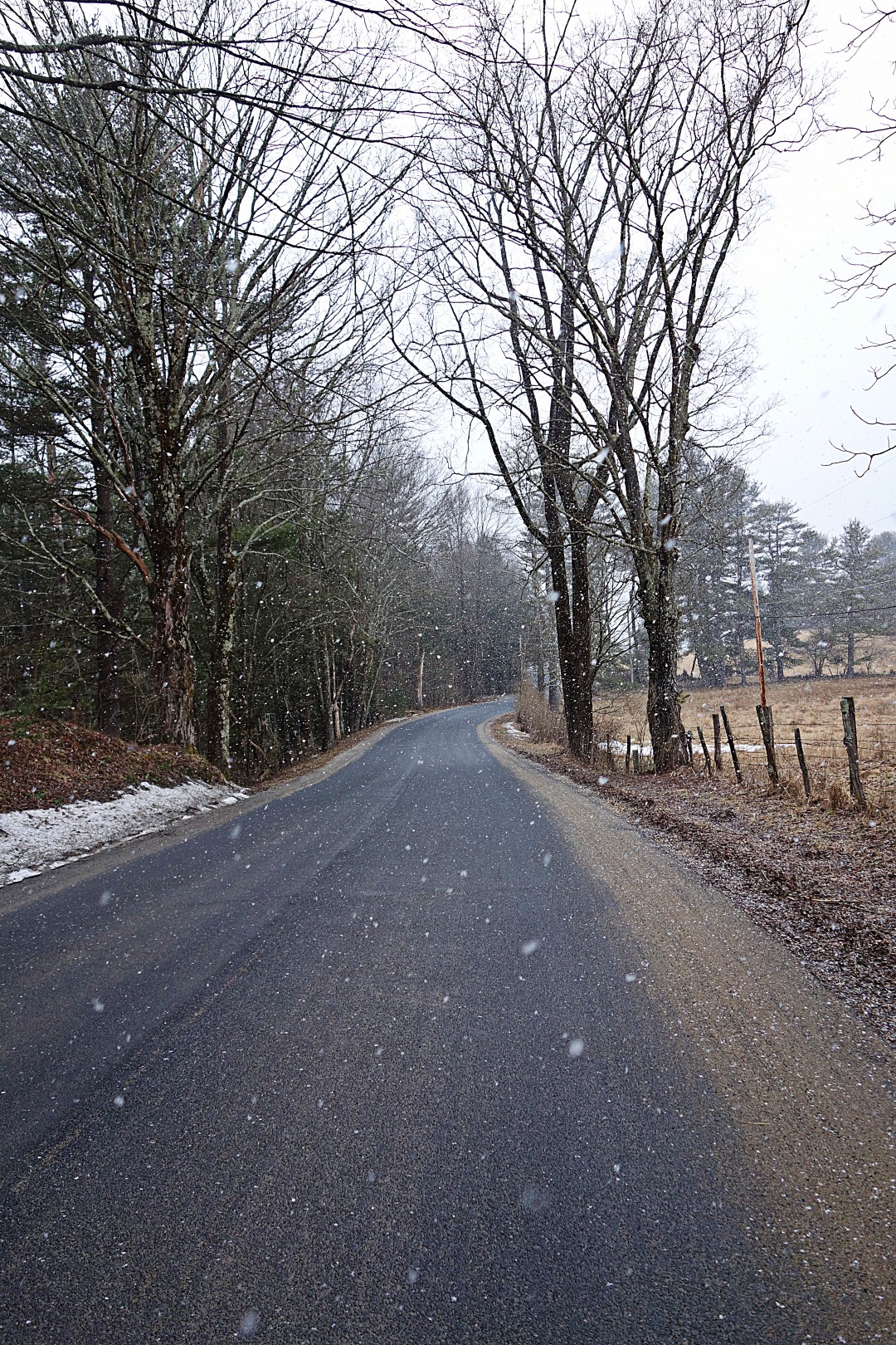
Then the snow turned into a sloppy, wet, nasty mess.


Which ended up soaking my gloves. And then the temperature dropped well below freezing, the wind kicked up, and the last 10 miles of my route was mostly descending.
I seriously thought I was suffering from frostbite. When I touched the ends of my fingers, I could hear a crackling noise–they were frozen. I spent the last 10 miles of the ride stopping every mile, unzipping my jacket and jersey, and warming my fingers by putting my hands under my arms. Two fingertips still hurt, so I must have gotten some mild frostbite.
I think I might have been better off with wool gloves, instead of the synthetic gloves I was wearing. Wool continues to insulate even when wet, apparently, but the Assos gloves I was wearing–which are ordinarily too warm even at 35 degrees–lost all insulating characteristics after getting wet.
That’s all I have to report right now. My wrist is getter, and I got in 110 miles of riding this week as it was healing. Now, however, we’ve had another 8-12 inches of snow dropped on us. Soon, very soon I will be able to get out for real rides–meaning at the very least 50 miles.
Oh, and one more thing: Thank you to everyone who has sent me e-mails about the blog, it’s very encouraging. Given that the blog is getting 150-200 views per day, I expect to see a lot more people riding up here next year. Most of my routes pass by my place at some point, so if you get chased by a giant black Cane Corso or Rhodesian Ridgeback, don’t worry, they don’t bite.
If you have any questions or requests, my contact information can be found via the about page. And again, if you’re just looking for routes, click on “Worth the Trip” in the categories to the right, or just go to my Ride With GPS page.
John
Or not.
I haven’t let my wrist fracture slow me down at all. In fact, I’ve been out for rides the last three days. I found that if I support myself by putting my right hand on the tops, and rest my left gently on the hoods, riding is tolerable as long as I’m careful not to hit any big bumps. Using this methodology, I’ve managed to ride ~80 miles over the last 3 days.
This is Brown Road, very close to home. I just took this picture because the dead plants in the swamp remind me of an alien from the original Dr. Who series.

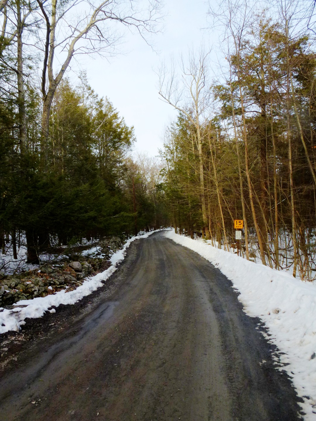
On Monday, I decided to figure out what lies at Trail’s End. Although I am opposed to out-and-back routes or roads that dead end, I mapped this road on Ride with GPS and found that it includes a pretty decent climb with 15% grades. I was also curious to see how far back into Catskill Park I could get…perhaps this could be a shortcut to Yeagerville Road?
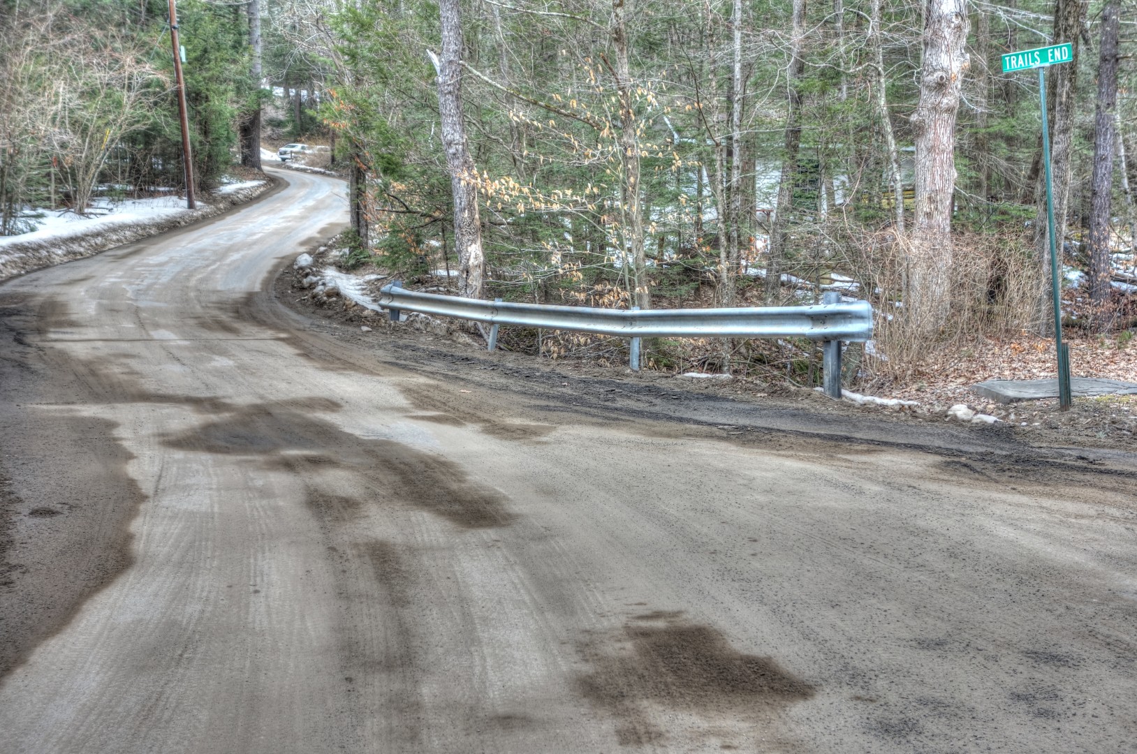
Unfortunately, when I got to the top of the road, I saw it continued on icy gravel. Normally, that wouldn’t stop me, but I really did not want to fall on my hand again. So I’ll save this discovery for a little later in the year.
On the way home, I took a new route on Kelder Highway, which is actually a narrow 2-lane road. I’ve ridden past it dozens of times, but for some reason it never occurred to me to take it. Nice views.
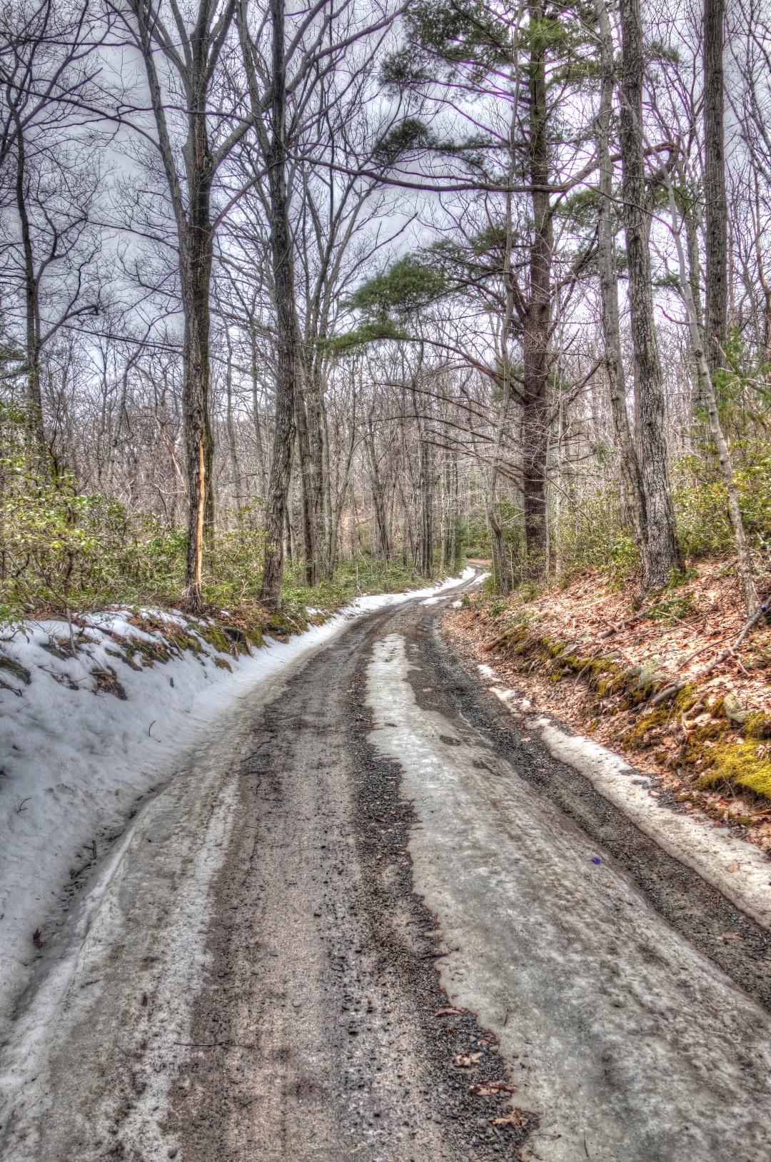
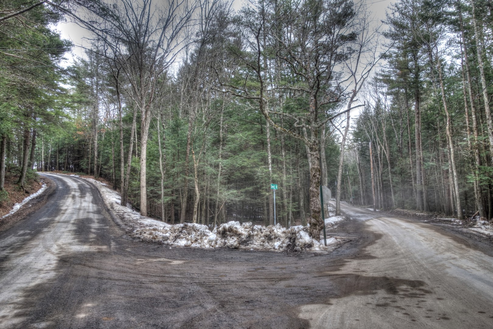
Again, close to home. The road to the right, DeWitt, is some beautiful nicely groomed gravel. The road to the left is Brown Road, which leads back to my place.
This is, I believe, Mill Road. As you can see, it was a wet n’ muddy ride to say the least. I’ve said this before, but I actually really enjoy riding in a nice cold rain, perhaps even more than a riding on a perfect 65-degree day.
The rains led to significant flooding. This waterfall along the side of the Vly road is usually barely a trickle; in fact, I hadn’t noticed it previously, even though I go this way all the time.

I installed some SiCCC rotors on the winter bike (after taking this picture, obviously). I’ll have an initial review for you tomorrow.

I did a lot of gravel grinding over the past few days, resulting in a lot of laundry. This is Kozon Road, which leads up to Ricci Road, which in turn leads to Lower Sahler Mill Road.
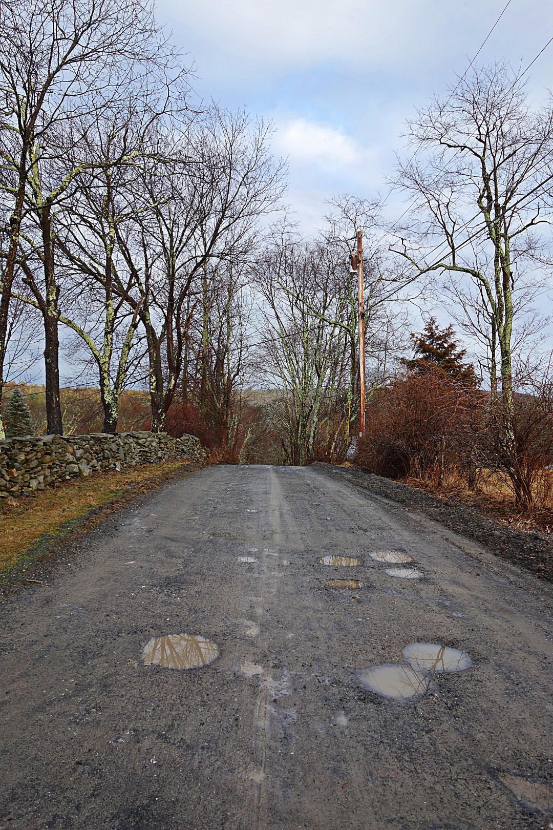
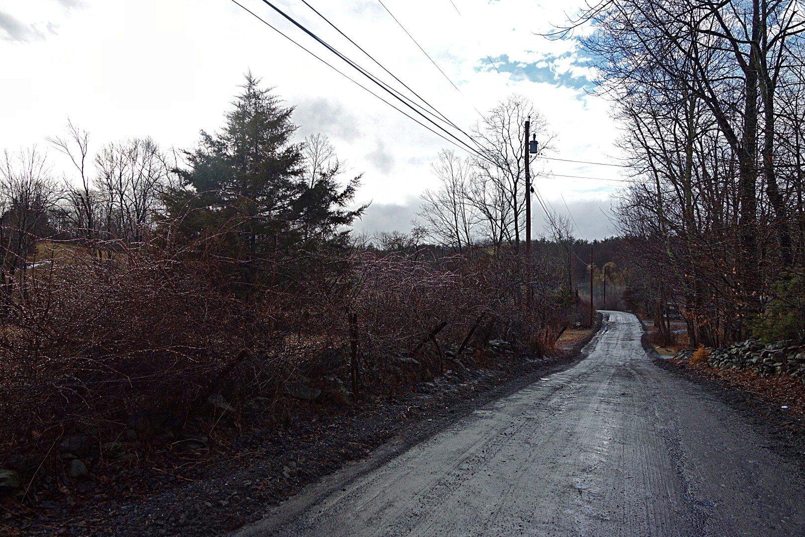
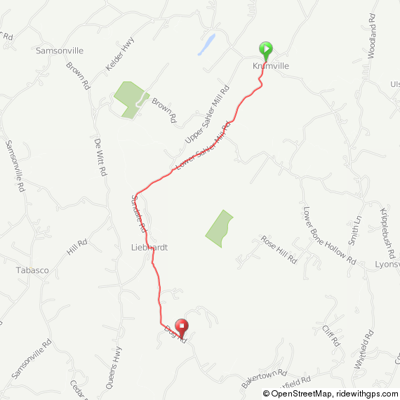
If you’re planning a route in the area and want to have a good time, try to include Lower Sahler Mill Road, starting from County Road 2. It’s the most fun you can have on two wheels. It starts with a gentle descent for about 1.5 miles–I usually get going about 40 miles an hour. Then, it turns into a gentle gravel descent for another 1.3 miles. Then, you can take a left on Dug Road and enjoy another 2-3 miles of gravel, albeit uphill. A map of this short segment is below, and GPS can be found here. Include this section in your route, I promise you’ll like it.
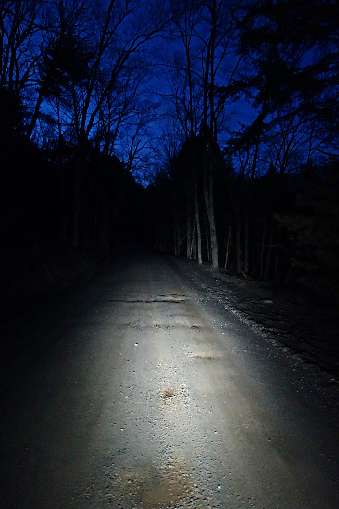
Finally, this is what today’s ride looked like. I’m using an Exposure Diablo here, which I suppose I should review at some point, if for no other reason than to thank them for manufacturing the finest battery light ever made. Believe it or not, this is on low power, which I believe provides 12-14 hours of battery life with an output comparable to that of an Edelux.
That’s all for now. I’ll review the SiCCC rotors tomorrow and perhaps post some more images of my shorter rides later this week. I’ll get back to route finding shortly, just have to wait for the wrist to heal a little more.
John
Or at least better. I’m buried under a pile of work, but at least I’m not traveling.
I made time for a 50-mile ride yesterday. I had planned on riding 20 miles and then getting back to work, but it was so nice out that I decided to play hooky. I deserve it after 21 days of travel.
Here’s the route. There are no bad segments, and it is not very challenging. If you’re looking for a fast, fun and easy route, this is a good one (GPS here).
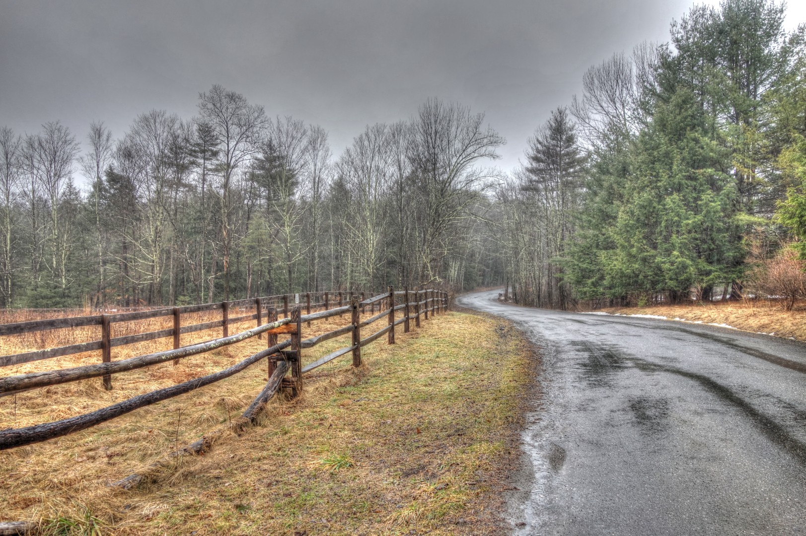
This was my first time on Berme Road. As always, I’m indebted to John Schwartz for the advice. Much more pleasant than 209.
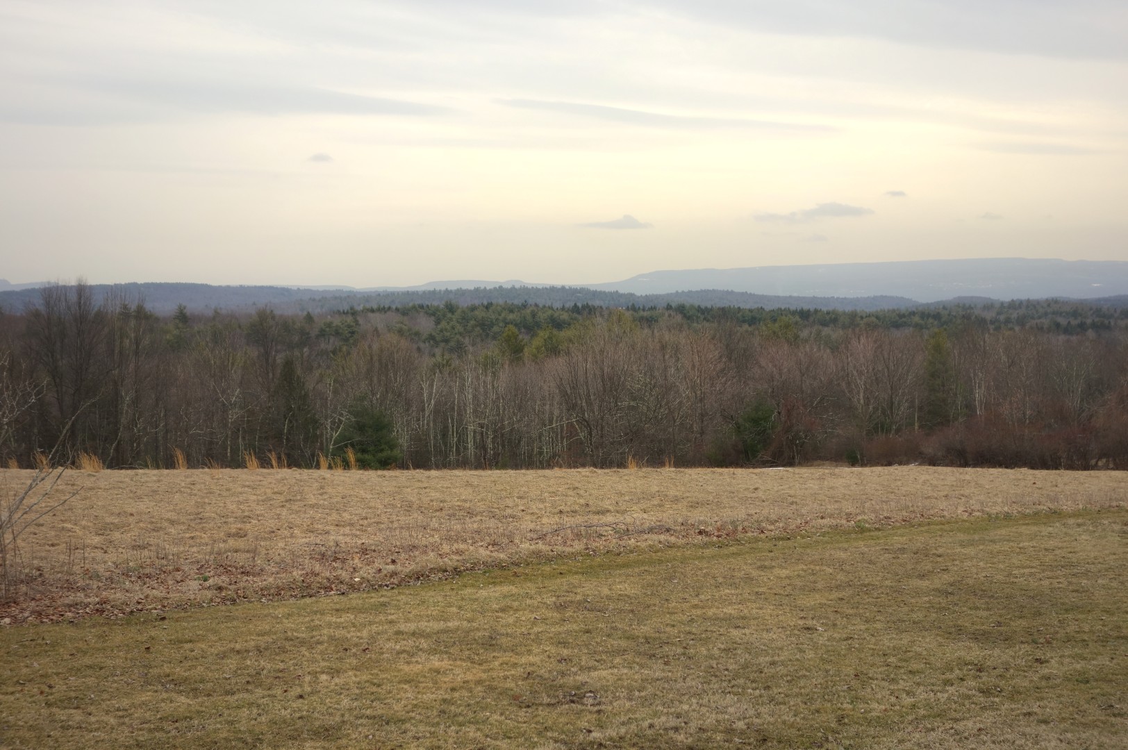
This is the view from Towpath Road, which lies to the west of the town of Accord. I recognized this from several long rides we did out of Poughkeepsie when I still lived in New York City, but this was the first time I rode it north to south.

I got dirty on Rouge Harbor road. It’s my favorite gravel road out here, although it is spooky and very isolated. There’s a good swimming hole on nearby on Lundy Road.
 Close to home. This is Old Whitfield Road. Or it might be Mettacahonts Road, I don’t really remember. Nice to finally see it again sans snow.
Finally, my winter bike. I never got around to cutting the steerer or getting a longer stem. I have a formal fit next week with Signature Cycles, I’ll let them tell me what to do, but I suspect my stem will be within 5-10 mm of being slammed and at least 2 cm longer. I removed the ugly Lynsky stickers with acetone.
I have a quick 20 planned for tomorrow. This weekend we have a 90-mile route planned that includes hitting Ferguson Road, a very steep gravel road over the Shawangunk Ridge (again, a John S suggestion). How could I resist a road named after me? And next week Doug has planned a 114-mile torture test that includes a ride to the highest drivable point in the Catskills.
Ah, life truly is returning to normal.
John
