Category Archives: routes

How to Get Your Man Card Without Buying an Automatic Weapon

Despite my obsession with politics I’ve made a resolution to keep this blog politics-free. However, I think we can all agree that the Bushmaster’s recent “Man Card” ad campaign is not only in poor taste, it’s meant to appeal to men who are…um, deficient in ways that can only be ameliorated by purchasing a hard phallic object that shoots projectiles.*

Well, I’m here to tell you that you can get your man card without buying a Bushmaster. It involves dressing up in tight Lycra and riding 116 of the toughest miles you’ll ever ride.

This is the Platte Clove ride, remapped for your convenience from Poughkeepsie. I provided a complete description of the route here. Send me an self-addressed, stamped envelope with proof of completion to receive your limited-edition laminated man card.†

route-2019136-map-full

*As someone who has considerable expertise in guiding marketing and advertising campaigns much more significant than some crappy little gun manufacturer’s campaign, I’d strongly suggest that the advertising agency that came up with this garbage be fired posthaste.
†Limited-time offer only.

John

medicalwriter.net

Mapped that for you: Peekamoose loop from Poughkeepsie

This blog is only 3 weeks old and I’m already getting complaints!

I’ve gotten a few comments that it is difficult to string together routes from the directions I’ve given…in other words, putting together the “getting there” stages with the desired routes. For this reason, I’m starting to remap all the best routes in single files/cuesheets. Here’s the first.

A few weeks ago, I posted a great route through the mountains on Peekamoose Road. Here’s a complete route in a single file, starting at the Poughkeepsie train station. This takes you from Poughkeepsie to Olivebridge, where the route starts, and then back from near Kerhonkson, while keeping you off Route 209 as much as possible.

I also chose to use the “easy” way from New Paltz to Rosendale: instead of going over the Shawangunk Ridge, you’ll take a flat, fast bike path. That way you can save your energy for Peekamoose, and it also has the advantage of minimizing time on 209. Don’t worry, the return route takes you over the ridge in the most brutal manner possible.

I’ll take care of Platte Clove and other routes over the next few weeks. Enjoy!

John

medicalwriter.net

Worth the Trip: Platte Clove

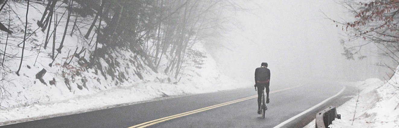
When I was living in New York City, I heard rumors of a climb…a climb so awful that people flip off the back of their bikes if they’re not careful. A climb that makes pros cry like babies and walk their bikes up the hill.

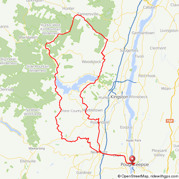
After a little research, I found it: Platte Clove Road, just west of West Saugerties. The climb is so steep—averaging 12% for 2 miles with maximum extended grades exceeding 22%—that professionals riding in the Tour de Trump had to get off their bicycles and walk. I set this as my goal ride for 2012. But, being who I am, I set out to conquer Platte Clove only 2 weeks after moving up here.

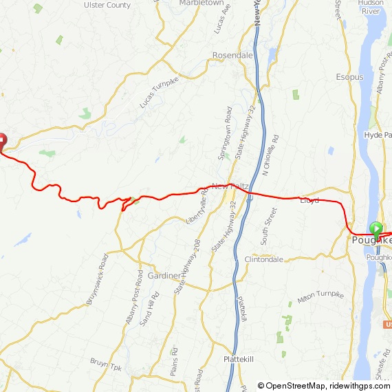
I set out late on a Sunday morning, with the intent of riding the 65 miles and being home in time for an early dinner. The route starts with a nice, easy, rolling warm up on Krumville Road. “Down the Lane” road was closed, so I took a brief 2-mile detour to get back on track (instructions below), spinning past the Ashokan Reservoir and some lovely scenery.

12_pe (Large)

I stopped at a gas station in Woodstock to top up my bottles and get a little food. Past this point, there are few opportunities to eat or refill your water bottles until Phoenicia, so be sure to do so now. Here, I had my only encounter this year with another road cyclist. Cyclists seem to be an exotic species out here in the Catskills. Alternatively, the relative scarcity of roadies in the area might be explained by the fact that we’re more spread out than people riding out of NYC—on any decent weekend, there’s a bicycle traffic jam on 9W north from the George Washington Bridge. Depending on where you live it can take an hour or more of misery to even get out of the city on a bicycle, and 9W is unpleasant at best, particularly north of Nyack. You would think that some of them might consider taking a train to ride somewhere decent. Maybe there’s safety in numbers?

I waved, he waved, and I continued north on West Saugerties Road to my date with destiny.

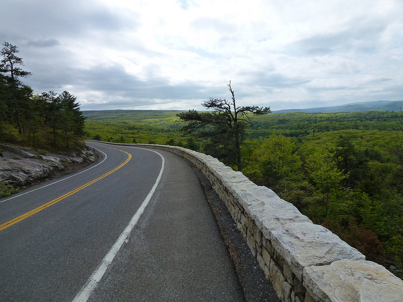
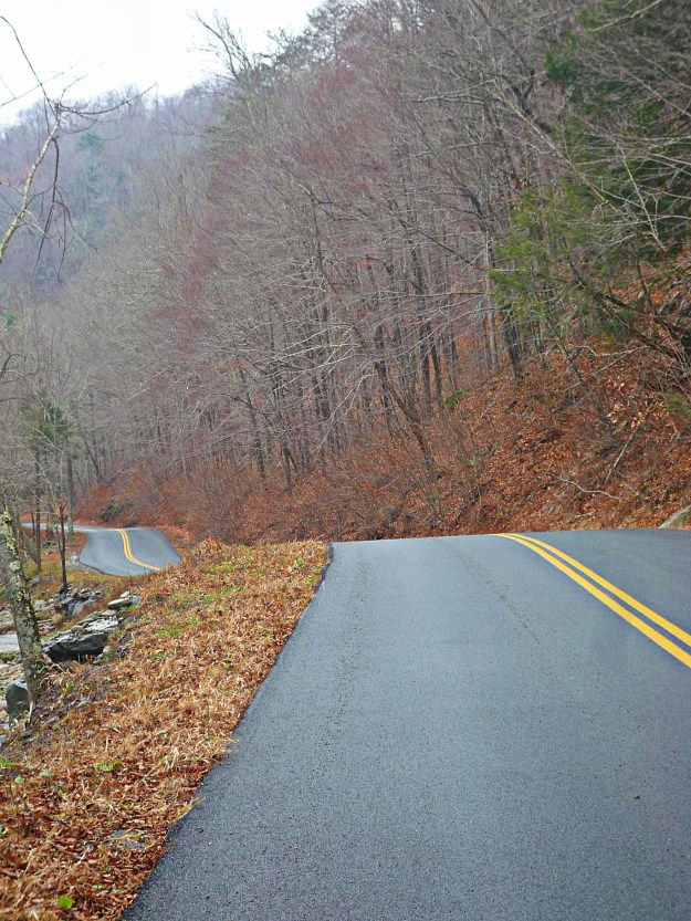
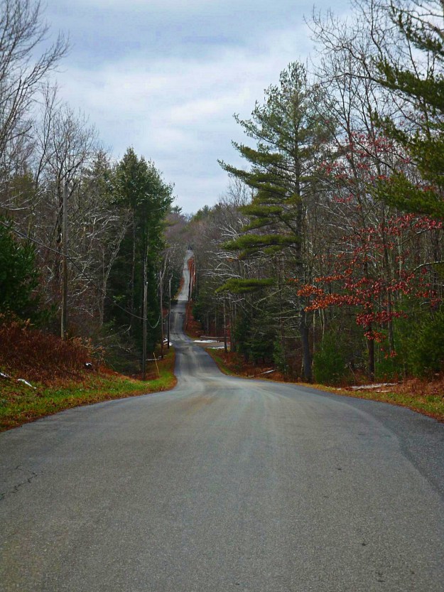
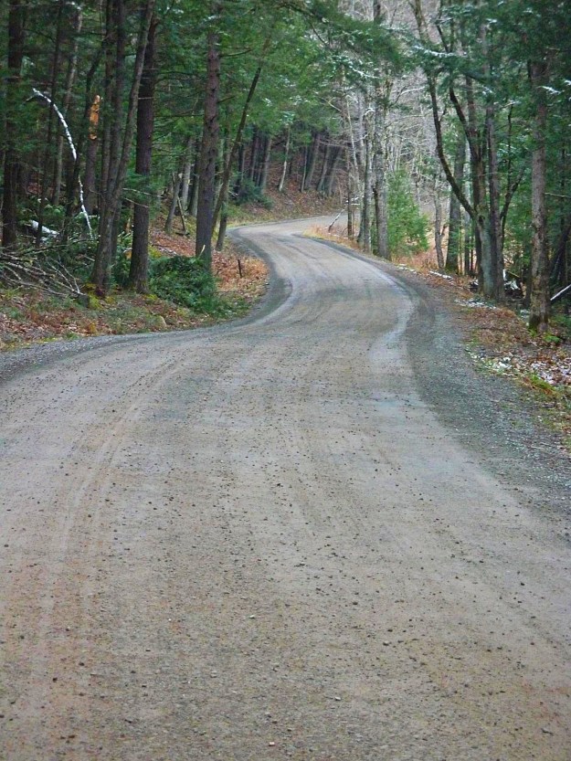
West Saugerties Road will lead to a T intersection. Take a left, and continue on West Saugerties Road, where you’ll have your first sighting of the challenge ahead.

11_pe (Large)

You’ll see this sign, which marks the beginning of Platte Clove Road, one of the most difficult—if not the most difficult—climbs in the northeast. Over 1200 vertical feet in only 1.4 miles.

10_pe (Large)

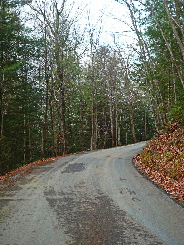
Platte Clove Road is officially closed and unmaintained from November to April, but I don’t think anyone is going to stop you from riding it even in the off season. Just use some common sense and don’t try to climb it in inclement weather. And don’t ride down Platte Clove Road. There’s no guardrail, and even though the southern edge of the road is nicely shaded with trees, it’s a long way down if you blow a turn.

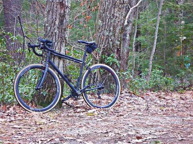
I am proud to say that I did not walk at any point. I am less proud to admit that my achievement was primarily attributable to sensible gearing.  Vanity gearing has its place on easy Bear Mountain runs from New York City, but out here it’s just not advisable, even if  you are an exceptionally strong rider.

7_pe (Large)

6_pe (Large)

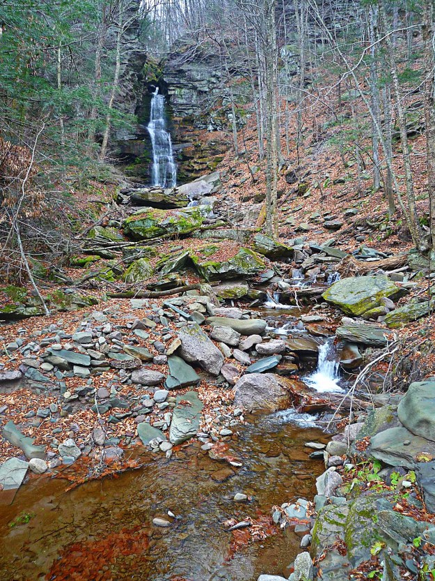
The climb is well worth it. The Clove is beautiful and has been the deserved subject of many paintings by Thomas Cole and other members of the Hudson River School. This view is arguably one of the most painted in the Hudson Valley.

9_pe (Large)

Incidentally, you can also pick up Devil’s Path from Platte Clove Road. The aptly named Devil’s Path features 4 summits, little water, and is one of the toughest hikes in the Catskills. There’s a parking lot about halfway up the climb if you’re interested in hiking a section, just don’t bring children or pets, hikers are injured and some even die every year on Devil’s Path.

Platte Clove Road leads to one of the most inaccessible parts of the Catskills. At the top, you’ll find the Bruderhof (literally, “place of brothers”), a Christian community founded in 1920 by a Protestant theologian named Eberhard Arnold, his wife Emmy Arnold, and her sister Else von Hollander. Arnold was born in 1883, and at age 16 had an experience that he later described as God’s acceptance and forgiveness of his sins. He left the Protestant state church in 1908, and, as near as I can tell, joined the Hutterite branch of the Anabaptists. In 1920, he founded the Bruderhof in Germany, a Christian group that believes in living “in full community,” meaning that there is no private property. Seventeen years later, in 1937, the Nazi government ordered them to leave the country. They moved to England, but as German nationals during World War 2, they were offered the choice of internment or emigration. They chose to move to Paraguay, and finally–in 1954–to the United States.

The Platte Clove community, home to 250 people, was founded in 1990. It’s located on land formerly owned by the New York City Police department, which had built a resort hotel—informally known as “Police Camp” —complete with a movie theater, casino, bar, lounge, swimming pool, and ballroom. The Police Camp opened in 1921 and closed in 1983.

I was then treated to a cold rain. The camera went in a zip lock, so I didn’t take a photo; the following image is from the Platte Clove Community website.

platte-clove-4

The Catskill Bruderhof and the new Police Recreation Center are open to the public every day. I’m not sure if they will feed you, but you may be able to refill your water bottles.

After Platte Clove Road, you’ll ride over some gently rolling terrain high in the mountains. A nice recovery from the climb, and some beautiful scenery to keep your mind off the pain.

4_pe (Large)

From there you’ll take a left onto route 214…

2_pe (Large)

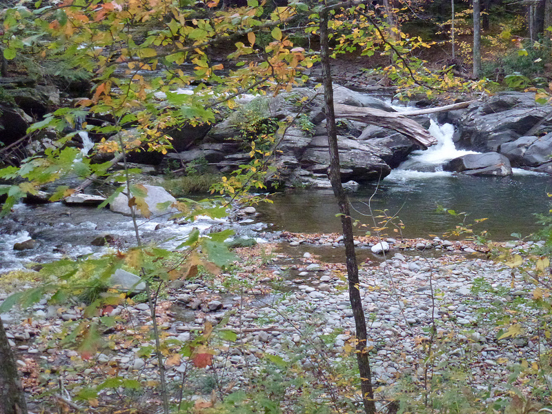
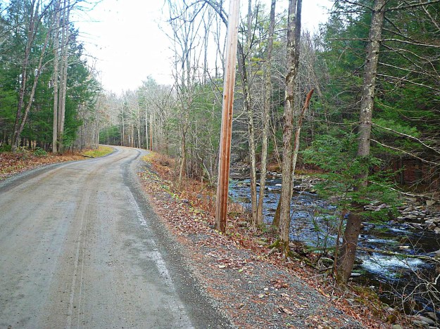
…and after a few more miles of a gentle false flat you’ll hit a 16.5 mile descent past Notch Lake and Hunter Mountain. At mile 46 you’ll pass through Phoenicia, which—despite its population of 306—hosts a number of good restaurants. As usual, I skipped a formal meal in favor of some Power Bars and a Coke in the local gas station. On your way out of Phoenicia, you’ll briefly follow Esopus Creek, famed for its trout fishing.

From there, you’re home free!

I rode 75 miles—about 10 miles more than the planned route. Although it was a short ride by my standards, the steepness of the climbs make it as tough as any single day ride I’ve done before or since. This is what I’d call a destination ride—it’s worth the trip and even a stay in a hotel in Stone Ridge or Woodstock. Here’s the original route without detours:

route-1748336-map-full

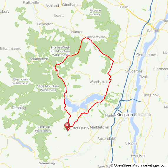
The Garmin file for the route, starting from near my house, is here. If “Down the Lane” Road between miles 5 and 6 is closed, simply take a left on 213, a right on 28A, and then a right on Beaverkill Road to rejoin the route. If you want to start in Stone Ridge, take this route to the start on Krumville Road. You could also start in New Paltz or Poughkeepsie (you will need to follow route 209 from Kerhonksen to Schoonmaker Lane, just before Stone Ridge, to pick up the route).

Enjoy, and let me know if you can make it up Platte Clove Road without a break! In a few weeks I’ll post my favorite 80- to 90-mile route out of Brewster, the last direct stop on Metro North. A summer classic, and perhaps one of the best rides ever. So good, in fact, that it is one of the few rides I repeat multiple times each summer.

John

http://www.medicalwriter.net

Lundy Road: Highway to Hell?

On the right, Rogue Harbor road. Lundy Road continues on the left. Follow for 3-4 miles  to Pottersville. The road becomes extremely rough, passable only by Jeeps, bikes, and hikers.

Image

The area is quite isolated today; I can’t even imagine what it was like 100 years or more ago. A milling town called Potterville was founded here in the 19th century and named after the owner of a lumber mill, Francis Potter. Potter’s mill was the main source of income for the townspeople until it burned down. Because it was the sole employer in the town, people began leaving. In 1927, there was a flood that accelerated the exodus.

According to Ulster County records, several murders occurred there; a man killed his family and then killed himself; in another incident a murderer was caught and hung in the town square. I’m not superstitious, but some who have visited the remnants of Potterville report a feeling of being watched.

The land Potterville once stood on is now owned by Open Space Institute and the buildings have been demolished, although you can still see some foundations.

The road and the country up there are beautiful, but I have never seen anyone on Lundy Road past this point…scared maybe? Perhaps one year I’ll  organize a Halloween ride up Lundy, to arrive at midnight.

Getting there from NYC: Take the Metro North to Poughkeepsie, and then take this route, which I described in a previous post, to get to Kerhonksen. Then take this route  to the end of Lundy. Fat tires are a good idea, but I regularly ride this route on my precious…my precious…ahem, excuse me…on 25 mm FMBs.

Good luck, and if you make it out alive let me know.

Image


Getting There: Part I–The Hard Way

Over the next few weeks, I’m going to post a number of different routes to the starting points of my rides. We’ll start with one that I’d consider intermediate difficulty. The route starts in Poughkeepsie, New York, which is easily accessible by Metro North Rail from Grand Central Station.

It includes one long, but not particularly challenging, climb over the Gunks on route 55.

Image

You’ll pass over the Walkway on the Hudson–the world’s longest pedestrian bridge–and continue for 5 miles on a bike path.

Image

If you’re using my GPS route, your device will go crazy here. Don’t worry…for some reason Ride With GPS will no longer allow routes to follow bike paths, so I had to draw lines. Just silence your device and follow the bike path until you come out at a ball field nestled in the hills.

Image

Ultimately, you’ll emerge on Route 299. This road is busy, but there’s a wide shoulder and it is ever so slightly downhill into New Paltz. You can easily complete this short segment in a few minutes at 25-30 mph, provided the wind cooperates. Continue through New Paltz, down the hill, and cross the bridge over the river.

Here, you’ll have a decision to make…either way you’re in for a climb. If you take a right, you’ll climb on Mountain Rest Road. If you go straight, you’ll climb on 55 through the middle of Minnewaska State Park. Today, we’ll pretend we went straight, continuing on County Road 6 past this lovely field.

I’d actually recommend this route for the trip out to the good stuff, and then taking Mountain Rest Road on the return trip. You can find a description of that climb on the Rapha site. Trust me, it’s not as bad as it sounds; in fact, my friend who rides a 30-lb bike has accompanied me on several occasions up this climb, no problem. More about that in a separate post.

Image

Between mile 16 and 17, you’ll hook around to the right and start climbing on 55. At the base of this climb, though, there’s a German restaurant, the Mountain Brauhaus, with excellent food, albeit decidedly 70s decor. There is also a convenience store across the street as well as a tiny Eastern Mountain Sports shop. Have some spatzle and fill your water bottles. At some point, I’ll post a route with the Brauhaus closer to the end. It’s not a good place for a meal at the beginning of a ride, but it sure would be welcome after a hundred miles!

Image

When you’re done admiring the waitresses in their lederhosen, continue up 55. The climbing begins at mile 17, and continues through about mile 21. It’s a Cat 2 climb; average grade 3.5%, maximum grade 9.2%.

You’ve reached the top at mile 21. Not much to see there, but if you pause during your 7-mile 50 mph descent, you’ll get a great overview of what lies ahead.Image

At the base of the descent, you’ll reach a T intersection. There’s a gas station where you can refill or get some packaged food; if it’s hot out you’ll definitely have gone through two bottles on that climb.

Where you go from there is up to you, but try to minimize time on 209, which is the only really busy road in the area. If it’s hot out and you need a break, take a left on 209, a right on Lundy, and continue to the secret swimmin’ hole. Just don’t tell the locals who told you how to find it!

Image

You can find the train schedule here. You should have a bike pass, although in 5 years I was only asked for one once. They can be had for $5 at any window in Grand Central. Also bring a bungie cord to attach your bike wherever you can find a spot in the car. The best spots for bikes on Metro North are, unfortunately, usually adjacent to the bathrooms.

The GPS route can be found here.

No more posts until next week; I’m off to California to lend my wisdom to an advisory board.

Enjoy!

John

www.medicalwriter.net

Worth the Trip: Peekamoose 52

(Retrospective note: I have also mapped this complete route out of Poughkeepsie. You can find it here.)

This past Sunday, I was fortunate enough to have excellent weather for what I thought would be a quick 52-mile ride up and over Peekamoose Road, a narrow, poorly maintained road passing through the Catskills. This was the route I developed on Ride With GPS; I planned from the beginning to follow it only loosely because I wanted to explore some of the side roads that extend off of Peekamoose into the deep mountains.

route-1841918-map-full

I had planned on getting an early start. However, my wonderful girlfriend decided to cook me breakfast, so it wasn’t until 10 am that I set out with a belly full of pancakes and fruit salad.

The route starts with Grassy Ridge Road, a rolling but easy warmup for what’s to come. I definitely needed the warmup after that breakfast.

1. Grassy Ridge Road

We continue on High Point Mountain Road, which leads past the Ashokan Reservoir. This is the low point of the ride. Not emotionally…in elevation.

4. Ashokan Reservoir from High Point Mountain Road

Watson Hollow Road leads into the mountains. I took my first detour here onto Moon Haw Road, which leads high into the mountains and ends in what looks like a few trails into the park.

6. Watson Hollow Road

8. Headed into the Mountains

7. Headed into the Mountains

The climbing begins with a slow and painful crawl up Peekamoose. The climb is steady from mile 8.0 to mile 13; maximum grade, 16.5%. I was swearing at myself by the time I got to the top, and I took a few moments to contemplate the sheer stupidity of what I do for fun. As a note, you’ll want to carry ample water and perhaps some food if you are taking this route during the off season, as there are no convenience stores for a refresh. During the season, you’ll see a shed at about the half way point, run by a local who sells the basics.

11. Peekamoose

9. Peekamoose

Once you make it the top, though, you are rewarded with a high-speed 7-mile descent into the next big climb, and some very nice scenery.

If you’re using my GPS route (link below), note that your GPS will occassionally indicate that you are off course. You’re not, and your GPS will find the route again in a few seconds. It’s not like there are any other roads to take, anyway.

12. Peekamoose

13. Peekamoose Waterfall

Peekamoose tops out at 2100 feet after a second climb (not as brutal as the first). I know it’s not much compared with the Rockies, but it’s what we have to work with. From what I understand, though, the roads around here are a lot less forgiving–that is to say, the people who planned and built them didn’t give a damn about extended 15% to 22% grades (more about that later, when I write about Platte Clove).

Here’s the view from the top of the ride.

14. At the top of Peekamoose

From Peekamoose, I turned onto Mill Road, which after a terrifying descent on broken pavement quickly turns into gravel. At exactly the wrong time, meaning just when you’ve hit 50 mph from the descent.

16. Mill Road

From there, it’s a quick trip on Route 55 to Naponach and a diner with edible food. You’re looking at the Gunks in this photo; if you continue on 55 you can climb up and over, ending up in New Paltz and, ultimately, Poughkeepsie. There are easier ways to get there, though.

19. 55 Going into Naponach

The route as shown is 53 miles. With exploratory detours, I rode 72 miles with about 7300 feet of climbing. Not counting the 5-mile section on route 209, I probably saw 10-15 cars the entire day.

A good day.

This route is definitely worth your while. Add in a trip to and from Poughkeepsie (preferably over the Gunks) and you can have a great 100-mile day. I’ll post later this month on good routes from Poughkeepsie to the starting points of my rides.

The complete GPS route can be found here.

John
medicalwriter.net

Ride Report: First sub-32 degree ride of the season

Every year, I turn into a chicken in late November when the weather starts getting really cold. I start thinking up excuses not to ride, and I’ll even skip one or two. I always get over it after a week or two of cold weather, after I realize that—provided I’m dressed properly—I’m not going to die after all. In fact, riding in the cold is a blast.

Today was my first sub-freezing ride of the season. It was only 26 miles, and it might have been 33 or 34 degrees in the sun, but it was pretty damn cold with the wind. I started at my place in Olivebridge, and hit about 10 miles of gravel, starting with Woodland Road, which leads past So-Hi campground.

Unfortunately, the two great parts of the route are linked by Route 209, which has relatively heavy traffic but wide shoulders. I continued on route 209 for 6 miles, and then took a right on Mettacahonts to head back home. The fun begins at Bakerstown Road.

Dug Road. There’s a good climb to get up here. I’m usually accompanied by Dug the dog. I don’t know who owns him (actually her) but she’s always running around in this area. One time she followed me at about 15-20 mph for over 3 miles. She looked tired and was panting really hard, so I let her lap Gatoraid out of the top of my water bottle.

Dug Road peaks with a nice view of the Catskills

Dug leads into Sundale Road. Getting closer to home. I still can’t believe I live here!

And finally Lower Sahler Mill Road. Good trout fishing in the stream to the right.

Here’s the chariot. I’m going to remove the ugly damn Zipp stickers.

In any case, I’m now over my annual case of cold-induced anxiety. At the end of my ride it was 26 degrees and I was fine. In fact, better than last year since I finally gave in and bought some neoprene booties.

Here’s the route. I changed the starting point to Stone Ridge for those of you who are interested in riding these roads.

GPS coordinates can be found here.

…and I promise to fill you in on much longer rides—ones that are worth the trip out here—in the near future.

John

www.medicalwriter.net

Introduction

On September 17, 2012, I finally left New York City behind and moved to Olivebridge, New York. I had been riding up here for years, always taking the train from Grand Central and then leaving from Poughkeepsie. I always had this notion that someday I’d live here. Well, here I am in the foothills of the Catskill Mountains, and this is the view from my window.

And why not? Our neighborhood—South Street Seaport—was going the way of the East Village circa 2003, mostly due to the fact that the fish market had moved out. We both work from home and have no particular reason to be in the city any more.

We were particularly lucky because, just a few weeks after we moved, our neighborhood was flooded and our building was rendered more-or-less permanently uninhabitable.

I’ll be honest: I mostly moved up here because of the riding. This blog will focus on riding in the Catskills, particularly the rough and dirty rides on back roads, on gravel, and occasionally cross country (although the latter is almost always accidental).

I’ve had a chance to ride most everywhere in the Tristate area and beyond, and—take it from me—this is the best riding to be found in three states, and perhaps anywhere in the US. All of it accessible by train from New York. I’ll try to provide guidance on the best rides, where to start, where to refill your water bottles and eat, and what to avoid, and I’ll include maps and GPS files. I’ll also talk about my bikes, post an occasional product review, and lots of pictures of animals.

Enjoy!

John

www.medicalwriter.net