Category Archives: rides

Fast and Easy: Beacon to Poughkeepsie via Bike Path

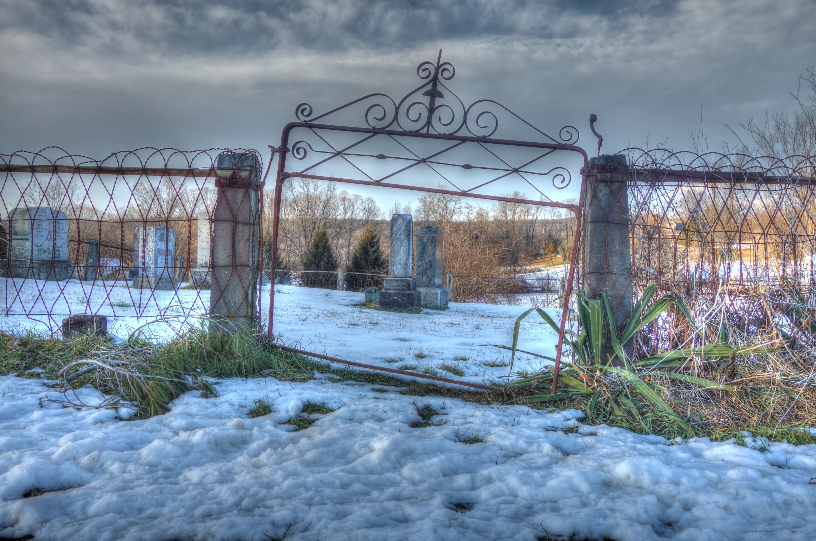
Finally, the long-promised new route…

Before we begin, though, I just want to note that my previous post was meant to be funny. Dry humor, you know? If you’re in a 5-hour drivers’ ed course you have to take your amusement where you can.

Now, back to the regularly scheduled post:

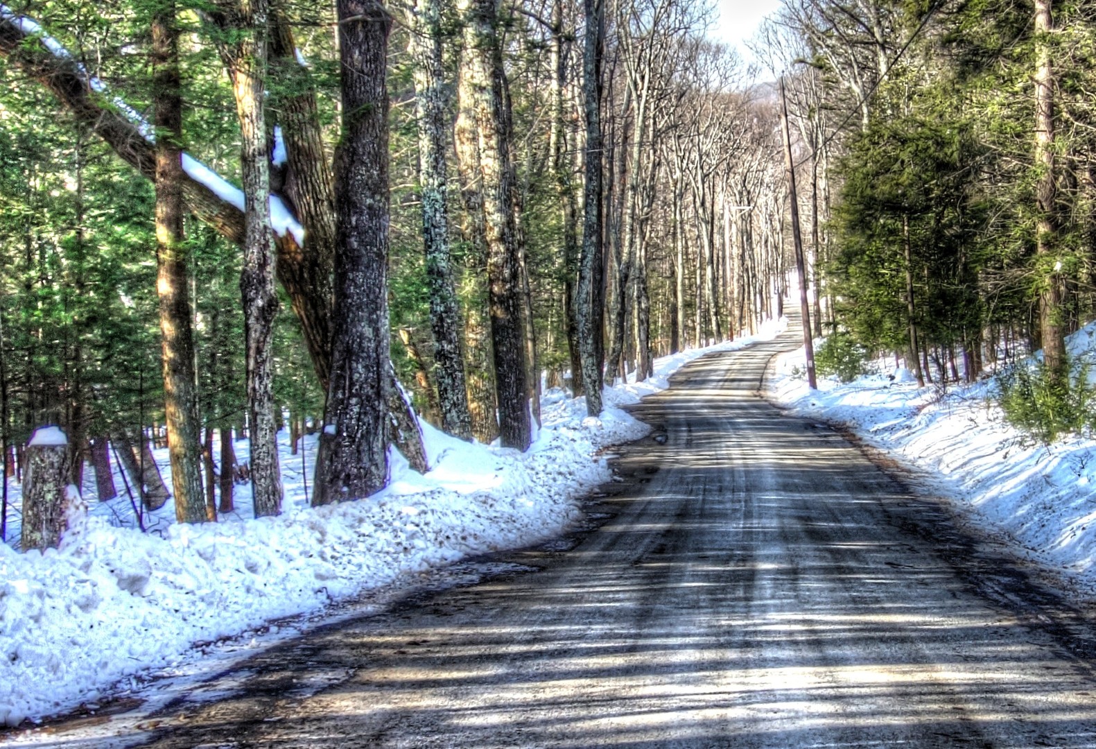
My friends and I have been riding the east side of the Hudson—mainly Putnam and Dutchess—as well as 9W up to Bear Mountain on the west side for some time, but we hadn’t gone farther north on the west side of the Hudson. In part, this was because of its relative inaccessibility, and in part because of a failure of our collective imagination. After all, there was a lot to explore on the east side, and all of it easily accessible by train, whereas the only way to get over to the other side was via the Bear Mountain Bridge, the Newburg-Beacon bridge, or the Poughkeepsie bridge. We didn’t think going over to the other side was worth the effort.

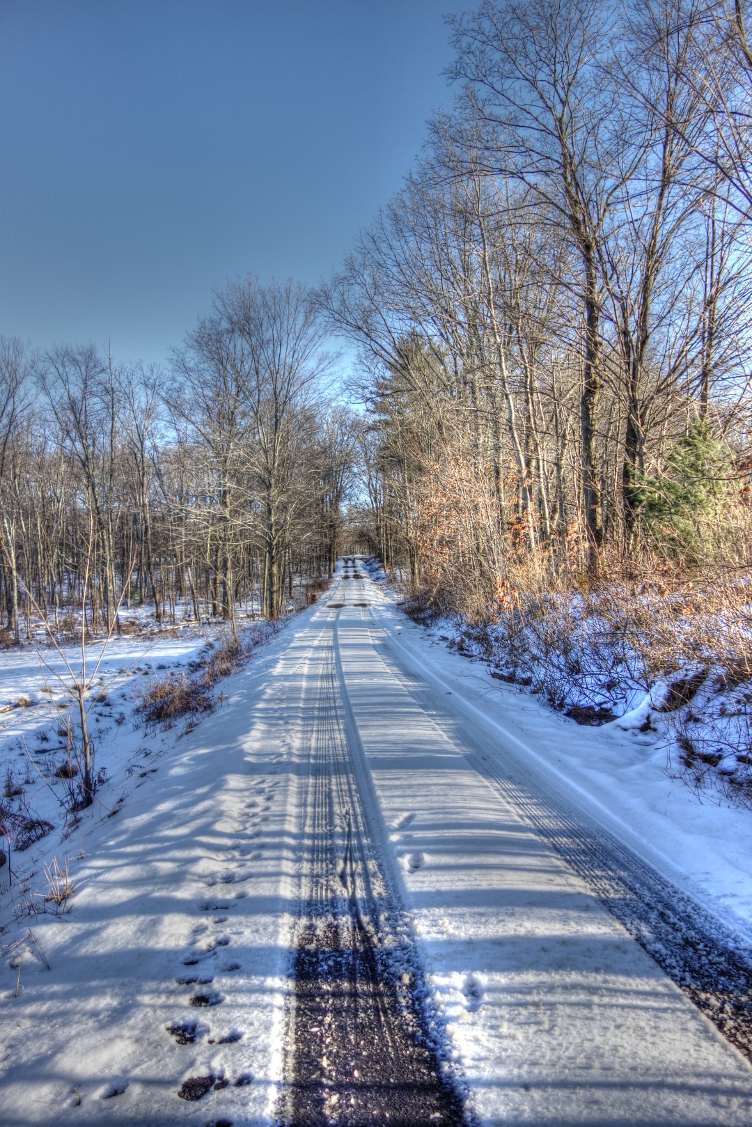
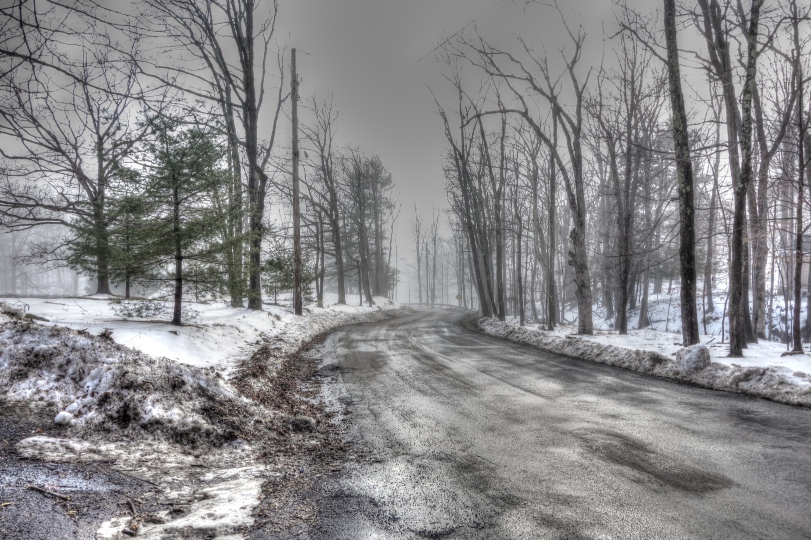
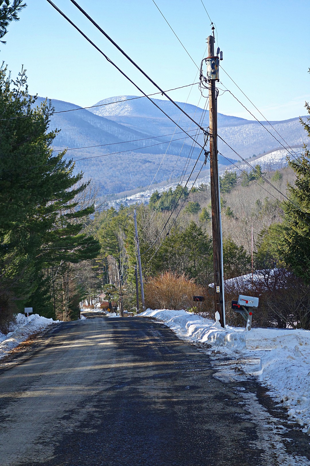
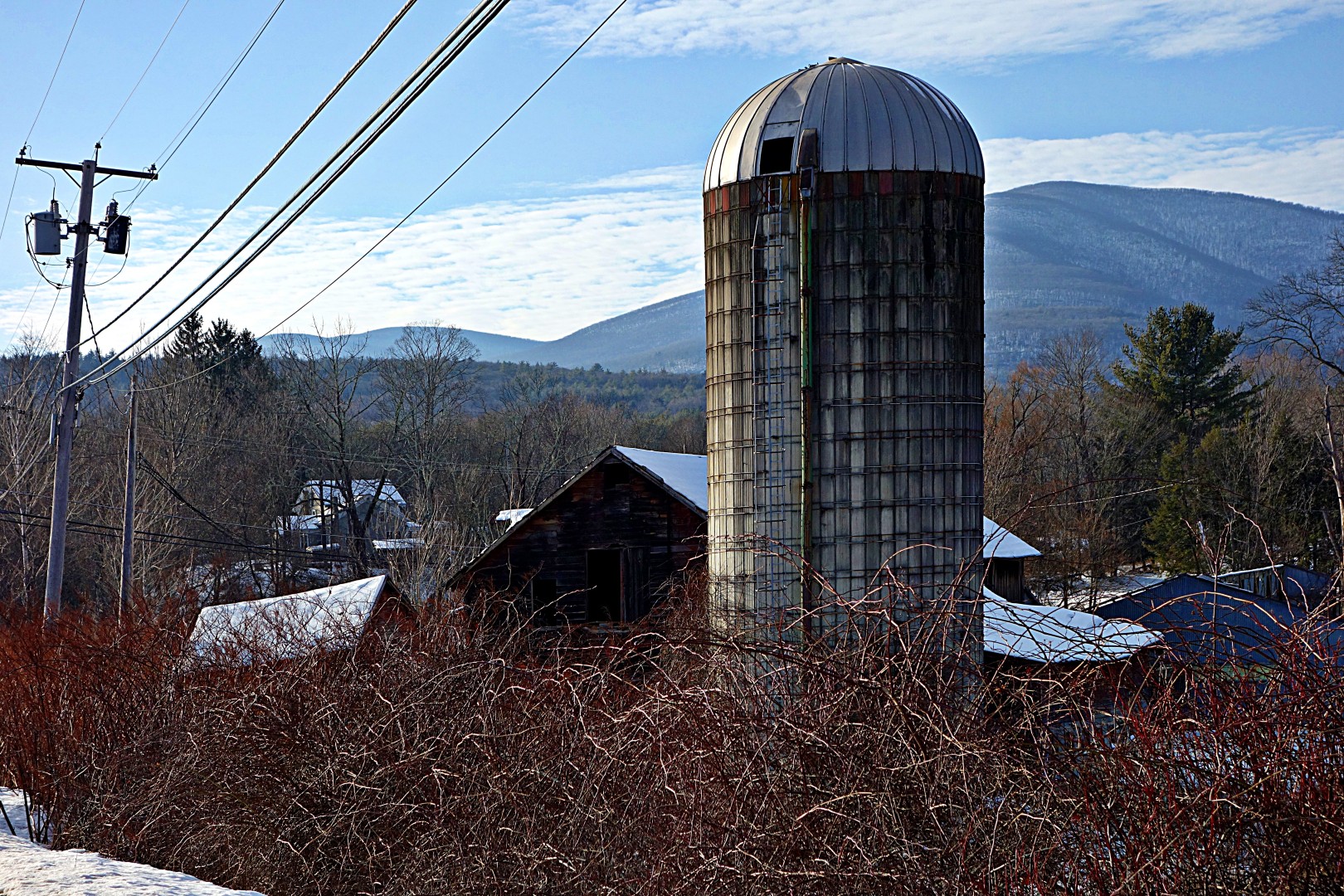
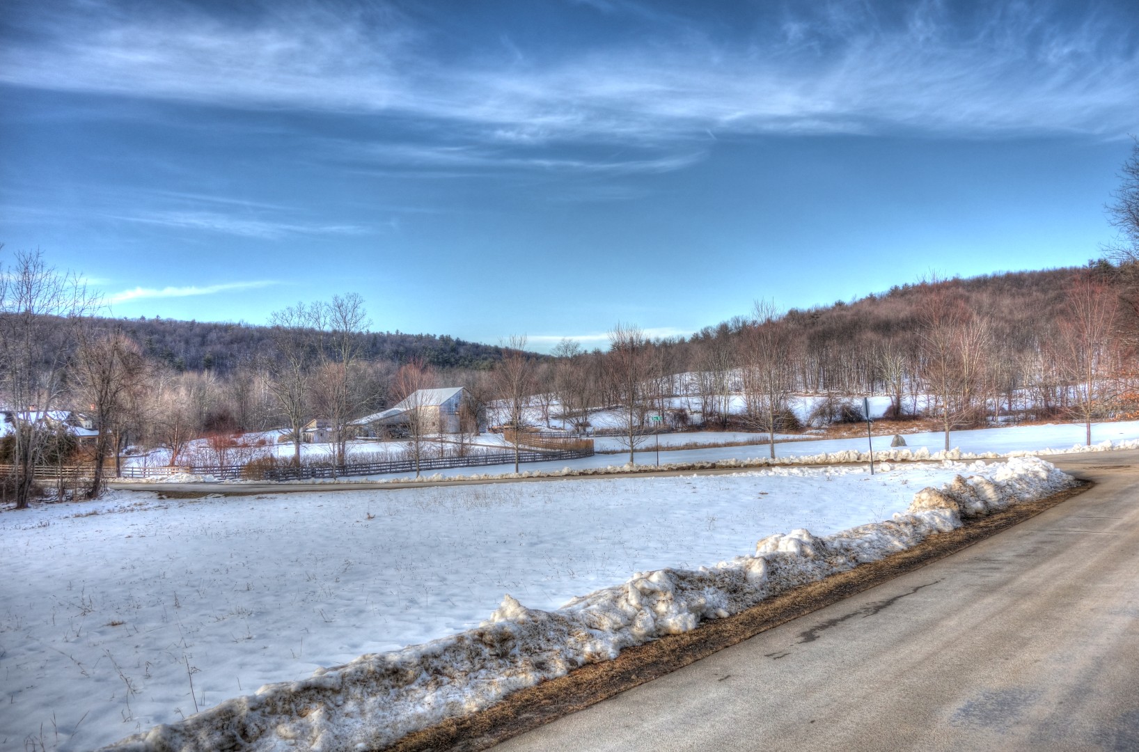
Of course, now I know that’s wrong. Ulster offers considerably more rugged terrain and is far less civilized than its counterparts on the east side of the river. All of which makes for great riding, if you’re not afraid of being far from civilization, a relative lack of services, and no cell phone contact in places. All in all, it makes for a more genuine adventure than riding in Putnam and Dutchess. Don’t get me wrong, though—the east side of the river makes for some fine riding in beautiful country…it’s just different and in some ways easier.

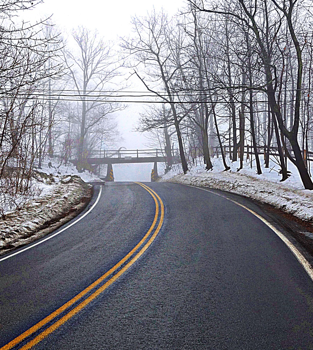
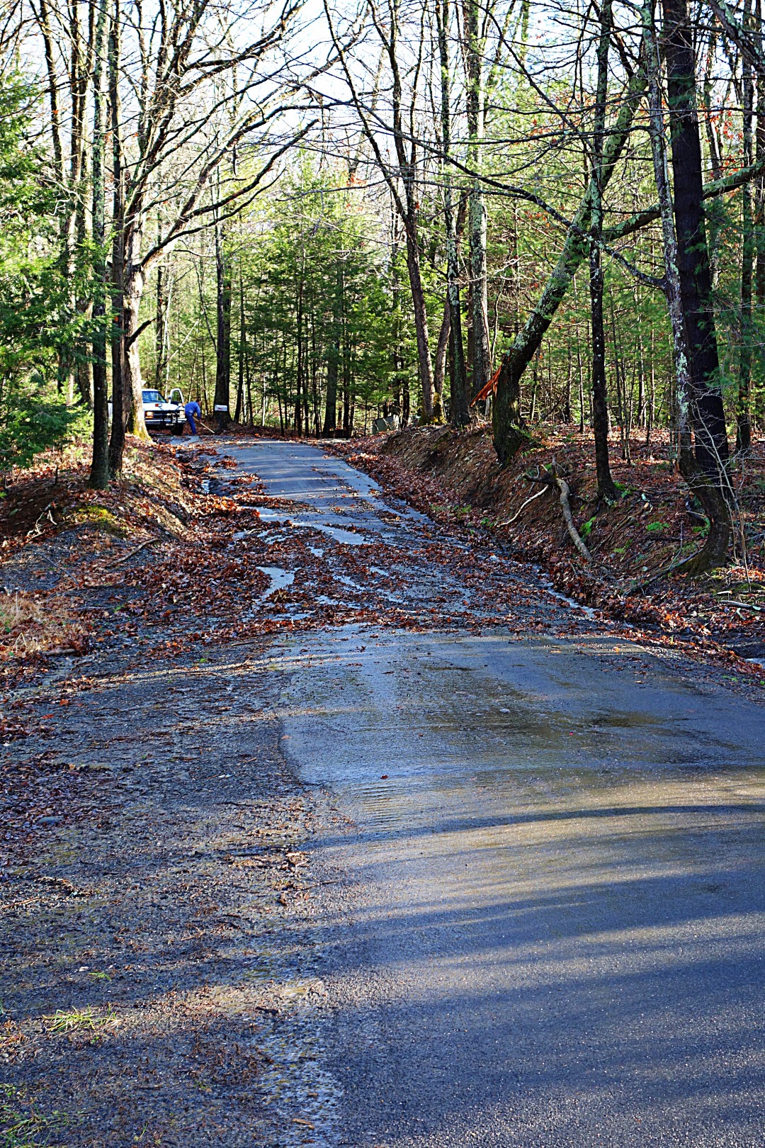
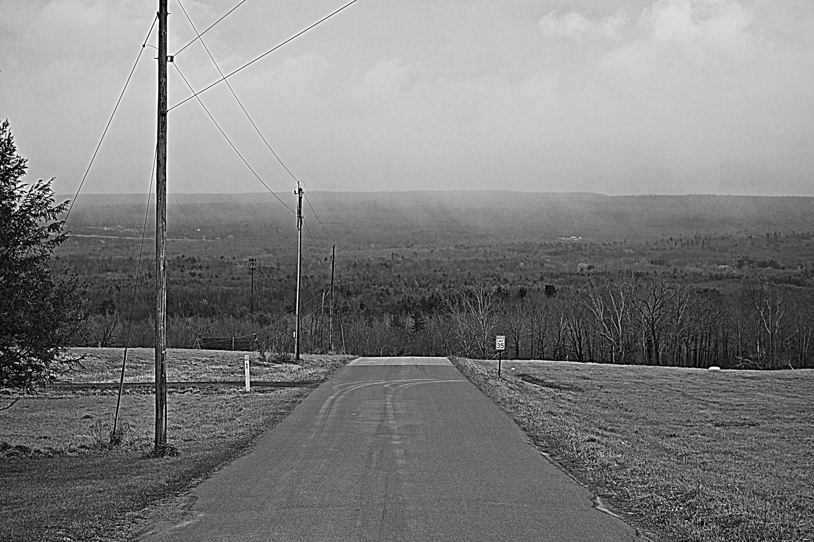
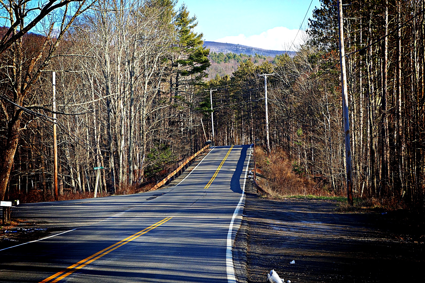
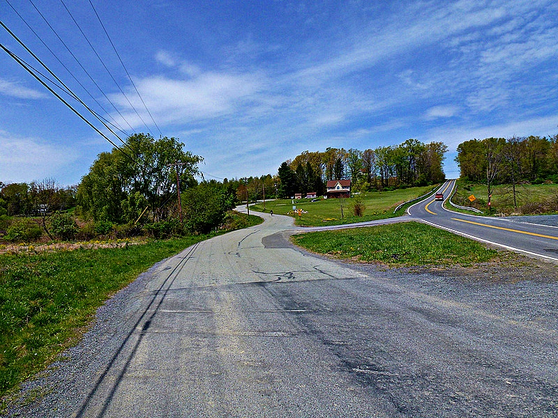
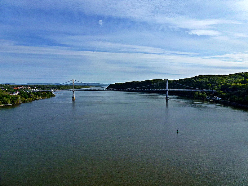
The route begins in Beacon, New York. It’s easy to get there from Grand Central Station—see the About page for train schedules and general guidance. You’ll go over the Beacon-Newburg Bridge to get to Newburg on the west side of the river. (This image is actually from an earlier ride where we attempted to go from NYC to Poughkeepsie. We abandoned in Newburg because, due to construction, all the traffic from the highway was rerouted onto our route…worst ride ever!).

Bridge

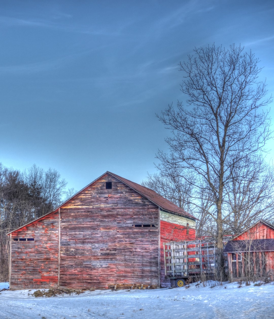
From Newburg, you’ll continue west to the little town of Walden. There is some traffic along the way, and a few crossings of busy roads, but overall it’s a safe and fast trip to the good stuff. In Walden, you can stop for drinks or food; I believe this roadside stand is open year-round.

Stop in Walden for some food_pe

Finding the start of the bike path itself in Walden can be tricky. I redrew the route to make it easier. You’ll know you’ve arrived when you see this funhouse chute. If nothing else, it will give you a chance to practice your bike handling skills. It’s like getting on the south path of the GWB, times nine.

I recommend jumping the rail and riding the dirt path on the right.

Entry to bike path_pe

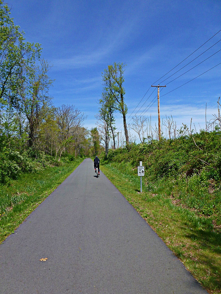
The first part of the bike path is paved and dead flat. Depending on your attitude and abilities, you can view this as either an opportunity to get it over with quickly, or a nice respite before the work begins (not that there’s much work to do on this route!)

First part of bike path_pe

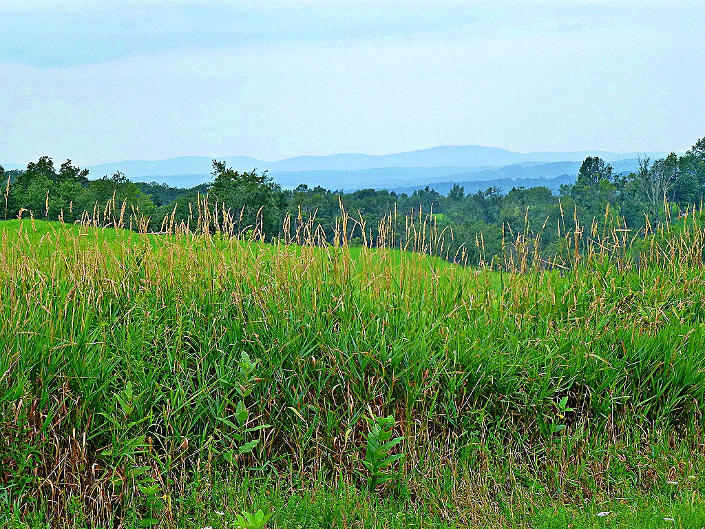
At about mile 18-19, you’ll arrive in Wallkill, home of the famous correctional facility. Some maps will show the bike path going right through the prison grounds, but sadly that is not allowed. You will need to detour around the prison. There are a few hills, but nice views.

1 bike path ends go around prison_pe

3 bike path ends go around prison_pe

Here is where we encountered a helpful prison guard, who directed us around the prison. I’ll admit we looked suspicious riding around with our bags full of who knows what. Personally, I had a cake and a file in my saddlebag. Please don’t tell the man.

You’ll want to go up that hill on the right.

2 bike path ends go around prison_pe

Make sure you turn on Dennison Road.

5 around the prison_pe

4 around the prison_pe_pe

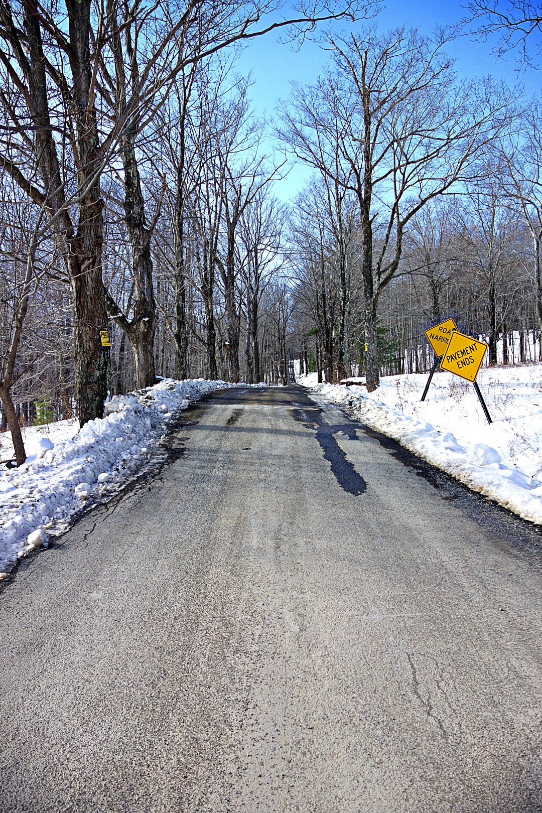
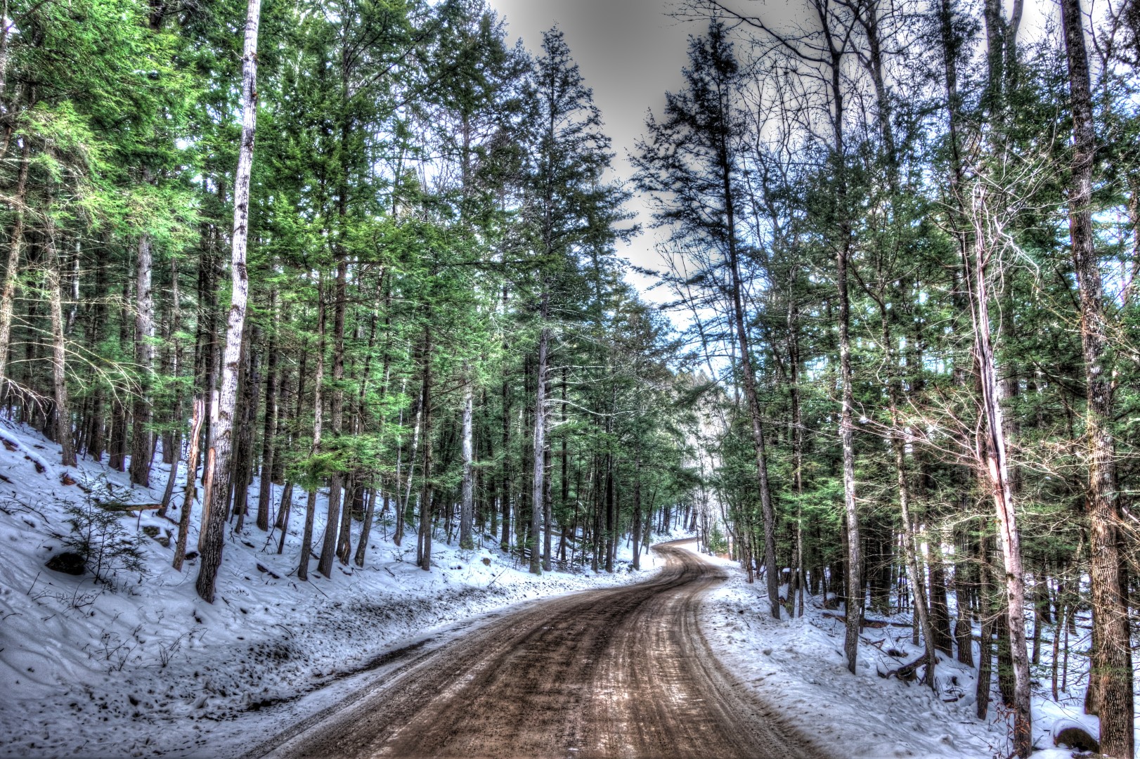
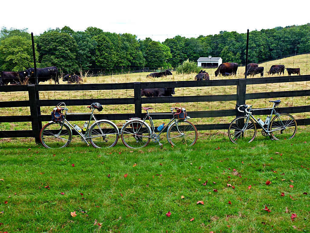
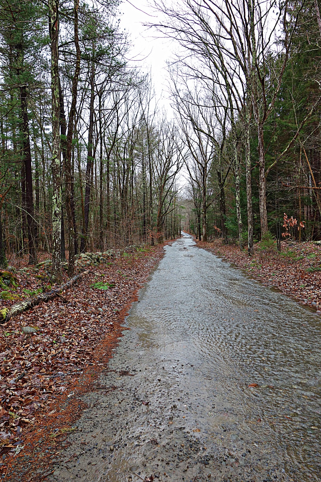
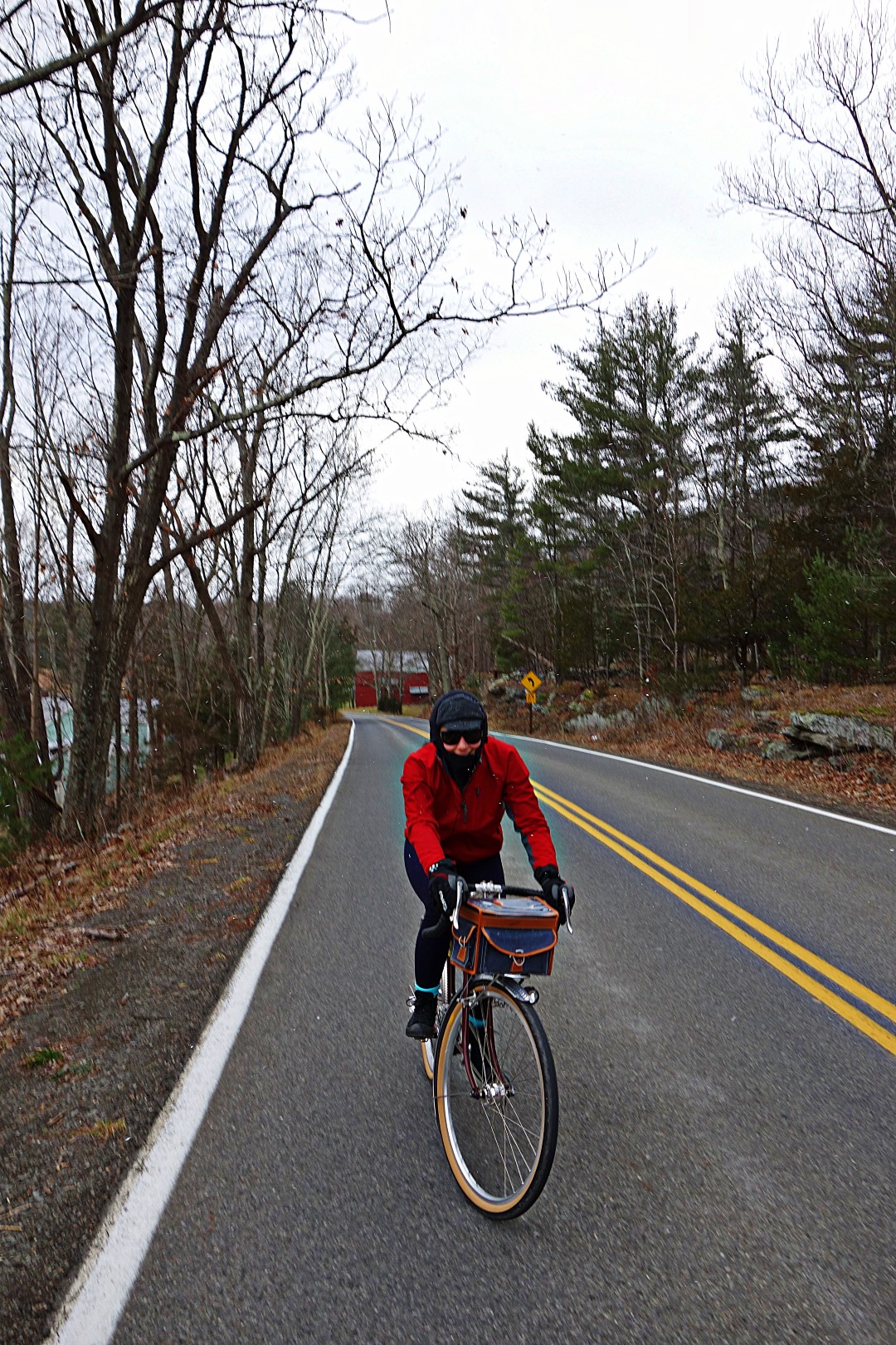
From there, it’s only about a quarter mile to the bike path, which–as you can see–is more of a cow trail in this area. I didn’t mention this earlier, but wider tires are a good idea, although, as usual, I rode the route on 25 mm tubulars.

6 bike path restarts after prison_pe

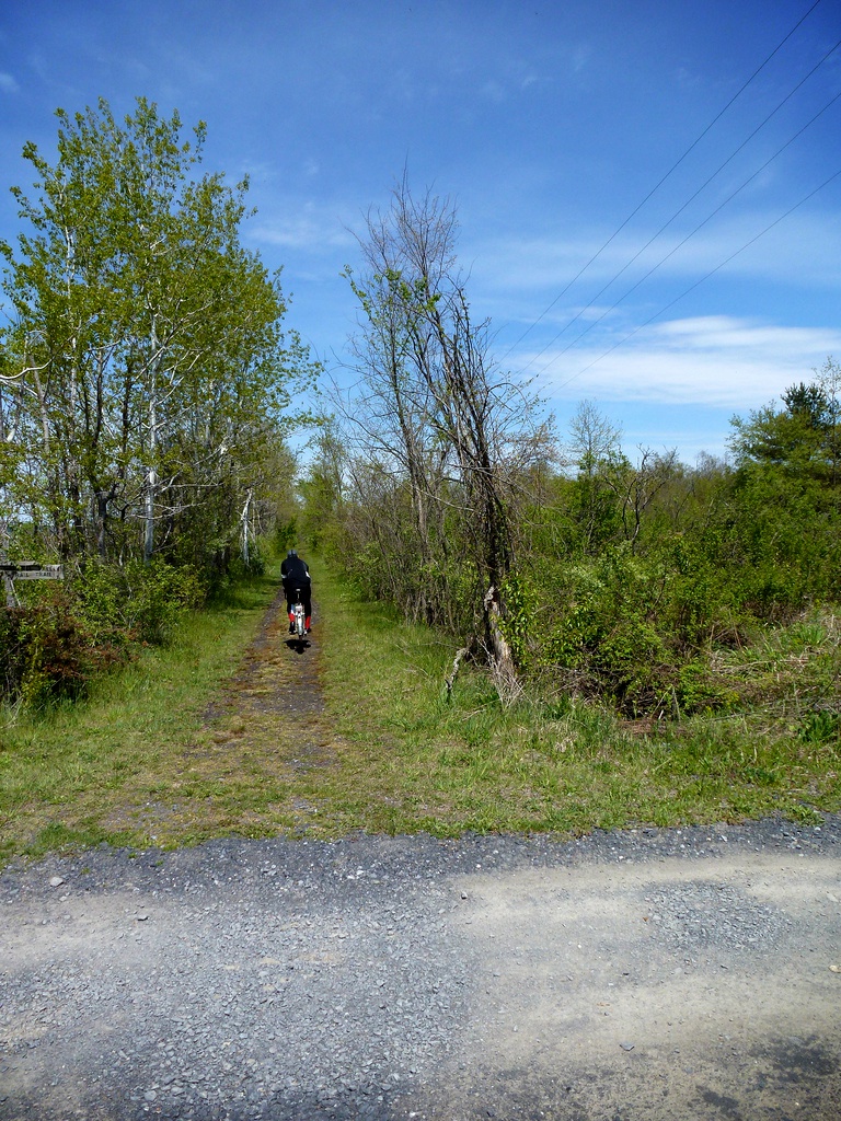
The bike path hides some baby head sized rocks, so perhaps it isn’t advisable to go this way in late fall, when the rocks and potholes are covered with fallen leaves.

7 bike path_pe

8 bike path_pe

You’ll pass through New Paltz at mile 31, which has a number of excellent restaurants, and ultimately you’ll emerge in the town of Rosendale at mile 38, which also has several good places to eat.

9 In Rosendale_pe

We stopped for lunch at Market Market Café (hours here), which has an outdoor seating area and was actually quite good. Note that the outdoor seating faces Route 213, so there is some traffic noise.

We had originally planned an out-and-back route, but we found the bike path far from challenging. We decided to return to Poughkeepsie the hard way. Luckily, Guy carries paper maps (and a fountain pen, of all things!) and he created a cue sheet to get back to the train station.

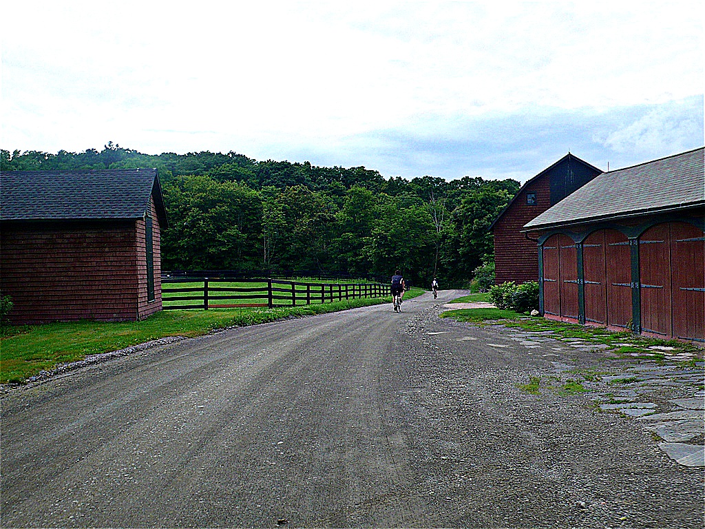
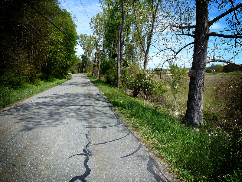
Here we are on the backroads to Poughkeepsie.

10 backroads to Poughkeepsie_pe

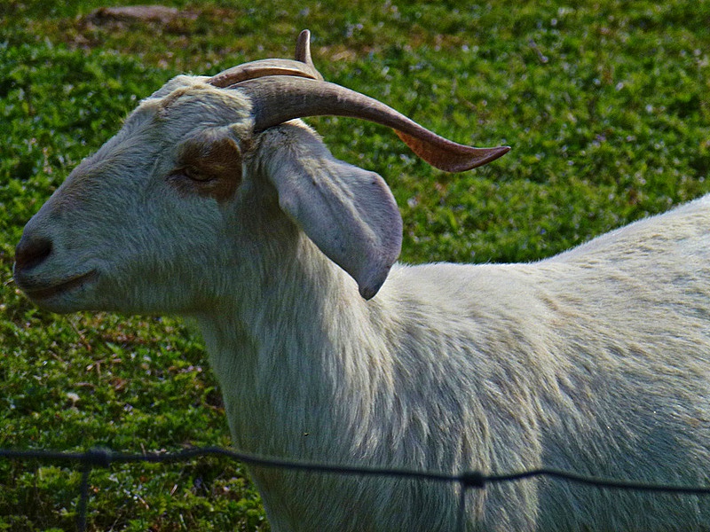
Where I took a picture of an extraordinarily handsome goat.

11 A goat_pe

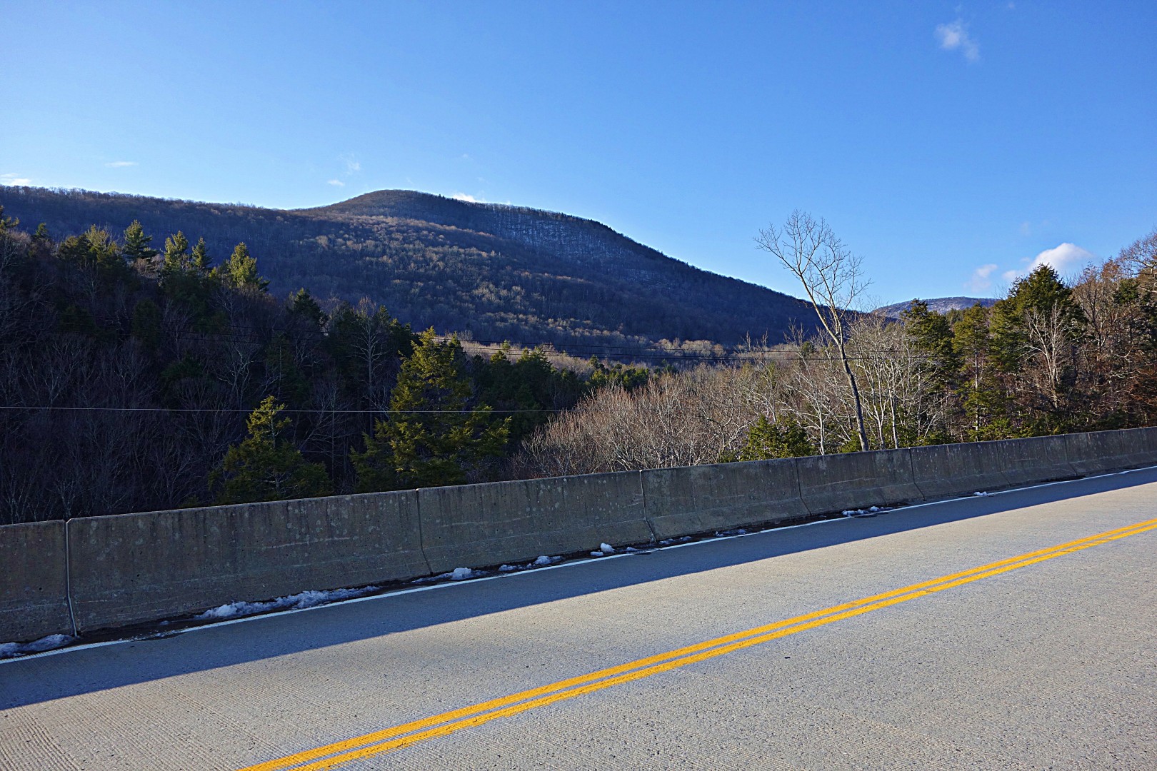
The route gets more challenging here, because you’re on real roads in the hills. The climb out of Rosendale is steep and long enough for the road to warrant a separate climbing lane for cars, and there are a few steep but short climbs along the way. Overall, you’ll do half of your total climbing (which is minimal—only 3300 feet in 55 miles) in the last 15 miles.

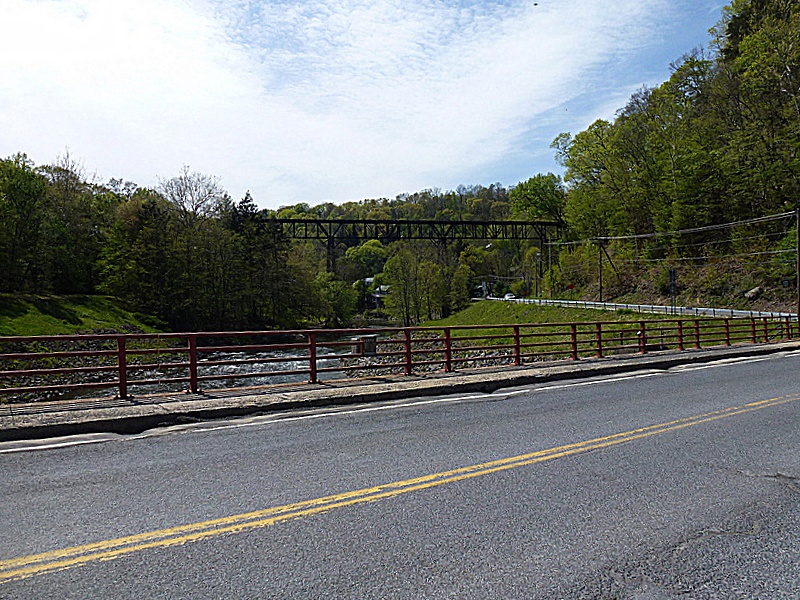
You’ll end in Poughkeepsie, where you’ll cross the world’s longest pedestrian bridge. This is a photo from the bridge, looking south.

Returning to Poughkeepsie on Pedestrian Bridge_pe

If you have dallied too long at–for example–the combined cheese/used clothes store in Rosendale, and have arrived after dark, the pedestrian bridge will be closed. No problem…just head south a quarter mile and cross the bridge pictured above. It’s actually easier to get to the train station from that bridge.

Is it worth the trip? Yes, depending on your needs and who you are riding with. Personally, even if I still lived in New York City I wouldn’t bother doing this again. It’s not challenging or remote enough for my tastes.

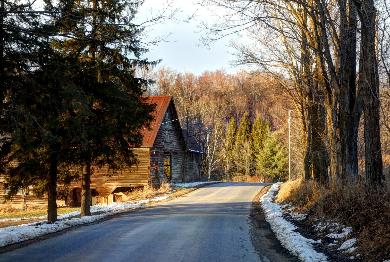
However, this route is a nice introduction to Ulster. It is fast, easy, and suitable for beginners in moderately good shape–or those who just want to go on a fun day ride. It includes a long segment on a very flat bike path (which I try to stay away from unless I’m riding just for transportation) but there are plenty of services along the way and several places to stop for food. Contrast that with riding in the mountains, where there are few services and you are, in fact, lucky to see more than 20 cars on an 8-hour ride.

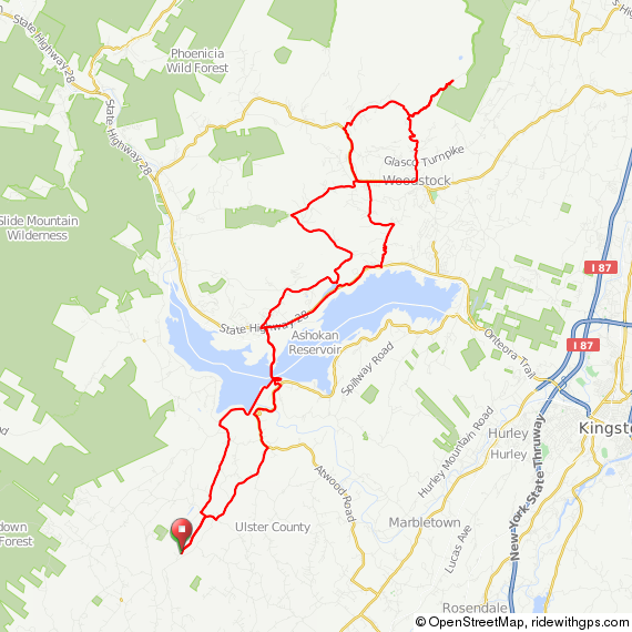
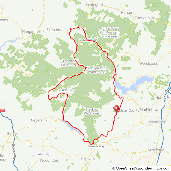
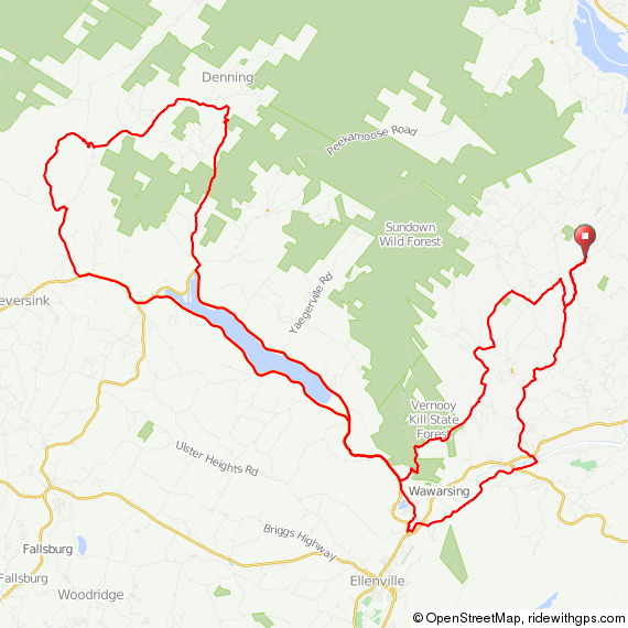
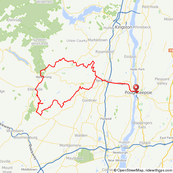
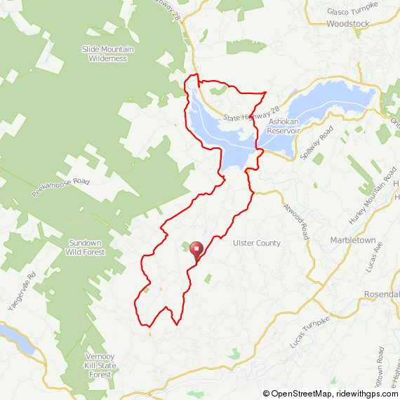
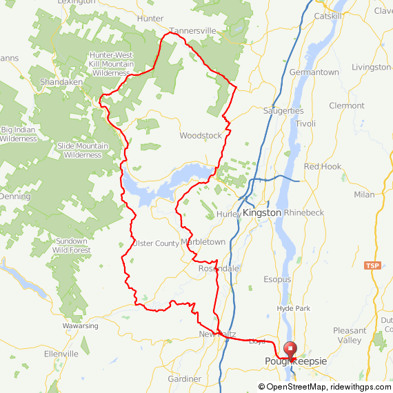
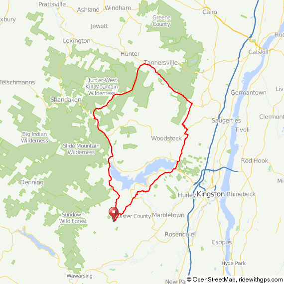
Finally, here’s the route.  Click on the link for GPS.

route-2038647-map-full

I should have a good report and route for you on Wednesday or Thursday this week…I took Wednesday off to do a 200-kilometer double-crossing of the Hudson with a couple friends (ah, the lifestyles of the self-employed!) Stay tuned for that route and a lot more. If I survive the anticipated freezing rain, that is.

Enjoy!

John

medicalwriter.net

A D2R2 a Day…

The best—and the worst—part of living out here is the climbs. A 15-mile quick midday ride involves almost 2000 feet of climbing; going to lunch in town involves 30 miles and around 3200 feet of climbing. Yes, there are substantially flatter ways of going about both routes, but what would be the fun in that?

After putting in almost 200 miles in the previous week, including a 70-mile climb fest over the Shawangunks with Doug (see below), I had to buckle down and get some work done. One of the nice things about self-employment is that I can work when I want, one of the bad things is that I end up working some really odd hours to make the time for longer-distance rides; for example, last week I worked three 16-hour days and an 8-hour day, interspersed with 3 days off for long rides.

This week consisted of five 1-2 hour rides, and less than 100 miles total. It’s January, okay? I did get a few pictures…

This is the Whitfield Cemetery, established in 1812 and in considerable disrepair. I stopped here on my way back from lunch because I’m still trying to learn to use my camera, and I thought it would be a good subject.

Image

Despite the fact that it warmed up considerably last week, many of the back roads remained snow-covered and treacherous.

Image

Image

Sunset over the Catskills, only a few miles from home.

Image

And finally, a few more pictures from this week. They’re all taken in the area north of Route 209 and south of Upper Cherrytown Road.

Image

Image

Image

Image

I’d like to blame my lack of photographic talent on my equipment (it’s just a point-and-shoot, after all), but, in truth, I just don’t know what I’m doing!

Later this week, I’ll write up an easy route out of Beacon, New York, that heads up to New Paltz via the bike path, into Rosendale, and then back on slightly more challenging (although still easy) terrain. It’s a good introduction to the area, and an easy ride even for inexperienced cyclists. Then—since it’s 10 degrees out here–I’ll get down to posting a bunch of more serious routes, I’ve got few dozen more good routes that deserve their own posts.

John

medicalwriter.net

Odi et Amo: The Eight Biggest Climbs in Ulster County

When I was in college, I thought it would be a good idea to learn Latin. Not only would I appear erudite to the ladies, but I also thought it would come in handy in Latin America.* So I am fluent in Latin, which has had considerably less utility than I first thought.

One of the things we were required to do was memorize poems, and my favorite, by Catullus, went a little something like this:

“Odi et amo. Quare id faciam, fortasse requiris?
Nescio, sed fieri sentio et excrucior.”

Translated:

“I hate and I love. Why do I do it, perchance you might ask?
I don’t know, but I feel it happening to me and I am tortured.”

Catullus’ poem sums up my feeling about the following….

This is a list of climbs to complete in 2013, preferably as part of longer-distance rides, plus routes for each. Completed, in part, with help from John Schwartz, Doug Hoffman, and Bike Hudson Valley, the best–and clearly the most comprehensive–site for rides in the Hudson Valley. Not many pictures, though!

Some are repeats from 2012 and (out of Poughkeepsie) 2011 and 2010. GPS for all of the routes–and many more–can be found on my Ride With GPS page.

California Quarry Road, north of Woodstock. This route includes Ohayo Mountain Road, which I hear is a decent climb itself. I’ve heard that this climb is extremely difficult, although by the numbers it doesn’t appear too bad.

California Quarry Road

Meads Mountain Road, again, north of Woodstock.  Climbing up to the Buddhist Temple at the top. Apparently there’s a jeep track that allows you to continue up. I think this route includes both the paved road and the jeep track. Tops out at 2929 feet, maximum grade 19.5%.

Meads Mountain Road

Big Indian/Slide Mountain. Already done once (out of Poughkeepsie, no less), but definitely worth doing again. Ride With GPS says the max grade is 14.7%. This is also, incidentally, the highest pass in the Catskills. There may be one-way roads leading higher, but I haven’t found them yet. When I ride this again, I’m going to set up a little shrine where I vomited from overexertion on my previous ride, which on this map is just to the west of the word “Slide.”

Big Indian

Vista Maria in the Shawangunks. I wrote about this one recently , and I want to repeat it in better weather. By the numbers, as difficult as Platte Clove. This route also includes a climb over the Shawangunks on Mountain Rest Road (not difficult).

Vista Maria

Peekamoose. A repeat. I’ll probably do this one many times, it’s a good 50-mile training route with a diner at around mile 40. A longer climb, but only transient 14% to 15% grades. Note that I have also created a GPS course for this route out of Poughkeepsie.

Peekamoose

Platte Clove. Another repeat. See the report here. I will probably repeat this one multiple times, it’s a good route with a nice 22% section, plus it has the benefit of a long high-speed downhill section on the back end. Note that I have also created a GPS course for this route out of Poughkeepsie.

Platte

Sugar Loaf. This is one of the longest and toughest climbs in the Catskills (or so I’ve read). I’ll probably modify this route to spend less time on Route 55, which actually isn’t bad in terms of traffic, but I prefer the back roads if at all possible.

Sugar Loaf

Glade Hill. Looks like 18.4% maximum grade, 9.4% average grade, but it is really short. For that reason, I threw some extra fun into this one…since I’m out that way, might as well do some exploring.

Glade Hill

Am I missing anything? Let me know, and tell me about it in the comments instead of via e-mail. That way everyone can benefit. Think of your recommendations like a Japanese game show–you know, the ones in which the audience chooses whether the contestant gets a punch in the 精巣 or simply has to endure eating an 蚯蚓.

Now, I just have to figure out how I’m going to get 1:1 gearing on my road bike. I pride myself in struggling up the steepest hills in 34/25, but–if nothing else–my experience with the Lynsky has shown that 1:1 makes climbing 22% grades more fun, not to mention faster since I can maintain a good spin. Better to have no pride and get to the top first!

Finally, an idea for Rapha video: Imagine me struggling up these climbs, helmetless,while a deep voice intones Catulus’ poem over and over. I even have a scruffy semi-beard to complete the effect.

Mēcum venī!

John

medicalwriter.net

*Just kidding, of course I know the primary language in Latin America is German!
Catullus’ poem was not, in fact, about climbing hills on a bicycle. He wrote this poem to express his feelings about his mistress Lesbia, before he figured out why she didn’t like him. Seems obvious in retrospect, doesn’t it?
Yes, mom, I always wear a helmet.

Mountain Climbing is Best Accomplished in Winter: The Shawangunk Ridge via Mountain Rest Road and Vista Maria

Warning: This ride involves ice, freezing mist, massive climbs, and fervent prayers to St Milhaus the Retainer.

On Saturday, my friend Doug was kind enough to come from Woodstock to start an intermediate-distance ride from my place in Olivebridge, New York. The weatherman reported that it was supposed to be 50 degrees and sunny.

He lied.

My girlfriend was in Los Angeles for meetings with agents, which meant the dogs were going to be home alone all day. So I got up at ass o’clock (that’s 6:00 am) to walk the dogs and make them do their business before I left. Unfortunately, my Rhodesian Ridgeback, Pandora, decided that she would pick that time to be a princess and wouldn’t go in the snow, so I had no choice but to leave her, hoping she could hold it.

Panda

So it was at ass o’clock thirty (that’s 7:30 am) that we set out from my place in a cold, misty rain at a temperature slightly below freezing.  Yes, that’s me on my winter cross bike, submitted as proof that I’m not just driving around taking pictures.

Image

In case it’s not completely obvious, this photo was taken by Doug.

We initially proceeded west onto a gravel road. Bad idea. The road was covered in ice, and not 50 yards in, Doug took a fall. Of course this happened right after I said “be very careful!” Luckily, he was uninjured, or least uninjured enough to go back to my place, where we loaded a new route into our Garmins that did not involve gravel. Doug is clearly made of tougher stuff than me, because if I had fallen (and I came damn close) I would have stayed at home to nurse a broken chicken bone.

Setting out again in the opposite direction, we headed south to route 209 on roads that were lightly coated with snow and ice that was, at least, starting to melt.

Image

There was a thick fog and a freezing mist that lent the ride a mysterious air, almost as if we were floating through the clouds.

Image

We passed through this graveyard on Airport Road on our way to 209. Some of the graves here date back to the early 19th century. The second photo was taken by Doug.

Image

Image

After crossing route 209, we headed into our first big climb of the day, over the Shawangunk ridge via Mountain Rest Road. This climb has been immortalized in numerous reports, so I won’t belabor it here.

The funny thing, though, is that when I lived in New York and rode out here, I thought this was a tough climb. This was my first time going this way since moving to the Catskills, and I didn’t think it was that hard.

When you see the second bridge—shown here—you’re almost done.

Image

The best part about this climb was the weather. It must have still been below freezing at altitude, because the cold mist clung to my sunglasses, where it froze, lending the climb a hallucinatory quality.

Image

Image

We continued through rolling country along the eastern edge of the Shawangunks to get to the next big climb over the ridge, Vista Maria into the town of Cragsmoor. Although you’re climbing through a lovely forest, there isn’t much vista to be had on the way up. Here’s a picture during a brief clearing.

Image

Once you get to the top, you have the option of taking a right onto Sam’s Point Road. We didn’t bother, because we were essentially inside a cloud the whole way up, and figured that there wouldn’t be much to see.

By the time we started to descend, the sun had started to come out, burning away some of the fog.

Image

The descent was fun, although we had to be extremely cautious because of the loose sand on the road. In the summer, this is probably a 50 mph descent. I hit 30 a few times on the way down, but I wasn’t willing to go much faster than that given the road conditions. Here’s where you get some great views, at least in the winter.

Image

We descended into Ellenville, where we stopped for a late lunch. Then we took the quick route back via 209 to Kerhonksen, followed by a great climb back to my place. Because of the crash, we had gotten off to a very late start, and—frankly—I underestimated how long it would take us to climb Vista Maria. So we ended up riding the last bit in the dark.

This is when I started to pray to St Milhaus the Retainer, a minor deity that Doug invented just for me on our return trip. St Milhaus, you see, is responsible for keeping dogs from pooping on the floor when left home alone for too long. The girls are perfectly house trained, but—because we work from home—they don’t have practice going 8 or 10 hours without a trip outside.

I’m happy to report that St Milhaus answered my prayers.

Doug stopped in for a hot tea, and I had my usual ice-cold Coke. Yes, I’m an addict. I gave Doug a naproxen since he was sore from his fall earlier in the day. In the middle of the night, I awoke terrified that I had accidentally given him a long-expired sleeping pill–the bottles look almost identical. How do you explain to someone you’ve just met that you’ve accidentally given them the wrong drug?

After fumbling for my glasses, I dashed downstairs. Thankfully, the bottle was still on the table. Doug, if you’re reading this…it was naproxen!

I decided to compare Vista Maria to the other big climbs I’ve done in the area. Here are some metrics for comparison:

  • The average grade of Vista Maria is 7.0% over 3.3 miles. The maximum grade is 18.7%, and it’s a Cat 2 climb that peaks at 2062 feet
  • The average grade of Platte Clove is 7.4% over 2.9 miles, with a maximum grade of 18.6%, and it’s a Cat 2 climb that peaks at 2058 feet
  • The average grade of Peekamoose is only 3.9% over 4.1 miles, the maximum grade is 12.0%, and it’s a Cat 3 climb

So, at least by the numbers, Vista Maria is of similar difficulty to Platte Clove, and equally as entertaining.

Is this ride worth the trip? Definitely, although I couldn’t see anything for most of the ride due to the dense fog. It is certainly challenging, and I think it will be gorgeous during the summer in nicer weather. I look forward to repeating it.

Here’s the route we took, mapped from my house. At the end of the day, we rode 70.2 miles. I’m not sure where we went 5 miles off track.

Image

Image

I’ve also mapped the route from Poughkeepsie, for those of you who would like to try it from the train station. It is a quite reasonable 90-mile day ride.

Image

As a note, this route includes a short segment to the north of Route 209. Why? Because 209 is no fun at all. Although there’s a wide shoulder, there is a lot of traffic. However, it is fast and flat, so if you’re tired from Vista Maria, you can skip this section and continue 10 or 11 miles on Route 209 to Old King’s Highway, just after Accord. There, you will take a right to continue the route. I’m also told by my friend John–who has lived out here much longer than me–that Berme Road, which lies just to the south of 209, is a good option here as well.

John

medicalwriter.net

Dug is my Copilot

Only 3 days of riding in the last 7 days, totaling a less-than-astonishing 95 miles. (Sorry for the massively overexposed pictures: between the snow and the sun it was tough to get a good shot).

The first ride was a failure. I rode north of the Ashokan reservoir in search of Pitcairn Mountain Road which, according to my map, is a nasty, twisty road with 1500 feet of climbing.

Image

Image

Unfortunately, I rode all that way only to find that Pitcairn Mountain Road was private. But almost all rides are good rides…I ended up exploring some of the roads nearby instead, which–happily–were gravel.

Image

Image

Image

Image

The route offers splendid views of the Ashokan Reservoir.

Image

I emerged onto Route 28 hungry after some great gravel miles, and–thankfully–there was a little restaurant with excellent food.

Image

I didn’t take any pictures after this because the roads were familiar to me. In fact, I entered what can only be described as a fugue state for the next 20 miles, aided by Youme and Meyou on repeat in my head. It was almost like being hypnotized. I didn’t realize it until I stood to climb a huge hill and realized I was breathing so hard that I was close to vomiting. I have no recollection of those miles, but when I looked down at my computer, my average speed was 23 mph. What a great way to train!

I took this picture after I emerged from my fugue state.

Image

…and would someone please save this Jaguar E-Type? Contact me if you want the address.

Image

Here’s the route for those of you who might be interested in a shorter ride around here.

Image

I didn’t take pictures on the next ride, because it was truly for training only. It involved me riding up and down a hill until the drool froze on my face. Appetizing, I know.

The weather started getting markedly nicer later in the week, and after many hours of working on a new drug with a name that, when letters are accidentally transposed when typing fast, spells “Asslympics,” I felt it was my duty to get out and ride. Plus, my girlfriend went to LA for meetings and I had a craving for a sub.

Yes, I rode 30 miles to get a sub. Here are a few pictures (click on the third one for full size, it’s pretty cool).

Image

DSC00420_1_2_tonemapped_pe (Large)

Image

Image

Image

On my way home, I met my copilot, Dug the Dog, so named because she lives on Dug Road. I am tempted to take her home…she’s always running around without a collar in the road, and although she’s very friendly, she’s extremely hand shy, which leads me to believe she isn’t treated well.

Image

The back end of the ride included 15 miles on gravel.

Image

Yes indeed, that’s my lunch ride.

That’s all for this week, although on Saturday I have a 75-mile ride planned out to the Neversink Reservoir with my human friend Doug (not Dug, pictured above). Along with new winter routes (mostly less than 50 miles) I literally have dozens of old 80- to 120-mile rides remaining to post, complete with GPS and cue sheets. I’m hoping to get all the old routes up before the end of winter, because starting in March it’s time to get serious again about longer-distance rides, which means I’ll have fresh long-distance routes to post.

John

medicalwriter.net

The Summer Classic: Brewster to New Hamburg

Update: An anonymous benefactor was kind enough to update the route (7/2013). The updated route can be found here.

When I mapped this route several years ago, I had almost no knowledge of the local roads north of Brewster. So I just used Ride With GPS to sort of randomly draw a course on what looked like back roads in Putnam and Dutchess. I had no idea it was going to become the all-time summer classic ride!

After I posted this ride on Flickr a few years ago (and well before I had a blog) I started getting very positive feedback about the route from complete strangers via e-mail and Flickr mail. So it is a truly happy accident.

Anyway—at least in my opinion—this is one of the best moderate-effort rides within easy reach of New York City. In fact, I enjoy this route so much that it is one of the few longer rides I repeat multiple times a year. It’s approximately eighty miles. Virtually no traffic, in fact for 90% or more of the ride it is perfectly safe to ride side by side. It alternates between perfect road surfaces and gravel. Big climbs, some on gravel, and long, long descents.

The route begins at Southeast Station, the last direct stop on the blue Metro North line, and only 2 to 3 minutes past the Brewster stop. Here, I showed my friend Tom the route and elevation profile. Tom only rides with us occasionally, and you can see from this picture how he felt about it.

Image

The station is in a deep hole that you’ll have to climb out of. A nice warm up for the rest of the day. Note that there’s a diner with acceptable food at the top of the hill if you want to stop for breakfast before continuing.

After climbing out of the hole, you’ll take a right on Dykeman Road (Route 312). Be careful here, because it’s a busy road. Luckily, you’ll only be on it for about 1.5 miles before you take a turn onto Farm to Market Road to head into the hills.

Image

You’ll continue to Route 164, take a quick left and then the first right at the pond onto Cornwall Hill Road/Country Road 292, which you’ll follow past Whaley Lake. At the north end of the lake, around mile 14, you’ll find an outdoor hotdog/burger stand, probably blasting the worst music you’ve ever heard at high volume. The people I ride with always want to stop there for second breakfast (yes, I ride with hobbits), but between the gristle burgers and the awful music, I wouldn’t recommend it. They open at 10 am, if you’re interested in trying it out regardless. The hot dogs are safe.

Continuing on, you’ll take a left on Route 55…and then the fun begins. Hynes Road is a nicely groomed gravel path the swoops through the countryside through a tunnel of trees.

Image

You’ll continue on Clove Road/Country Road 9, and at mile 25.5, you’ll take a left for one of the nastiest climbs in Dutchess County…Brush Hill Road. It certainly doesn’t compare to climbing Slide Mountain or Platte Clove on the other side of the Hudson, but it is not easy. My memory of it may be warped by the fact that we tend to ride this route on the hottest summer days; also, now that I live in the mountains I’d guess that I’d no longer find Brush Hill terribly challenging.

From there, you’ll cross Camby Road onto Flint/Overlook Road into some nice, rolling terrain.

Image

This is our traditional first rest stop, on Hoxie Road. Pictured here you see my Rene Herse, Guy’s very special Jonny Coast randonneur and a James’ Hampsten.

Image

You’ll continue to a brief stretch on 343, and then turn onto the appropriately named Little Rest Road. Off in the distance is the mountain I live next to now.

Image

You’ll cross Route 44 in Mabbettsville at mile 33. For some reason, my GPS tells me to take a right here. Don’t listen to it, just continue straight past the deli. You might stop for a refill here, but you don’t have long to go to get to the lunch spot.

Continuing on, you’ll follow this road through mile 41. It goes through a variety of name changes in this 8-mile span: County Road 66, North Mabbettsville Road, Ludlow Road, Shuman Road, and then, finally, Bengall-Amenia Road. I’m not sure why, but Dutchess is notorious for random road name changes. In any case, just keep following the road.

I didn’t take any pictures of Bangall-Amenia Road, for the simple reason that I was going too damn fast to whip out the camera. This picture was taken while stationary.

Image

Now, listen carefully: Ignore your GPS for a moment and follow Bangall Amenia Road all the way to Hunns Lake Road. Take a left, and about 300 feet down the road you’ll see the Bangall Whaling Company. Lunch. We’ve been there a number of times now, so they are familiar with the clan of lycra. The first time we showed up, though, we got some odd looks. We made friends, and they ended up giving us a bottle of wine, which my friend Guy subsequently had to haul over another 40 miles of hills. Luckily, he had panniers that day! Check ahead before you plan on stopping for lunch, their hours seem to change seasonally. They should be open for lunch during the summer, though.

Return to Bangall Amenia, go up a short hill, and take a right onto Duell Road, and then another right onto North Anson Road at mile 42. This is where many miles of serious gravel begins.

Image

Image

Image

Eventually, you’ll end up on Petit Road. At the crossing with Canoe Hill Road at mile 48.5, Pettit Road is often blocked; if I recall correctly the sign says something about “The Cary Foundation”. No worries if it is, though—just take a right on Canoe Hill Road and then the first left (Fowler Road, although it is unmarked) to rejoin the route.This leads to one of my all-time favorite cycling pictures, my good friend Guy doing some impromptu roadside repair work next to a pestilential swamp deep in the forests of Dutchess county.

Image

Nearby, you’ll see signs for the Cary Institute of Ecosystem Studies. They own some beautiful land; if you have a chance take a right into the preserve, take a break, and enjoy some nature.

At mile 54, you’re in for a dirt-road climbing treat on Milewood Road. The first time I did this, it was in a stiff rain and I didn’t make it to the top because I couldn’t get enough traction. The fourth or fifth time I did this (and alone, this time), I lost traction and tipped slowly over onto the drive side of my bike, unknowingly knocking my derailleur out of adjustment. I got to the top of the hill, shifted into the biggest cog and bam! derailleur shifts into the spokes, bending the hanger and rendering my bike completely inoperable. Luckily, I was able to hitchhike to a train station. Don’t worry mom, it was with a nice older couple with their grandson in the back.

The remainder of the ride is a blast, because it has a distinct downward drift. Yes, there are a few stiff hills, but for the majority of the ride after mile 60 you’re going more down than up.

Image

One final note: At mile 59.5, the route crosses the Taconic State Parkway. You heard that right: it doesn’t go under the Taconic State Parkway. It doesn’t go over the Taconic State Parkway. It crosses it at grade. Be very careful!

You’ll end in New Hamburg after a high-speed descent on Sheafe Road.

This is a fun ride, and nowhere near as challenging as riding on the other side of the Hudson in Ulster County. If you’re in reasonably good shape you should be able to make it, although there are a few genuinely difficult spots. It would be a good introduction to long-distance riding or a pleasant route to repeat a few times a year.

To get there: take Metro North to Southeast Station to start, return from New Hamburg. You’ll definitely need GPS for this, as many of the roads are unmarked. The route is here (and the updated route is here). Links to train schedules and general advice can be found on the About page.

Image

Do yourself a favor: Skip 9W one weekend and try this!

John

medicalwriter.net

How to Get Your Man Card Without Buying an Automatic Weapon

Despite my obsession with politics I’ve made a resolution to keep this blog politics-free. However, I think we can all agree that the Bushmaster’s recent “Man Card” ad campaign is not only in poor taste, it’s meant to appeal to men who are…um, deficient in ways that can only be ameliorated by purchasing a hard phallic object that shoots projectiles.*

Well, I’m here to tell you that you can get your man card without buying a Bushmaster. It involves dressing up in tight Lycra and riding 116 of the toughest miles you’ll ever ride.

This is the Platte Clove ride, remapped for your convenience from Poughkeepsie. I provided a complete description of the route here. Send me an self-addressed, stamped envelope with proof of completion to receive your limited-edition laminated man card.†

route-2019136-map-full

*As someone who has considerable expertise in guiding marketing and advertising campaigns much more significant than some crappy little gun manufacturer’s campaign, I’d strongly suggest that the advertising agency that came up with this garbage be fired posthaste.
†Limited-time offer only.

John

medicalwriter.net

The Big Freeze

Another week in paradise! Unfortunately, we’re buried under a ton of snow and ice, and the roads are frozen solid. I did get in some good days before the bad weather, though.

On day 1, I went for a 35-mile ride: 15 miles to the diner for my weekend cheeseburger, and then 20 miles back home. The night before, we had a severe rainstorm, and the roads were covered with gravel washouts.

Image

My favorite gravel road—Rogue Harbor—turned into a stream. There are a lot of potholes in this road, so I had to take it slow because the last thing I needed was to crash, get wet, and suffer hypothermia.

Image

Despite a forecast for truly terrible weather, the day turned out to be beautiful, albeit cold and windy.

Image

Image

Image

After lunch, the weather began to deteriorate, with some light, misty rain. Just the way I like it. I took this photo in native black and white to make it look suitably grim and wintery.

Image

On day 2, I went for a 15-mile ride with my girlfriend, Margot. Here she is on her tiny little blood-red Boulder.

Image

When I was 14, I bought and restored a second-hand sailboat called a Flying Fish. It was an ugly little thing, but fast as hell for a monohull; much faster than the C- and E-scows that everyone else was sailing. Although I sailed it almost daily from spring until late fall, the best times I had on that boat—and the times that I really remember—were those days that involved 30 mph winds, freezing spray, and rain.

I feel the same way about cycling; in fact, when it starts to rain I’ll get on my bike for a quick 20 miles, preferably on dirt roads so I get a little muddy. I also deliberately plan longer rides to be difficult enough that the last 10 miles is a test of survival more than anything else, much to the chagrin of my riding companions.

I’m not sure why I do this. In part, it might be because my life—and modern life in general—offers few real tests of our physical ability. Like many white-collar workers, I spend anywhere from 50 to 70 hours a week sitting behind a desk staring at monitors. There’s a certain clarity and satisfaction that can be achieved at the apex of a 200-mile ride that I just don’t get in any other way. I enjoy that “oh shit” feeling I get when I’m halfway through a long-distance ride and so tired that I don’t know how I’m going to get home.

In any case, note to self: Girlfriend only comes along when the weather is above 40 degrees.

On day 3 I rode halfway around the Ashokan Reservoir (that’s A-Show-kan, not Ash O’Can). About 30 miles. I’ve gone this way before, but in the opposite direction and at night, so I didn’t realize how beautiful it is. I think I’ll make this a regular training route when the weather clears. It involves a quick section on a busy part of Route 28, but the shoulders are wide so it is relatively safe. I also took my favorite picture of the year. These images, particularly the first, are remarkable because I didn’t stop to take them. I just held the camera out and kept on clicking away:

Image

Image

The rest of the ride was equally beautiful. This is the bridge that spans the Ashokan Reservoir . If you get a chance, ride it as it offers unparalleled views of the Catskills.

Image

Here’s a local tavern. I think the word insalubrious was coined especially to describe this place.

Image

And finally, a few more images from the ride.

Image

Image

Image

Image

Image

As usual I took a few exploratory detours; I ended up riding just over 31 miles. It was an easy ride for out here in the foothills, only about 2000 feet of climbing, and nothing too steep, although now that I have the special SRAM cassette with a 32 cog that the Lynskey came with as standard equipment, very little feels steep.

I took Day 4 off, because it was the day before Christmas and we were receiving guests. In retrospect, it was a bad decision because it was the last day of decent weather. I had planned on a 40-mile ride that involved climbing Mt Pitcairn north of the Ashokan reservoir the next day, but it rained, and then the roads froze solid. Then we got two feet of snow, so I was off the bike for a few more days. I get anxious without exercise, so I shoveled like a madman to get a decent workout. In fact, I even shoveled things that technically did not need shoveling just to burn some energy off.

Next week I’m going to review my best cycling purchase of the year, post a remapped version of the Platte Clove ride for people who want to ride out of Poughkeepsie, and—finally—post the finest ride you can do out of New York (with the help of Metro North). I am also going to start posting on design considerations for my new sub-15-lb 650b superbike that Rob English will be building me early next year. Stay tuned!

John

medicalwriter.net

Mapped that for you: Peekamoose loop from Poughkeepsie

This blog is only 3 weeks old and I’m already getting complaints!

I’ve gotten a few comments that it is difficult to string together routes from the directions I’ve given…in other words, putting together the “getting there” stages with the desired routes. For this reason, I’m starting to remap all the best routes in single files/cuesheets. Here’s the first.

A few weeks ago, I posted a great route through the mountains on Peekamoose Road. Here’s a complete route in a single file, starting at the Poughkeepsie train station. This takes you from Poughkeepsie to Olivebridge, where the route starts, and then back from near Kerhonkson, while keeping you off Route 209 as much as possible.

I also chose to use the “easy” way from New Paltz to Rosendale: instead of going over the Shawangunk Ridge, you’ll take a flat, fast bike path. That way you can save your energy for Peekamoose, and it also has the advantage of minimizing time on 209. Don’t worry, the return route takes you over the ridge in the most brutal manner possible.

I’ll take care of Platte Clove and other routes over the next few weeks. Enjoy!

John

medicalwriter.net

Worth the Trip: Platte Clove

When I was living in New York City, I heard rumors of a climb…a climb so awful that people flip off the back of their bikes if they’re not careful. A climb that makes pros cry like babies and walk their bikes up the hill.

After a little research, I found it: Platte Clove Road, just west of West Saugerties. The climb is so steep—averaging 12% for 2 miles with maximum extended grades exceeding 22%—that professionals riding in the Tour de Trump had to get off their bicycles and walk. I set this as my goal ride for 2012. But, being who I am, I set out to conquer Platte Clove only 2 weeks after moving up here.

I set out late on a Sunday morning, with the intent of riding the 65 miles and being home in time for an early dinner. The route starts with a nice, easy, rolling warm up on Krumville Road. “Down the Lane” road was closed, so I took a brief 2-mile detour to get back on track (instructions below), spinning past the Ashokan Reservoir and some lovely scenery.

12_pe (Large)

I stopped at a gas station in Woodstock to top up my bottles and get a little food. Past this point, there are few opportunities to eat or refill your water bottles until Phoenicia, so be sure to do so now. Here, I had my only encounter this year with another road cyclist. Cyclists seem to be an exotic species out here in the Catskills. Alternatively, the relative scarcity of roadies in the area might be explained by the fact that we’re more spread out than people riding out of NYC—on any decent weekend, there’s a bicycle traffic jam on 9W north from the George Washington Bridge. Depending on where you live it can take an hour or more of misery to even get out of the city on a bicycle, and 9W is unpleasant at best, particularly north of Nyack. You would think that some of them might consider taking a train to ride somewhere decent. Maybe there’s safety in numbers?

I waved, he waved, and I continued north on West Saugerties Road to my date with destiny.

West Saugerties Road will lead to a T intersection. Take a left, and continue on West Saugerties Road, where you’ll have your first sighting of the challenge ahead.

11_pe (Large)

You’ll see this sign, which marks the beginning of Platte Clove Road, one of the most difficult—if not the most difficult—climbs in the northeast. Over 1200 vertical feet in only 1.4 miles.

10_pe (Large)

Platte Clove Road is officially closed and unmaintained from November to April, but I don’t think anyone is going to stop you from riding it even in the off season. Just use some common sense and don’t try to climb it in inclement weather. And don’t ride down Platte Clove Road. There’s no guardrail, and even though the southern edge of the road is nicely shaded with trees, it’s a long way down if you blow a turn.

I am proud to say that I did not walk at any point. I am less proud to admit that my achievement was primarily attributable to sensible gearing.  Vanity gearing has its place on easy Bear Mountain runs from New York City, but out here it’s just not advisable, even if  you are an exceptionally strong rider.

7_pe (Large)

6_pe (Large)

The climb is well worth it. The Clove is beautiful and has been the deserved subject of many paintings by Thomas Cole and other members of the Hudson River School. This view is arguably one of the most painted in the Hudson Valley.

9_pe (Large)

Incidentally, you can also pick up Devil’s Path from Platte Clove Road. The aptly named Devil’s Path features 4 summits, little water, and is one of the toughest hikes in the Catskills. There’s a parking lot about halfway up the climb if you’re interested in hiking a section, just don’t bring children or pets, hikers are injured and some even die every year on Devil’s Path.

Platte Clove Road leads to one of the most inaccessible parts of the Catskills. At the top, you’ll find the Bruderhof (literally, “place of brothers”), a Christian community founded in 1920 by a Protestant theologian named Eberhard Arnold, his wife Emmy Arnold, and her sister Else von Hollander. Arnold was born in 1883, and at age 16 had an experience that he later described as God’s acceptance and forgiveness of his sins. He left the Protestant state church in 1908, and, as near as I can tell, joined the Hutterite branch of the Anabaptists. In 1920, he founded the Bruderhof in Germany, a Christian group that believes in living “in full community,” meaning that there is no private property. Seventeen years later, in 1937, the Nazi government ordered them to leave the country. They moved to England, but as German nationals during World War 2, they were offered the choice of internment or emigration. They chose to move to Paraguay, and finally–in 1954–to the United States.

The Platte Clove community, home to 250 people, was founded in 1990. It’s located on land formerly owned by the New York City Police department, which had built a resort hotel—informally known as “Police Camp” —complete with a movie theater, casino, bar, lounge, swimming pool, and ballroom. The Police Camp opened in 1921 and closed in 1983.

I was then treated to a cold rain. The camera went in a zip lock, so I didn’t take a photo; the following image is from the Platte Clove Community website.

platte-clove-4

The Catskill Bruderhof and the new Police Recreation Center are open to the public every day. I’m not sure if they will feed you, but you may be able to refill your water bottles.

After Platte Clove Road, you’ll ride over some gently rolling terrain high in the mountains. A nice recovery from the climb, and some beautiful scenery to keep your mind off the pain.

4_pe (Large)

From there you’ll take a left onto route 214…

2_pe (Large)

…and after a few more miles of a gentle false flat you’ll hit a 16.5 mile descent past Notch Lake and Hunter Mountain. At mile 46 you’ll pass through Phoenicia, which—despite its population of 306—hosts a number of good restaurants. As usual, I skipped a formal meal in favor of some Power Bars and a Coke in the local gas station. On your way out of Phoenicia, you’ll briefly follow Esopus Creek, famed for its trout fishing.

From there, you’re home free!

I rode 75 miles—about 10 miles more than the planned route. Although it was a short ride by my standards, the steepness of the climbs make it as tough as any single day ride I’ve done before or since. This is what I’d call a destination ride—it’s worth the trip and even a stay in a hotel in Stone Ridge or Woodstock. Here’s the original route without detours:

route-1748336-map-full

The Garmin file for the route, starting from near my house, is here. If “Down the Lane” Road between miles 5 and 6 is closed, simply take a left on 213, a right on 28A, and then a right on Beaverkill Road to rejoin the route. If you want to start in Stone Ridge, take this route to the start on Krumville Road. You could also start in New Paltz or Poughkeepsie (you will need to follow route 209 from Kerhonksen to Schoonmaker Lane, just before Stone Ridge, to pick up the route).

Enjoy, and let me know if you can make it up Platte Clove Road without a break! In a few weeks I’ll post my favorite 80- to 90-mile route out of Brewster, the last direct stop on Metro North. A summer classic, and perhaps one of the best rides ever. So good, in fact, that it is one of the few rides I repeat multiple times each summer.

John

http://www.medicalwriter.net