Tag Archives: Catskills Cycling Bicycle Routes

A Near Death Experience

A few weeks ago, I read a news report about a father and two sons who went out hiking and subsequently froze in 20-degree weather. A tragedy, to be sure, but I was curious how it’s possible to die of exposure in the 20s–after all, we regularly spend 12, 14, even 16 hours outside in that sort of weather with no problems.

Well, now I know…

I set out on a planned 40-mile ride. It was snowing lightly, but still above freezing at the start.

2

Then the snow turned into a sloppy, wet, nasty mess.

3

6

Which ended up soaking my gloves. And then the temperature dropped well below freezing, the wind kicked up, and the last 10 miles of my route was mostly descending.

7

I seriously thought I was suffering from frostbite. When I touched the ends of my fingers, I could hear a crackling noise–they were frozen. I spent the last 10 miles of the ride stopping every mile, unzipping my jacket and jersey, and warming my fingers by putting my hands under my arms. Two fingertips still hurt, so I must have gotten some mild frostbite.

I think I might have been better off with wool gloves, instead of the synthetic gloves I was wearing. Wool continues to insulate even when wet, apparently, but the Assos gloves I was wearing–which are ordinarily too warm even at 35 degrees–lost all insulating characteristics after getting wet.

That’s all I have to report right now. My wrist is getter, and I got in 110 miles of riding this week as it was healing. Now, however, we’ve had another 8-12 inches of snow dropped on us. Soon, very soon I will be able to get out for real rides–meaning at the very least 50 miles.

Oh, and one more thing: Thank you to everyone who has sent me e-mails about the blog, it’s very encouraging. Given that the blog is getting 150-200 views per day, I expect to see a lot more people riding up here next year. Most of my routes pass by my place at some point, so if you get chased by a giant black Cane Corso or Rhodesian Ridgeback, don’t worry, they don’t bite.

If you have any questions or requests, my contact information can be found via the about page. And again, if you’re just looking for routes, click on “Worth the Trip” in the categories to the right, or just go to my Ride With GPS page.

John

medicalwriter.net

Let the Fun Begin!

Or not.

I haven’t let my wrist fracture slow me down at all. In fact, I’ve been out for rides the last three days. I found that if I support myself by putting my right hand on the tops, and rest my left gently on the hoods, riding is tolerable as long as I’m careful not to hit any big bumps. Using this methodology, I’ve managed to ride ~80 miles over the last 3 days.

This is Brown Road, very close to home. I just took this picture because the dead plants in the swamp remind me of an alien from the original Dr. Who series.

1

On Monday, I decided to figure out what lies at Trail’s End. Although I am opposed to out-and-back routes or roads that dead end, I mapped this road on Ride with GPS and found that it includes a pretty decent climb with 15% grades. I was also curious to see how far back into Catskill Park I could get…perhaps this could be a shortcut to Yeagerville Road?

2

Unfortunately, when I got to the top of the road, I saw it continued on icy gravel. Normally, that wouldn’t stop me, but I really did not want to fall on my hand again. So I’ll save this discovery for a little later in the year.

3

On the way home, I took a new route on Kelder Highway, which is actually a narrow 2-lane road. I’ve ridden past it dozens of times, but for some reason it never occurred to me to take it. Nice views.

4

Again, close to home. The road to the right, DeWitt, is some beautiful nicely groomed gravel. The road to the left is Brown Road, which leads back to my place.

5

This is, I believe, Mill Road. As you can see, it was a wet n’ muddy ride to say the least. I’ve said this before, but I actually really enjoy riding in a nice cold rain, perhaps even more than a riding on a perfect 65-degree day.

6

The rains led to significant flooding. This waterfall along the side of the Vly road is usually barely a trickle; in fact, I hadn’t noticed it previously, even though I go this way all the time.

7

I installed some SiCCC rotors on the winter bike (after taking this picture, obviously). I’ll have an initial review for you tomorrow.

10

I did a lot of gravel grinding over the past few days, resulting in a lot of laundry. This is Kozon Road, which leads up to Ricci Road, which in turn leads to Lower Sahler Mill Road.

13

12

If you’re planning a route in the area and want to have a good time, try to include Lower Sahler Mill Road, starting from County Road 2. It’s the most fun you can have on two wheels. It starts with a gentle descent for about 1.5 miles–I usually get going about 40 miles an hour. Then, it turns into a gentle gravel descent for another 1.3 miles. Then, you can take a left on Dug Road and enjoy another 2-3 miles of gravel, albeit uphill. A map of this short segment is below, and GPS can be found here. Include this section in your route, I promise you’ll like it.

map

Finally, this is what today’s ride looked like. I’m using an Exposure Diablo here, which I suppose I should review at some point, if for no other reason than to thank them for manufacturing the finest battery light ever made. Believe it or not, this is on low power, which I believe provides 12-14 hours of battery life with an output comparable to that of an Edelux.

14

That’s all for now. I’ll review the SiCCC rotors tomorrow and perhaps post some more images of my shorter rides later this week. I’ll get back to route finding shortly, just have to wait for the wrist to heal a little more.

John

medicalwriter.net

Life is Good…

Or at least better. I’m buried under a pile of work, but at least I’m not traveling.

I made time for a 50-mile ride yesterday. I had planned on riding 20 miles and then getting back to work, but it was so nice out that I decided to play hooky. I deserve it after 21 days of travel.

Here’s the route. There are no bad segments, and it is not very challenging. If you’re looking for a fast, fun and easy route, this is a good one (GPS here).

Mar 5

This was my first time on Berme Road. As always, I’m indebted to John Schwartz for the advice. Much more pleasant than 209.

1

2

3

This is the view from Towpath Road, which lies to the west of the town of Accord. I recognized this from several long rides we did out of Poughkeepsie when I still lived in New York City, but this was the first time I rode it north to south.

4

I got dirty on Rouge Harbor road. It’s my favorite gravel road out here, although it is spooky and very isolated. There’s a good swimming hole on nearby on Lundy Road.

6 Close to home. This is Old Whitfield Road. Or it might be Mettacahonts Road, I don’t really remember. Nice to finally see it again sans snow.

8

7

Finally, my winter bike. I never got around to cutting the steerer or getting a longer stem. I have a formal fit next week with Signature Cycles, I’ll let them tell me what to do, but I suspect my stem will be within 5-10 mm of being slammed and at least 2 cm longer. I removed the ugly Lynsky stickers with acetone.

5

I have a quick 20 planned for tomorrow. This weekend we have a 90-mile route planned that includes hitting Ferguson Road, a very steep gravel road over the Shawangunk Ridge (again, a John S suggestion). How could I resist a road named after me? And next week Doug has planned a 114-mile torture test that includes a ride to the highest drivable point in the Catskills.

Ah, life truly is returning to normal.

John

medicalwriter.net

Great Climbs of the Catskills, Continued: Ski Run Road

A few weeks ago, I posted on the 8 biggest climbs in the Catskills, some of which I have completed, and others that I plan to ride over the summer. I’ve only been getting out for brief rides because of the weather, so I’ve had plenty of time to waste on Ride With GPS to identify other big climbs.

I think I’ve found the best (read: most terrifying) one yet. This route takes you over Ski Run Road, which I believe is the highest through road in the Catskills. Maximum elevation, 3261 feet. Maximum grade, 33.6%. There may be dead end roads that go higher, but I haven’t found them yet.

I did some research online to find out if this was an actual road, or just a figment of Google’s imagination. I’ve had plenty of experiences around here where Google has shown a road, and it has turned out to be nothing more than the most faintly delineated path. For example, this is Rock Hill Road, just north of Minnewaska State Park:

8210753031_28b694f264_c

And that was the part that looked most like a road. I ended up orienteering through the woods using my cell phone when the road disappeared completely.

Back to the point…Ski Run Road is real, and it’s gravel, and it is occasionally used by mountain bikers. This is the best photo I was able to find of it:

Image 8

And I found a report from Catskills Cycling (where the picture came from, hope you don’t mind!) about a ride on this road. Of course, they did it on mountain bikes. I’m not that smart.

Here’s the GPS route (with thanks to Catskills Cycling, I adapted it from their Strava trace) and a map.

Ski Run

I’d categorize this one as a must do as soon as possible ride. However, I do have some common sense, so I’m not going to take a shot at this until April or later unless it warms up considerably. Gravel + snow + ice + 33% grade is not a good combination.

More climbs to come based on recommendations from friends and readers. And now I must finish my work, I’m off to Italy tomorrow morning.

John

medicalwriter.net

The Ride of the Damned: Hudson Double-Cross

On Wednesday, Doug and I set out on a planned 101-mile route, starting from his place in Woodstock, New York. I had also asked my friend John along, but the night before he informed me that he had picked up a bug from one of his kids, and was unlikely to make it.

Since the route was long enough as planned, my girlfriend was kind enough to get up early and drive me and my bike to Woodstock for the start. The plan was to complete the route and then ride home, making it an even 200k for the day…as you’ll see, that didn’t quite work out!

The day started out promising. Low 40s, lots of fog and maybe a tiny bit of mist. The forecast was for 59 degrees, maybe some rain in the afternoon. All in all, just the way I like it. The route from Woodstock to the Rhinebeck Bridge was mostly downhill, so we hauled ass to the bridge for our first crossing of the Hudson. As you can see…foggy.

1

As we were crossing the bridge, I heard something behind me, and turned around. There was John, who was actually waiting for us, as planned, at a gas station just south of the entrance to the bridge. He had texted me a little earlier, when we were already underway, and I didn’t check my phone. The remarkable thing is that he had just gotten over whatever he had, and he was riding fueled only by a single pancake. Even so, he was clearly faster than either Doug or myself. Thanks for being patient!

The route crosses shortly thereafter into Columbia county. Although I’ve done a lot of riding in Dutchess, this was my first time in Columbia county for any reason.

2

Columbia county, unlike its counterparts Ulster and Greene on the west side of the river, is gently rolling farmland. I think it will be beautiful during the summer, and a nice change of pace from grinding up and screaming down hills nearer to me.

3

We hit a lot of strange semi-gravel roads. I’m not really sure if they were gravel, or regular roads covered in gravel and general filth.

4

In any case, they were dirty enough to result in some nice skunk stripes. Doug was sensible, and rode a bike with fenders.

5

More gently rolling countryside.

6

8

10

7

Followed by a second crossing of the Hudson about 35 miles north (or about mile 50 on the route) on the Route 23 bridge. This picture looks like more like a still from Deadliest Catch than anything that should be in New York.

11

Watch out for the expansion joint on the bridge, it will eat even the fattest tire. Doug took it at an angle and survived. I actually stopped and duck walked over it because I wasn’t going fast enough to jump it.

We stopped at Pizza and Pasta on the Catskill side of the bridge. Yes, that’s the name of the restaurant. However, they also offer a simulacrum of Mexican food if that’s what you’re craving after 55 miles. We parted ways with John here.

12

So…that was the first 55 miles. The weather deteriorated rapidly, falling into the upper 30s, accompanied by a freezing rain. Compounding the issue, there was a 20-30 mph intermittent headwind driving the rain directly into our faces, and fog started to descend. I’m fine with all of that except the heavy fog, especially since the last few miles of the route are on a heavily trafficked road. So we abandoned our plans to complete the route, ending up with somewhere around 77 miles for the day. I also abandoned my plan to ride home, and I called my girlfriend to pick me up. I’m actually a little embarrassed…the only other time I’ve abandoned a ride was in 2010, when traffic from 9W was rerouted onto my route due to construction (worst ride ever!).

As it turns out, that was my best decision all week. As we were driving home, the fog became so heavy that we had to crawl along at about 25-30 mph. There was one panicky moment where we couldn’t see the road at all. I can’t even imagine how I would have survived that on a bike.

Every ride is a good ride. With that said, I’m going to have to give this one a dissatisfactory rating. But it’s not the route’s fault, nor is it the company’s fault. I blame the lyin’ sonofabitch at The Weather Channel.

Like all the other routes I’ve published here, this one is probably worth the trip. It’s a beautiful ride through rolling farmland, and I’m sure it will be gorgeous in better weather. It is different from my usual routes in that there is easy access to services and plenty of places to stop along the way. Here’s the route, but keep in mind we took an alternate route back that cut off some miles.

route-2090895-map-full

Now I’m off to Rome to talk about the role of the sympathetic nervous system in a whole bunch of diseases—hypertension, diabetes, sleep apnea, etc. Then I return for one day, and then I’m off to Arizona. I rented a Specialized Roubaix there and am planning a 200k in the mountains. I’m looking forward to the ride, less so to the bike. I’m spoiled.

John

medicalwriter.net

Fast and Easy: Beacon to Poughkeepsie via Bike Path

Finally, the long-promised new route…

Before we begin, though, I just want to note that my previous post was meant to be funny. Dry humor, you know? If you’re in a 5-hour drivers’ ed course you have to take your amusement where you can.

Now, back to the regularly scheduled post:

My friends and I have been riding the east side of the Hudson—mainly Putnam and Dutchess—as well as 9W up to Bear Mountain on the west side for some time, but we hadn’t gone farther north on the west side of the Hudson. In part, this was because of its relative inaccessibility, and in part because of a failure of our collective imagination. After all, there was a lot to explore on the east side, and all of it easily accessible by train, whereas the only way to get over to the other side was via the Bear Mountain Bridge, the Newburg-Beacon bridge, or the Poughkeepsie bridge. We didn’t think going over to the other side was worth the effort.

Of course, now I know that’s wrong. Ulster offers considerably more rugged terrain and is far less civilized than its counterparts on the east side of the river. All of which makes for great riding, if you’re not afraid of being far from civilization, a relative lack of services, and no cell phone contact in places. All in all, it makes for a more genuine adventure than riding in Putnam and Dutchess. Don’t get me wrong, though—the east side of the river makes for some fine riding in beautiful country…it’s just different and in some ways easier.

The route begins in Beacon, New York. It’s easy to get there from Grand Central Station—see the About page for train schedules and general guidance. You’ll go over the Beacon-Newburg Bridge to get to Newburg on the west side of the river. (This image is actually from an earlier ride where we attempted to go from NYC to Poughkeepsie. We abandoned in Newburg because, due to construction, all the traffic from the highway was rerouted onto our route…worst ride ever!).

Bridge

From Newburg, you’ll continue west to the little town of Walden. There is some traffic along the way, and a few crossings of busy roads, but overall it’s a safe and fast trip to the good stuff. In Walden, you can stop for drinks or food; I believe this roadside stand is open year-round.

Stop in Walden for some food_pe

Finding the start of the bike path itself in Walden can be tricky. I redrew the route to make it easier. You’ll know you’ve arrived when you see this funhouse chute. If nothing else, it will give you a chance to practice your bike handling skills. It’s like getting on the south path of the GWB, times nine.

I recommend jumping the rail and riding the dirt path on the right.

Entry to bike path_pe

The first part of the bike path is paved and dead flat. Depending on your attitude and abilities, you can view this as either an opportunity to get it over with quickly, or a nice respite before the work begins (not that there’s much work to do on this route!)

First part of bike path_pe

At about mile 18-19, you’ll arrive in Wallkill, home of the famous correctional facility. Some maps will show the bike path going right through the prison grounds, but sadly that is not allowed. You will need to detour around the prison. There are a few hills, but nice views.

1 bike path ends go around prison_pe

3 bike path ends go around prison_pe

Here is where we encountered a helpful prison guard, who directed us around the prison. I’ll admit we looked suspicious riding around with our bags full of who knows what. Personally, I had a cake and a file in my saddlebag. Please don’t tell the man.

You’ll want to go up that hill on the right.

2 bike path ends go around prison_pe

Make sure you turn on Dennison Road.

5 around the prison_pe

4 around the prison_pe_pe

From there, it’s only about a quarter mile to the bike path, which–as you can see–is more of a cow trail in this area. I didn’t mention this earlier, but wider tires are a good idea, although, as usual, I rode the route on 25 mm tubulars.

6 bike path restarts after prison_pe

The bike path hides some baby head sized rocks, so perhaps it isn’t advisable to go this way in late fall, when the rocks and potholes are covered with fallen leaves.

7 bike path_pe

8 bike path_pe

You’ll pass through New Paltz at mile 31, which has a number of excellent restaurants, and ultimately you’ll emerge in the town of Rosendale at mile 38, which also has several good places to eat.

9 In Rosendale_pe

We stopped for lunch at Market Market Café (hours here), which has an outdoor seating area and was actually quite good. Note that the outdoor seating faces Route 213, so there is some traffic noise.

We had originally planned an out-and-back route, but we found the bike path far from challenging. We decided to return to Poughkeepsie the hard way. Luckily, Guy carries paper maps (and a fountain pen, of all things!) and he created a cue sheet to get back to the train station.

Here we are on the backroads to Poughkeepsie.

10 backroads to Poughkeepsie_pe

Where I took a picture of an extraordinarily handsome goat.

11 A goat_pe

The route gets more challenging here, because you’re on real roads in the hills. The climb out of Rosendale is steep and long enough for the road to warrant a separate climbing lane for cars, and there are a few steep but short climbs along the way. Overall, you’ll do half of your total climbing (which is minimal—only 3300 feet in 55 miles) in the last 15 miles.

You’ll end in Poughkeepsie, where you’ll cross the world’s longest pedestrian bridge. This is a photo from the bridge, looking south.

Returning to Poughkeepsie on Pedestrian Bridge_pe

If you have dallied too long at–for example–the combined cheese/used clothes store in Rosendale, and have arrived after dark, the pedestrian bridge will be closed. No problem…just head south a quarter mile and cross the bridge pictured above. It’s actually easier to get to the train station from that bridge.

Is it worth the trip? Yes, depending on your needs and who you are riding with. Personally, even if I still lived in New York City I wouldn’t bother doing this again. It’s not challenging or remote enough for my tastes.

However, this route is a nice introduction to Ulster. It is fast, easy, and suitable for beginners in moderately good shape–or those who just want to go on a fun day ride. It includes a long segment on a very flat bike path (which I try to stay away from unless I’m riding just for transportation) but there are plenty of services along the way and several places to stop for food. Contrast that with riding in the mountains, where there are few services and you are, in fact, lucky to see more than 20 cars on an 8-hour ride.

Finally, here’s the route.  Click on the link for GPS.

route-2038647-map-full

I should have a good report and route for you on Wednesday or Thursday this week…I took Wednesday off to do a 200-kilometer double-crossing of the Hudson with a couple friends (ah, the lifestyles of the self-employed!) Stay tuned for that route and a lot more. If I survive the anticipated freezing rain, that is.

Enjoy!

John

medicalwriter.net

A D2R2 a Day…

The best—and the worst—part of living out here is the climbs. A 15-mile quick midday ride involves almost 2000 feet of climbing; going to lunch in town involves 30 miles and around 3200 feet of climbing. Yes, there are substantially flatter ways of going about both routes, but what would be the fun in that?

After putting in almost 200 miles in the previous week, including a 70-mile climb fest over the Shawangunks with Doug (see below), I had to buckle down and get some work done. One of the nice things about self-employment is that I can work when I want, one of the bad things is that I end up working some really odd hours to make the time for longer-distance rides; for example, last week I worked three 16-hour days and an 8-hour day, interspersed with 3 days off for long rides.

This week consisted of five 1-2 hour rides, and less than 100 miles total. It’s January, okay? I did get a few pictures…

This is the Whitfield Cemetery, established in 1812 and in considerable disrepair. I stopped here on my way back from lunch because I’m still trying to learn to use my camera, and I thought it would be a good subject.

Image

Despite the fact that it warmed up considerably last week, many of the back roads remained snow-covered and treacherous.

Image

Image

Sunset over the Catskills, only a few miles from home.

Image

And finally, a few more pictures from this week. They’re all taken in the area north of Route 209 and south of Upper Cherrytown Road.

Image

Image

Image

Image

I’d like to blame my lack of photographic talent on my equipment (it’s just a point-and-shoot, after all), but, in truth, I just don’t know what I’m doing!

Later this week, I’ll write up an easy route out of Beacon, New York, that heads up to New Paltz via the bike path, into Rosendale, and then back on slightly more challenging (although still easy) terrain. It’s a good introduction to the area, and an easy ride even for inexperienced cyclists. Then—since it’s 10 degrees out here–I’ll get down to posting a bunch of more serious routes, I’ve got few dozen more good routes that deserve their own posts.

John

medicalwriter.net

Odi et Amo: The Eight Biggest Climbs in Ulster County

When I was in college, I thought it would be a good idea to learn Latin. Not only would I appear erudite to the ladies, but I also thought it would come in handy in Latin America.* So I am fluent in Latin, which has had considerably less utility than I first thought.

One of the things we were required to do was memorize poems, and my favorite, by Catullus, went a little something like this:

“Odi et amo. Quare id faciam, fortasse requiris?
Nescio, sed fieri sentio et excrucior.”

Translated:

“I hate and I love. Why do I do it, perchance you might ask?
I don’t know, but I feel it happening to me and I am tortured.”

Catullus’ poem sums up my feeling about the following….

This is a list of climbs to complete in 2013, preferably as part of longer-distance rides, plus routes for each. Completed, in part, with help from John Schwartz, Doug Hoffman, and Bike Hudson Valley, the best–and clearly the most comprehensive–site for rides in the Hudson Valley. Not many pictures, though!

Some are repeats from 2012 and (out of Poughkeepsie) 2011 and 2010. GPS for all of the routes–and many more–can be found on my Ride With GPS page.

California Quarry Road, north of Woodstock. This route includes Ohayo Mountain Road, which I hear is a decent climb itself. I’ve heard that this climb is extremely difficult, although by the numbers it doesn’t appear too bad.

California Quarry Road

Meads Mountain Road, again, north of Woodstock.  Climbing up to the Buddhist Temple at the top. Apparently there’s a jeep track that allows you to continue up. I think this route includes both the paved road and the jeep track. Tops out at 2929 feet, maximum grade 19.5%.

Meads Mountain Road

Big Indian/Slide Mountain. Already done once (out of Poughkeepsie, no less), but definitely worth doing again. Ride With GPS says the max grade is 14.7%. This is also, incidentally, the highest pass in the Catskills. There may be one-way roads leading higher, but I haven’t found them yet. When I ride this again, I’m going to set up a little shrine where I vomited from overexertion on my previous ride, which on this map is just to the west of the word “Slide.”

Big Indian

Vista Maria in the Shawangunks. I wrote about this one recently , and I want to repeat it in better weather. By the numbers, as difficult as Platte Clove. This route also includes a climb over the Shawangunks on Mountain Rest Road (not difficult).

Vista Maria

Peekamoose. A repeat. I’ll probably do this one many times, it’s a good 50-mile training route with a diner at around mile 40. A longer climb, but only transient 14% to 15% grades. Note that I have also created a GPS course for this route out of Poughkeepsie.

Peekamoose

Platte Clove. Another repeat. See the report here. I will probably repeat this one multiple times, it’s a good route with a nice 22% section, plus it has the benefit of a long high-speed downhill section on the back end. Note that I have also created a GPS course for this route out of Poughkeepsie.

Platte

Sugar Loaf. This is one of the longest and toughest climbs in the Catskills (or so I’ve read). I’ll probably modify this route to spend less time on Route 55, which actually isn’t bad in terms of traffic, but I prefer the back roads if at all possible.

Sugar Loaf

Glade Hill. Looks like 18.4% maximum grade, 9.4% average grade, but it is really short. For that reason, I threw some extra fun into this one…since I’m out that way, might as well do some exploring.

Glade Hill

Am I missing anything? Let me know, and tell me about it in the comments instead of via e-mail. That way everyone can benefit. Think of your recommendations like a Japanese game show–you know, the ones in which the audience chooses whether the contestant gets a punch in the 精巣 or simply has to endure eating an 蚯蚓.

Now, I just have to figure out how I’m going to get 1:1 gearing on my road bike. I pride myself in struggling up the steepest hills in 34/25, but–if nothing else–my experience with the Lynsky has shown that 1:1 makes climbing 22% grades more fun, not to mention faster since I can maintain a good spin. Better to have no pride and get to the top first!

Finally, an idea for Rapha video: Imagine me struggling up these climbs, helmetless,while a deep voice intones Catulus’ poem over and over. I even have a scruffy semi-beard to complete the effect.

Mēcum venī!

John

medicalwriter.net

*Just kidding, of course I know the primary language in Latin America is German!
Catullus’ poem was not, in fact, about climbing hills on a bicycle. He wrote this poem to express his feelings about his mistress Lesbia, before he figured out why she didn’t like him. Seems obvious in retrospect, doesn’t it?
Yes, mom, I always wear a helmet.

Mountain Climbing is Best Accomplished in Winter: The Shawangunk Ridge via Mountain Rest Road and Vista Maria

Warning: This ride involves ice, freezing mist, massive climbs, and fervent prayers to St Milhaus the Retainer.

On Saturday, my friend Doug was kind enough to come from Woodstock to start an intermediate-distance ride from my place in Olivebridge, New York. The weatherman reported that it was supposed to be 50 degrees and sunny.

He lied.

My girlfriend was in Los Angeles for meetings with agents, which meant the dogs were going to be home alone all day. So I got up at ass o’clock (that’s 6:00 am) to walk the dogs and make them do their business before I left. Unfortunately, my Rhodesian Ridgeback, Pandora, decided that she would pick that time to be a princess and wouldn’t go in the snow, so I had no choice but to leave her, hoping she could hold it.

Panda

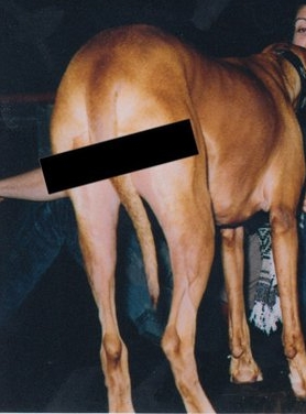
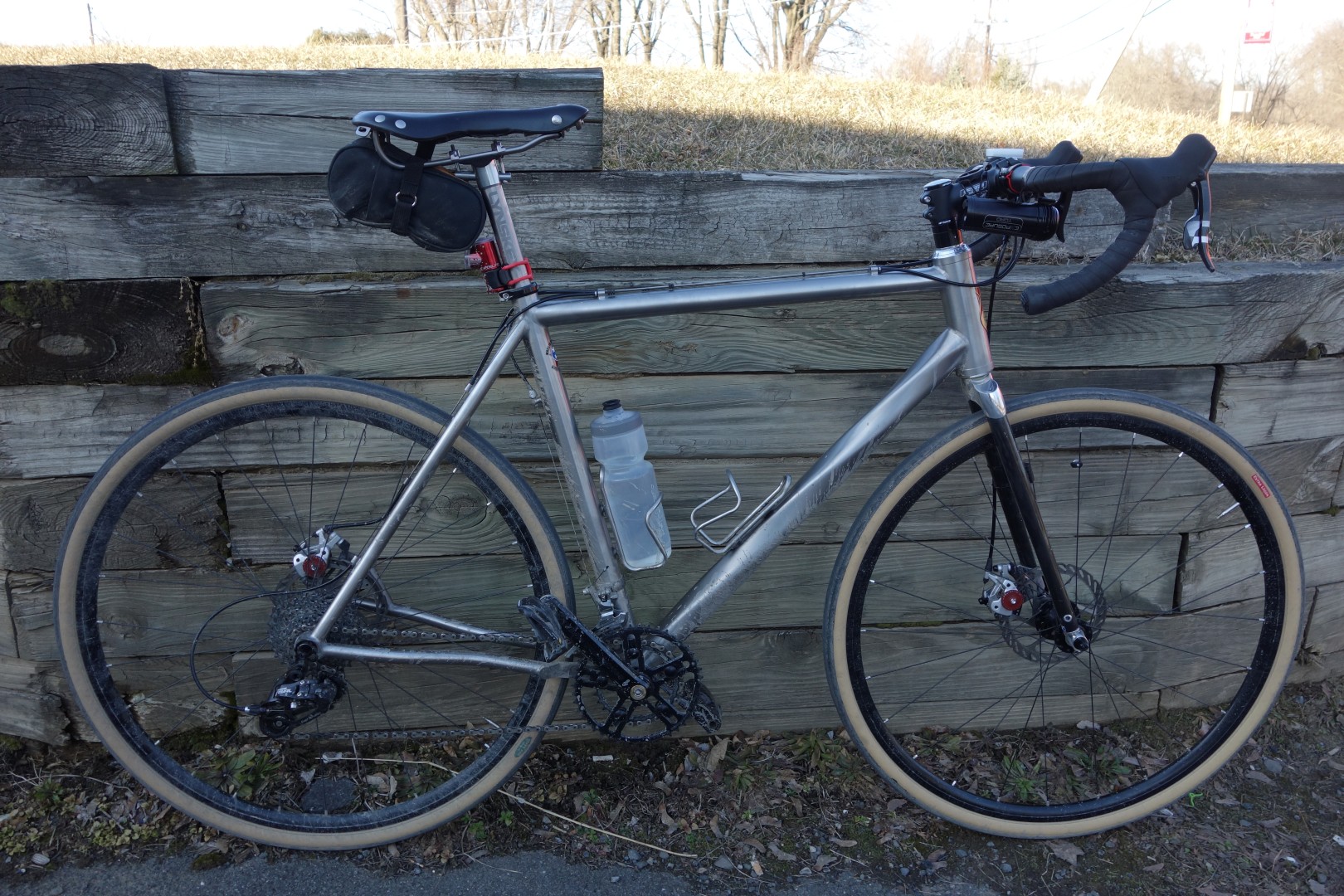
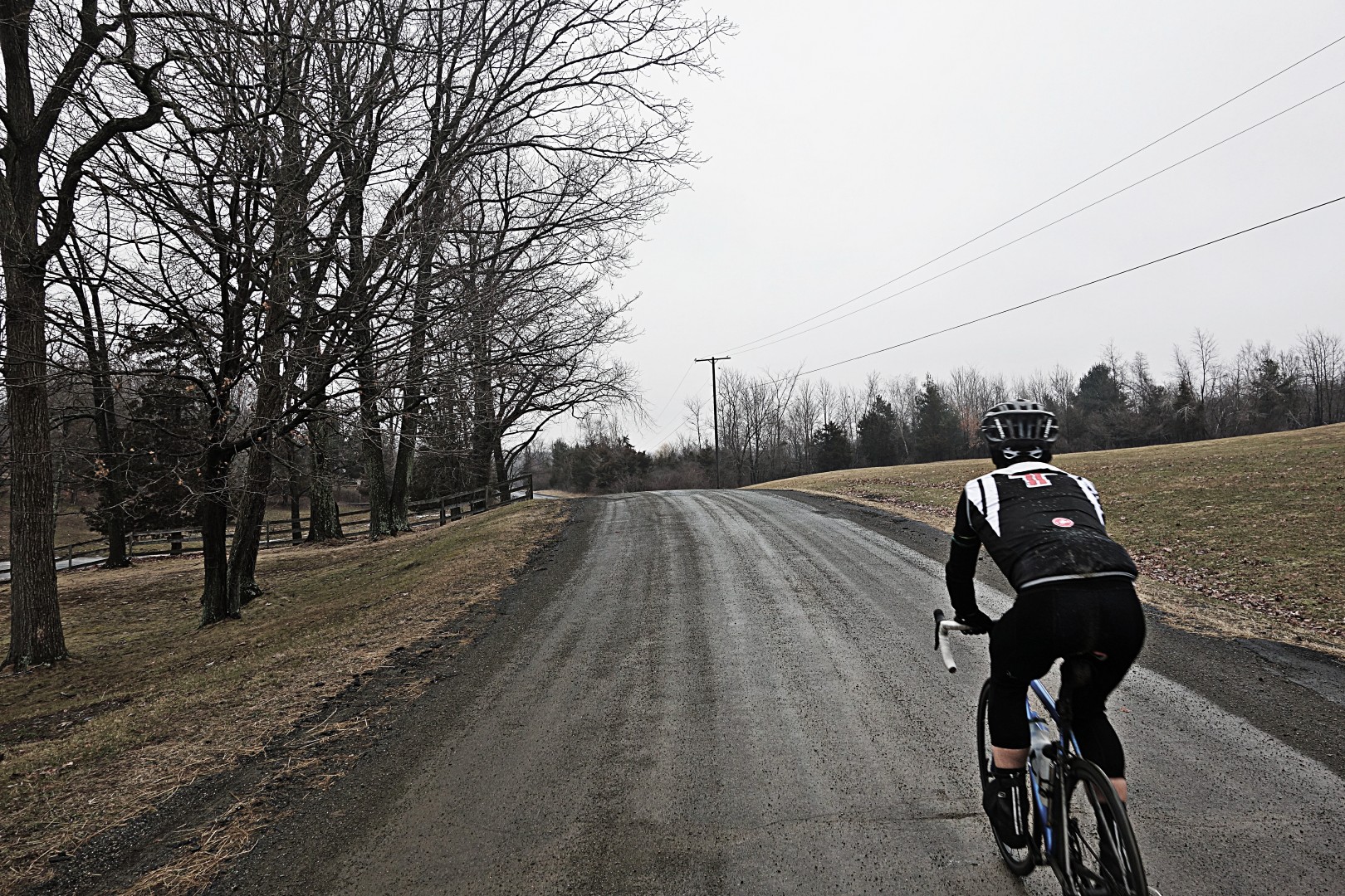
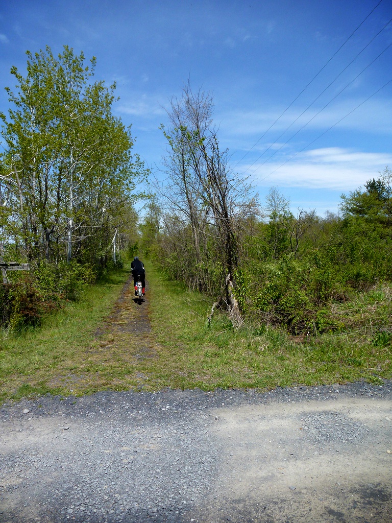
So it was at ass o’clock thirty (that’s 7:30 am) that we set out from my place in a cold, misty rain at a temperature slightly below freezing.  Yes, that’s me on my winter cross bike, submitted as proof that I’m not just driving around taking pictures.

Image

In case it’s not completely obvious, this photo was taken by Doug.

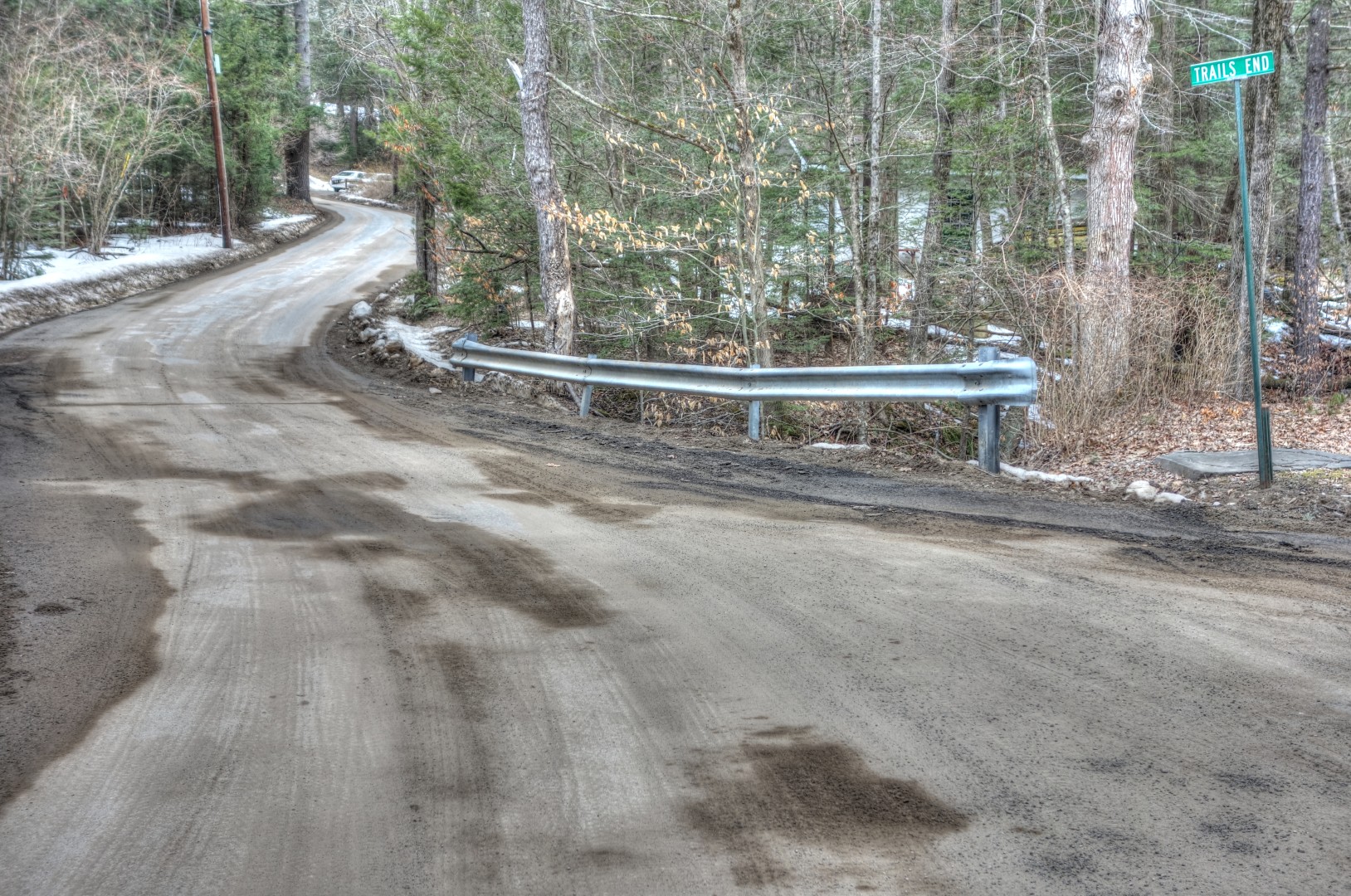
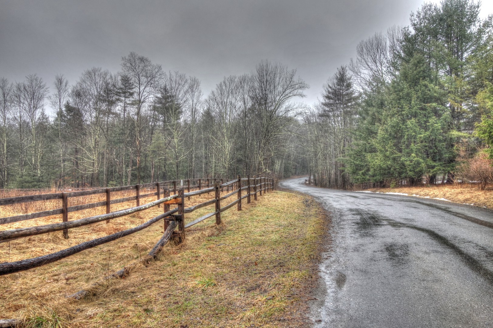
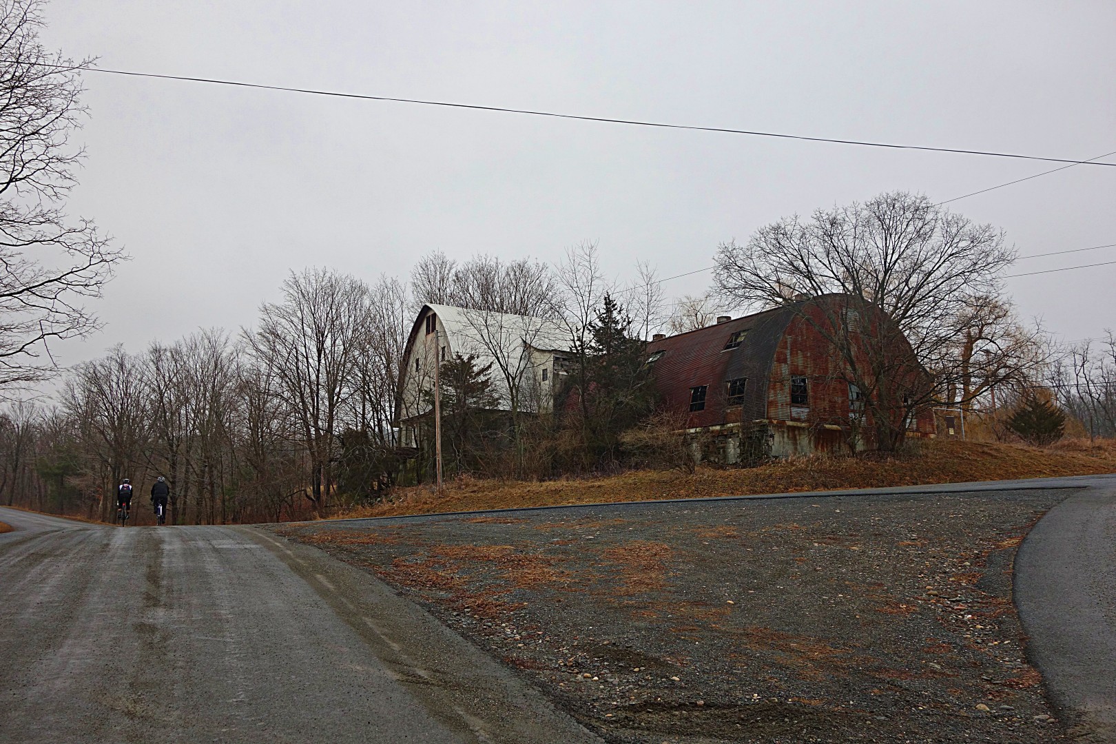
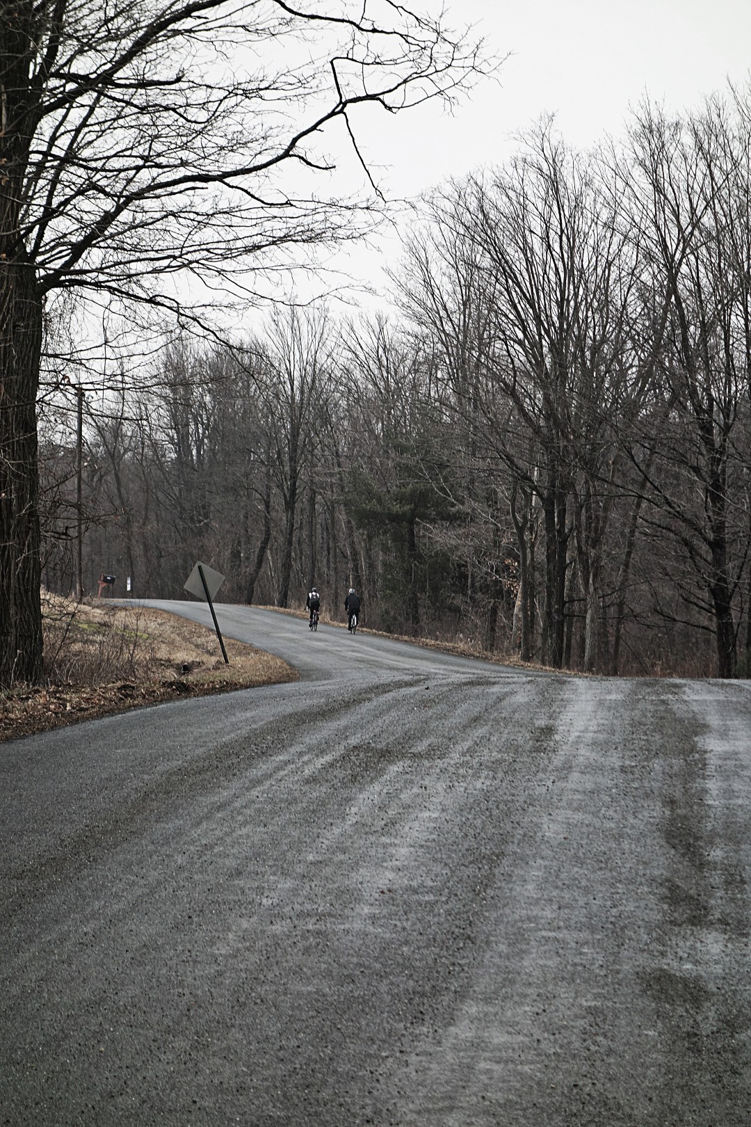
We initially proceeded west onto a gravel road. Bad idea. The road was covered in ice, and not 50 yards in, Doug took a fall. Of course this happened right after I said “be very careful!” Luckily, he was uninjured, or least uninjured enough to go back to my place, where we loaded a new route into our Garmins that did not involve gravel. Doug is clearly made of tougher stuff than me, because if I had fallen (and I came damn close) I would have stayed at home to nurse a broken chicken bone.

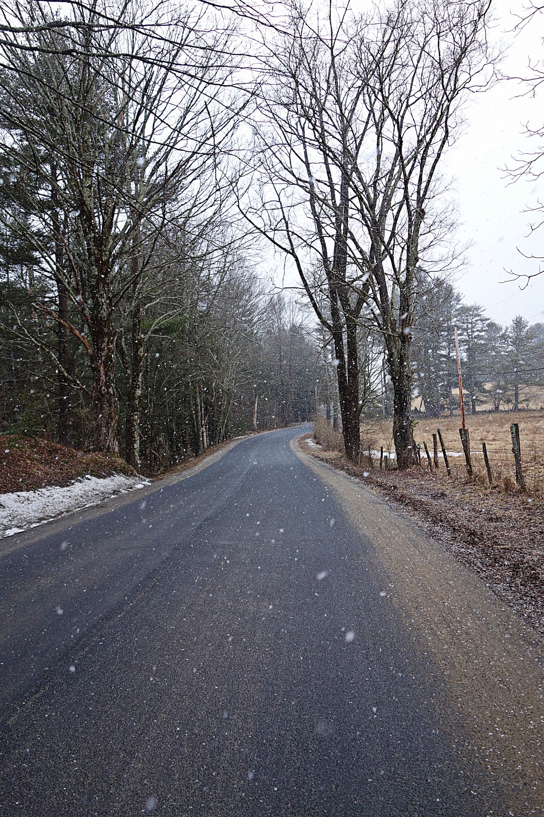
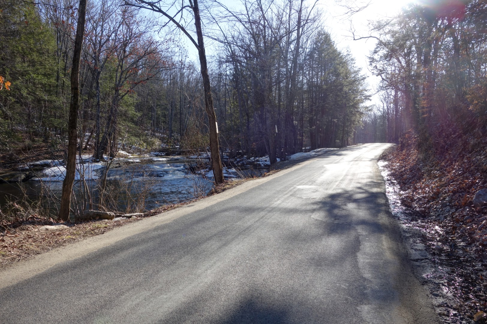
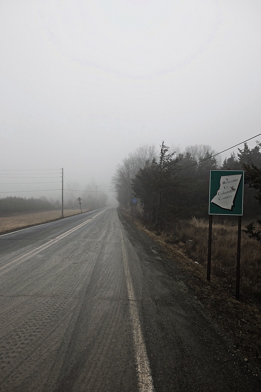
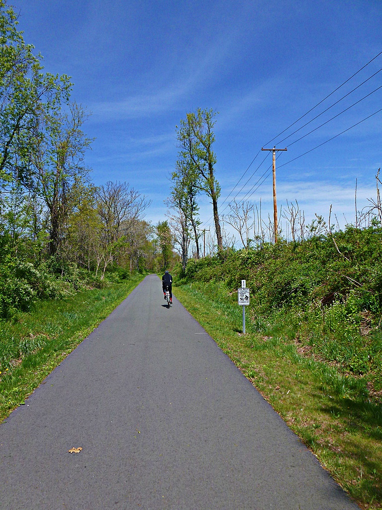
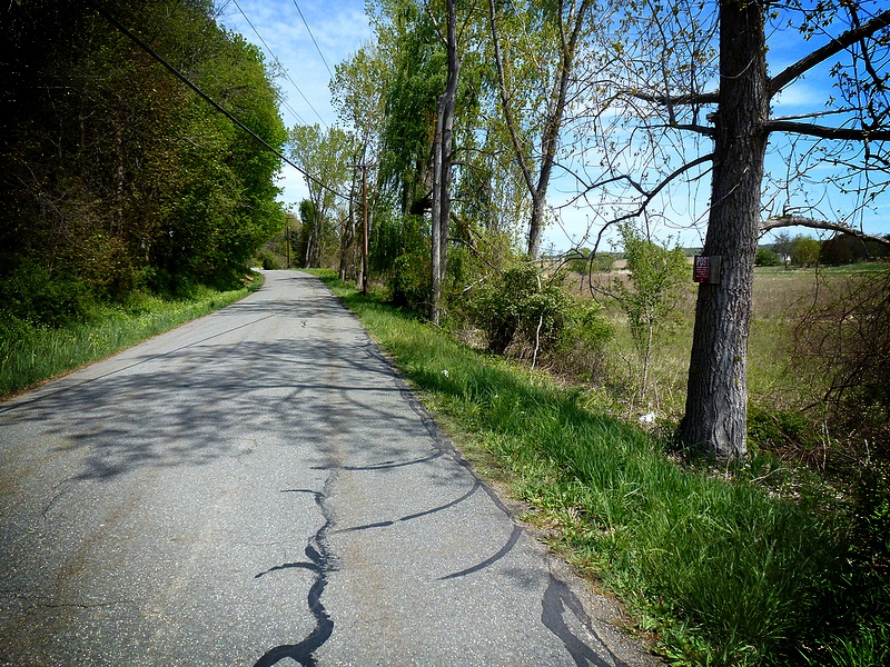
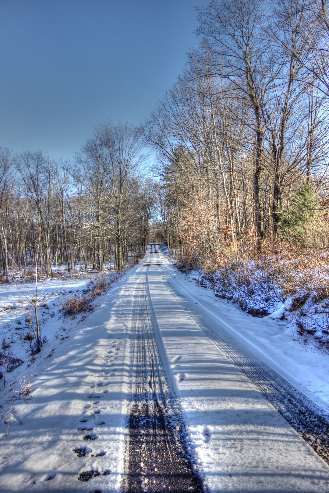
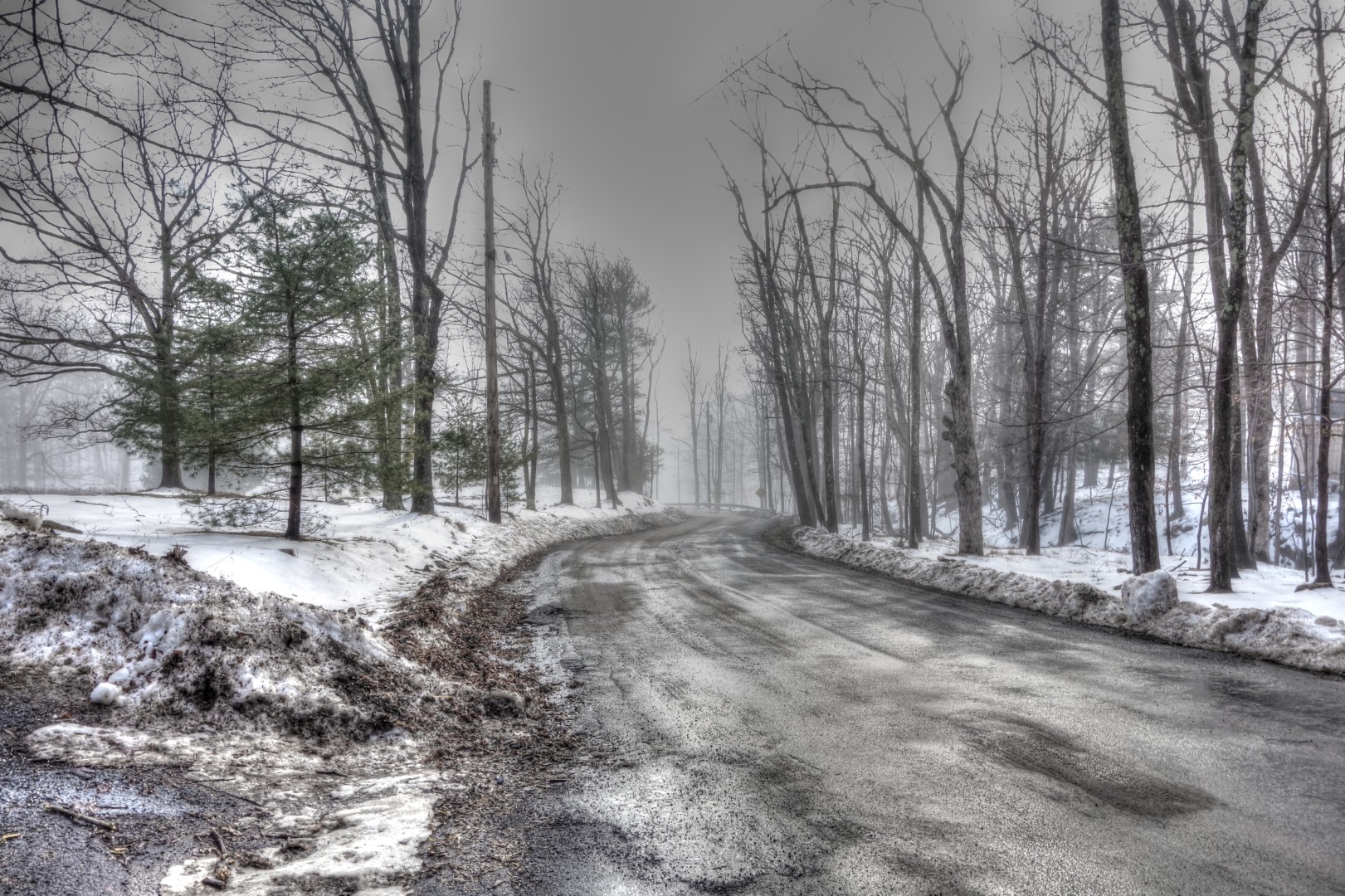
Setting out again in the opposite direction, we headed south to route 209 on roads that were lightly coated with snow and ice that was, at least, starting to melt.

Image

There was a thick fog and a freezing mist that lent the ride a mysterious air, almost as if we were floating through the clouds.

Image

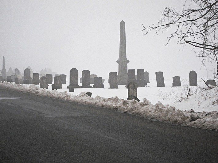
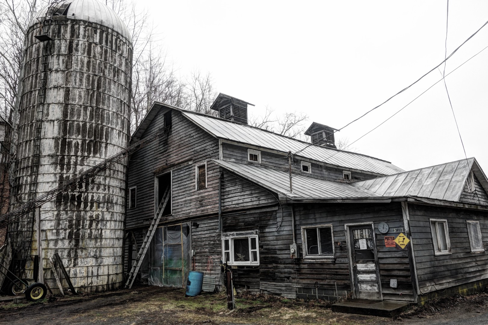
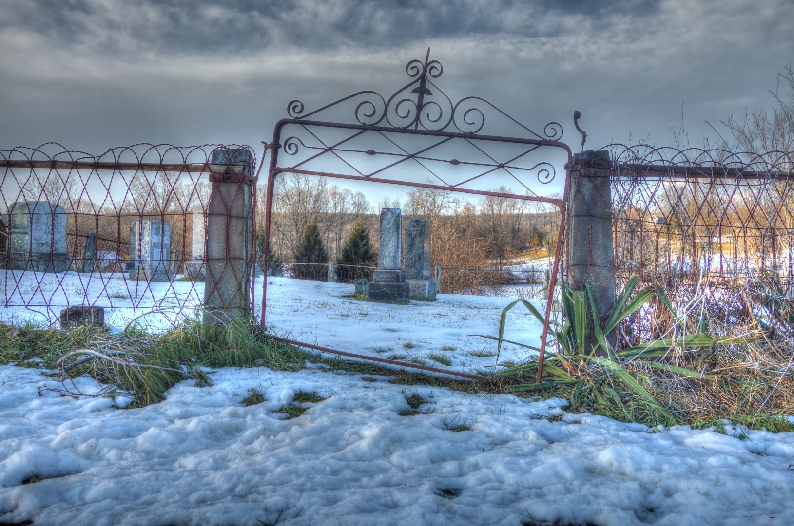
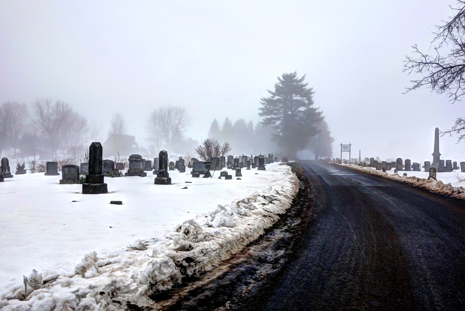
We passed through this graveyard on Airport Road on our way to 209. Some of the graves here date back to the early 19th century. The second photo was taken by Doug.

Image

Image

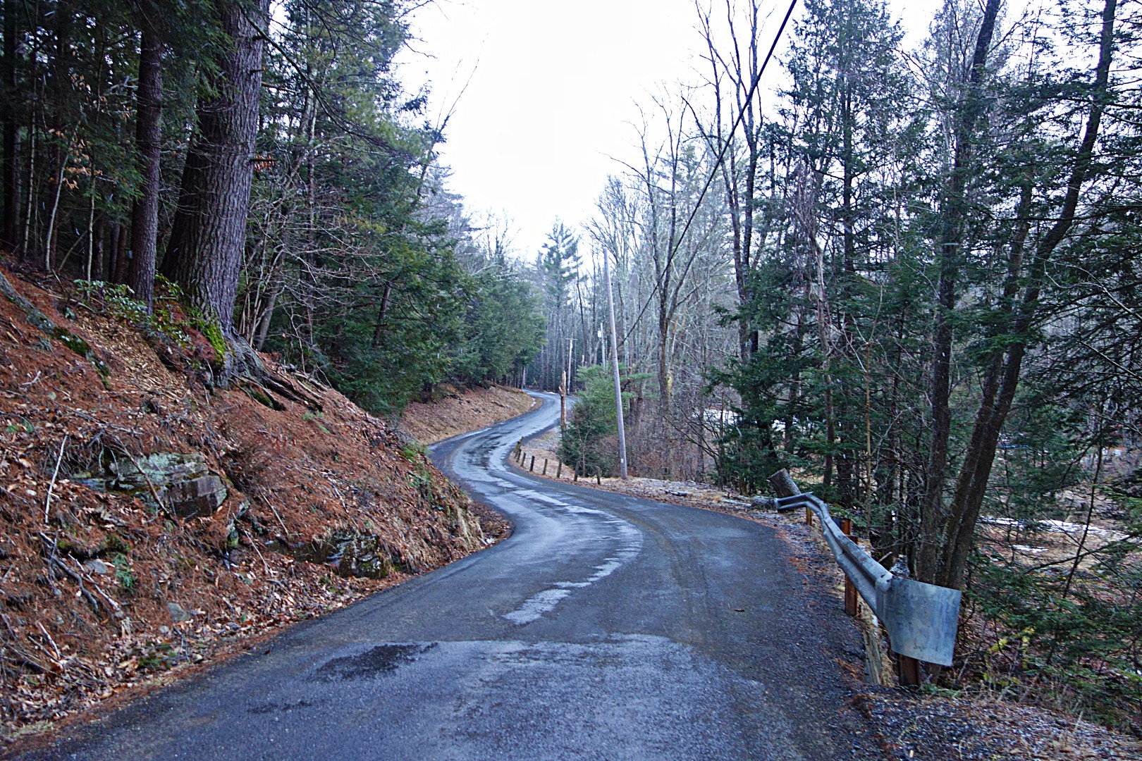
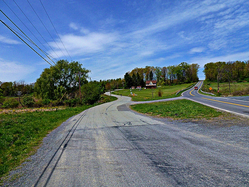
After crossing route 209, we headed into our first big climb of the day, over the Shawangunk ridge via Mountain Rest Road. This climb has been immortalized in numerous reports, so I won’t belabor it here.

The funny thing, though, is that when I lived in New York and rode out here, I thought this was a tough climb. This was my first time going this way since moving to the Catskills, and I didn’t think it was that hard.

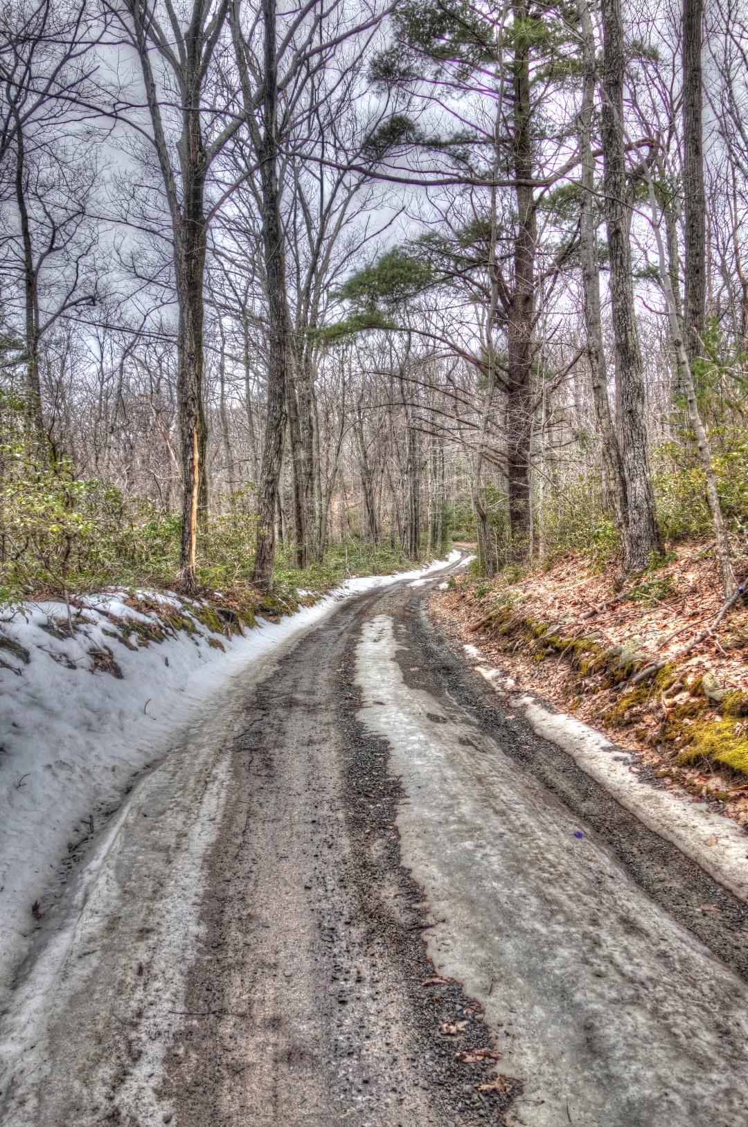
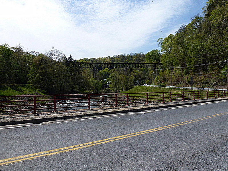
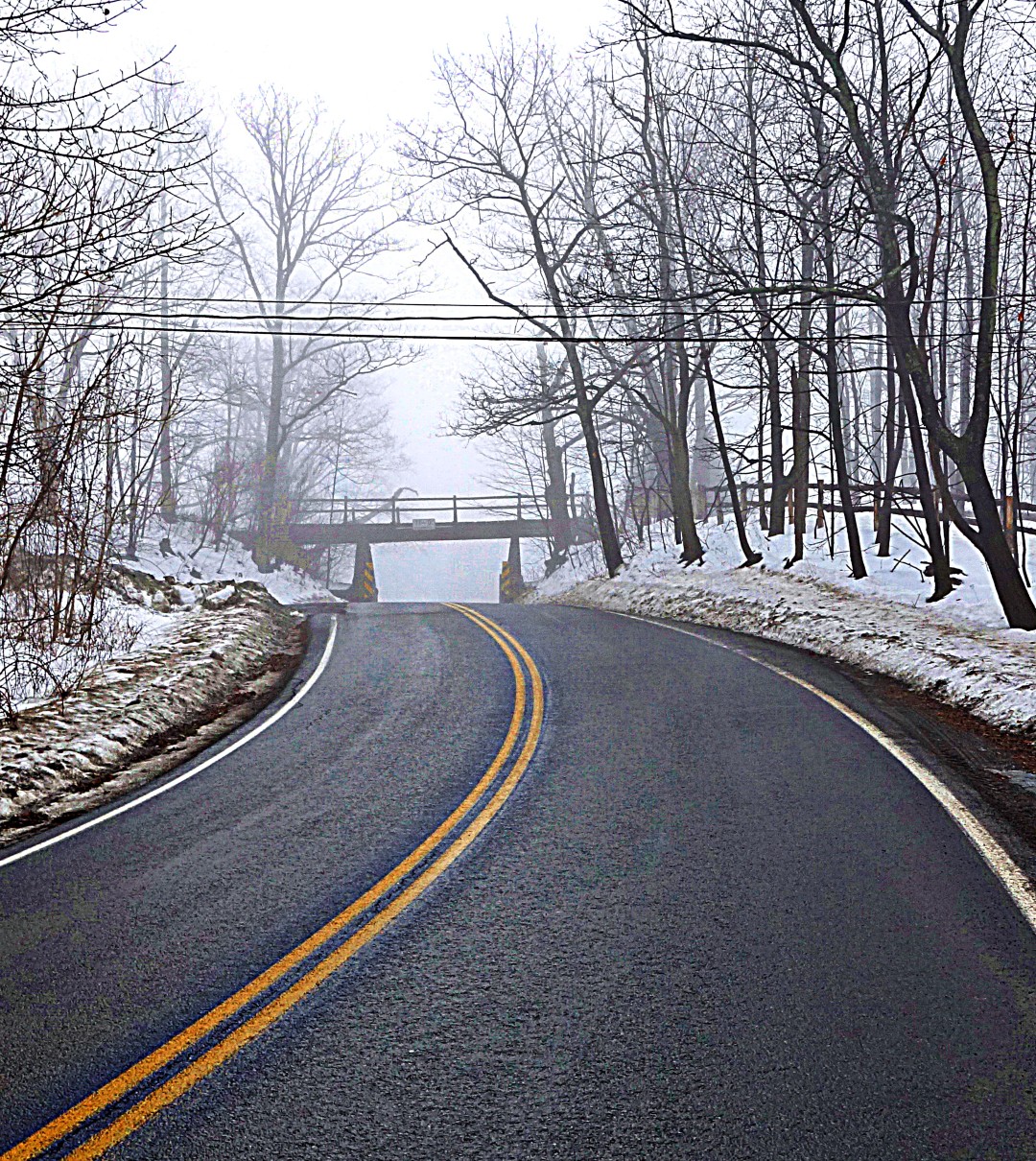
When you see the second bridge—shown here—you’re almost done.

Image

The best part about this climb was the weather. It must have still been below freezing at altitude, because the cold mist clung to my sunglasses, where it froze, lending the climb a hallucinatory quality.

Image

Image

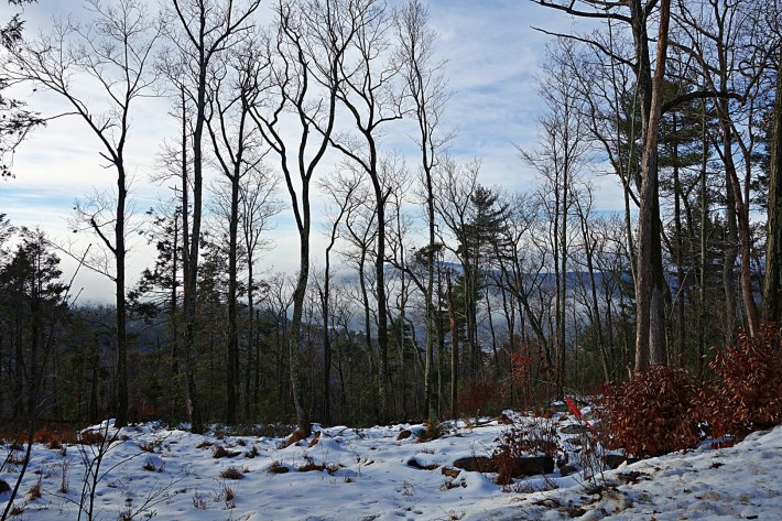
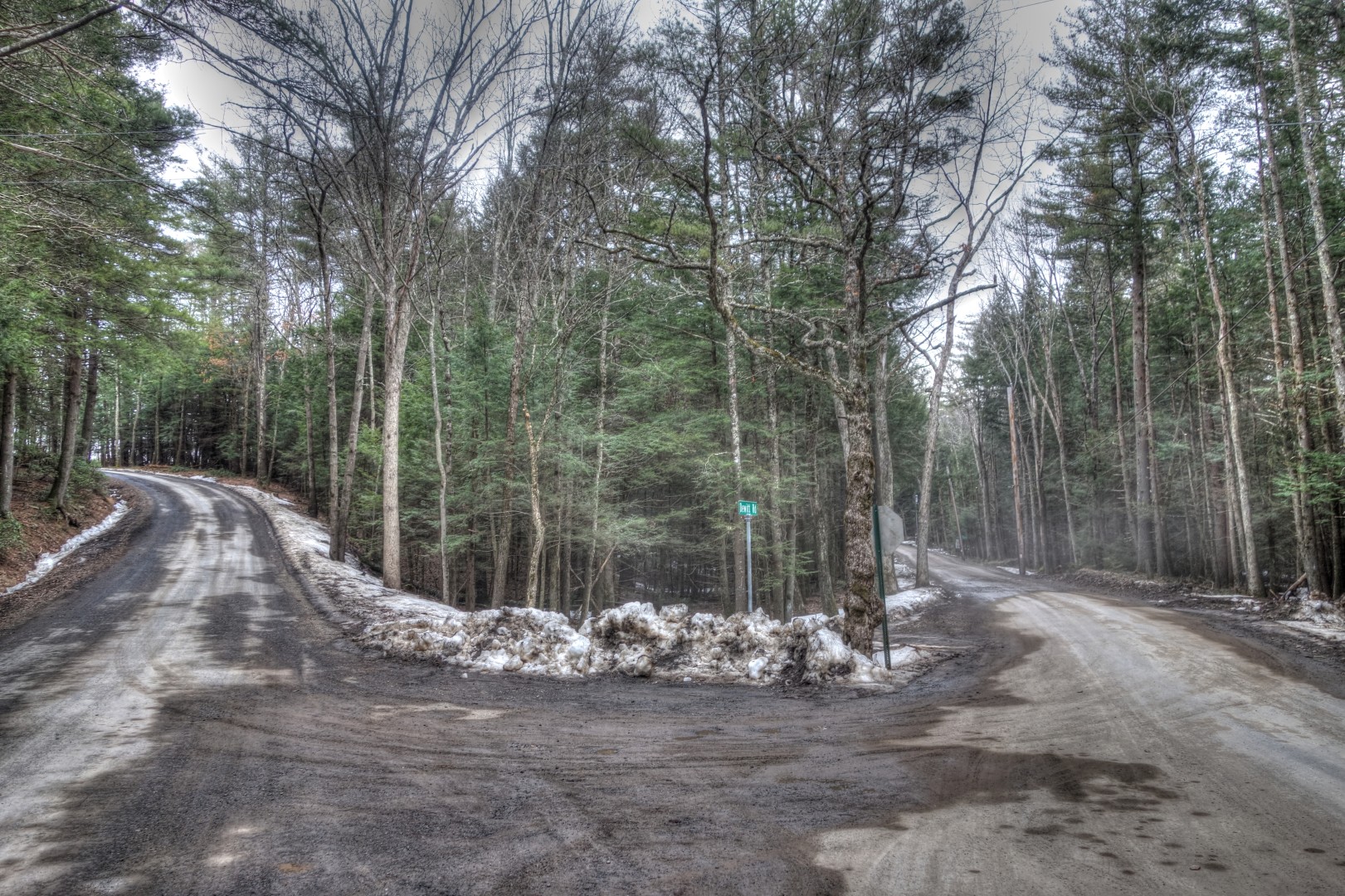
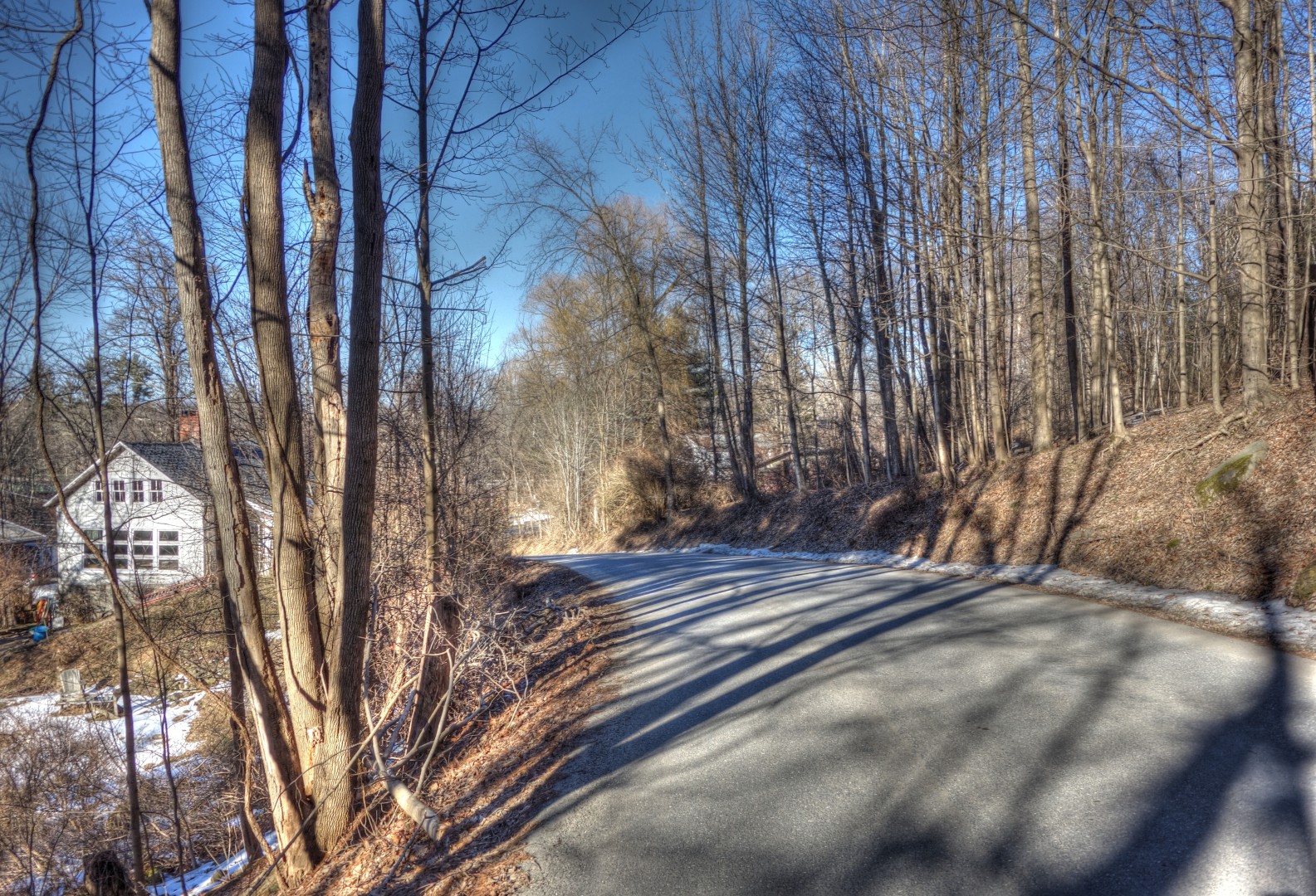
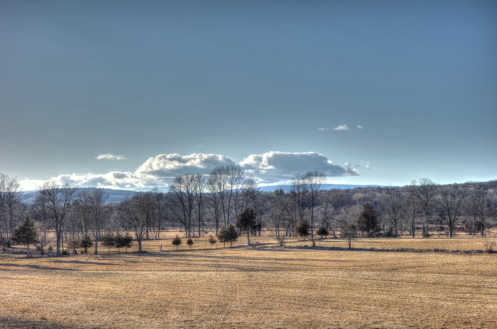
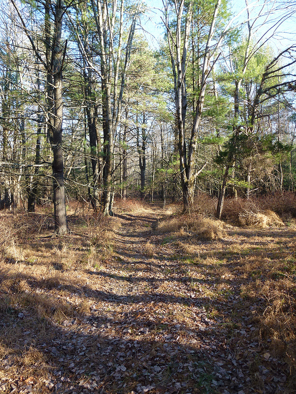
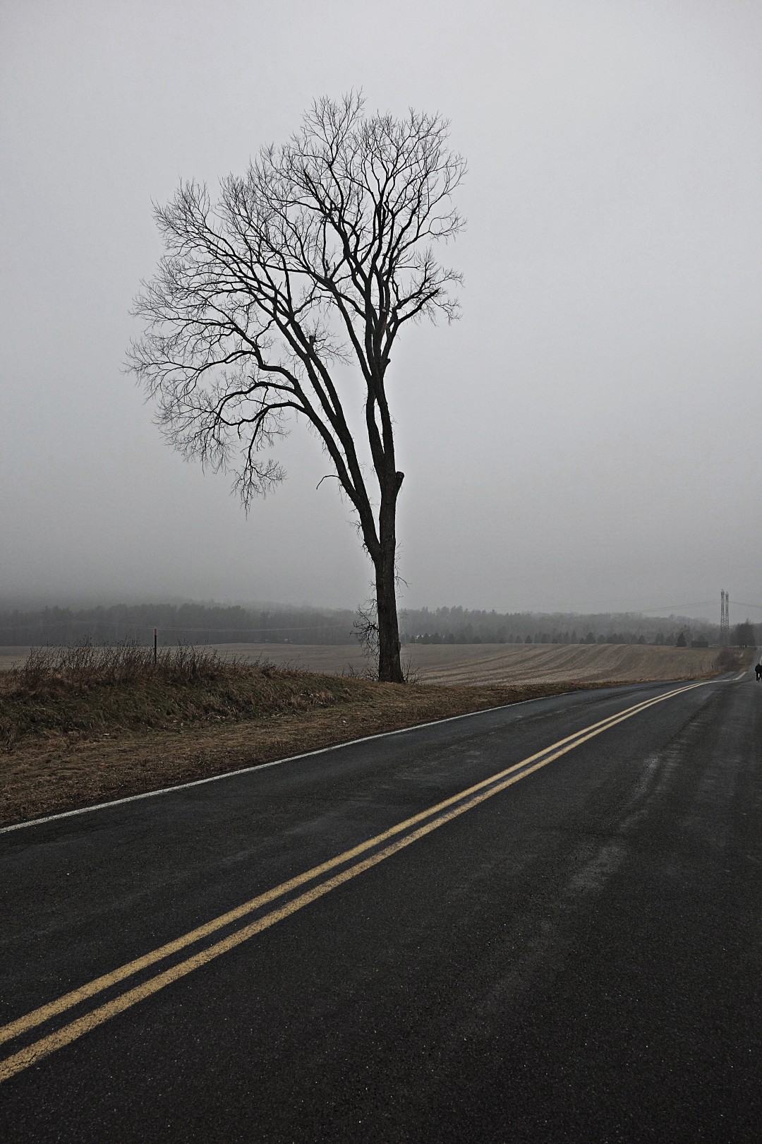
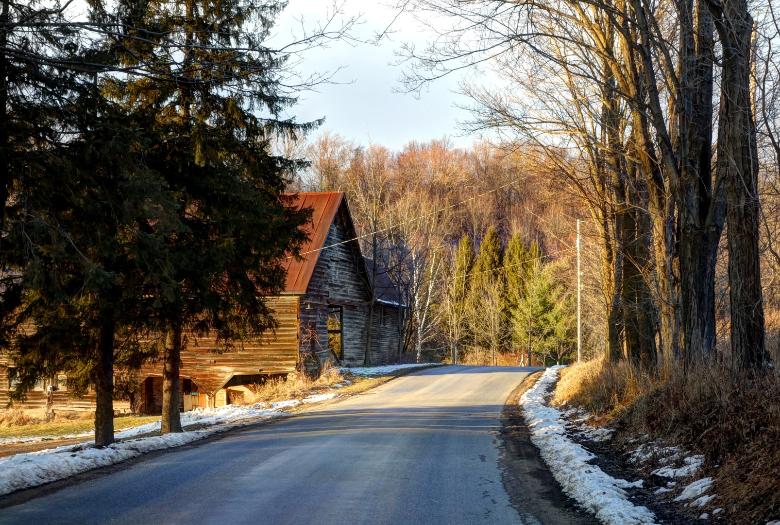
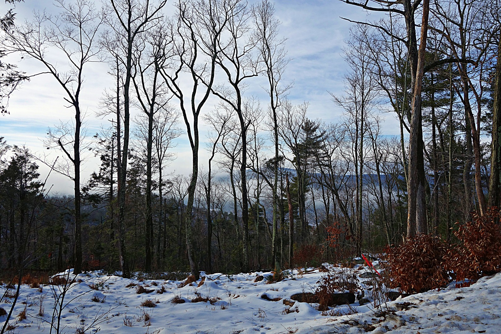
We continued through rolling country along the eastern edge of the Shawangunks to get to the next big climb over the ridge, Vista Maria into the town of Cragsmoor. Although you’re climbing through a lovely forest, there isn’t much vista to be had on the way up. Here’s a picture during a brief clearing.

Image

Once you get to the top, you have the option of taking a right onto Sam’s Point Road. We didn’t bother, because we were essentially inside a cloud the whole way up, and figured that there wouldn’t be much to see.

By the time we started to descend, the sun had started to come out, burning away some of the fog.

Image

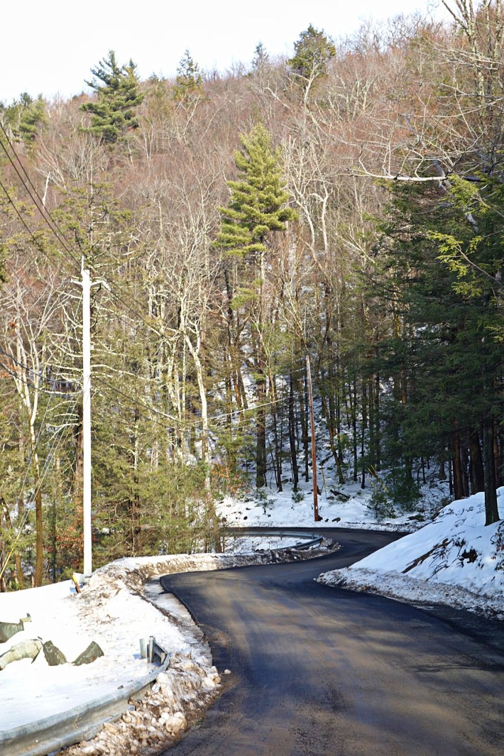
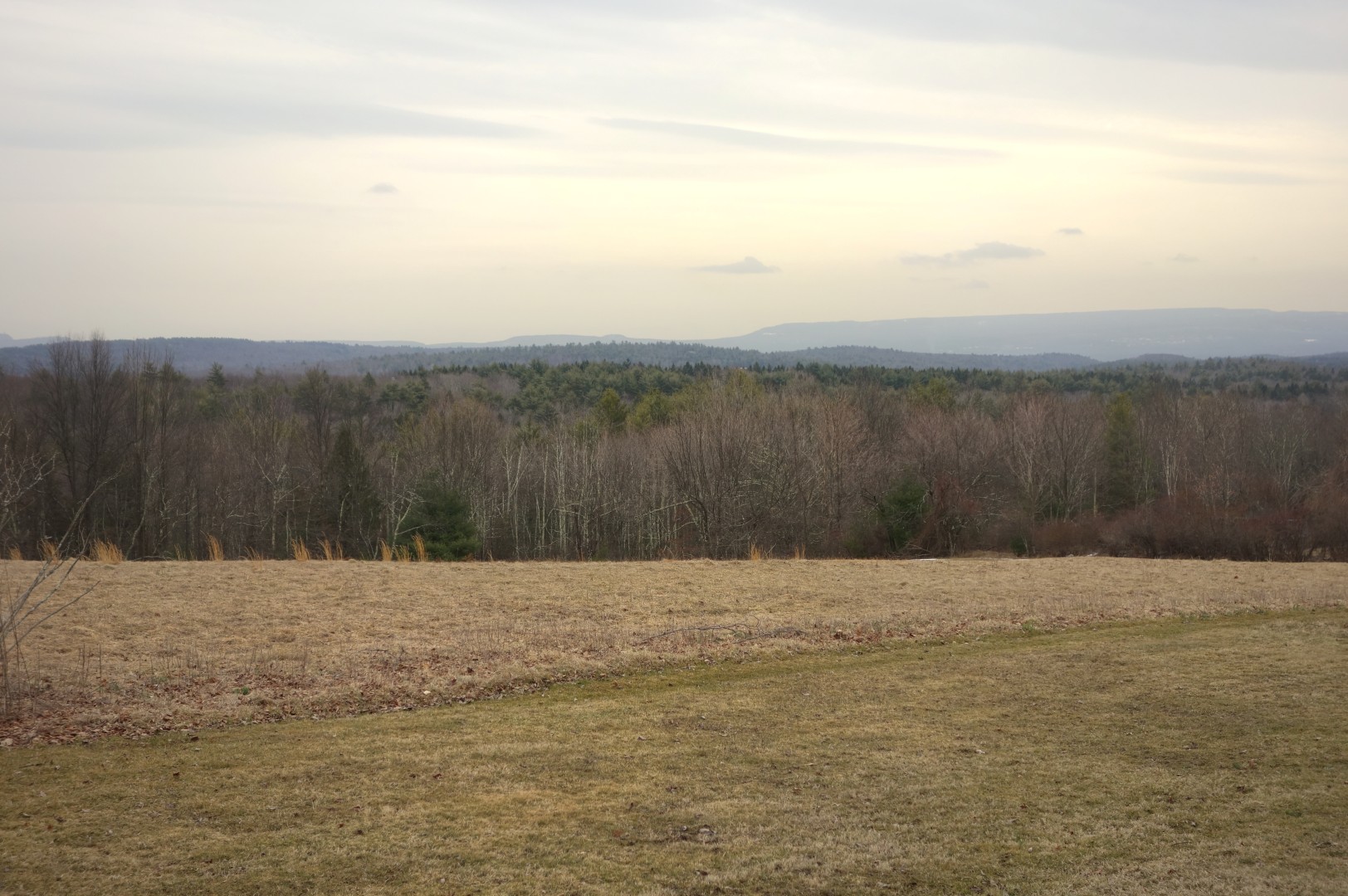
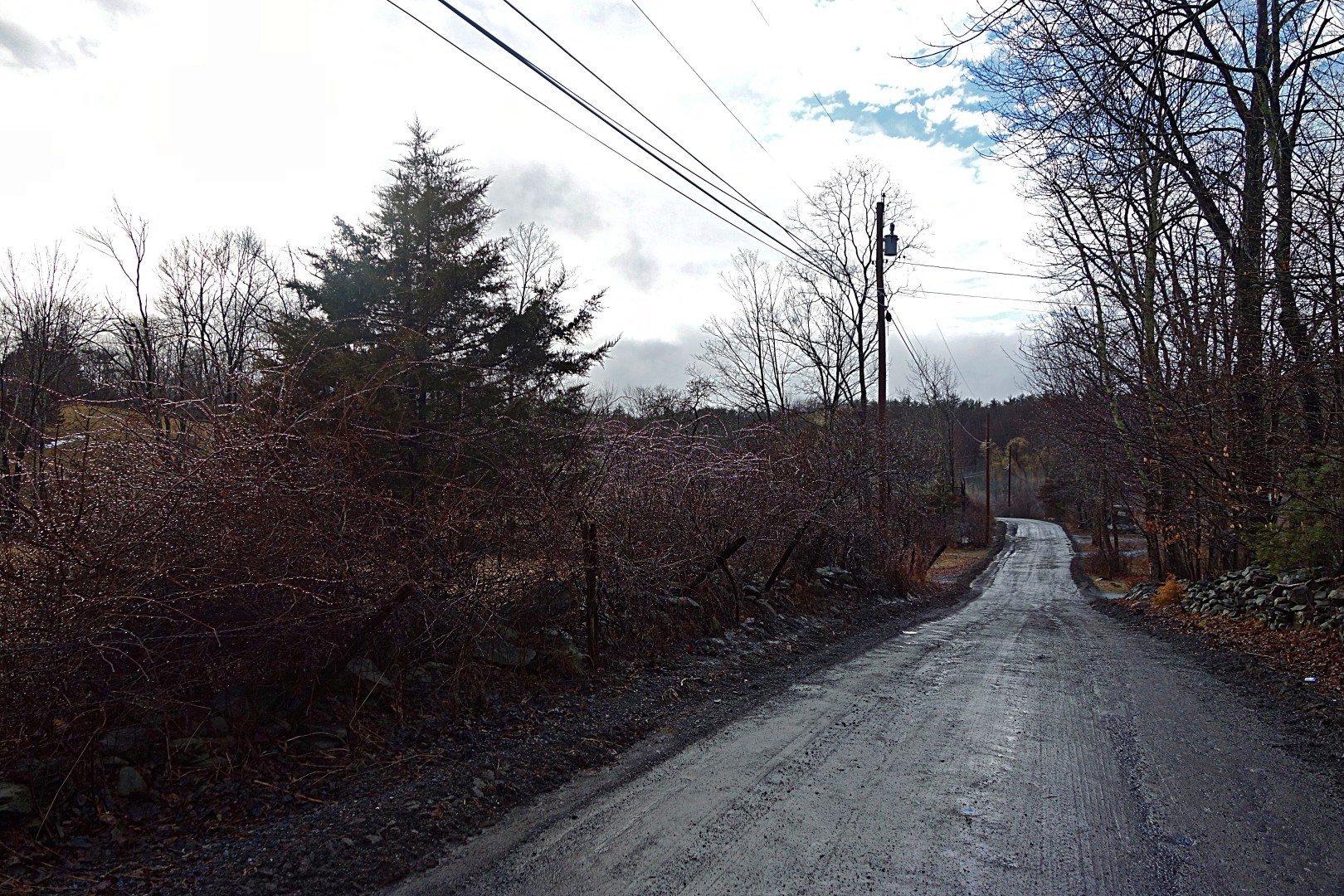
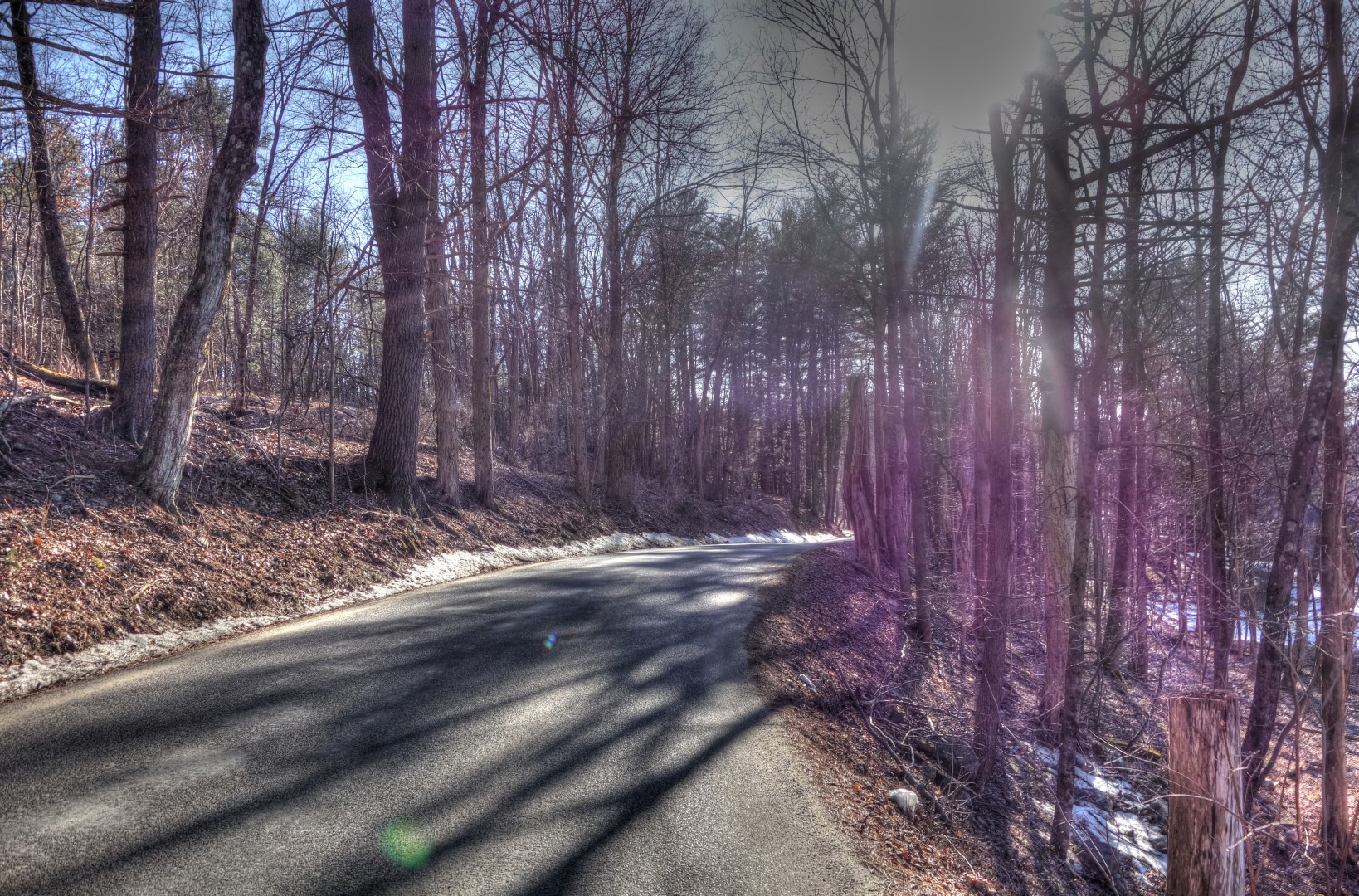
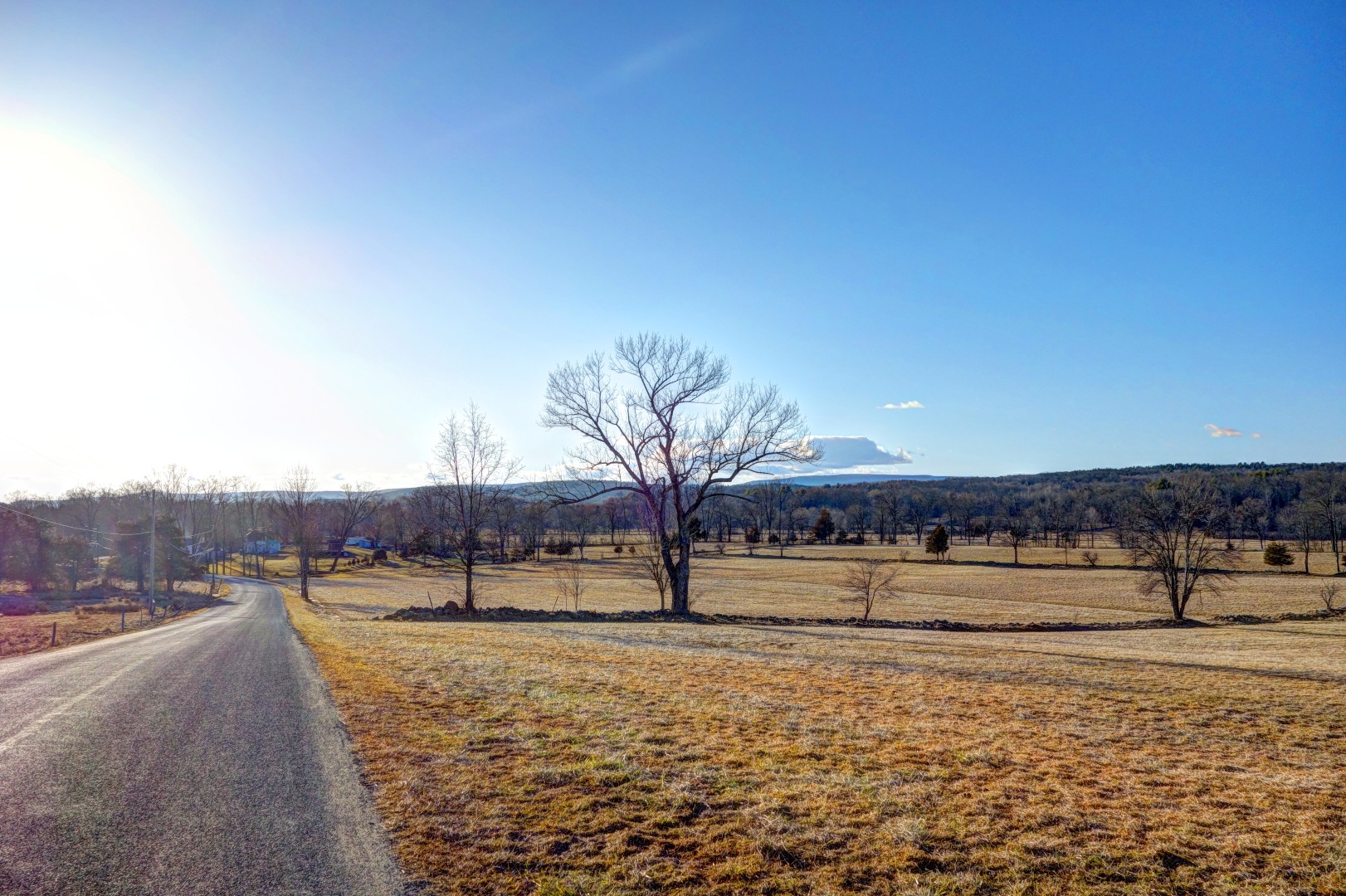
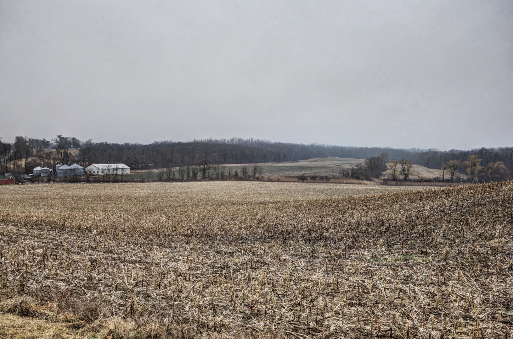
The descent was fun, although we had to be extremely cautious because of the loose sand on the road. In the summer, this is probably a 50 mph descent. I hit 30 a few times on the way down, but I wasn’t willing to go much faster than that given the road conditions. Here’s where you get some great views, at least in the winter.

Image

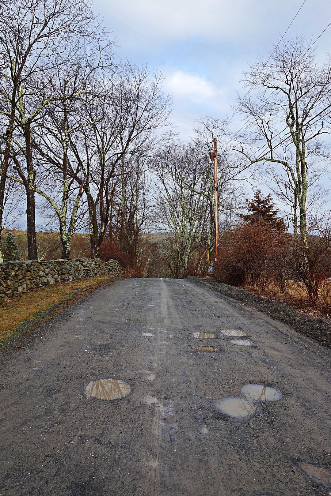
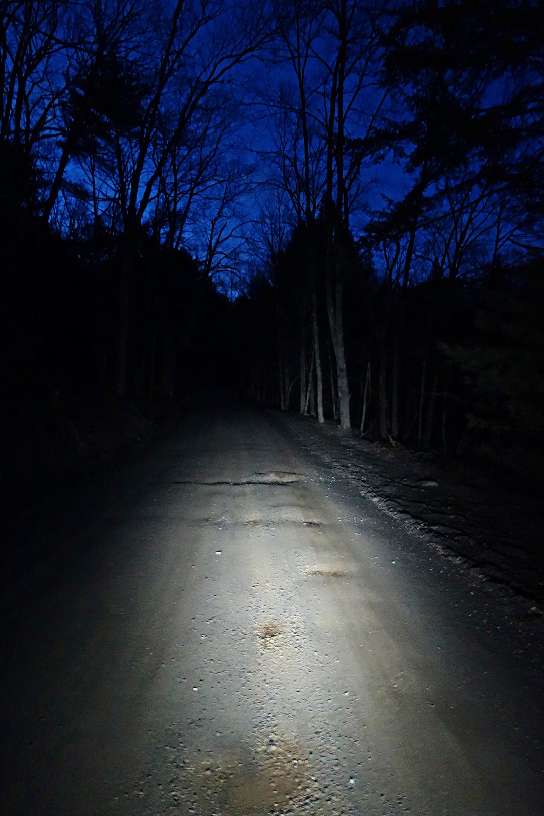
We descended into Ellenville, where we stopped for a late lunch. Then we took the quick route back via 209 to Kerhonksen, followed by a great climb back to my place. Because of the crash, we had gotten off to a very late start, and—frankly—I underestimated how long it would take us to climb Vista Maria. So we ended up riding the last bit in the dark.

This is when I started to pray to St Milhaus the Retainer, a minor deity that Doug invented just for me on our return trip. St Milhaus, you see, is responsible for keeping dogs from pooping on the floor when left home alone for too long. The girls are perfectly house trained, but—because we work from home—they don’t have practice going 8 or 10 hours without a trip outside.

I’m happy to report that St Milhaus answered my prayers.

Doug stopped in for a hot tea, and I had my usual ice-cold Coke. Yes, I’m an addict. I gave Doug a naproxen since he was sore from his fall earlier in the day. In the middle of the night, I awoke terrified that I had accidentally given him a long-expired sleeping pill–the bottles look almost identical. How do you explain to someone you’ve just met that you’ve accidentally given them the wrong drug?

After fumbling for my glasses, I dashed downstairs. Thankfully, the bottle was still on the table. Doug, if you’re reading this…it was naproxen!

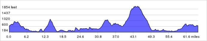
I decided to compare Vista Maria to the other big climbs I’ve done in the area. Here are some metrics for comparison:

  • The average grade of Vista Maria is 7.0% over 3.3 miles. The maximum grade is 18.7%, and it’s a Cat 2 climb that peaks at 2062 feet
  • The average grade of Platte Clove is 7.4% over 2.9 miles, with a maximum grade of 18.6%, and it’s a Cat 2 climb that peaks at 2058 feet
  • The average grade of Peekamoose is only 3.9% over 4.1 miles, the maximum grade is 12.0%, and it’s a Cat 3 climb

So, at least by the numbers, Vista Maria is of similar difficulty to Platte Clove, and equally as entertaining.

Is this ride worth the trip? Definitely, although I couldn’t see anything for most of the ride due to the dense fog. It is certainly challenging, and I think it will be gorgeous during the summer in nicer weather. I look forward to repeating it.

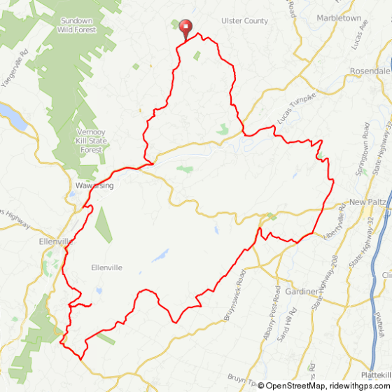
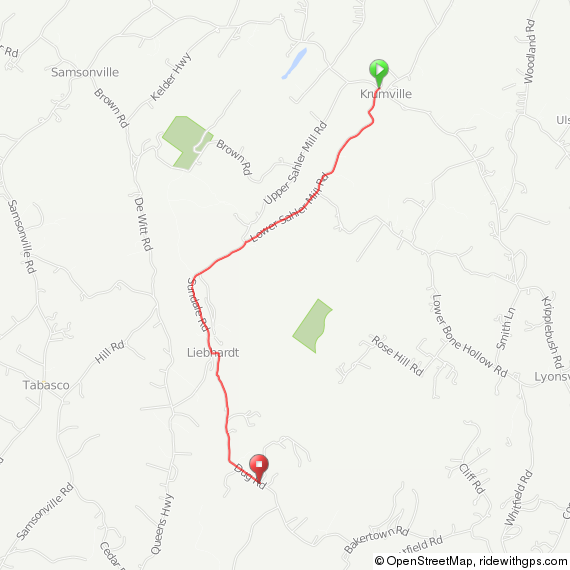
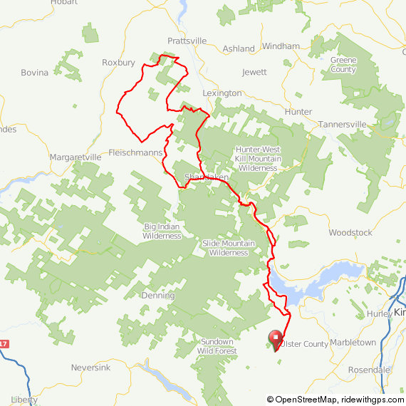
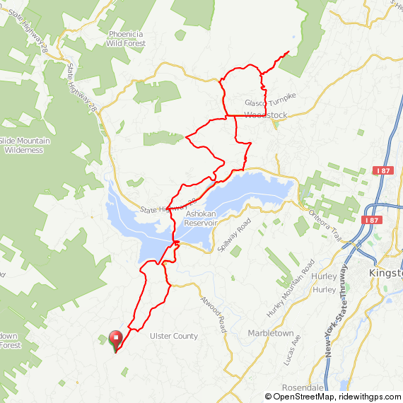
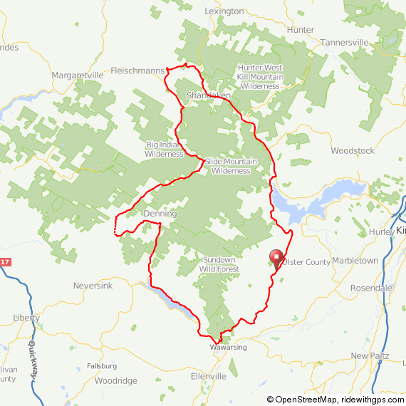
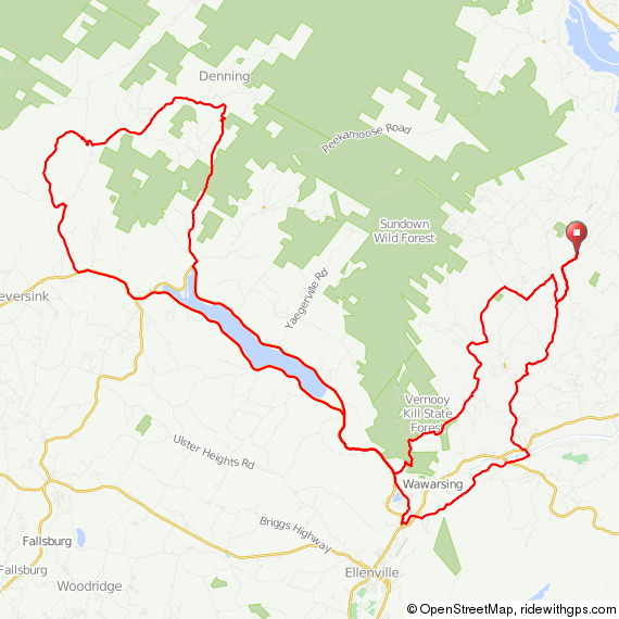
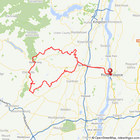
Here’s the route we took, mapped from my house. At the end of the day, we rode 70.2 miles. I’m not sure where we went 5 miles off track.

Image

Image

I’ve also mapped the route from Poughkeepsie, for those of you who would like to try it from the train station. It is a quite reasonable 90-mile day ride.

Image

As a note, this route includes a short segment to the north of Route 209. Why? Because 209 is no fun at all. Although there’s a wide shoulder, there is a lot of traffic. However, it is fast and flat, so if you’re tired from Vista Maria, you can skip this section and continue 10 or 11 miles on Route 209 to Old King’s Highway, just after Accord. There, you will take a right to continue the route. I’m also told by my friend John–who has lived out here much longer than me–that Berme Road, which lies just to the south of 209, is a good option here as well.

John

medicalwriter.net

Using Ride With GPS Routes, Continued….

I went for a long and brutal ride with my friend Doug this weekend (more about that later, but it involved crashing on ice, freezing mist, massive climbs, and fervent prayers to St Milhaus the Retainer), and we both had Garmin 800s. Despite the fact that we both had the same course loaded, my Garmin was giving the correct directions, while his kept telling us to make U-turns and was generally just a pain in the ass.

I realized this morning that I had made some changes to my Garmin setup long ago that facilitate its use as a tool for guiding bicycle routes. These changes are important:

  • When you first turn on your GPS, click on menu. Then click on the wrench icon on the lower right. Then click on system, and then routing
  • Make sure the first line says “Calculate Routes for Bicycle”
  • The second line (guidance method) should say “off road”
  • The third line (lock on road) should say “no”
  • Click through the fourth line (avoidance setup), avoid U turns, toll roads, highways, carpool lanes. Do not avoid unpaved roads.
  • Click the back arrow, and the fifth line (recalculate) should be set to “off.”

If you don’t do this, your GPS will recalculate your route every time you stray off course. Also see my previous post on using Ride With GPS routes for full directions on loading courses into your Garmin.

John

medicalwriter.net