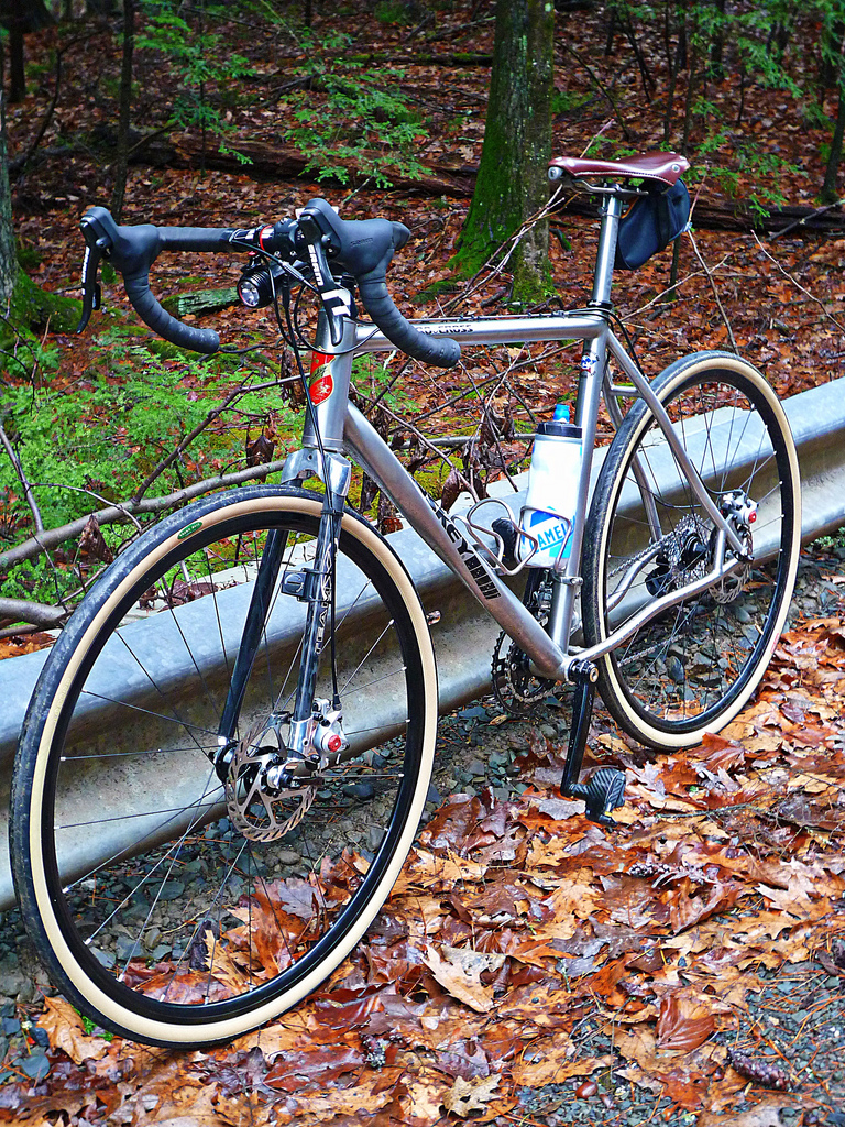
At some point I will put together posts on each of my bikes. Until then…
John


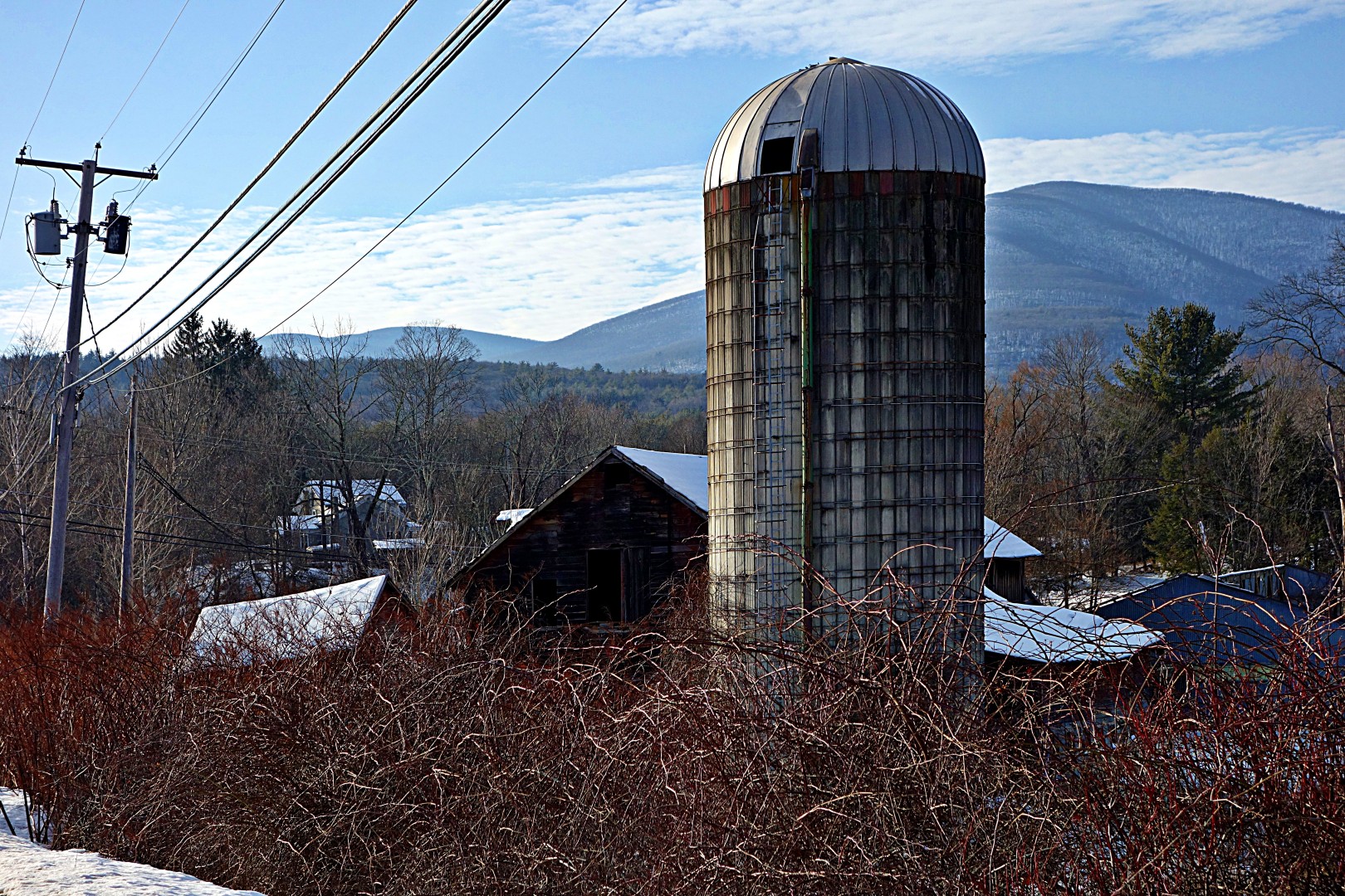
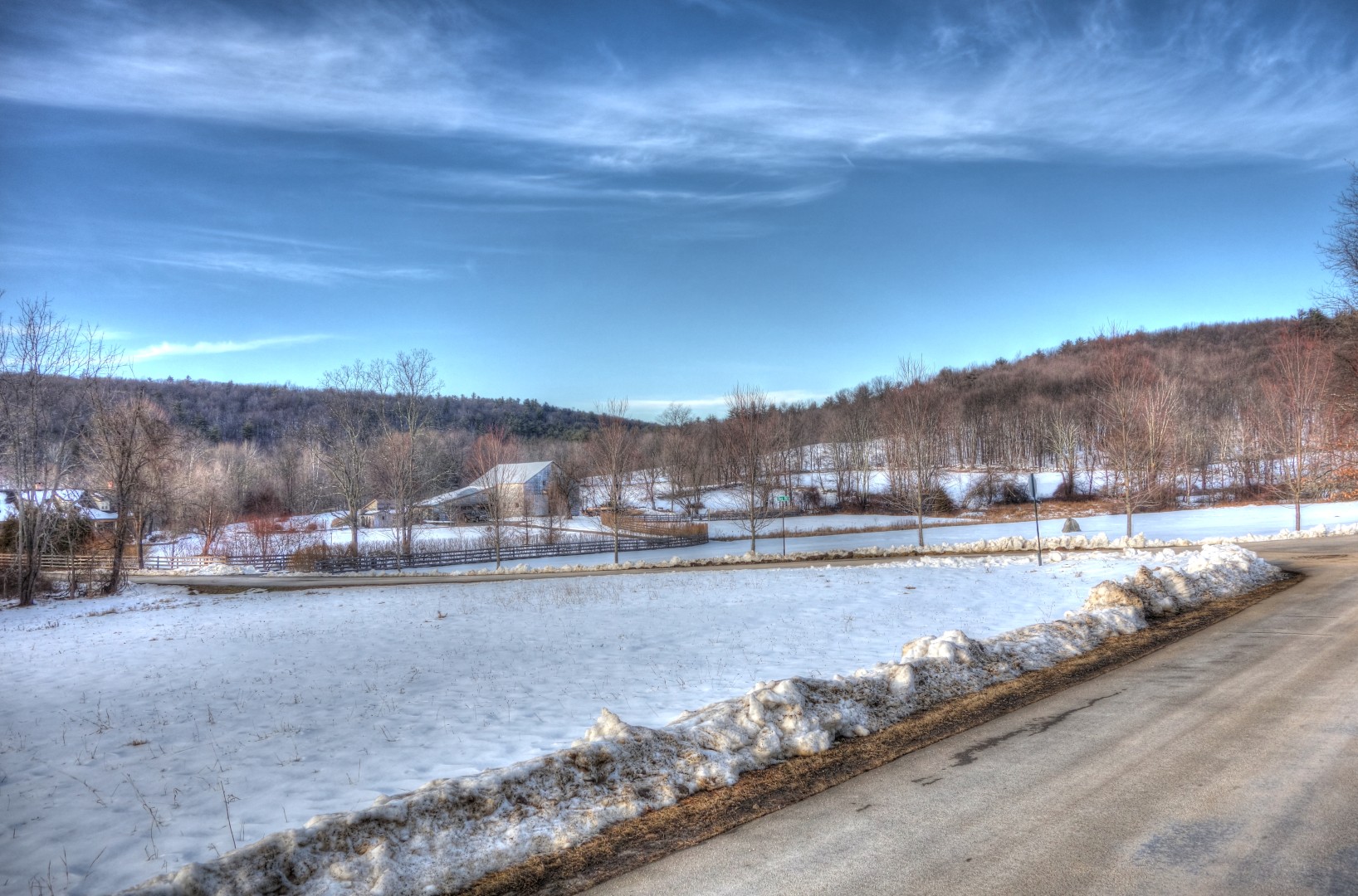
Only 3 days of riding in the last 7 days, totaling a less-than-astonishing 95 miles. (Sorry for the massively overexposed pictures: between the snow and the sun it was tough to get a good shot).
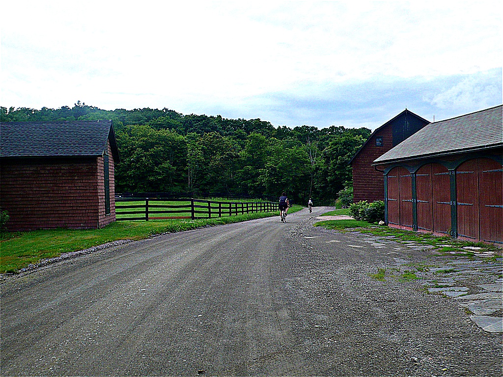
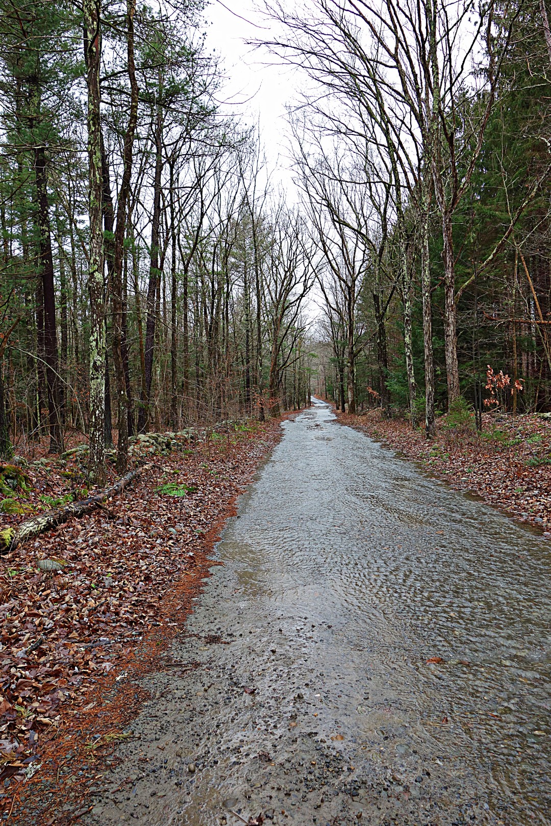
The first ride was a failure. I rode north of the Ashokan reservoir in search of Pitcairn Mountain Road which, according to my map, is a nasty, twisty road with 1500 feet of climbing.


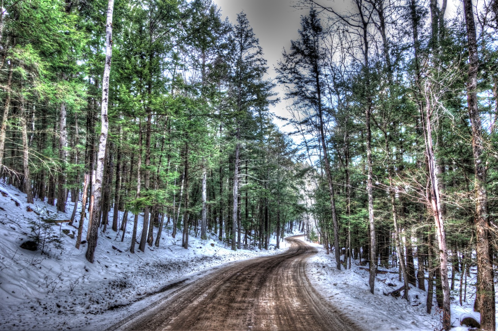
Unfortunately, I rode all that way only to find that Pitcairn Mountain Road was private. But almost all rides are good rides…I ended up exploring some of the roads nearby instead, which–happily–were gravel.

The route offers splendid views of the Ashokan Reservoir.

I emerged onto Route 28 hungry after some great gravel miles, and–thankfully–there was a little restaurant with excellent food.

I didn’t take any pictures after this because the roads were familiar to me. In fact, I entered what can only be described as a fugue state for the next 20 miles, aided by Youme and Meyou on repeat in my head. It was almost like being hypnotized. I didn’t realize it until I stood to climb a huge hill and realized I was breathing so hard that I was close to vomiting. I have no recollection of those miles, but when I looked down at my computer, my average speed was 23 mph. What a great way to train!
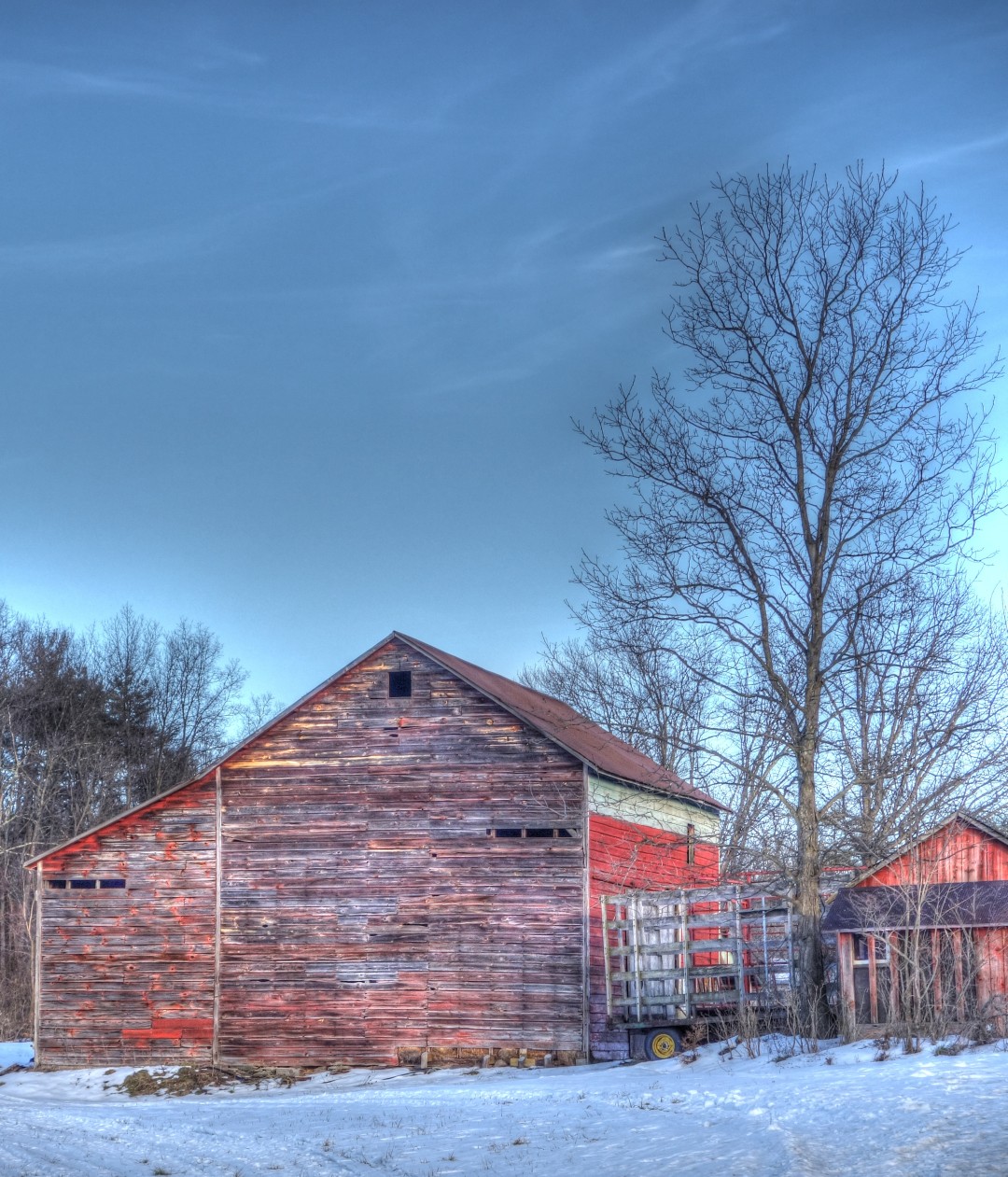
I took this picture after I emerged from my fugue state.
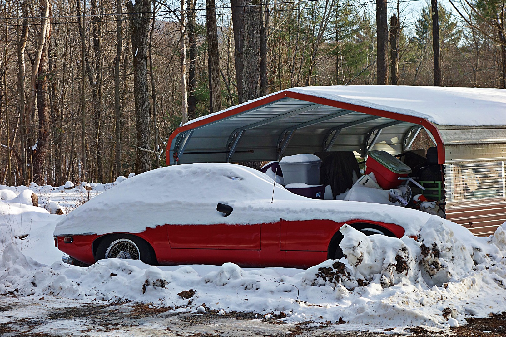
…and would someone please save this Jaguar E-Type? Contact me if you want the address.
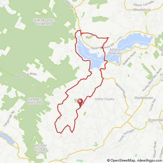
Here’s the route for those of you who might be interested in a shorter ride around here.
I didn’t take pictures on the next ride, because it was truly for training only. It involved me riding up and down a hill until the drool froze on my face. Appetizing, I know.
The weather started getting markedly nicer later in the week, and after many hours of working on a new drug with a name that, when letters are accidentally transposed when typing fast, spells “Asslympics,” I felt it was my duty to get out and ride. Plus, my girlfriend went to LA for meetings and I had a craving for a sub.
Yes, I rode 30 miles to get a sub. Here are a few pictures (click on the third one for full size, it’s pretty cool).


On my way home, I met my copilot, Dug the Dog, so named because she lives on Dug Road. I am tempted to take her home…she’s always running around without a collar in the road, and although she’s very friendly, she’s extremely hand shy, which leads me to believe she isn’t treated well.

The back end of the ride included 15 miles on gravel.
Yes indeed, that’s my lunch ride.
That’s all for this week, although on Saturday I have a 75-mile ride planned out to the Neversink Reservoir with my human friend Doug (not Dug, pictured above). Along with new winter routes (mostly less than 50 miles) I literally have dozens of old 80- to 120-mile rides remaining to post, complete with GPS and cue sheets. I’m hoping to get all the old routes up before the end of winter, because starting in March it’s time to get serious again about longer-distance rides, which means I’ll have fresh long-distance routes to post.
John
As you’ve probably noticed, all my routes are on Ride With GPS. It’s a great platform–much better than Map My Ride–plus the guys running it are great at responding to questions and fixing bugs. At this point, though, there’s little to fix.
A friend who is new to using Garmin just asked me for directions on how to get a route into his device. Since I wrote it up for him, I thought I’d cut and paste the directions here for your edification.
Go to my Ride With GPS page.
Click “view” for the route of your choice. On the next page, you’ll see a map and 3 tabs on the right: overview, metrics, and photo. Click on overview, if needed (it should be the default tab), and below you’ll see more three tabs: comments, share, and export. Click on export. Right click on TCX course and save to your desktop.
Plug in your Garmin. A folder should automatically pop up (if it doesn’t and if you have a PC, go to Computer and click on Garmin). Drop the TCX course into the “New Files” subfolder. When you start your Garmin up next, [route name] will appear in your list of Courses.
When you turn on your Garmin, click on the route you just uploaded, then when the map comes up, click on the wrench icon. Turn on turn-by-turn directions (which are off by default), turn off virtual companion (which is on by default), and make sure that off-course warnings are on. This is important and was a source of considerable frustration when I first got my Garmin…I couldn’t figure out why it wasn’t giving me directions!
That’s it!
You can also print the cue sheet using the print icon on the left. It prints as a PDF and is not ideal for riding. I copy and paste the text into Word in landscape mode, increase the font size, and improve the formatting. If you leave a 2″ margin at the top and bottom, after trimming with a scissors it fits into the map case of a Berthoud bag perfectly.
You can get most of the functionality of Ride With GPS for free, but I’d recommend paying for it. It’s inexpensive, you get some additional functionality, and you will be supporting the guys who created this useful tool.
Note that there is a second post in this series that deals with the proper Garmin settings for cycling.
PS: Read the comments for some useful information from a man who rides far more than me.
John
Update: An anonymous benefactor was kind enough to update the route (7/2013). The updated route can be found here.
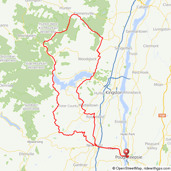
When I mapped this route several years ago, I had almost no knowledge of the local roads north of Brewster. So I just used Ride With GPS to sort of randomly draw a course on what looked like back roads in Putnam and Dutchess. I had no idea it was going to become the all-time summer classic ride!
After I posted this ride on Flickr a few years ago (and well before I had a blog) I started getting very positive feedback about the route from complete strangers via e-mail and Flickr mail. So it is a truly happy accident.
Anyway—at least in my opinion—this is one of the best moderate-effort rides within easy reach of New York City. In fact, I enjoy this route so much that it is one of the few longer rides I repeat multiple times a year. It’s approximately eighty miles. Virtually no traffic, in fact for 90% or more of the ride it is perfectly safe to ride side by side. It alternates between perfect road surfaces and gravel. Big climbs, some on gravel, and long, long descents.
The route begins at Southeast Station, the last direct stop on the blue Metro North line, and only 2 to 3 minutes past the Brewster stop. Here, I showed my friend Tom the route and elevation profile. Tom only rides with us occasionally, and you can see from this picture how he felt about it.

The station is in a deep hole that you’ll have to climb out of. A nice warm up for the rest of the day. Note that there’s a diner with acceptable food at the top of the hill if you want to stop for breakfast before continuing.
After climbing out of the hole, you’ll take a right on Dykeman Road (Route 312). Be careful here, because it’s a busy road. Luckily, you’ll only be on it for about 1.5 miles before you take a turn onto Farm to Market Road to head into the hills.

You’ll continue to Route 164, take a quick left and then the first right at the pond onto Cornwall Hill Road/Country Road 292, which you’ll follow past Whaley Lake. At the north end of the lake, around mile 14, you’ll find an outdoor hotdog/burger stand, probably blasting the worst music you’ve ever heard at high volume. The people I ride with always want to stop there for second breakfast (yes, I ride with hobbits), but between the gristle burgers and the awful music, I wouldn’t recommend it. They open at 10 am, if you’re interested in trying it out regardless. The hot dogs are safe.
Continuing on, you’ll take a left on Route 55…and then the fun begins. Hynes Road is a nicely groomed gravel path the swoops through the countryside through a tunnel of trees.

You’ll continue on Clove Road/Country Road 9, and at mile 25.5, you’ll take a left for one of the nastiest climbs in Dutchess County…Brush Hill Road. It certainly doesn’t compare to climbing Slide Mountain or Platte Clove on the other side of the Hudson, but it is not easy. My memory of it may be warped by the fact that we tend to ride this route on the hottest summer days; also, now that I live in the mountains I’d guess that I’d no longer find Brush Hill terribly challenging.
From there, you’ll cross Camby Road onto Flint/Overlook Road into some nice, rolling terrain.

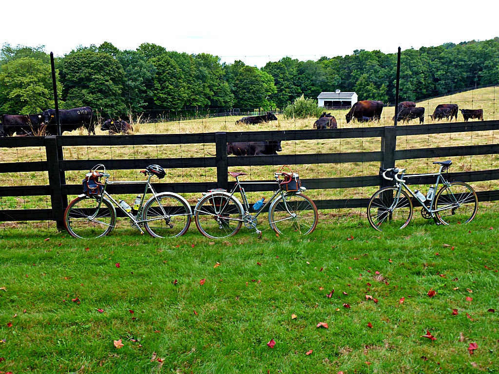
This is our traditional first rest stop, on Hoxie Road. Pictured here you see my Rene Herse, Guy’s very special Jonny Coast randonneur and a James’ Hampsten.
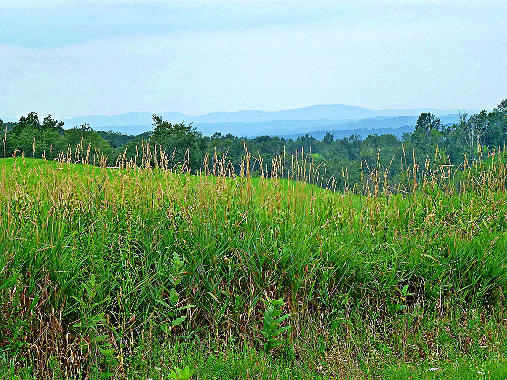
You’ll continue to a brief stretch on 343, and then turn onto the appropriately named Little Rest Road. Off in the distance is the mountain I live next to now.
You’ll cross Route 44 in Mabbettsville at mile 33. For some reason, my GPS tells me to take a right here. Don’t listen to it, just continue straight past the deli. You might stop for a refill here, but you don’t have long to go to get to the lunch spot.
Continuing on, you’ll follow this road through mile 41. It goes through a variety of name changes in this 8-mile span: County Road 66, North Mabbettsville Road, Ludlow Road, Shuman Road, and then, finally, Bengall-Amenia Road. I’m not sure why, but Dutchess is notorious for random road name changes. In any case, just keep following the road.
I didn’t take any pictures of Bangall-Amenia Road, for the simple reason that I was going too damn fast to whip out the camera. This picture was taken while stationary.

Now, listen carefully: Ignore your GPS for a moment and follow Bangall Amenia Road all the way to Hunns Lake Road. Take a left, and about 300 feet down the road you’ll see the Bangall Whaling Company. Lunch. We’ve been there a number of times now, so they are familiar with the clan of lycra. The first time we showed up, though, we got some odd looks. We made friends, and they ended up giving us a bottle of wine, which my friend Guy subsequently had to haul over another 40 miles of hills. Luckily, he had panniers that day! Check ahead before you plan on stopping for lunch, their hours seem to change seasonally. They should be open for lunch during the summer, though.
Return to Bangall Amenia, go up a short hill, and take a right onto Duell Road, and then another right onto North Anson Road at mile 42. This is where many miles of serious gravel begins.


Eventually, you’ll end up on Petit Road. At the crossing with Canoe Hill Road at mile 48.5, Pettit Road is often blocked; if I recall correctly the sign says something about “The Cary Foundation”. No worries if it is, though—just take a right on Canoe Hill Road and then the first left (Fowler Road, although it is unmarked) to rejoin the route.This leads to one of my all-time favorite cycling pictures, my good friend Guy doing some impromptu roadside repair work next to a pestilential swamp deep in the forests of Dutchess county.

Nearby, you’ll see signs for the Cary Institute of Ecosystem Studies. They own some beautiful land; if you have a chance take a right into the preserve, take a break, and enjoy some nature.
At mile 54, you’re in for a dirt-road climbing treat on Milewood Road. The first time I did this, it was in a stiff rain and I didn’t make it to the top because I couldn’t get enough traction. The fourth or fifth time I did this (and alone, this time), I lost traction and tipped slowly over onto the drive side of my bike, unknowingly knocking my derailleur out of adjustment. I got to the top of the hill, shifted into the biggest cog and bam! derailleur shifts into the spokes, bending the hanger and rendering my bike completely inoperable. Luckily, I was able to hitchhike to a train station. Don’t worry mom, it was with a nice older couple with their grandson in the back.
The remainder of the ride is a blast, because it has a distinct downward drift. Yes, there are a few stiff hills, but for the majority of the ride after mile 60 you’re going more down than up.

One final note: At mile 59.5, the route crosses the Taconic State Parkway. You heard that right: it doesn’t go under the Taconic State Parkway. It doesn’t go over the Taconic State Parkway. It crosses it at grade. Be very careful!
You’ll end in New Hamburg after a high-speed descent on Sheafe Road.
This is a fun ride, and nowhere near as challenging as riding on the other side of the Hudson in Ulster County. If you’re in reasonably good shape you should be able to make it, although there are a few genuinely difficult spots. It would be a good introduction to long-distance riding or a pleasant route to repeat a few times a year.
To get there: take Metro North to Southeast Station to start, return from New Hamburg. You’ll definitely need GPS for this, as many of the roads are unmarked. The route is here (and the updated route is here). Links to train schedules and general advice can be found on the About page.

Do yourself a favor: Skip 9W one weekend and try this!
John
I bought some (deep breath) Grand Bois Col de la Madelaine Extra Leger 23 mm tires. I won’t try them until the spring, but given that they are limited production, I wanted to get my hands on some before they were sold out.

Ah, Christmas. The time of year you get things you really want but wouldn’t buy otherwise.
I present to you the Assos Fugu Glove. As you can tell, I love them…they’re already covered in grime and snot. I’ll review them later but they were definitely worth Margot’s money.
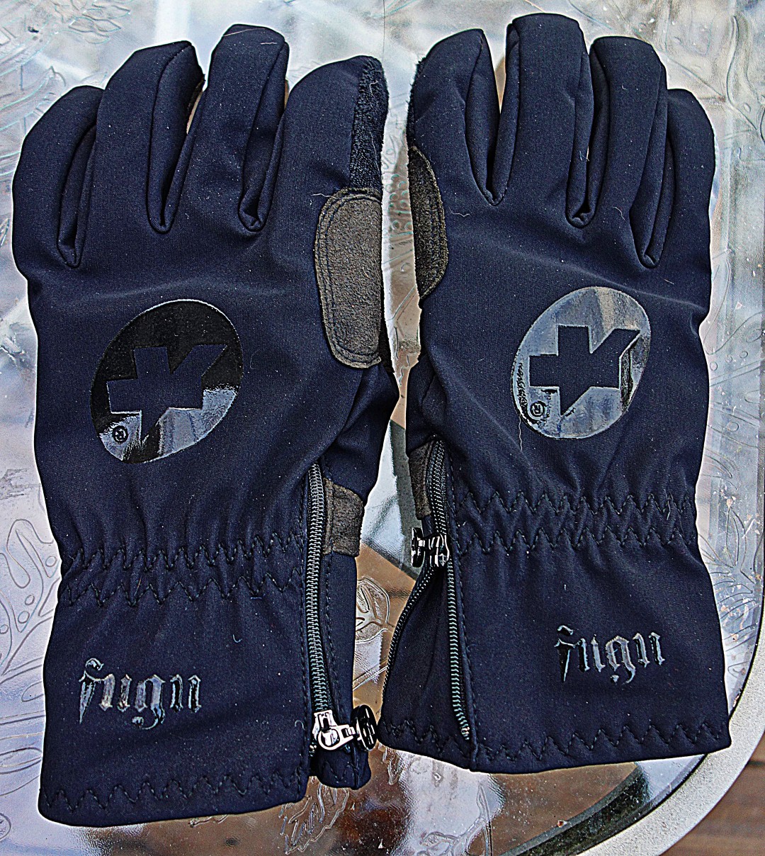
Assos certainly gets an award for best font.
I’m busily working away on a new radiotherapy for castration-resistant prostate cancer (and driving Margot crazy with Einstuerzende Neubauten’s “Sabrina” on repeat) but I do have rides and routes to report. Later in the week I’ll write about my trip to Pitcairn Mountain Road, and another 50-miler including a climb up Meads Mountain Road, a famous Catskill climb that is almost–but not quite–as terrible as Platte Clove. I also still owe you a report and directions for the Brewster to New Hamburg summer classic.
All coming this week, and I hope you don’t stop reading just because I managed to use the words “snot” and “castration” in a single post.
John
Saddles are the bane of my existence, as they are for many people who put in long steady distance rides. In contrast to short, fast rides that require repeated bursts of high-intensity pedaling—often out of the saddle—on longer rides you often sit…and sit…and sit. A comfortable saddle is a must.
I’ve preferred the Brooks Swallow for a long time now. It’s narrow enough to fit neatly between my thighs and has a flat profile, which suits my skinny ass well. Like other leather saddles, it appears rock hard, but there’s a bit of a trampoline effect that provides a cushion, particularly when the saddle is new. I like it enough that I use it on wildly inappropriate bikes, like my English, which really deserves a 100-gram wonder saddle.
I’ve tried other saddles without success, including the Fizik Kurve, which—despite claims that it offers the benefits of a Brooks in a modern saddle—has all of the initial drawbacks of a Brooks without the benefit of being able to break it in after a few hundred miles.
However, I still experience some pain, particularly when I’m in the saddle for longer than 10 or 12 hours. As importantly, the Swallow tends to collapse after seven or eight thousand miles. Not good if that’s about how far you ride each year, and especially not good considering that it costs more than $300.
This is the Rivet. It looks like a Brooks Swallow and, in fact, has almost identical dimensions, but it also has a cutout in the center.

If you’ve got your saddle set up properly, there’s no need for a cutout because you’re not sitting on your perineum. However, the slot offers one key benefit: It allows greater flex and permits the saddle to move naturally with your pedal stroke.
I received the titanium-railed saddle a few days ago, and my initial impressions were favorable. In particular, the leather appears to be thicker than on the Brooks (closer to a Berthoud saddle) and is at least equally well finished.
I went for a 35-mile ride today with the saddle with positive results. It has been a year since my last Brooks Swallow, so my recollection may be off, but the saddle was comfortable immediately, unlike the Brooks which takes at least a few hundred miles to break in. This may or may not be a good thing—if it is comfortable immediately, as the saddle breaks in it may become less comfortable.
Only time will tell if the Rivet is more durable than a Brooks. If it is—and it continues to perform—I’m a convert. So far, so good.
I’ll report back after a thousand more miles, and PS, the Kurve Bull is for sale, if anyone wants it.
John
Despite my obsession with politics I’ve made a resolution to keep this blog politics-free. However, I think we can all agree that the Bushmaster’s recent “Man Card” ad campaign is not only in poor taste, it’s meant to appeal to men who are…um, deficient in ways that can only be ameliorated by purchasing a hard phallic object that shoots projectiles.*
Well, I’m here to tell you that you can get your man card without buying a Bushmaster. It involves dressing up in tight Lycra and riding 116 of the toughest miles you’ll ever ride.
This is the Platte Clove ride, remapped for your convenience from Poughkeepsie. I provided a complete description of the route here. Send me an self-addressed, stamped envelope with proof of completion to receive your limited-edition laminated man card.†
*As someone who has considerable expertise in guiding marketing and advertising campaigns much more significant than some crappy little gun manufacturer’s campaign, I’d strongly suggest that the advertising agency that came up with this garbage be fired posthaste.
†Limited-time offer only.
John
Another week in paradise! Unfortunately, we’re buried under a ton of snow and ice, and the roads are frozen solid. I did get in some good days before the bad weather, though.
On day 1, I went for a 35-mile ride: 15 miles to the diner for my weekend cheeseburger, and then 20 miles back home. The night before, we had a severe rainstorm, and the roads were covered with gravel washouts.
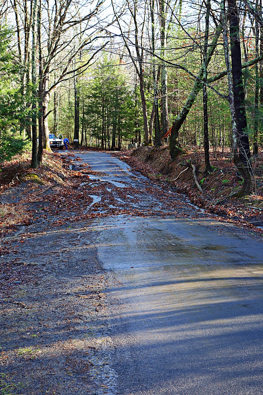
My favorite gravel road—Rogue Harbor—turned into a stream. There are a lot of potholes in this road, so I had to take it slow because the last thing I needed was to crash, get wet, and suffer hypothermia.
Despite a forecast for truly terrible weather, the day turned out to be beautiful, albeit cold and windy.

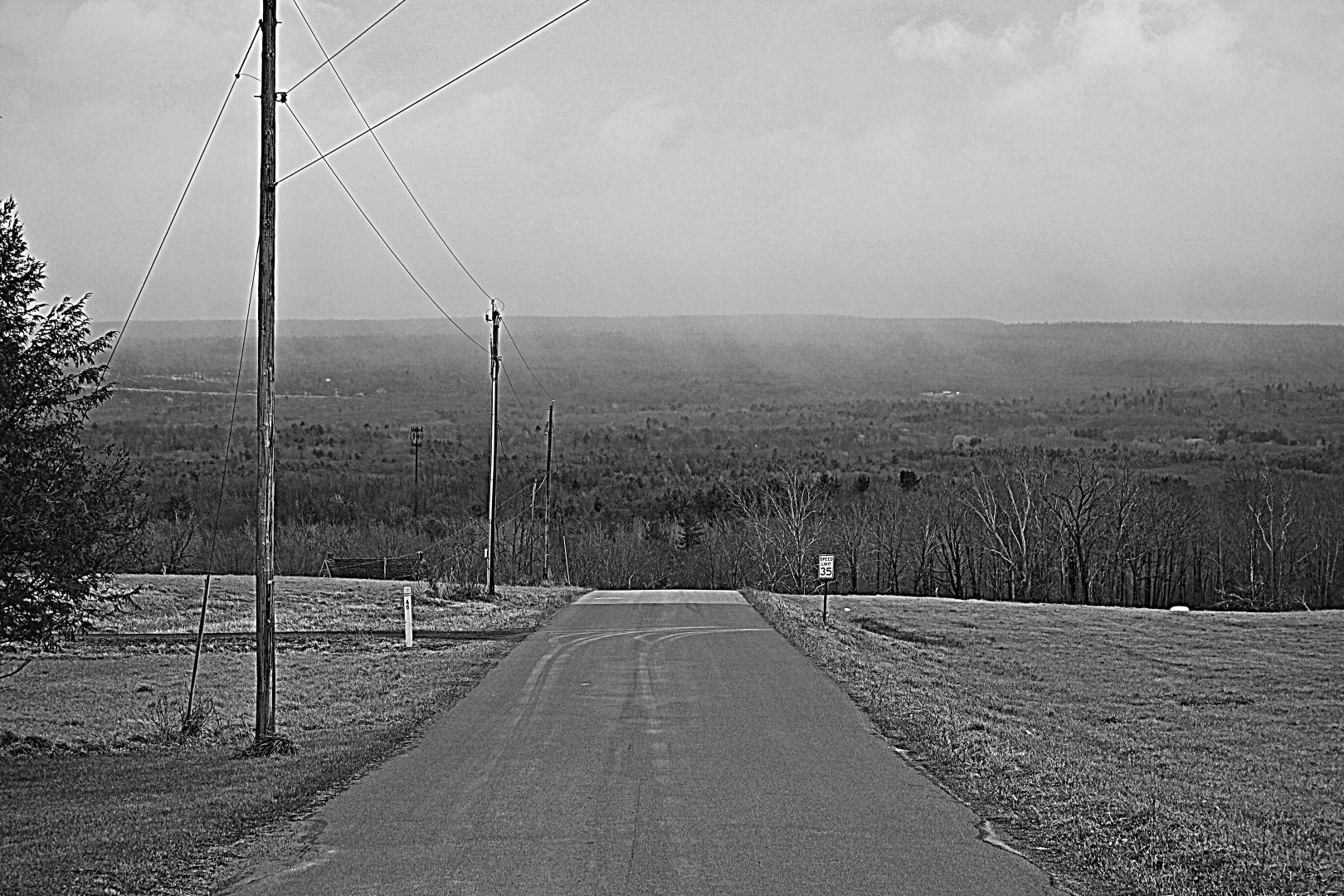
After lunch, the weather began to deteriorate, with some light, misty rain. Just the way I like it. I took this photo in native black and white to make it look suitably grim and wintery.
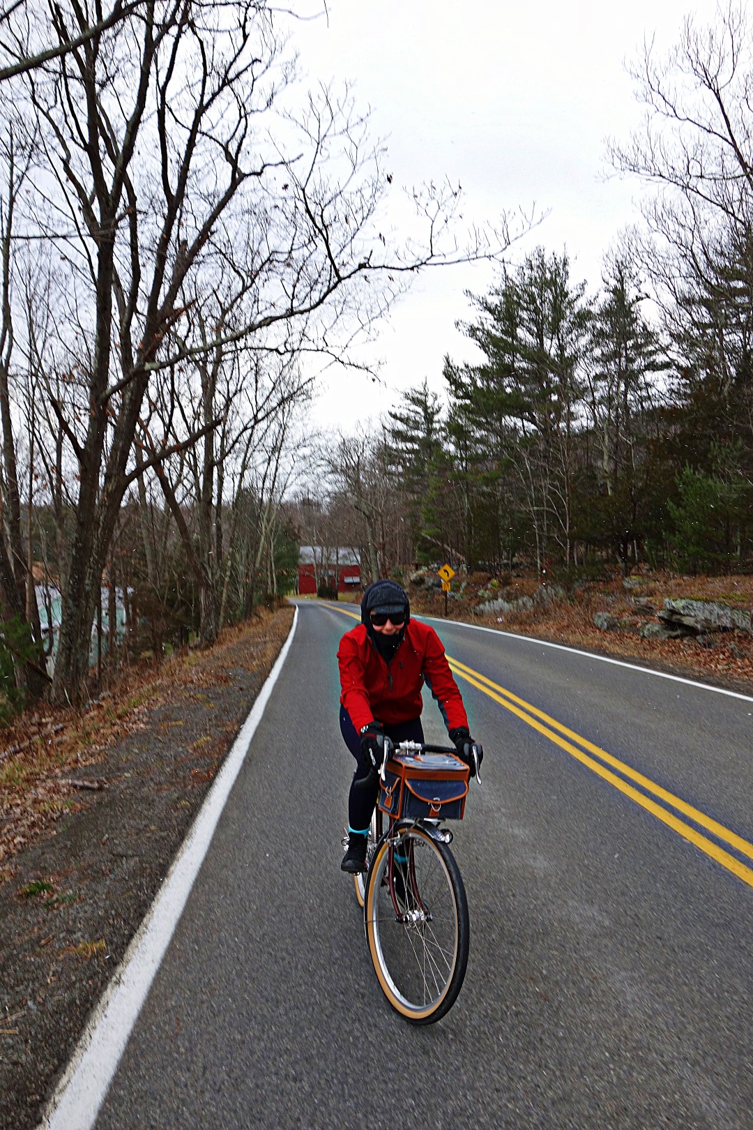
On day 2, I went for a 15-mile ride with my girlfriend, Margot. Here she is on her tiny little blood-red Boulder.
When I was 14, I bought and restored a second-hand sailboat called a Flying Fish. It was an ugly little thing, but fast as hell for a monohull; much faster than the C- and E-scows that everyone else was sailing. Although I sailed it almost daily from spring until late fall, the best times I had on that boat—and the times that I really remember—were those days that involved 30 mph winds, freezing spray, and rain.
I feel the same way about cycling; in fact, when it starts to rain I’ll get on my bike for a quick 20 miles, preferably on dirt roads so I get a little muddy. I also deliberately plan longer rides to be difficult enough that the last 10 miles is a test of survival more than anything else, much to the chagrin of my riding companions.
I’m not sure why I do this. In part, it might be because my life—and modern life in general—offers few real tests of our physical ability. Like many white-collar workers, I spend anywhere from 50 to 70 hours a week sitting behind a desk staring at monitors. There’s a certain clarity and satisfaction that can be achieved at the apex of a 200-mile ride that I just don’t get in any other way. I enjoy that “oh shit” feeling I get when I’m halfway through a long-distance ride and so tired that I don’t know how I’m going to get home.
In any case, note to self: Girlfriend only comes along when the weather is above 40 degrees.
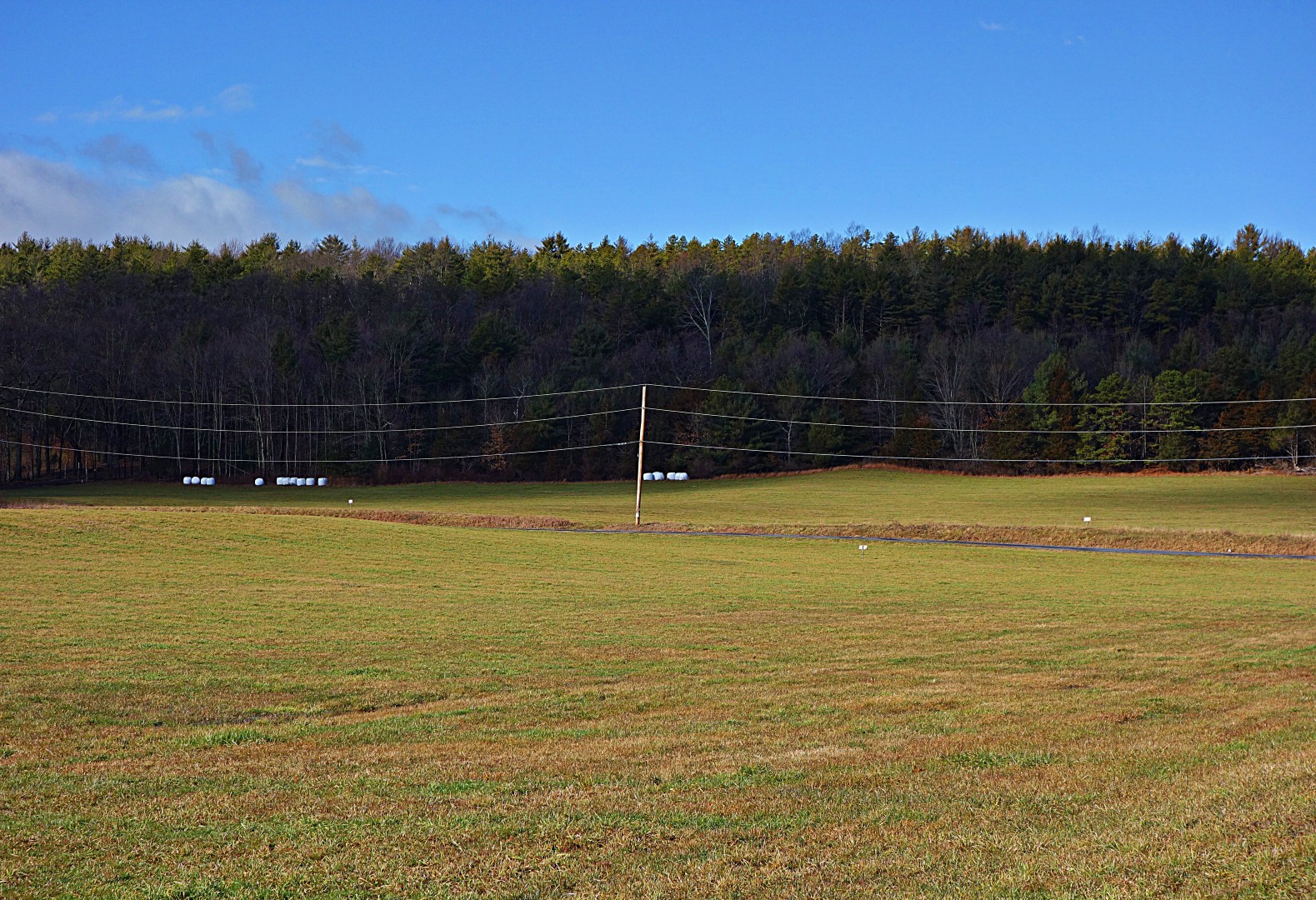
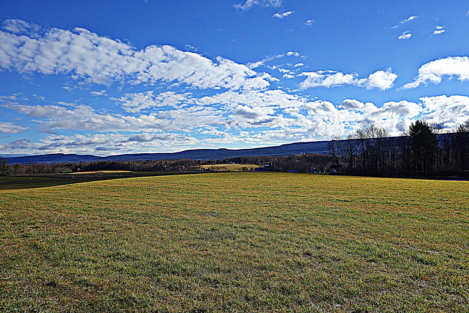
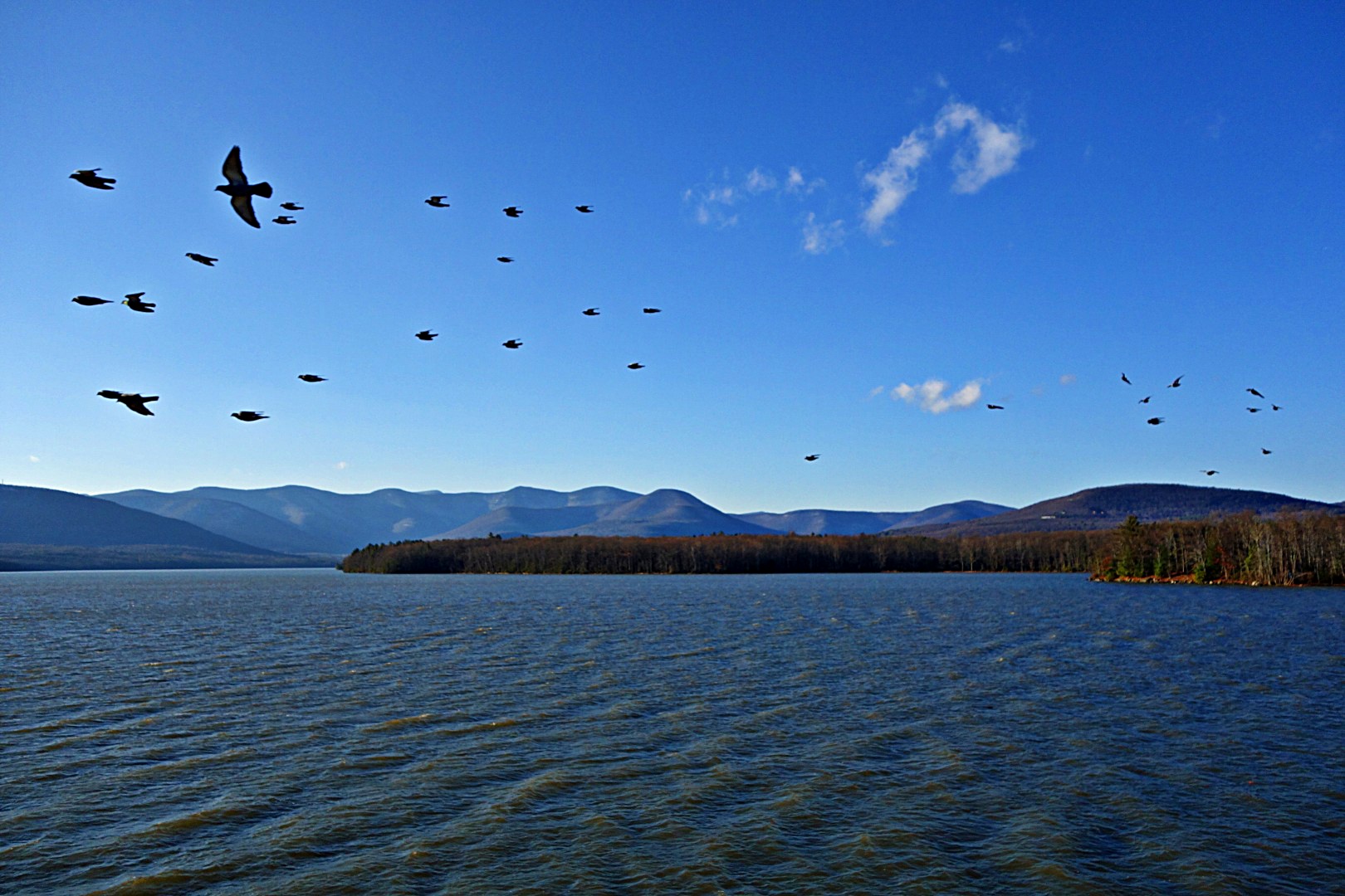
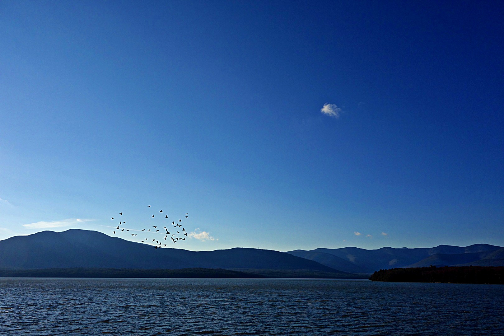
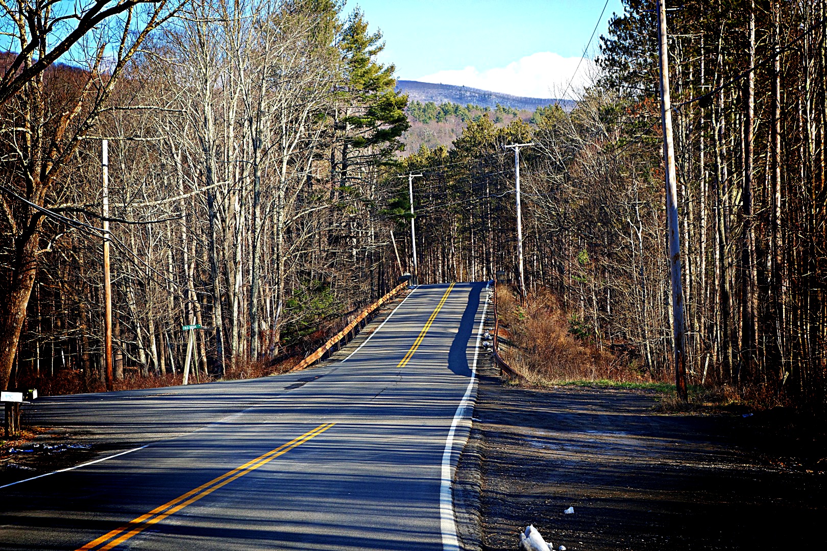
On day 3 I rode halfway around the Ashokan Reservoir (that’s A-Show-kan, not Ash O’Can). About 30 miles. I’ve gone this way before, but in the opposite direction and at night, so I didn’t realize how beautiful it is. I think I’ll make this a regular training route when the weather clears. It involves a quick section on a busy part of Route 28, but the shoulders are wide so it is relatively safe. I also took my favorite picture of the year. These images, particularly the first, are remarkable because I didn’t stop to take them. I just held the camera out and kept on clicking away:
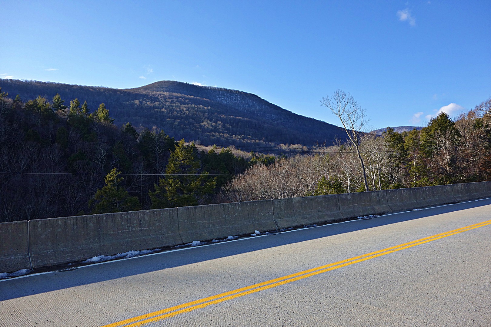
The rest of the ride was equally beautiful. This is the bridge that spans the Ashokan Reservoir . If you get a chance, ride it as it offers unparalleled views of the Catskills.

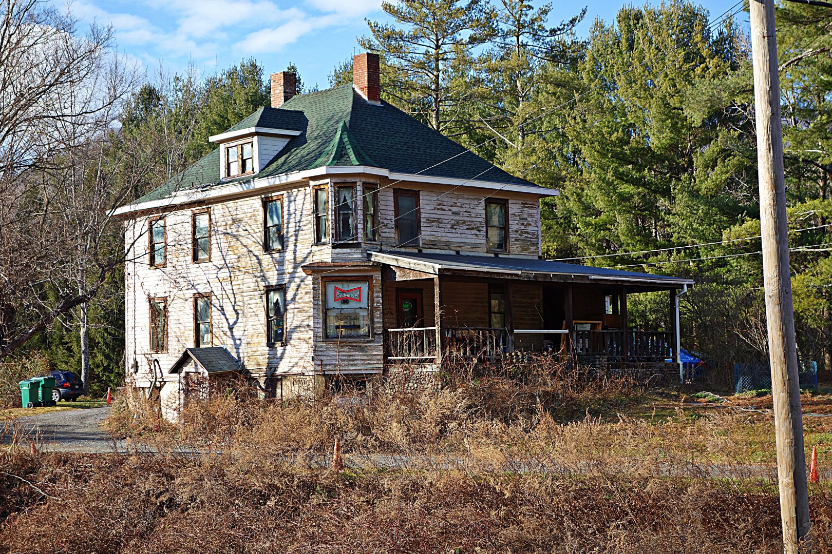
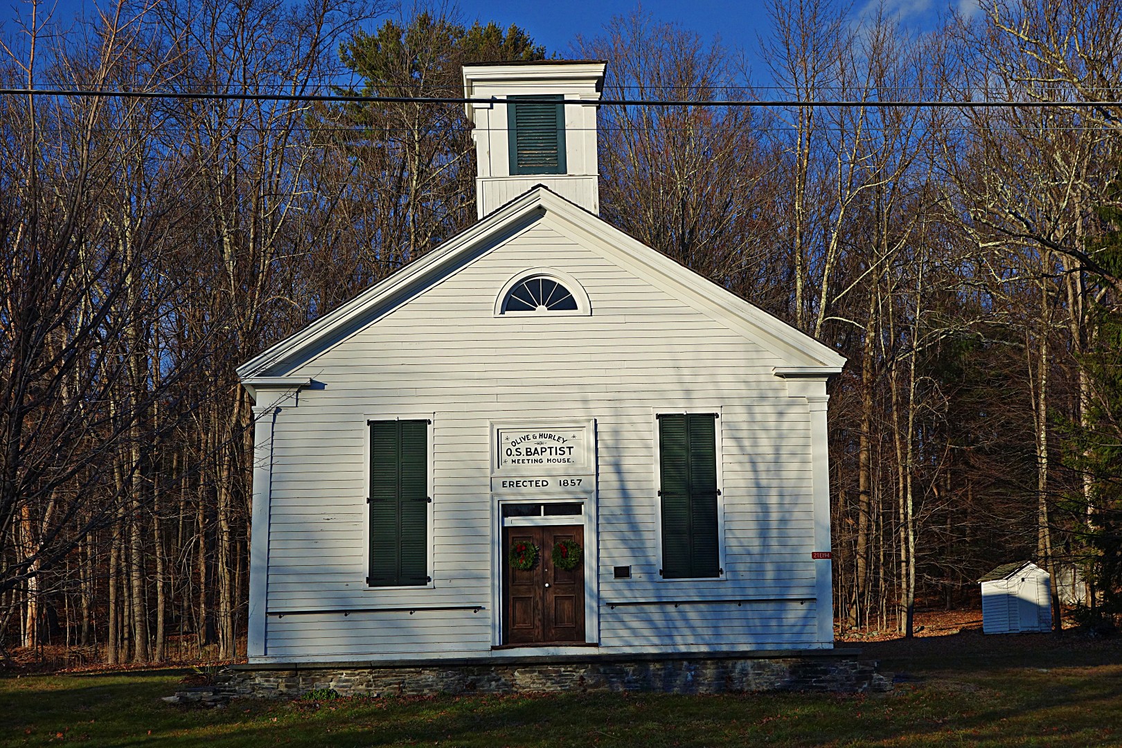
Here’s a local tavern. I think the word insalubrious was coined especially to describe this place.
And finally, a few more images from the ride.


As usual I took a few exploratory detours; I ended up riding just over 31 miles. It was an easy ride for out here in the foothills, only about 2000 feet of climbing, and nothing too steep, although now that I have the special SRAM cassette with a 32 cog that the Lynskey came with as standard equipment, very little feels steep.
I took Day 4 off, because it was the day before Christmas and we were receiving guests. In retrospect, it was a bad decision because it was the last day of decent weather. I had planned on a 40-mile ride that involved climbing Mt Pitcairn north of the Ashokan reservoir the next day, but it rained, and then the roads froze solid. Then we got two feet of snow, so I was off the bike for a few more days. I get anxious without exercise, so I shoveled like a madman to get a decent workout. In fact, I even shoveled things that technically did not need shoveling just to burn some energy off.
Next week I’m going to review my best cycling purchase of the year, post a remapped version of the Platte Clove ride for people who want to ride out of Poughkeepsie, and—finally—post the finest ride you can do out of New York (with the help of Metro North). I am also going to start posting on design considerations for my new sub-15-lb 650b superbike that Rob English will be building me early next year. Stay tuned!
John
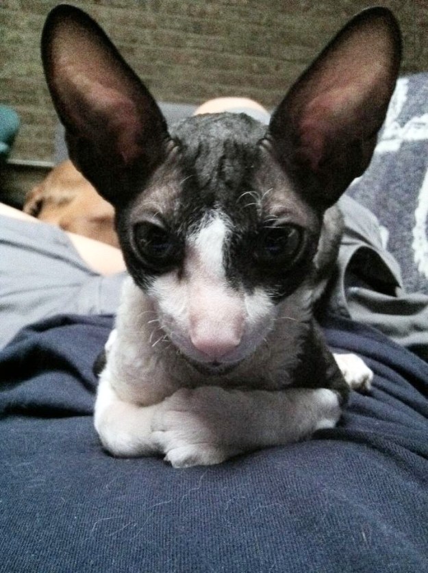
Winston, scheming my demise.
Two feet of snow…no Festive 500 for me. I’ll report on this week’s rides in a few days, but suffice it to say that I only managed 75 miles before the roads froze solid, followed by copious snow.
Since it looks like I’ll be off the bike for a week or more because of the weather, or at least until my Marathon spiked tires arrive (900 grams each!), I won’t be posting new routes for a few weeks. However, I have a bunch of old ones to post; if I get desperate maybe I’ll do a product review or two…and of course pet pictures can always serve to fill in the gaps.
See you in a few days!
John
Not even six months ago—and being of the decidedly entrepreneurial bent (in my entire life, I’ve only been “employed” by someone other than myself for 6 months)—I was considering getting into the tire business myself. Not as a huge money maker, but instead because I thought there was no reason why someone couldn’t make a clincher as nice as my favorite tubular, the FMB Paris-Roubaix 25 mm. I even went so far as to start researching the equipment needed and scoping out sites for a mini-factory. I figured I’d make a little money, employ 5 or 6 people in upstate New York, and most importantly get the tire I wanted. The tires would be expensive, sure, but no more than a high-quality tubular and they’d be made in the US.
I had heard rumors of a new ultralight tire from Compass that was supposed to ride like a tubular, so I snapped up a pair of 32 mm Grand Bois Extra Léger tires, literally within minutes of them becoming available at the Compass Bicycles site. Compass has finally started using Priority Mail, so the tires arrived within a few days of ordering (they used to use regular post, and things would arrive in 7 to 10 days, if at all) My initial feelings about the tires before they arrived were mixed…although I was excited to get what might be a truly superb clincher tire, there would be no need for me to manufacture my own.
When I opened the package, it was apparent right from the beginning that there was something different about these tires. The sidewalls are so flexible that they actually wrinkle when unmounted—something I’ve never seen before except in the highest-quality tubulars.

They mounted up relatively easily, although I had to use a tire jack to get the rear tire on. Later, when my latex tubes arrived, the tires had stretched enough to get on and off by hand. This is in sharp contrast to the Challenge Eroica tires that I purchased and subsequently returned—those tires were so tight that I couldn’t even jam a tube under them.

I pumped the tires up to 60 psi front and 65 psi rear (I weigh 145 lbs) and went for my usual 18-mile lunchtime loop with 2000 feet of climbing. It was a revelation. All traces of road buzz were eliminated relative to the regular Grand Bois 32s that I have on another bike. I suspect the smoother ride and reduction in road buzz made me feel a little slower than usual. However, my speed on multiple days on this loop averaged +0.3 mph of my usual speed. I’m not ready to say that they are any faster, but they are unambiguously more comfortable than the standard version. Even better with Challenge latex tubes.
The Grand Bois Extra Léger tires are available in 23 mm, 32 mm, and 42 mm. I think that’s an unfortunate range of sizes. 23 mm will fit on most race bikes, but many people (and everyone I know) are going with 25 mm or 27 mm tires these days. If Compass cares about selling tires, they would make a true 25 mm Extra Léger tire. Not 26 mm for the simple reason that many who own race bikes would reject it out of hand because they will think it won’t fit on their bikes.
I’ve had a chance to ride some really good clinchers and tubulars. Because these are 32s, it is impossible to do a direct comparison with tires other than the regular Grand Bois 32. However, based on what I’ve seen I’m confident that the 23s will ride better than any other clincher in the 23 to 25 range, and will probably provide as close to a tubular experience as it is possible to get on a clincher. I’m going to buy some Extra Léger 23s and compare with other tires in the 23 to 25 mm size range.
John
